Matafelon-Granges
Matafelon-Granges (French pronunciation: [matafəlɔ̃ gʁɑ̃ʒ]) is a commune in the Ain department in eastern France.
Matafelon-Granges | |
|---|---|
 A general view of Matafelon | |
Location of Matafelon-Granges 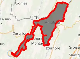
| |
 Matafelon-Granges  Matafelon-Granges | |
| Coordinates: 46°15′43″N 5°33′16″E | |
| Country | France |
| Region | Auvergne-Rhône-Alpes |
| Department | Ain |
| Arrondissement | Nantua |
| Canton | Pont-d'Ain |
| Government | |
| • Mayor (2020–2026) | Jean-Pierre Duparchy |
| Area 1 | 21.54 km2 (8.32 sq mi) |
| Population | 641 |
| • Density | 30/km2 (77/sq mi) |
| Time zone | UTC+01:00 (CET) |
| • Summer (DST) | UTC+02:00 (CEST) |
| INSEE/Postal code | 01240 /01580 |
| Elevation | 267–783 m (876–2,569 ft) (avg. 448 m or 1,470 ft) |
| 1 French Land Register data, which excludes lakes, ponds, glaciers > 1 km2 (0.386 sq mi or 247 acres) and river estuaries. | |
Population
| Year | Pop. | ±% |
|---|---|---|
| 1962 | 298 | — |
| 1968 | 262 | −12.1% |
| 1975 | 296 | +13.0% |
| 1982 | 336 | +13.5% |
| 1990 | 406 | +20.8% |
| 1999 | 483 | +19.0% |
| 2008 | 653 | +35.2% |
See also
References
- "Populations légales 2017". INSEE. Retrieved 6 January 2020.
| Wikimedia Commons has media related to Matafelon-Granges. |
This article is issued from Wikipedia. The text is licensed under Creative Commons - Attribution - Sharealike. Additional terms may apply for the media files.