Saint-Jean-de-Gonville
Saint-Jean-de-Gonville is a commune in the Ain department in eastern France.
Saint-Jean-de-Gonville | |
|---|---|
_-_Eglise.JPG.webp) Church of Saint-Jean-de-Gonville | |
.svg.png.webp) Coat of arms | |
Location of Saint-Jean-de-Gonville 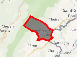
| |
 Saint-Jean-de-Gonville  Saint-Jean-de-Gonville | |
| Coordinates: 46°13′00″N 5°57′00″E | |
| Country | France |
| Region | Auvergne-Rhône-Alpes |
| Department | Ain |
| Arrondissement | Gex |
| Canton | Thoiry |
| Intercommunality | Pays de Gex |
| Government | |
| • Mayor (2008–2014) | Michel Brulhart |
| Area 1 | 12.36 km2 (4.77 sq mi) |
| Population (2017-01-01)[1] | 1,787 |
| • Density | 140/km2 (370/sq mi) |
| Time zone | UTC+01:00 (CET) |
| • Summer (DST) | UTC+02:00 (CEST) |
| INSEE/Postal code | 01360 /01630 |
| Elevation | 444–1,632 m (1,457–5,354 ft) |
| 1 French Land Register data, which excludes lakes, ponds, glaciers > 1 km2 (0.386 sq mi or 247 acres) and river estuaries. | |
Population
|
|
See also
References
- "Populations légales 2017". INSEE. Retrieved 6 January 2020.
| Wikimedia Commons has media related to Saint-Jean-de-Gonville. |
| Authority control |
|
|---|
This article is issued from Wikipedia. The text is licensed under Creative Commons - Attribution - Sharealike. Additional terms may apply for the media files.