Saint-Rambert-en-Bugey
Saint-Rambert-en-Bugey is a commune in the Ain department in eastern France.
Saint-Rambert-en-Bugey | |
|---|---|
 The church in Saint-Rambert-en-Bugey | |
.svg.png.webp) Coat of arms | |
Location of Saint-Rambert-en-Bugey 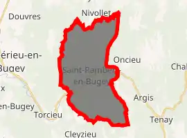
| |
 Saint-Rambert-en-Bugey  Saint-Rambert-en-Bugey | |
| Coordinates: 45°57′00″N 5°26′00″E | |
| Country | France |
| Region | Auvergne-Rhône-Alpes |
| Department | Ain |
| Arrondissement | Belley |
| Canton | Ambérieu-en-Bugey |
| Intercommunality | Vallée de l'Albarine |
| Government | |
| • Mayor (2008–2014) | Gilbert Bouchon |
| Area 1 | 28.55 km2 (11.02 sq mi) |
| Population (2017-01-01)[1] | 2,269 |
| • Density | 79/km2 (210/sq mi) |
| Time zone | UTC+01:00 (CET) |
| • Summer (DST) | UTC+02:00 (CEST) |
| INSEE/Postal code | 01384 /01230 |
| Elevation | 271–819 m (889–2,687 ft) (avg. 290 m or 950 ft) |
| 1 French Land Register data, which excludes lakes, ponds, glaciers > 1 km2 (0.386 sq mi or 247 acres) and river estuaries. | |
History
The commune takes its name from St Rambert (or Ragnebert) who was assassinated here in the 7th century. The site soon became popular for pilgrimage and an influential abbey was built in the town.
Geography
The river Albarine flows southwest through the commune.
Population
|
|
See also
References
- "Populations légales 2017". INSEE. Retrieved 6 January 2020.
External links
| Wikimedia Commons has media related to Saint-Rambert-en-Bugey. |
| Authority control |
|---|
This article is issued from Wikipedia. The text is licensed under Creative Commons - Attribution - Sharealike. Additional terms may apply for the media files.