Corbonod
Corbonod is a commune in the Ain department in eastern France.
Corbonod | |
|---|---|
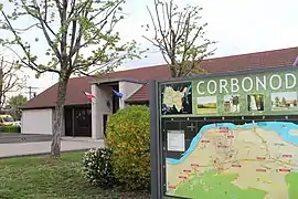 The town hall in Corbonod | |
Location of Corbonod 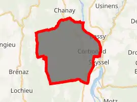
| |
 Corbonod  Corbonod | |
| Coordinates: 45°57′00″N 5°49′00″E | |
| Country | France |
| Region | Auvergne-Rhône-Alpes |
| Department | Ain |
| Arrondissement | Belley |
| Canton | Hauteville-Lompnes |
| Government | |
| • Mayor (2008–2014) | Joseph Travail |
| Area 1 | 31.59 km2 (12.20 sq mi) |
| Population (2017-01-01)[1] | 1,264 |
| • Density | 40/km2 (100/sq mi) |
| Time zone | UTC+01:00 (CET) |
| • Summer (DST) | UTC+02:00 (CEST) |
| INSEE/Postal code | 01118 /01420 |
| Elevation | 250–1,390 m (820–4,560 ft) (avg. 258 m or 846 ft) |
| 1 French Land Register data, which excludes lakes, ponds, glaciers > 1 km2 (0.386 sq mi or 247 acres) and river estuaries. | |
Population
|
|
See also
References
- "Populations légales 2017". INSEE. Retrieved 6 January 2020.
External links
| Wikimedia Commons has media related to Corbonod. |
This article is issued from Wikipedia. The text is licensed under Creative Commons - Attribution - Sharealike. Additional terms may apply for the media files.