Le Plantay
Le Plantay is a commune in the Ain department in eastern France.
Le Plantay | |
|---|---|
 Abbey of Notre-Dame des Dombes | |
Location of Le Plantay 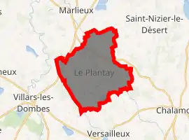
| |
 Le Plantay  Le Plantay | |
| Coordinates: 46°01′00″N 5°05′00″E | |
| Country | France |
| Region | Auvergne-Rhône-Alpes |
| Department | Ain |
| Arrondissement | Bourg-en-Bresse |
| Canton | Ceyzériat |
| Government | |
| • Mayor (2020-2026) | Patrick Saroni |
| Area 1 | 19.96 km2 (7.71 sq mi) |
| Population (2017-01-01)[1] | 564 |
| • Density | 28/km2 (73/sq mi) |
| Time zone | UTC+01:00 (CET) |
| • Summer (DST) | UTC+02:00 (CEST) |
| INSEE/Postal code | 01299 /01330 |
| Elevation | 267–286 m (876–938 ft) (avg. 275 m or 902 ft) |
| 1 French Land Register data, which excludes lakes, ponds, glaciers > 1 km2 (0.386 sq mi or 247 acres) and river estuaries. | |
Population
|
|
Sights
The Abbey of Notre-Dame des Dombes, founded by Trappist monks in 1863, is located in the commune.
See also
References
- "Populations légales 2017". INSEE. Retrieved 6 January 2020.
External links
| Wikimedia Commons has media related to Le Plantay. |
This article is issued from Wikipedia. The text is licensed under Creative Commons - Attribution - Sharealike. Additional terms may apply for the media files.
