Trenton, Nebraska
Trenton is a village in Hitchcock County, Nebraska, United States. The population was 560 at the 2010 census. It is the county seat of Hitchcock County.[6]
Trenton, Nebraska | |
|---|---|
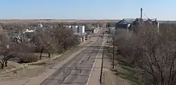 Trenton in 2013 (looking south) | |
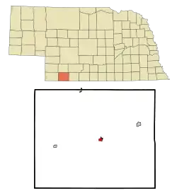 Location of Trenton, Nebraska | |
| Coordinates: 40°10′34″N 101°0′49″W | |
| Country | United States |
| State | Nebraska |
| County | Hitchcock |
| Area | |
| • Total | 0.58 sq mi (1.50 km2) |
| • Land | 0.58 sq mi (1.50 km2) |
| • Water | 0.00 sq mi (0.00 km2) |
| Elevation | 2,674 ft (815 m) |
| Population | |
| • Total | 560 |
| • Estimate (2019)[3] | 535 |
| • Density | 925.61/sq mi (357.66/km2) |
| Time zone | UTC-6 (Central (CST)) |
| • Summer (DST) | UTC-5 (CDT) |
| ZIP code | 69044 |
| Area code(s) | 308 |
| FIPS code | 31-49145[4] |
| GNIS feature ID | 0834155[5] |
| Website | villageoftrenton.net |
History
Trenton was platted in 1885 when the railroad was extended to that point.[7] It was named after Trenton, New Jersey.[8][9]
Due to Trenton's location near the center of the county, and its position on the Chicago, Burlington and Quincy Railroad, the seat of Hitchcock County was transferred there from the first county seat, Culbertson.[10]
Geography
Trenton is located at 40°10′34″N 101°0′49″W (40.176241, -101.013723).[11] According to the United States Census Bureau, the village has a total area of 0.58 square miles (1.50 km2), all land.[12]
Trenton Dam, impounding the Republican River, and its large reservoir called Lake Swanson, stand about two and one-half miles west of the city.
Demographics
| Historical population | |||
|---|---|---|---|
| Census | Pop. | %± | |
| 1890 | 267 | — | |
| 1900 | 329 | 23.2% | |
| 1910 | 497 | 51.1% | |
| 1920 | 592 | 19.1% | |
| 1930 | 865 | 46.1% | |
| 1940 | 920 | 6.4% | |
| 1950 | 1,239 | 34.7% | |
| 1960 | 914 | −26.2% | |
| 1970 | 770 | −15.8% | |
| 1980 | 796 | 3.4% | |
| 1990 | 656 | −17.6% | |
| 2000 | 507 | −22.7% | |
| 2010 | 560 | 10.5% | |
| 2019 (est.) | 535 | [3] | −4.5% |
| U.S. Decennial Census | |||
2010 census
As of the census[2] of 2010, there were 560 people, 264 households, and 134 families residing in the village. The population density was 965.5 inhabitants per square mile (372.8/km2). There were 328 housing units at an average density of 565.5 per square mile (218.3/km2). The racial makeup of the village was 98.4% White, 0.4% African American, 0.5% Native American, 0.4% from other races, and 0.4% from two or more races. Hispanic or Latino of any race were 1.6% of the population.
There were 264 households, of which 22.7% had children under the age of 18 living with them, 37.5% were married couples living together, 10.6% had a female householder with no husband present, 2.7% had a male householder with no wife present, and 49.2% were non-families. 43.9% of all households were made up of individuals, and 20.8% had someone living alone who was 65 years of age or older. The average household size was 2.02 and the average family size was 2.77.
The median age in the village was 48.1 years. 18.6% of residents were under the age of 18; 6.9% were between the ages of 18 and 24; 20.1% were from 25 to 44; 26.8% were from 45 to 64; and 27.7% were 65 years of age or older. The gender makeup of the village was 49.1% male and 50.9% female.
2000 census
As of the census[4] of 2000, there were 507 people, 246 households, and 138 families residing in the village. The population density was 878.7 people per square mile (337.5/km2). There were 301 housing units at an average density of 521.7 per square mile (200.4/km2). The racial makeup of the village was 98.62% White, 0.20% Asian, 0.59% from other races, and 0.59% from two or more races. Hispanic or Latino of any race were 1.18% of the population.
There were 246 households, out of which 19.5% had children under the age of 18 living with them, 46.3% were married couples living together, 6.9% had a female householder with no husband present, and 43.9% were non-families. 38.2% of all households were made up of individuals, and 18.7% had someone living alone who was 65 years of age or older. The average household size was 2.03 and the average family size was 2.70.
In the village, the population was spread out, with 17.8% under the age of 18, 6.9% from 18 to 24, 22.7% from 25 to 44, 27.8% from 45 to 64, and 24.9% who were 65 years of age or older. The median age was 47 years. For every 100 females, there were 92.8 males. For every 100 females age 18 and over, there were 87.8 males.
As of 2000 the median income for a household in the village was $25,078, and the median income for a family was $34,271. Males had a median income of $26,094 versus $20,625 for females. The per capita income for the village was $14,057. About 13.7% of families and 15.0% of the population were below the poverty line, including 12.8% of those under age 18 and 8.5% of those age 65 or over.
Notable person
- Tom Baker, Nebraska state legislator.
See also
References
- "2019 U.S. Gazetteer Files". United States Census Bureau. Retrieved July 26, 2020.
- "U.S. Census website". United States Census Bureau. Retrieved 2012-06-24.
- "Population and Housing Unit Estimates". United States Census Bureau. May 24, 2020. Retrieved May 27, 2020.
- "U.S. Census website". United States Census Bureau. Retrieved 2008-01-31.
- "US Board on Geographic Names". United States Geological Survey. 2007-10-25. Retrieved 2008-01-31.
- "Find a County". National Association of Counties. Retrieved 2011-06-07.
- "Trenton, Hitchcock County". Center for Advanced Land Management Information Technologies. University of Nebraska. Retrieved 12 August 2014.
- "Profile for Trenton, NE". ePodunk. Retrieved 12 August 2014.
- Fitzpatrick, Lillian L. (1960). Nebraska Place-Names. University of Nebraska Press. p. 74. ISBN 0-8032-5060-6. A 1925 edition is available for download at University of Nebraska—Lincoln Digital Commons.
- Burr, George L. (1921). History of Hamilton and Clay Counties, Nebraska, Volume 1. S.J. Clarke Publishing Company. p. 118.
- "US Gazetteer files: 2010, 2000, and 1990". United States Census Bureau. 2011-02-12. Retrieved 2011-04-23.
- "US Gazetteer files 2010". United States Census Bureau. Archived from the original on 2012-01-25. Retrieved 2012-06-24.
- Stacy Stupka-Burda. "National Register of Historic Places Registration Form: Weyl Service Station". Nebraska State Historical Society. Retrieved 2013-04-06.
External links
| Wikimedia Commons has media related to Trenton, Nebraska. |
Municipalities and communities of Hitchcock County, Nebraska, United States | ||
|---|---|---|
| Villages | Map of Nebraska highlighting Hitchcock County | |
| Unincorporated community | ||
| Footnotes | ‡This populated place also has portions in an adjacent county or counties | |
| ||

