Jackson County, Iowa
Jackson County is a county located in the U.S. state of Iowa. As of the 2010 census, the population was 19,848.[1] The county seat is Maquoketa.[2]
Jackson County | |
|---|---|
 Jackson County Courthouse | |
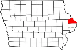 Location within the U.S. state of Iowa | |
 Iowa's location within the U.S. | |
| Coordinates: 42°10′13″N 90°34′30″W | |
| Country | |
| State | |
| Founded | December 21, 1837 |
| Named for | Andrew Jackson |
| Seat | Maquoketa |
| Largest city | Maquoketa |
| Area | |
| • Total | 650 sq mi (1,700 km2) |
| • Land | 584 sq mi (1,510 km2) |
| • Water | 69 sq mi (180 km2) 10.63% |
| Population (2010) | |
| • Total | 19,848 |
| • Estimate (2019) | 19,439 |
| • Density | 31/sq mi (12/km2) |
| Time zone | UTC−6 (Central) |
| • Summer (DST) | UTC−5 (CDT) |
| Congressional district | 1st |
| Website | www |
History
The county was formed on December 21, 1837 and named after US President Andrew Jackson.[3]
Geography
According to the U.S. Census Bureau, the county has a total area of 650 square miles (1,700 km2), of which 636 square miles (1,650 km2) is land and 14 square miles (36 km2) (2.1%) is water.[4] Its eastern border is formed by the Mississippi River.
Major highways
Adjacent counties
- Dubuque County (north)
- Jo Daviess County, Illinois (northeast)
- Carroll County, Illinois (east)
- Clinton County (south)
- Jones County (west)
National protected areas
State protected areas
Demographics
| Historical population | |||
|---|---|---|---|
| Census | Pop. | %± | |
| 1840 | 1,411 | — | |
| 1850 | 7,210 | 411.0% | |
| 1860 | 18,493 | 156.5% | |
| 1870 | 22,619 | 22.3% | |
| 1880 | 23,771 | 5.1% | |
| 1890 | 22,771 | −4.2% | |
| 1900 | 23,615 | 3.7% | |
| 1910 | 21,258 | −10.0% | |
| 1920 | 19,931 | −6.2% | |
| 1930 | 18,481 | −7.3% | |
| 1940 | 19,181 | 3.8% | |
| 1950 | 18,622 | −2.9% | |
| 1960 | 20,754 | 11.4% | |
| 1970 | 20,839 | 0.4% | |
| 1980 | 22,503 | 8.0% | |
| 1990 | 19,950 | −11.3% | |
| 2000 | 20,296 | 1.7% | |
| 2010 | 19,848 | −2.2% | |
| 2019 (est.) | 19,439 | [5] | −2.1% |
| U.S. Decennial Census[6] 1790-1960[7] 1900-1990[8] 1990-2000[9] 2010-2018[1] | |||
2010 census
The 2010 census recorded a population of 19,848 in the county, with a population density of 31.2031/sq mi (12.0476/km2). There were 9,415 housing units, of which 8,289 were occupied.[10]
2000 census

As of the census[11] of 2000, there were 20,296 people, 8,078 households, and 5,589 families residing in the county. The population density was 32 people per square mile (12/km2). There were 8,949 housing units at an average density of 14 per square mile (5/km2). The racial makeup of the county was 98.96% White, 0.10% Black or African American, 0.12% Native American, 0.09% Asian, 0.11% Pacific Islander, 0.15% from other races, and 0.47% from two or more races. 0.60% of the population were Hispanic or Latino of any race.
There were 8,078 households, out of which 32.00% had children under the age of 18 living with them, 58.20% were married couples living together, 7.70% had a female householder with no husband present, and 30.80% were non-families. 27.00% of all households were made up of individuals, and 13.80% had someone living alone who was 65 years of age or older. The average household size was 2.47 and the average family size was 3.01.
In the county, the population was spread out, with 26.00% under the age of 18, 7.00% from 18 to 24, 26.50% from 25 to 44, 23.20% from 45 to 64, and 17.30% who were 65 years of age or older. The median age was 39 years. For every 100 females there were 97.10 males. For every 100 females age 18 and over, there were 93.90 males.
The median income for a household in the county was $34,529, and the median income for a family was $42,526. Males had a median income of $29,334 versus $20,577 for females. The per capita income for the county was $17,329. About 7.70% of families and 10.30% of the population were below the poverty line, including 13.90% of those under age 18 and 8.90% of those age 65 or over.
Government
As of 2018 the three-member Jackson County Board of Supervisors is Larry McDevitt, Mike Steines, and Jack Willey. Their Executive Assistant is LuAnn Goeke.[12]
Sheriff's office
The Jackson County Sheriff's Office is the primary law enforcement agency located in the county. The headquarters for the Sheriff's Department are in Maquoketa, Iowa. The department is led by an elected Sheriff. The current Sheriff is Brent Kilburg.[13]
Fire Protection and Emergency Medical Services
Fire protection in the county is left up to the discretion of the cities within the county. The towns of Maquoketa, Preston, Miles, Springbrook, Sabula, Baldwin, Bellevue, Andrew and La Motte all have their own fire departments providing protection for the whole county. Most city fire departments also provide rescue services. Fire equipment usually consists of Engines, Tankers and brush trucks as well as most fire departments owning a Rescue truck. The Maquoketa Fire department also owns a Ladder truck. Most firefighters certify as Iowa Firefighter One and HAZMAT Operations and some also are certified as EMTs. The towns of Maquoketa, Preston, Sabula and Bellevue also have their own Ambulance Services which provide coverage for the county while towns not having ambulances have First Responder units and contract ambulance response to a nearby community. All firefighters in Jackson County are volunteers and most EMS personnel are also volunteers however the Maquoketa Ambulance Service is a paid service. All Jackson County departments are members of the Jackson County Firefighters Association and the Iowa Firefighters Association. Mutual Aid Agreements from surrounding Iowa counties as well as the state of Illinois are in place to provide additional help during emergencies which tax the county emergency resources beyond their limits.
Hospital
Jackson County has one Hospital in Maquoketa, the Jackson County Regional Health Center. As of 2016 the hospital is under the administration of Genesis Healthcare. Patients near Maquoketa are transported to this hospital, while patients closer to Clinton County will most likely be taken to Mercy Medical Center in Clinton, Iowa. Some patients closer to Dubuque County are taken to Mercy or Finley Hospitals, both in the city of Dubuque.
Election results
Prior to 1988, Jackson County was a Republican-leaning swing county, only failing to back the national winner four times between 1896 & 1984. The county was reliably Democratic from 1988 to 2012, but made a 36-point swing to back Donald Trump in 2016. In 2020 Donald Trump carried Jackson County with 62% of the vote over Joseph Biden 36%.[14][15]
| Year | Republican | Democratic | Third Parties |
|---|---|---|---|
| 2020 | 62.3% 6,940 | 36.2% 4,029 | 1.5% 166 |
| 2016 | 56.5% 5,824 | 37.2% 3,837 | 6.3% 649 |
| 2012 | 40.8% 4,177 | 57.7% 5,907 | 1.5% 158 |
| 2008 | 36.9% 3,673 | 61.3% 6,102 | 1.8% 182 |
| 2004 | 42.4% 4,242 | 56.5% 5,656 | 1.1% 113 |
| 2000 | 41.7% 3,769 | 54.8% 4,945 | 3.5% 318 |
| 1996 | 33.4% 2,827 | 54.5% 4,609 | 12.1% 1,025 |
| 1992 | 28.7% 2,673 | 47.5% 4,421 | 23.8% 2,211 |
| 1988 | 39.3% 3,237 | 59.1% 4,864 | 1.6% 132 |
| 1984 | 51.5% 4,811 | 47.1% 4,400 | 1.4% 129 |
| 1980 | 51.2% 4,479 | 40.2% 3,518 | 8.7% 757 |
| 1976 | 47.5% 4,221 | 50.3% 4,467 | 2.2% 198 |
| 1972 | 55.8% 4,975 | 41.5% 3,704 | 2.8% 245 |
| 1968 | 53.0% 4,535 | 39.9% 3,413 | 7.1% 605 |
| 1964 | 37.4% 3,066 | 62.5% 5,130 | 0.1% 9 |
| 1960 | 53.9% 5,084 | 46.1% 4,345 | 0.1% 5 |
| 1956 | 62.6% 5,575 | 35.7% 3,181 | 1.7% 149 |
| 1952 | 64.3% 5,867 | 33.7% 3,074 | 2.0% 186 |
| 1948 | 51.4% 3,597 | 46.6% 3,263 | 2.1% 145 |
| 1944 | 55.1% 4,341 | 44.9% 3,537 | 0.1% 8 |
| 1940 | 56.1% 5,417 | 43.7% 4,218 | 0.3% 26 |
| 1936 | 40.6% 3,581 | 55.4% 4,889 | 4.0% 353 |
| 1932 | 34.0% 2,892 | 59.9% 5,094 | 6.0% 513 |
| 1928 | 55.7% 4,740 | 43.8% 3,729 | 0.4% 37 |
| 1924 | 50.2% 4,218 | 28.0% 2,352 | 21.8% 1,833 |
| 1920 | 68.0% 4,763 | 27.9% 1,954 | 4.1% 288 |
| 1916 | 52.6% 2,533 | 45.4% 2,186 | 2.0% 94 |
| 1912 | 24.5% 1,174 | 47.1% 2,259 | 28.5% 1,367 |
| 1908 | 48.5% 2,542 | 48.6% 2,545 | 2.9% 153 |
| 1904 | 52.3% 2,899 | 44.8% 2,483 | 2.9% 158 |
| 1900 | 50.7% 2,964 | 48.8% 2,854 | 0.6% 33 |
| 1896 | 52.5% 3,713 | 46.4% 3,279 | 1.2% 82 |
Communities
Cities
| Rank | City | 2019 City Population | 2010 City Population | Change |
|---|---|---|---|---|
| 1 | Maquoketa † | 5,990 | 6,141 | −2.46% |
| 2 | Bellevue | 2,209 | 2,191 | +0.82% |
| 3 | Preston | 959 | 1,012 | −5.24% |
| 4 | Sabula | 554 | 576 | −3.82% |
| 5 | Miles | 437 | 445 | −1.80% |
| 6 | Andrew | 408 | 434 | −5.99% |
| 7 | La Motte | 254 | 260 | −2.31% |
| 8 | Monmouth | 154 | 153 | +0.65% |
| 9 | Springbrook | 146 | 144 | +1.39% |
| 10 | St. Donatus | 129 | 135 | −4.44% |
| 11 | Baldwin | 108 | 109 | −0.92% |
| 12 | Zwingle (partially in Dubuque County) | 92 | 91 | +1.10% |
| 13 | Spragueville | 77 | 81 | −4.94% |
Unincorporated communities
Ghost towns
- Alma
- Amoy
- America
- Bridgeport
- Brookfield
- Buckhorn
- Canton
- Carrollport
- Centerville
- Charleston
- Charkstown
- Cobb
- Coloma
- Copper Creek
- Cottonville
- Crabb
- Crabb's Mill
- Crabbtown
- Deventersville
- Duggan
- Duke
- Emeline
- Fremont
- Fulton
- Gordon's Ferry
- Hickory Grove
- Higginsport
- Hugo
- Hurstville
- Fairfield
- Farmers Creek
- Franklin
- Iron Hill
- East Iron Hills
- Isabel
- Lainsville
- Lowell
- Millrock
- Mount Algor
- Nashville
- New Castle
- New Rochester
- North Maquoketa
- Otter Creek
- Ozark
- Pass
- Prairie Springs
- Rolley
- Silsbee
- Smiths Ferry
- Springfield
- Spruce Mills
- Sterling
- Sullivan
- Summer Hill
- Sylva
- Tetes des Morts
- Union Center
- Van Buren
- Wagonersburgh
- Waterford
- Wickliffe
"Iowa Ghost Towns". Archived from the original on 2006-08-21.
Townships
Jackson County is divided into 18 townships:
Bibliography
- Sorensen, Lucille. Holihan, Grace. Ghost Towns of Jackson County Iowa/History of Jackson County, Vol. 1, Jackson County Historical Society 1988 and 2000.
References
- "State & County QuickFacts". United States Census Bureau. Archived from the original on June 7, 2011. Retrieved July 18, 2014.
- "Find a County". National Association of Counties. Archived from the original on May 31, 2011. Retrieved June 7, 2011.
- Gannett, Henry (1905). The Origin of Certain Place Names in the United States. Govt. Print. Off. pp. 167.
- "US Gazetteer files: 2010, 2000, and 1990". United States Census Bureau. February 12, 2011. Retrieved April 23, 2011.
- "QuickFacts Jackson County, Iowa United States". Retrieved June 10, 2020.
- "U.S. Decennial Census". United States Census Bureau. Retrieved July 18, 2014.
- "Historical Census Browser". University of Virginia Library. Retrieved July 18, 2014.
- "Population of Counties by Decennial Census: 1900 to 1990". United States Census Bureau. Retrieved July 18, 2014.
- "Census 2000 PHC-T-4. Ranking Tables for Counties: 1990 and 2000" (PDF). United States Census Bureau. Retrieved July 18, 2014.
- "Population & Housing Occupancy Status 2010". United States Census Bureau American FactFinder. Retrieved May 18, 2011.
- "U.S. Census website". United States Census Bureau. Retrieved January 31, 2008.
- Board of Supervisors. Retrieved September 23, 2018
- "Jackson County Iowa Sheriffs Office".
- "Here's a map of the US counties that flipped to Trump from Democrats". www.cnbc.com. Retrieved 2019-09-07.
- https://sos.iowa.gov/elections/pdf/2020/general/canvsummary.pdf
- Leip, David. "Dave Leip's Atlas of U.S. Presidential Elections". uselectionatlas.org. Retrieved April 26, 2018.
External links
| Wikimedia Commons has media related to Jackson County, Iowa. |
- Official Jackson County Government Website
- Jackson County Economic Development Council's website
- Jackson County Government Overview Webpages
- Jackson County Historical Society
Places adjacent to Jackson County, Iowa | ||||||||||
|---|---|---|---|---|---|---|---|---|---|---|
| ||||||||||
Municipalities and communities of Jackson County, Iowa, United States | ||
|---|---|---|
| Cities | Map of Iowa highlighting Jackson County | |
| Townships | ||
| Unincorporated communities | ||
| Footnotes | ‡This populated place also has portions in an adjacent county or counties | |
| ||

| Authority control |
|---|