National Register of Historic Places listings in Jackson County, Iowa
This is a list of the National Register of Historic Places listings in Jackson County, Iowa.
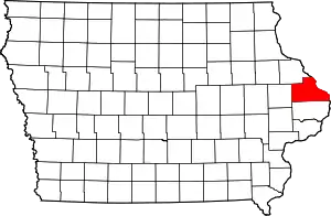
Location of Jackson County in Iowa
This is intended to be a complete list of the properties and districts on the National Register of Historic Places in Jackson County, Iowa, United States. Latitude and longitude coordinates are provided for many National Register properties and districts; these locations may be seen together in a map.[1]
There are 75 properties and districts listed on the National Register in the county.
- This National Park Service list is complete through NPS recent listings posted January 29, 2021.[2]
Current listings
| [3] | Name on the Register[4] | Image | Date listed[5] | Location | City or town | Description |
|---|---|---|---|---|---|---|
| 1 | D.H. Anderson Building | April 10, 1986 (#86000718) |
129 S. Main St. 42°04′06″N 90°39′54″W |
Maquoketa | ||
| 2 | D.H. Anderson House | 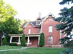 D.H. Anderson House |
August 9, 1991 (#91000964) |
315 E. Locust 42°03′51″N 90°39′41″W |
Maquoketa | |
| 3 | Bassnett-Nickerson House | 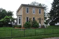 Bassnett-Nickerson House |
July 24, 1992 (#92000914) |
116 S. Vermont 42°04′04″N 90°40′24″W |
Maquoketa | |
| 4 | Bellevue Herald Building | 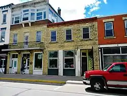 Bellevue Herald Building |
August 30, 1991 (#91001079) |
130 S. Riverview St. 42°15′28″N 90°25′22″W |
Bellevue | |
| 5 | Big Mill Homestead | 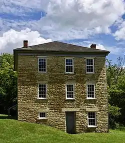 Big Mill Homestead |
August 30, 1991 (#91001075) |
Paradise Valley Rd. west of Bellevue 42°16′14″N 90°31′03″W |
Bellevue | |
| 6 | Building at 101 North Riverview Street | 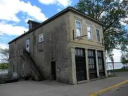 Building at 101 North Riverview Street |
August 30, 1991 (#91001068) |
101 N. Riverview St. 42°15′32″N 90°25′22″W |
Bellevue | |
| 7 | Building at 126 South Riverview Street | 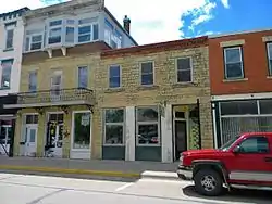 Building at 126 South Riverview Street |
August 30, 1991 (#91001070) |
126 S. Riverview St. 42°15′28″N 90°25′22″W |
Bellevue | |
| 8 | Building at 130–132 North Riverview Street | 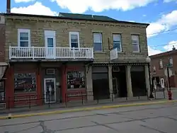 Building at 130–132 North Riverview Street |
August 30, 1991 (#91001069) |
130–132 N. Riverview St. 42°15′33″N 90°25′24″W |
Bellevue | |
| 9 | Building at 306 South Second Street | 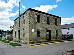 Building at 306 South Second Street |
August 30, 1991 (#91001071) |
306 S. 2nd St. 42°15′21″N 90°25′24″W |
Bellevue | |
| 10 | Nathaniel Butterworth House | 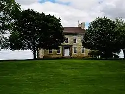 Nathaniel Butterworth House |
July 24, 1992 (#92000909) |
Eastern side of Iowa Highway 62 north of Andrew 42°09′46″N 90°35′52″W |
Andrew | |
| 11 | Canton School | 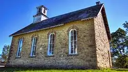 Canton School |
July 24, 1979 (#79000898) |
South St. 42°09′47″N 90°53′46″W |
Canton | |
| 12 | Central School | 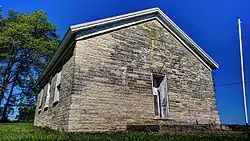 Central School |
July 24, 1992 (#92000920) |
Junction of Bellevue-Canton and Dubuque-Canton Rds. 42°10′24″N 90°51′15″W |
Canton | |
| 13 | Chicago, Milwaukee & St. Paul Narrow Gauge Depot-LaMotte | 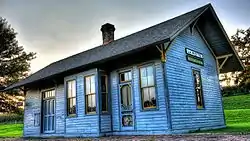 Chicago, Milwaukee & St. Paul Narrow Gauge Depot-LaMotte |
February 17, 1995 (#95000105) |
Market St. 42°17′32″N 90°37′22″W |
La Motte | |
| 14 | George Cooper House | 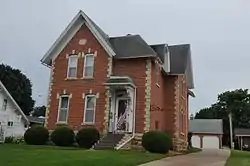 George Cooper House |
August 9, 1991 (#91000963) |
413 W. Platt St. 42°04′07″N 90°40′11″W |
Maquoketa | |
| 15 | Cundill Block | 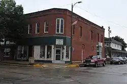 Cundill Block |
August 9, 1991 (#89002112) |
202 S. Main 42°04′03″N 90°39′57″W |
Maquoketa | |
| 16 | Decker House Hotel | 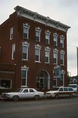 Decker House Hotel |
December 29, 1978 (#78003451) |
128 N. Main St. 42°04′13″N 90°40′04″W |
Maquoketa | |
| 17 | DeFries House, Barn and Carpenter Shop | July 24, 1992 (#92000910) |
Eastern side of 232nd Ave., 255 feet south-west of its junction with 180th St. 42°11′18″N 90°37′18″W |
Andrew | Limestone house, barn and carpenter shop | |
| 18 | John S. Dominy House | 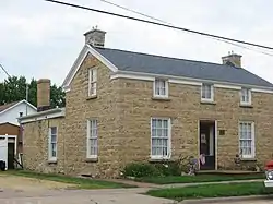 John S. Dominy House |
July 24, 1992 (#92000922) |
605 Pearl St. 42°04′12″N 90°10′19″W |
Sabula | |
| 19 | Dyas Hexagonal Barn | 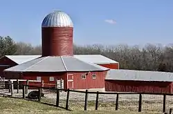 Dyas Hexagonal Barn |
June 30, 1986 (#86001442) |
U.S. Route 52 42°13′57″N 90°24′20″W |
Bellevue | |
| 20 | George Dyas House | August 30, 1991 (#91001077) |
County Road Z-15 southwest of its junction with U.S. Route 52 42°14′30″N 90°25′20″W |
Bellevue | ||
| 21 | William Dyas Barn | 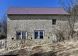 William Dyas Barn |
August 30, 1991 (#91001078) |
County Road Z-15 southwest of its junction with U.S. Route 52 42°14′39″N 90°25′11″W |
Bellevue | |
| 22 | First National Bank | 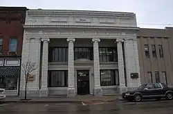 First National Bank |
August 9, 1991 (#89002108) |
120 S. Main 42°04′06″N 90°39′57″W |
Maquoketa | |
| 23 | Fritz Chapel | 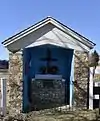 Fritz Chapel |
August 30, 1991 (#91001067) |
Spruce Creek Rd. west of its junction with U.S. Route 52 42°17′41″N 90°29′39″W |
Bellevue | |
| 24 | Gehlen House and Barn | 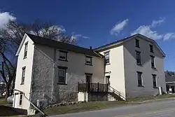 Gehlen House and Barn |
June 18, 1979 (#79000901) |
U.S. Route 52 42°21′38″N 90°32′23″W |
St. Donatus | |
| 25 | Milton Godard House | 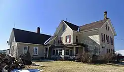 Milton Godard House |
July 24, 1992 (#92000915) |
Southern side of 7th St. southwest of Maquoketa 42°02′21″N 90°44′07″W |
Maquoketa | |
| 26 | Harris Wagon and Carriage Shop | 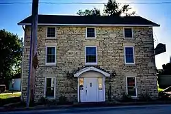 Harris Wagon and Carriage Shop |
July 24, 1992 (#92000917) |
Junction of Main and Pine Sts. 42°17′44″N 90°37′16″W |
La Motte | |
| 27 | Hotel Hurst | 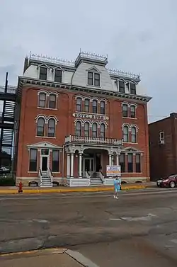 Hotel Hurst |
December 27, 1989 (#89002105) |
227 S. Main 42°04′00″N 90°39′54″W |
Maquoketa | |
| 28 | Hotel Hurst Garage | December 27, 1989 (#89002109) |
219 S. Main 42°04′01″N 90°39′54″W |
Maquoketa | ||
| 29 | House at 505 Court Street | 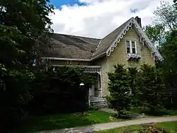 House at 505 Court Street |
August 30, 1991 (#91001073) |
505 Court St. 42°15′24″N 90°25′42″W |
Bellevue | |
| 30 | House at 111 E. Maple Street | 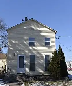 House at 111 E. Maple Street |
August 9, 1991 (#91000959) |
111 E. Maple St. 42°03′56″N 90°39′54″W |
Maquoketa | |
| 31 | A.A. Hurst House | 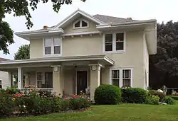 A.A. Hurst House |
August 9, 1991 (#91000960) |
513 W. Platt St. 42°04′08″N 90°40′16″W |
Maquoketa | |
| 32 | Hurstville Historic District | 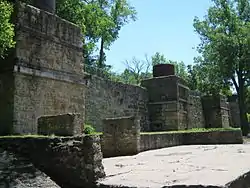 Hurstville Historic District |
December 3, 1979 (#79000900) |
North of Maquoketa on U.S. Route 61 42°05′38″N 90°40′55″W |
Maquoketa | |
| 33 | Insane Asylum at the County Poor Farm | 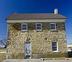 Insane Asylum at the County Poor Farm |
July 24, 1992 (#92000918) |
Eastern side of County Road Y61 (250th Ave.) north of Andrew 42°11′56″N 90°36′36″W |
Andrew | |
| 34 | IOOF Building | 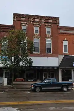 IOOF Building |
August 9, 1991 (#89002110) |
103 N. Main 42°04′09″N 90°39′54″W |
Maquoketa | |
| 35 | Jackson County Courthouse | 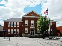 Jackson County Courthouse |
July 2, 1981 (#81000248) |
Bounded by 3rd, State, 4th, and Court Sts. 42°15′27″N 90°25′34″W |
Bellevue | |
| 36 | Jackson County Jail |  Jackson County Jail |
December 12, 1978 (#78001224) |
Emmet St. 42°09′15″N 90°35′29″W |
Andrew | |
| 37 | Mrs. Lydia Johnson House |  Mrs. Lydia Johnson House |
August 9, 1991 (#91000966) |
209 E. Locust 42°03′51″N 90°39′47″W |
Maquoketa | |
| 38 | Kegler Gonner Store and Post Office |  Kegler Gonner Store and Post Office |
June 27, 1985 (#85001375) |
100 E. Main 42°09′50″N 90°28′35″W |
Springbrook | |
| 39 | Kucheman Building |  Kucheman Building |
August 30, 1991 (#91001072) |
100 N. 2nd St. 42°15′30″N 90°25′28″W |
Bellevue | |
| 40 | John Lake House | 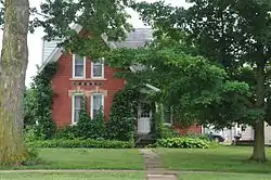 John Lake House |
December 30, 1991 (#91000969) |
601 W. Platt St. 42°04′06″N 90°40′19″W |
Maquoketa | |
| 41 | Lock and Dam No. 12 Historic District |  Lock and Dam No. 12 Historic District |
March 10, 2004 (#04000172) |
401 N. Riverview St. 42°15′41″N 90°25′22″W |
Bellevue | |
| 42 | Henry Lubben House, Smokehouse and Springhouse | July 24, 1992 (#92000919) |
Western side of County Road Y34 north of Baldwin 42°05′38″N 90°50′26″W |
Baldwin | ||
| 43 | Lyon Block | 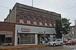 Lyon Block |
August 9, 1991 (#89002104) |
112-116 N. Main 42°04′11″N 90°39′57″W |
Maquoketa | |
| 44 | Maquoketa Caves State Park Historic District | 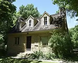 Maquoketa Caves State Park Historic District |
December 23, 1991 (#91001843) |
County Road 428 northwest of Maquoketa 42°07′05″N 90°46′28″W |
Maquoketa | |
| 45 | Maquoketa Company-Clinton Machine Company Administration Building | 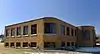 Maquoketa Company-Clinton Machine Company Administration Building |
August 23, 2006 (#06000712) |
605 E. Maple St. 42°03′59″N 90°39′33″W |
Maquoketa | |
| 46 | Maquoketa Free Public Library | 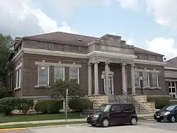 Maquoketa Free Public Library |
December 27, 1989 (#89002102) |
2nd and Pleasant 42°04′04″N 90°40′01″W |
Maquoketa | |
| 47 | Dr. G.S. Martin House | 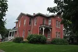 Dr. G.S. Martin House |
December 30, 1991 (#91000967) |
311 S. 2nd St. 42°03′54″N 90°39′59″W |
Maquoketa | |
| 48 | Merrero Building | 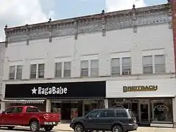 Merrero Building |
August 9, 1991 (#89002107) |
111-115 S. Main 42°04′07″N 90°39′54″W |
Maquoketa | |
| 49 | Mill Rock School | 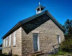 Mill Rock School |
July 24, 1992 (#92000913) |
Western side of 153rd Ave., south of Baldwin 42°03′31″N 90°50′21″W |
Baldwin | |
| 50 | Mitchell-Maskrey Mill | 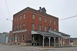 Mitchell-Maskrey Mill |
August 9, 1991 (#89002111) |
120 E. Pleasant 42°04′04″N 90°39′52″W |
Maquoketa | |
| 51 | New Era Building | 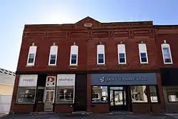 New Era Building |
August 9, 1991 (#89002103) |
115-117 E. Platt 42°04′08″N 90°39′53″W |
Maquoketa | |
| 52 | Theodore Niemann House and Spring House | August 30, 1991 (#91001065) |
Spruce Creek Rd. west of its junction with U.S. Route 52 42°17′35″N 90°29′28″W |
Bellevue | ||
| 53 | Alexander Organ House | 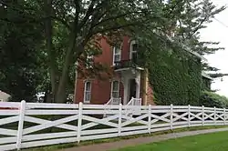 Alexander Organ House |
August 9, 1991 (#91000968) |
607 W. Summit 42°03′42″N 90°40′22″W |
Maquoketa | |
| 54 | Paradise Farm | 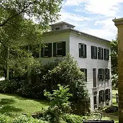 Paradise Farm |
July 13, 1977 (#77000520) |
West of Bellevue 42°16′10″N 90°29′04″W |
Bellevue | |
| 55 | Perham House | 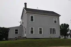 Perham House |
August 9, 1991 (#91000961) |
213 E. Pleasant St. 42°04′03″N 90°39′48″W |
Maquoketa | |
| 56 | Polygonal Barn, Van Buren Township | June 30, 1986 (#86001443) |
Iowa Highway 64 42°03′09″N 90°21′34″W |
Van Buren Township | ||
| 57 | E.G. Potter's Jasper Flour Mill | 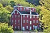 E.G. Potter's Jasper Flour Mill |
April 19, 1984 (#84001257) |
South and 2nd St. 42°15′03″N 90°25′36″W |
Bellevue | |
| 58 | Robb House and Spring House | 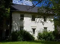 Robb House and Spring House |
August 30, 1991 (#91001076) |
Paradise Valley Rd. west of Bellevue 42°16′52″N 90°32′33″W |
Bellevue | |
| 59 | Henry Roling House | 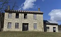 Henry Roling House |
August 30, 1991 (#91001066) |
Spruce Creek Rd. west of its junction with U.S. Route 52 42°17′30″N 90°28′42″W |
Bellevue | |
| 60 | St. Lawrence Catholic Church | 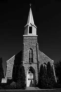 St. Lawrence Catholic Church |
July 24, 1992 (#92000912) |
Bellevue-Cascade Rd. (County Road D61) west of its junction with U.S. Route 61 42°14′26″N 90°41′42″W |
Otter Creek | |
| 61 | St. Patrick's Church-Garryowen | 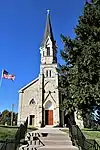 St. Patrick's Church-Garryowen |
July 24, 1992 (#92000921) |
W. Bellevue-Cascade Rd. (County Road D61) west of Garryowen 42°17′07″N 90°50′50″W |
Garryowen | |
| 62 | C.M. Sanborn Building | 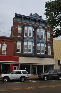 C.M. Sanborn Building |
August 9, 1991 (#89002106) |
203 S. Main 42°04′02″N 90°39′54″W |
Maquoketa | |
| 63 | Savanna-Sabula Bridge | 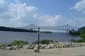 Savanna-Sabula Bridge |
August 27, 1999 (#99001033) |
U.S. Route 52/Iowa Highway 64 over the Mississippi River 42°06′14″N 90°10′01″W |
Sabula | Extends into Carroll County, Illinois |
| 64 | Mrs. Margaret Sieben House | July 24, 1992 (#92000916) |
0.3 miles east of County Road Y34 north of Baldwin 42°05′21″N 90°50′09″W |
Baldwin | ||
| 65 | Thomas Slye House | July 24, 1992 (#92000911) |
Southern side of 184th St. east of its junction with Iowa Highway 62 42°11′29″N 90°36′15″W |
Andrew | ||
| 66 | Spring Side | 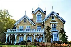 Spring Side |
December 28, 1990 (#90001955) |
Junction of U.S. Route 52 and Ensign Rd. 42°16′13″N 90°26′00″W |
Bellevue | |
| 67 | J.E. Squiers House | 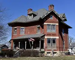 J.E. Squiers House |
April 20, 1995 (#95000385) |
418 W. Pleasant St. 42°04′05″N 90°40′16″W |
Maquoketa | |
| 68 | W.B. Swigert House | 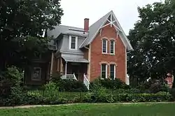 W.B. Swigert House |
August 9, 1991 (#91000965) |
309 N. Main St. 42°04′17″N 90°39′54″W |
Maquoketa | |
| 69 | Henry Taubman House |  Henry Taubman House |
August 9, 1991 (#91000962) |
303 E. Pleasant St. 42°04′03″N 90°39′43″W |
Maquoketa | |
| 70 | Upper Paradise | 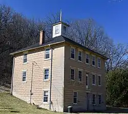 Upper Paradise |
August 30, 1991 (#91001074) |
Paradise Valley Rd. west of Bellevue 42°16′24″N 90°30′20″W |
Bellevue | |
| 71 | Village of St. Donatus Historic District | 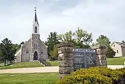 Village of St. Donatus Historic District |
November 8, 1989 (#89001870) |
Junction of U.S. Route 52/Main St. and 1st St. 42°21′42″N 90°32′26″W |
St. Donatus | |
| 72 | West Pleasant Street Historic District | 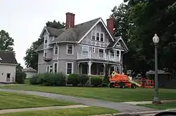 West Pleasant Street Historic District |
August 9, 1991 (#91000970) |
Pleasant St. between 2nd and Prospect Sts. 42°04′04″N 90°40′11″W |
Maquoketa | |
| 73 | Seneca Williams Mill | 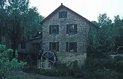 Seneca Williams Mill |
September 1, 1976 (#76000774) |
East of Maquoketa on Iowa Highway 64 42°04′05″N 90°38′44″W |
Maquoketa | |
| 74 | Anson Wilson House | November 17, 1977 (#77000521) |
South of Maquoketa off U.S. Route 61 42°03′02″N 90°40′39″W |
Maquoketa | ||
| 75 | Jeremiah Wood House | 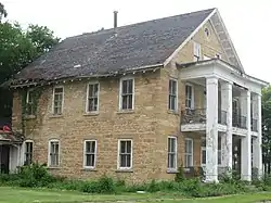 Jeremiah Wood House |
November 10, 1982 (#82000409) |
802 River St. 42°04′05″N 90°10′14″W |
Sabula |
See also
| Wikimedia Commons has media related to National Register of Historic Places in Jackson County, Iowa. |
References
- The latitude and longitude information provided in this table was derived originally from the National Register Information System, which has been found to be fairly accurate for about 99% of listings. Some locations in this table may have been corrected to current GPS standards.
- "National Register of Historic Places: Weekly List Actions". National Park Service, United States Department of the Interior. Retrieved on January 29, 2021.
- Numbers represent an alphabetical ordering by significant words. Various colorings, defined here, differentiate National Historic Landmarks and historic districts from other NRHP buildings, structures, sites or objects.
- "National Register Information System". National Register of Historic Places. National Park Service. April 24, 2008.
- The eight-digit number below each date is the number assigned to each location in the National Register Information System database, which can be viewed by clicking the number.
| Topics | |
|---|---|
| Lists by state |
|
| Lists by insular areas | |
| Lists by associated state | |
| Other areas | |
| Related | |
| |

Municipalities and communities of Jackson County, Iowa, United States | ||
|---|---|---|
| Cities | Map of Iowa highlighting Jackson County | |
| Townships | ||
| Unincorporated communities | ||
| Footnotes | ‡This populated place also has portions in an adjacent county or counties | |
| ||
This article is issued from Wikipedia. The text is licensed under Creative Commons - Attribution - Sharealike. Additional terms may apply for the media files.