Todd County, South Dakota
Todd County is a county in the U.S. state of South Dakota. As of the 2010 United States Census, the population was 9,612.[2] Todd County does not have its own county seat. Instead, Winner in neighboring Tripp County serves as its administrative center.[3] Its largest city is Mission. The county was created in 1909, although it remains unorganized.[1][4] The county was named for John Blair Smith Todd, a delegate from Dakota Territory to the United States House of Representatives[1] and a Civil War general.
Todd County | |
|---|---|
_from_S_1.JPG.webp) | |
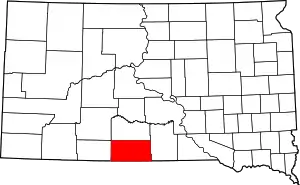 Location within the U.S. state of South Dakota | |
 South Dakota's location within the U.S. | |
| Coordinates: 43°11′N 100°44′W | |
| Country | |
| State | |
| Founded | 1909[1] |
| Named for | John Blair Smith Todd |
| Seat | None (de jure) Winner (de facto) |
| Largest city | Mission |
| Area | |
| • Total | 1,391 sq mi (3,600 km2) |
| • Land | 1,389 sq mi (3,600 km2) |
| • Water | 2.3 sq mi (6 km2) 0.2% |
| Population (2010) | |
| • Total | 9,612 |
| • Estimate (2018) | 10,283 |
| • Density | 6.9/sq mi (2.7/km2) |
| Time zone | UTC−6 (Central) |
| • Summer (DST) | UTC−5 (CDT) |
| Congressional district | At-large |
| Winner in neighboring Tripp County serves as Todd County's administrative center. | |
The county lies entirely within the Rosebud Indian Reservation and is coterminous with the main reservation (exclusive of off-reservation trust lands, which lie in four nearby counties). Its southern border is with the state of Nebraska. It is one of five South Dakota counties entirely within an Indian reservation.[5] The county's per-capita income makes it the third poorest county in the United States.[6] Unlike many rural counties in South Dakota, since 1960, its net population has increased.
History
Until 1981 Todd, Shannon (now Oglala Lakota), and Washabaugh were the last unorganized counties in the United States. Although then organized, Todd did not receive a home rule charter until 1983. It contracts with Tripp County for its Auditor, Treasurer, and Registrar of Deeds.[7]
Geography
Todd County lies on the south line of South Dakota. Its south boundary line abuts the north boundary line of the state of Nebraska. Its terrain consists of semi-arid rolling hills, cut by gullies and drainages which flow to the northeast. The land is partially dedicated to agriculture, including center pivot irrigation.[8] The terrain slopes to the northeast, and its highest point is near the SW corner, at 3,176' (968m) ASL.[9]
The eastern portion of South Dakota's counties (48 of 66) observe Central Time; the western counties (18 of 66) observe Mountain Time. Todd County is the westernmost of the SD counties to observe Central Time.[10]
Todd County has a total area of 1,391 square miles (3,600 km2), of which 1,389 square miles (3,600 km2) is land and 2.3 square miles (6.0 km2) (0.2%) is water.[11]
Major highways
 U.S. Highway 18
 U.S. Highway 83
 South Dakota Highway 63
Adjacent counties
- Mellette County - north
- Tripp County - east
- Cherry County, Nebraska - south (western half observes Mountain Time)
- Keya Paha County, Nebraska - southeast[9]
- Bennett County - west (observes Mountain Time)
- Jackson County - northwest[8] (observes Mountain Time)
Protected areas[8]
- Hollow Horn Bear Village
Lakes[8]
- Antelope Lake
- He Dog Lake
- White Lake
Demographics
| Historical population | |||
|---|---|---|---|
| Census | Pop. | %± | |
| 1910 | 2,164 | — | |
| 1920 | 2,784 | 28.7% | |
| 1930 | 5,898 | 111.9% | |
| 1940 | 5,714 | −3.1% | |
| 1950 | 4,758 | −16.7% | |
| 1960 | 4,661 | −2.0% | |
| 1970 | 6,606 | 41.7% | |
| 1980 | 7,328 | 10.9% | |
| 1990 | 8,352 | 14.0% | |
| 2000 | 9,050 | 8.4% | |
| 2010 | 9,612 | 6.2% | |
| 2019 (est.) | 10,177 | [12] | 5.9% |
| US Decennial Census[13] 1790-1960[14] 1900-1990[15] 1990-2000[16] 2010-2018[2] | |||
2000 census
As of the 2000 census,[17] there were 9,050 people, 2,462 households, and 1,917 families in the county. The population density was 6 people per square mile (3/km2). There were 2,766 housing units at an average density of 2 per square mile (1/km2). The racial makeup of the county was 85.60% Native American, 12.57% White, 0.09% Black or African American, 0.14% Asian, 0.21% from other races, and 1.38% from two or more races. 1.52% of the population were Hispanic or Latino of any race.
There were 2,462 households, out of which 48.90% had children under the age of 18 living with them, 35.20% were married couples living together, 31.80% had a female householder with no husband present, and 22.10% were non-families. 18.90% of all households were made up of individuals, and 5.20% had someone living alone who was 65 years of age or older. The average household size was 3.62 and the average family size was 4.09.
The county population contained 44.00% under the age of 18, 10.40% from 18 to 24, 25.10% from 25 to 44, 14.80% from 45 to 64, and 5.80% who were 65 years of age or older. The median age was 22 years. For every 100 females there were 97.90 males. For every 100 females age 18 and over, there were 92.30 males.
The median income for a household in the county was $20,035, and the median income for a family was $19,533. Males had a median income of $20,993 as opposed to $21,449 for females. The per capita income for the county was $7,714. About 44.00% of families and 48.30% of the population were below the poverty line, including 57.60% of those under age 18 and 33.50% of those age 65 or over. The county's per-capita income makes it one of the poorest counties in the United States.[18]
2010 census
As of the 2010 United States Census, there were 9,612 people, 2,780 households, and 2,091 families in the county.[19] The population density was 6.9 inhabitants per square mile (2.7/km2). There were 3,142 housing units at an average density of 2.3 per square mile (0.89/km2).[20] The racial makeup of the county was 88.1% American Indian, 9.6% white, 0.2% black or African American, 0.2% Asian, 0.2% from other races, and 1.8% from two or more races. Those of Hispanic or Latino origin made up 2.4% of the population.[19] In terms of ancestry, 5.1% were German, and 1.1% were American.[21]
Of the 2,780 households, 55.9% had children under the age of 18 living with them, 28.5% were married couples living together, 34.7% had a female householder with no husband present, 24.8% were non-families, and 21.1% of all households were made up of individuals. The average household size was 3.45 and the average family size was 3.95. The median age was 24.0 years.[19]
The median income for a household in the county was $25,196 and the median income for a family was $29,010. Males had a median income of $26,971 versus $30,211 for females. The per capita income for the county was $11,010. About 44.2% of families and 48.8% of the population were below the poverty line, including 59.0% of those under age 18 and 45.7% of those age 65 or over.[22]
Communities
City
Town
Census-designated places
Unincorporated communities[8]
- Grass Mountain
- HeDog
- Hidden Timber
- Olsonville
Unorganized territories
- East Todd
- West Todd
Politics
Similar to most other Native American-majority counties, Hillary Clinton won the majority of votes in Todd County in 2016. The last election in which the Republican nominee won the county was in 1960 which the Richard Nixon-Henry Cabot Lodge Jr. ticket carried the county.
| Year | Republican | Democratic | Third parties |
|---|---|---|---|
| 2020 | 21.0% 532 | 77.3% 1,963 | 1.7% 44 |
| 2016 | 22.9% 487 | 70.8% 1,505 | 6.3% 133 |
| 2012 | 19.9% 498 | 79.1% 1,976 | 0.9% 23 |
| 2008 | 20.2% 571 | 78.1% 2,208 | 1.7% 49 |
| 2004 | 25.2% 889 | 72.2% 2,543 | 2.6% 92 |
| 2000 | 32.0% 478 | 66.5% 993 | 1.5% 23 |
| 1996 | 24.2% 482 | 69.3% 1,380 | 6.5% 129 |
| 1992 | 28.0% 456 | 56.1% 915 | 15.9% 259 |
| 1988 | 31.9% 535 | 66.7% 1,117 | 1.4% 24 |
| 1984 | 39.6% 679 | 59.6% 1,022 | 0.8% 13 |
| 1980 | 41.8% 803 | 50.6% 972 | 7.7% 148 |
| 1976 | 40.7% 583 | 57.6% 826 | 1.7% 25 |
| 1972 | 46.8% 806 | 52.6% 907 | 0.6% 10 |
| 1968 | 38.8% 683 | 56.1% 987 | 5.2% 91 |
| 1964 | 36.2% 723 | 63.8% 1,274 | |
| 1960 | 50.1% 909 | 49.9% 904 | |
| 1956 | 47.3% 748 | 52.7% 833 | |
| 1952 | 62.7% 1,025 | 37.4% 611 | |
| 1948 | 43.5% 625 | 55.4% 796 | 1.2% 17 |
| 1944 | 51.9% 737 | 48.1% 683 | |
| 1940 | 50.1% 1,245 | 49.9% 1,238 | |
| 1936 | 31.7% 624 | 67.0% 1,318 | 1.2% 24 |
| 1932 | 26.2% 533 | 73.0% 1,485 | 0.8% 16 |
| 1928 | 48.4% 789 | 51.0% 831 | 0.6% 9 |
| 1924 | 67.0% 837 | 19.0% 237 | 14.0% 175 |
| 1920 | 0.0% 0 | 0.0% 0 |
References
- Legislative Manual, South Dakota, 2005, p. 597
- "State & County QuickFacts". US Census Bureau. Retrieved November 28, 2013.
- "Find a County". National Association of Counties. Retrieved June 7, 2011.
- "Dakota Territory, South Dakota, and North Dakota: Individual County Chronologies". Dakota Territory Atlas of Historical County Boundaries. The Newberry Library. 2006. Retrieved March 31, 2015.
- The other counties are Corson, Dewey, Oglala Lakota, and Ziebach.
- United States counties by per capita income
- Archived February 17, 2012, at the Wayback Machine, Reference Desk/South Dakota Counties (accessed April 19, 2009).
- Todd County SD Google Maps (accessed 4 February 2019)
- ""Find an Altitude" Google Maps (accessed 4 February 2019)". Archived from the original on May 21, 2019. Retrieved February 4, 2019.
- Map of Time Zone Line through South Dakota (accessed 30 January 2019)
- "2010 Census Gazetteer Files". US Census Bureau. August 22, 2012. Retrieved March 28, 2015.
- "Annual Estimates of the Resident Population for Counties: April 1, 2010 to July 1, 2019". Retrieved April 10, 2020.
- "US Decennial Census". US Census Bureau. Retrieved March 28, 2015.
- "Historical Census Browser". University of Virginia Library. Retrieved March 28, 2015.
- Forstall, Richard L., ed. (March 27, 1995). "Population of Counties by Decennial Census: 1900 to 1990". US Census Bureau. Retrieved March 28, 2015.
- "Census 2000 PHC-T-4. Ranking Tables for Counties: 1990 and 2000" (PDF). US Census Bureau. April 2, 2001. Retrieved March 28, 2015.
- "U.S. Census website". US Census Bureau. Retrieved May 14, 2011.
- Lottery Winner from Winner, SD Yahoo! News Published June 6, 2009. Retrieved June 6, 2009.
- "Profile of General Population and Housing Characteristics: 2010 Demographic Profile Data". US Census Bureau. Archived from the original on February 13, 2020. Retrieved March 12, 2016.
- "Population, Housing Units, Area, and Density: 2010 - County". US Census Bureau. Archived from the original on February 13, 2020. Retrieved March 12, 2016.
- "Selected Social Characteristics in the US – 2006-2010 American Community Survey 5-Year Estimates". US Census Bureau. Archived from the original on February 13, 2020. Retrieved March 12, 2016.
- "Selected Economic Characteristics – 2006-2010 American Community Survey 5-Year Estimates". US Census Bureau. Archived from the original on February 13, 2020. Retrieved March 12, 2016.
- Leip, David. "Atlas of US Presidential Elections". uselectionatlas.org. Retrieved April 15, 2018.
Places adjacent to Todd County, South Dakota | ||||||||||
|---|---|---|---|---|---|---|---|---|---|---|
| ||||||||||
Municipalities and communities of Todd County, South Dakota, United States | ||
|---|---|---|
| City | | |
| Town | ||
| CDPs | ||
| Unincorporated communities | ||
| Indian reservation | ||
| Footnotes | ‡This populated place also has portions in an adjacent county or counties | |
| ||

| Authority control |
|---|