National Register of Historic Places listings in Poweshiek County, Iowa
This is a list of the National Register of Historic Places listings in Poweshiek County, Iowa.
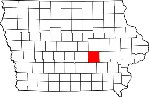
Location of Poweshiek County in Iowa
This is intended to be a complete list of the properties and districts on the National Register of Historic Places in Poweshiek County, Iowa, United States. Latitude and longitude coordinates are provided for many National Register properties and districts; these locations may be seen together in a map.[1]
There are 24 properties and districts listed on the National Register in the county, including one National Historic Landmark.
- This National Park Service list is complete through NPS recent listings posted January 29, 2021.[2]
Current listings
| [3] | Name on the Register[4] | Image | Date listed[5] | Location | City or town | Description |
|---|---|---|---|---|---|---|
| 1 | Bowers and McDonald Office Building | 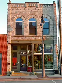 Bowers and McDonald Office Building |
December 20, 1990 (#90001849) |
816 Commercial St. 41°44′33″N 92°43′29″W |
Grinnell | |
| 2 | Brooklyn Hotel | 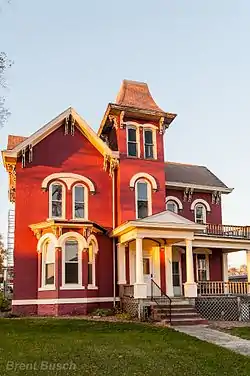 Brooklyn Hotel |
October 1, 1979 (#79000933) |
154 Front St. 41°43′42″N 92°26′51″W |
Brooklyn | |
| 3 | Chicago, Rock Island and Pacific Railroad-Grinnell Passenger Station | 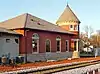 Chicago, Rock Island and Pacific Railroad-Grinnell Passenger Station |
December 12, 1976 (#76000805) |
Park and State Sts. 41°44′36″N 92°43′20″W |
Grinnell | |
| 4 | Farmers Mutual Reinsurance Company Building | .jpeg.webp) Farmers Mutual Reinsurance Company Building |
March 13, 2013 (#13000069) |
821 5th Ave. 41°44′42″N 92°43′29″W |
Grinnell | |
| 5 | Goodnow Hall | 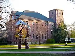 Goodnow Hall |
April 26, 1979 (#79000934) |
Grinnell College campus 41°44′49″N 92°43′19″W |
Grinnell | |
| 6 | Grinnell Herald Building | 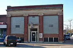 Grinnell Herald Building |
January 17, 1991 (#90002131) |
813 5th Ave. 41°44′41″N 92°43′29″W |
Grinnell | See Grinnell Herald-Register |
| 7 | Grinnell Historic Commercial District | 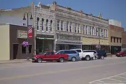 Grinnell Historic Commercial District |
April 9, 1991 (#91000384) |
Roughly bounded by Main, Broad, and Commercial Sts. and 5th Ave. 41°44′37″N 92°43′30″W |
Grinnell | |
| 8 | Levi P. Grinnell House | 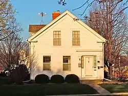 Levi P. Grinnell House |
October 1, 1979 (#79000935) |
1002 Park St. 41°44′42″N 92°43′33″W |
Grinnell | |
| 9 | Interior Telephone Company Building | 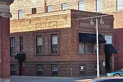 Interior Telephone Company Building |
December 20, 1990 (#90001850) |
815 5th Ave. 41°44′42″N 92°43′29″W |
Grinnell | |
| 10 | Kent Union Chapel and Cemetery | 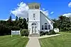 Kent Union Chapel and Cemetery |
September 16, 2009 (#09000715) |
3386 V18 Rd. 41°48′22″N 92°26′35″W |
Brooklyn | |
| 11 | William Manatt House | 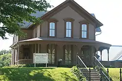 William Manatt House |
October 30, 1997 (#97001288) |
304 Jackson St. 41°43′50″N 92°26′44″W |
Brooklyn | |
| 12 | E.A. and Rebecca (Johnson) Marsh House | 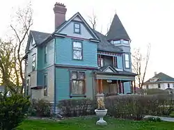 E.A. and Rebecca (Johnson) Marsh House |
April 15, 1999 (#99000454) |
833 East St. 41°44′17″N 92°43′27″W |
Grinnell | |
| 13 | Mears Hall | 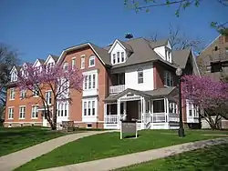 Mears Hall |
April 26, 1979 (#79000936) |
Grinnell College campus 41°44′49″N 92°43′07″W |
Grinnell | |
| 14 | Merchants' National Bank | 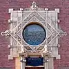 Merchants' National Bank |
January 7, 1976 (#76000804) |
Northwestern corner of 4th Ave. and Broad St. 41°44′39″N 92°43′33″W |
Grinnell | |
| 15 | Montezuma Downtown Historic District | 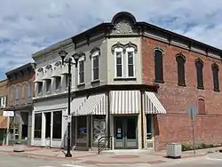 Montezuma Downtown Historic District |
May 30, 2012 (#12000131) |
Roughly along 3rd, 4th, Main & Liberty Sts. around courthouse square 41°35′06″N 92°31′27″W |
Montezuma | part of the Iowa's Main Street Commercial Architecture Multiple Property Submission |
| 16 | New Carroll House Hotel | October 1, 1979 (#79000938) |
E. Main and 5th Sts. 41°35′00″N 92°31′21″W |
Montezuma | ||
| 17 | North Grinnell Historic District | 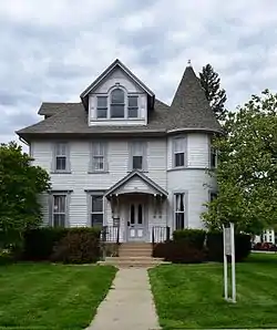 North Grinnell Historic District |
December 10, 2008 (#08001164) |
Park to W. 6th Ave. to 11th Ave. 41°44′59″N 92°43′21″W |
Grinnell | |
| 18 | Pioneer Oil Company Filling Station | 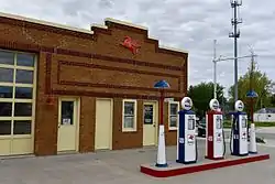 Pioneer Oil Company Filling Station |
March 13, 2013 (#13000070) |
831 West St. 41°44′32″N 92°43′39″W |
Grinnell | |
| 19 | Poweshiek County Courthouse | 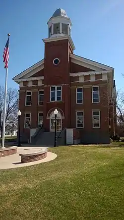 Poweshiek County Courthouse |
July 2, 1981 (#81000266) |
302 E. Main St. 41°35′07″N 92°31′30″W |
Montezuma | |
| 20 | P.P. Raymond House | 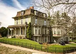 P.P. Raymond House |
April 24, 1985 (#85000873) |
4th St. 41°42′30″N 92°33′22″W |
Malcom | |
| 21 | B.J. Ricker House | 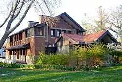 B.J. Ricker House |
December 25, 1979 (#79000937) |
1510 Broad St. 41°45′05″N 92°43′33″W |
Grinnell | |
| 22 | Spaulding Manufacturing Company | 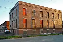 Spaulding Manufacturing Company |
December 21, 1978 (#78001257) |
500-610 4th Ave., 827-829 Spring St. 41°44′36″N 92°43′33″W |
Grinnell | |
| 23 | Charles H. Spencer House | 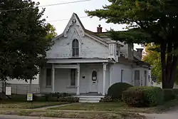 Charles H. Spencer House |
January 25, 1980 (#80001458) |
611 6th Ave. 41°44′52″N 92°43′50″W |
Grinnell | |
| 24 | Stewart Library | 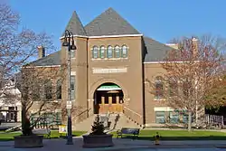 Stewart Library |
November 21, 1976 (#76000806) |
926 Broad St. 41°44′42″N 92°43′24″W |
Grinnell |
Former listings
| [3] | Name on the Register | Image | Date listed | Date removed | Location | City or town | Summary |
|---|---|---|---|---|---|---|---|
| 1 | McDowell Bridge | .jpg.webp) McDowell Bridge |
May 15, 1998 (#98000488) | May 10, 2012 | River Rd. over the North Skunk River 41°31′14″N 92°40′32″W |
Montezuma | Part of the Highway Bridges of Iowa Multiple Property Submission. Moved to the Auburn Heights Preserve in Yorklyn, Delaware.[6] |
See also
| Wikimedia Commons has media related to National Register of Historic Places in Poweshiek County, Iowa. |
References
- The latitude and longitude information provided in this table was derived originally from the National Register Information System, which has been found to be fairly accurate for about 99% of listings. Some locations in this table may have been corrected to current GPS standards.
- "National Register of Historic Places: Weekly List Actions". National Park Service, United States Department of the Interior. Retrieved on January 29, 2021.
- Numbers represent an alphabetical ordering by significant words. Various colorings, defined here, differentiate National Historic Landmarks and historic districts from other NRHP buildings, structures, sites or objects.
- "National Register Information System". National Register of Historic Places. National Park Service. April 24, 2008.
- The eight-digit number below each date is the number assigned to each location in the National Register Information System database, which can be viewed by clicking the number.
- "Former Iowa Bowstring Arch Bridge Restored and Reerected in Delaware". Bridgehunter's Chronicles. Retrieved November 30, 2018.
| Topics | |
|---|---|
| Lists by state |
|
| Lists by insular areas | |
| Lists by associated state | |
| Other areas | |
| Related | |
| |

Municipalities and communities of Poweshiek County, Iowa, United States | ||
|---|---|---|
| Cities | Map of Iowa highlighting Poweshiek County | |
| CDP | ||
| Unincorporated communities | ||
| Footnotes | ‡This populated place also has portions in an adjacent county or counties | |
| ||
This article is issued from Wikipedia. The text is licensed under Creative Commons - Attribution - Sharealike. Additional terms may apply for the media files.