National Register of Historic Places listings in Winneshiek County, Iowa
This is a list of the National Register of Historic Places listings in Winneshiek County, Iowa.
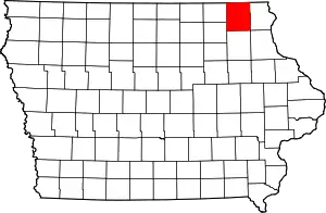
Location of Winneshiek County in Iowa
This is intended to be a complete list of the properties and districts on the National Register of Historic Places in Winneshiek County, Iowa, United States. Latitude and longitude coordinates are provided for many National Register properties and districts; these locations may be seen together in a map.[1]
There are 31 properties and districts listed on the National Register in the county. Five other properties have been delisted.
- This National Park Service list is complete through NPS recent listings posted February 5, 2021.[2]
| [3] | Name on the Register[4] | Image | Date listed[5] | Location | City or town | Description |
|---|---|---|---|---|---|---|
| 1 | Birdsall Lime Kiln | March 21, 1979 (#79000948) |
Northeast of Decorah 43°18′08″N 91°46′02″W |
Decorah | ||
| 2 | Broadway-Phelps Park Historic District | 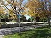 Broadway-Phelps Park Historic District |
November 13, 1976 (#76000813) |
West Broadway from Winnebago Street to Park Drive 43°18′01″N 91°47′35″W |
Decorah | |
| 3 | Burr Oak House/Masters Hotel | 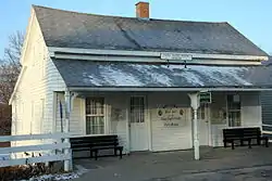 Burr Oak House/Masters Hotel |
January 27, 1983 (#83000410) |
State Street 43°27′28″N 91°51′56″W |
Burr Oak | Laura Ingalls Wilder Museum |
| 4 | Burr Oak Savings Bank | 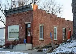 Burr Oak Savings Bank |
August 8, 2001 (#01000857) |
3608 236th Ave. 43°27′30″N 91°51′55″W |
Burr Oak | Museum Visitor Center |
| 5 | Calmar Passenger Depot | 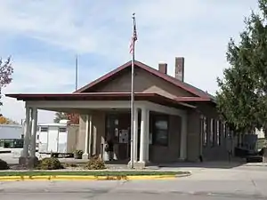 Calmar Passenger Depot |
March 21, 2011 (#11000137) |
201 N. Maryville St. 43°11′02″N 91°51′53″W |
Calmar | Advent & Development of Railroads in Iowa MPS |
| 6 | Cooley-Whitney House | 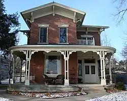 Cooley-Whitney House |
January 25, 1980 (#80001461) |
305 Grove St. 43°12′45″N 91°48′03″W |
Decorah | |
| 7 | Decorah Commercial Historic District | 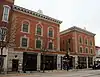 Decorah Commercial Historic District |
August 21, 2017 (#100001482) |
Blocks 500-100 W. Water, 100-200 E. Water, 100 Washington, 100 Winnebago, parts of W. Main, Court & W. Day Spring 43°18′15″N 91°47′16″W |
Decorah | |
| 8 | Decorah Ice Cave | 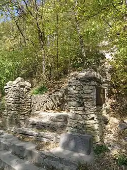 Decorah Ice Cave |
December 20, 1978 (#78001269) |
Ice Cave Road 43°18′38″N 91°47′03″W |
Decorah | |
| 9 | Decorah Municipal Bathhouse and Swimming Pool | 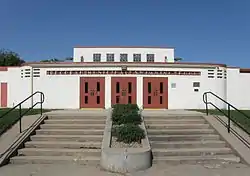 Decorah Municipal Bathhouse and Swimming Pool |
January 30, 2012 (#11001057) |
701 College Dr. 43°18′49″N 91°48′05″W |
Decorah | |
| 10 | Decorah Woolen Mill | 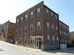 Decorah Woolen Mill |
January 26, 2001 (#00001681) |
107 Court St. 43°18′18″N 91°47′18″W |
Decorah | |
| 11 | Ellsworth-Porter House | 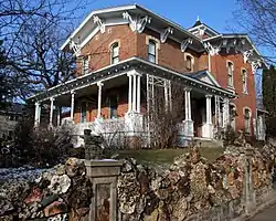 Ellsworth-Porter House |
August 6, 1975 (#75000702) |
401 West Broadway 43°17′59″N 91°47′48″W |
Decorah | Porter House Museum |
| 12 | Fort Atkinson Bridge | 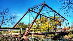 Fort Atkinson Bridge |
May 15, 1998 (#98000460) |
150th Street over the Turkey River 43°09′12″N 91°55′43″W |
Fort Atkinson | |
| 13 | Fort Atkinson Historic District | 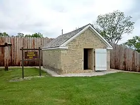 Fort Atkinson Historic District |
February 27, 2013 (#13000036) |
2nd St. & 8th Ave. 43°08′45″N 91°56′22″W |
Fort Atkinson | U.S. Army fort maintained 1840–1853 to oversee Ho-Chunk people relocated from Wisconsin. Now Fort Atkinson State Preserve.[6] |
| 14 | Frankville School | 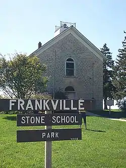 Frankville School |
November 14, 1978 (#78001272) |
State Street 43°11′20″N 91°37′18″W |
Frankville | |
| 15 | Gilliece Bridge | May 15, 1998 (#98000464) |
Cattle Creek Road over the Upper Iowa River 43°24′54″N 91°57′32″W |
Bluffton | Destroyed by overweight truck May 2017[7] | |
| 16 | Highlandville School | 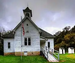 Highlandville School |
February 5, 2014 (#13001141) |
3499 Highlandville Rd. 43°26′34″N 91°40′06″W |
Decorah | |
| 17 | Horn House | 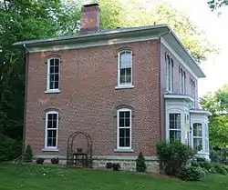 Horn House |
March 25, 1977 (#77000568) |
Northwest of Decorah 43°20′33″N 91°49′32″W |
Decorah | |
| 18 | Jacobson Farm | 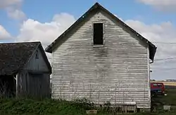 Jacobson Farm |
June 14, 1982 (#82002645) |
Junction of County Road W42 and 162nd Street, southeast of Decorah 43°10′21″N 91°45′54″W |
Decorah | |
| 19 | Kinney Octagon Barn | 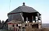 Kinney Octagon Barn |
November 19, 1986 (#86003191) |
Off U.S. Route 52 43°28′21″N 91°52′04″W |
Burr Oak | |
| 20 | Koren Library | 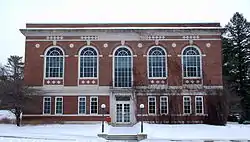 Koren Library |
January 12, 1984 (#84001610) |
Luther College campus 43°18′38″N 91°48′14″W |
Decorah | |
| 21 | Lawrence Bridge | May 15, 1998 (#98000462) |
330th Avenue over the Little Turkey River 43°04′58″N 92°03′08″W |
Jackson Junction | ||
| 22 | Locust School | 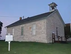 Locust School |
May 22, 1978 (#78001270) |
North of Decorah 43°25′14″N 91°43′22″W |
Decorah | |
| 23 | Luther College Farm |  Luther College Farm |
July 17, 1979 (#79000949) |
Luther College campus 43°19′04″N 91°48′05″W |
Decorah | |
| 24 | Norris Miller House | 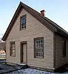 Norris Miller House |
June 8, 1976 (#76000814) |
118 N. Mill St. 43°18′19″N 91°47′31″W |
Decorah | Part of Vesterheim Norwegian-American Museum |
| 25 | Milwaukee and St. Paul Railway Combination Depot | 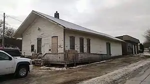 Milwaukee and St. Paul Railway Combination Depot |
September 12, 2016 (#16000609) |
203 W. Pearl St. 43°17′55″N 91°47′15″W |
Decorah | |
| 26 | Ossian Opera House | 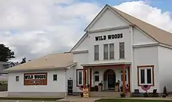 Ossian Opera House |
June 18, 1979 (#79000950) |
Main Street 43°08′41″N 91°45′53″W |
Ossian | |
| 27 | Painter-Bernatz Mill | 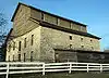 Painter-Bernatz Mill |
January 11, 1974 (#74000816) |
200 N. Mill St. 43°18′21″N 91°47′32″W |
Decorah | Part of Vesterheim Norwegian-American Museum |
| 28 | Steyer Bridge | 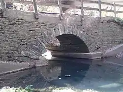 Steyer Bridge |
January 4, 1983 (#83000411) |
Oneata Road off U.S. Route 52 43°17′54″N 91°48′39″W |
Decorah | |
| 29 | Steyer Opera House | 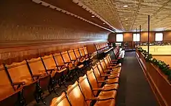 Steyer Opera House |
January 24, 1980 (#80001462) |
102-104 W. Water St. 43°18′12″N 91°47′21″W |
Decorah | |
| 30 | Wenzil Taylor Building |  Wenzil Taylor Building |
March 21, 1979 (#79000951) |
Main Street 43°12′20″N 91°57′13″W |
Spillville | |
| 31 | Upper Bluffton Bridge | May 15, 1998 (#98000458) |
Ravine Road over the Upper Iowa River 43°24′18″N 91°55′12″W |
Bluffton | ||
| 32 | Washington Prairie Methodist Church | 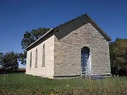 Washington Prairie Methodist Church |
January 29, 1980 (#80001463) |
Southeast of Decorah 43°14′17″N 91°44′38″W |
Decorah |
Former listings
Five properties were once listed on the Register, but have been removed:
| [3] | Name on the Register | Image | Date listed | Date removed | Location | City or town | Summary |
|---|---|---|---|---|---|---|---|
| 1 | Big Stone Mills | 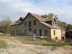 Big Stone Mills |
July 15, 2009 (#09000516) | December 19, 2014 | 113 North Main Street 43°12′27″N 91°57′03″W |
Spillville | Demolished June 23, 2011. |
| 2 | Clarksville Diner | December 10, 1993 (#93001356) | May 8, 2002 | 504 Heivly Street |
Decorah | ||
| 3 | Decorah East Side Elementary and Middle School | 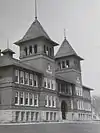 Decorah East Side Elementary and Middle School |
September 25, 1998 (#98001204) | September 10, 2008 | 210 Vernon Street |
Decorah | |
| 4 | Freeport Bowstring Arch Bridge | 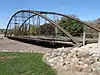 Freeport Bowstring Arch Bridge |
April 19, 1984 (#84001407) | September 10, 2008 | Spans Upper Iowa River |
Freeport vicinity | Delisted after relocation |
| 5 | Ten Mile Creek Bridge | 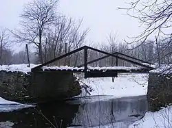 Ten Mile Creek Bridge |
May 15, 1998 (#98000466) | May 2, 2017 | Happy Hollow Road over Ten Mile Creek 43°20′17″N 91°53′18″W |
Decorah | |
| 6 | Turkey River Bridge | May 15, 1998 (#98000468) | October 15, 2014 | Little Church Road over the Turkey River 43°05′06″N 91°53′38″W |
Festina vicinity | Demolished and replaced in 2010[8] |
See also
| Wikimedia Commons has media related to National Register of Historic Places in Winneshiek County, Iowa. |
References
- The latitude and longitude information provided in this table was derived originally from the National Register Information System, which has been found to be fairly accurate for about 99% of listings. Some locations in this table may have been corrected to current GPS standards.
- "National Register of Historic Places: Weekly List Actions". National Park Service, United States Department of the Interior. Retrieved on February 5, 2021.
- Numbers represent an alphabetical ordering by significant words. Various colorings, defined here, differentiate National Historic Landmarks and historic districts from other NRHP buildings, structures, sites or objects.
- "National Register Information System". National Register of Historic Places. National Park Service. April 24, 2008.
- The eight-digit number below each date is the number assigned to each location in the National Register Information System database, which can be viewed by clicking the number.
- Peterson, Cynthia L.; David G. Stanley (2012-09-05). "National Register of Historic Places Multiple Property Documentation Form: Historic Properties of the Ho-Chunk (Winnebago) Removal to the Neutral Ground" (PDF). National Park Service. Retrieved 2013-12-29. Cite journal requires
|journal=(help) - Des Moines Register
- "Turkey River Bridge". Bridgehunter.com. Retrieved April 4, 2011.
| Topics | |
|---|---|
| Lists by state |
|
| Lists by insular areas | |
| Lists by associated state | |
| Other areas | |
| Related | |
| |

Municipalities and communities of Winneshiek County, Iowa, United States | ||
|---|---|---|
| Cities | Map of Iowa highlighting Winneshiek County | |
| Townships | ||
| CDP | ||
| Unincorporated community | ||
| Ghost town | ||
| ||
This article is issued from Wikipedia. The text is licensed under Creative Commons - Attribution - Sharealike. Additional terms may apply for the media files.