National Register of Historic Places listings in Jefferson County, Iowa
This is a list of the National Register of Historic Places listings in Jefferson County, Iowa.
Location of Jefferson County in Iowa
This is intended to be a complete list of the properties and districts on the National Register of Historic Places in Jefferson County, Iowa, United States. Latitude and longitude coordinates are provided for many National Register properties and districts; these locations may be seen together in a map.[1]
There are 29 properties and districts listed on the National Register in the county.
- This National Park Service list is complete through NPS recent listings posted February 5, 2021.[2]
Current listings
| [3] | Name on the Register[4] | Image | Date listed[5] | Location | City or town | Description |
|---|---|---|---|---|---|---|
| 1 | Architecture of Henry K. Holsman Historic Campus District | 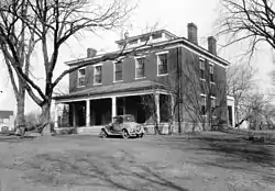 Architecture of Henry K. Holsman Historic Campus District |
October 31, 1983 (#83003605) |
Bounded by Merrill St., Iowa Highway 1, and Carter Memorial Dr. 41°00′58″N 91°58′00″W |
Fairfield | |
| 2 | W.C. Ball House | 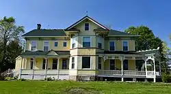 W.C. Ball House |
April 4, 1985 (#85000691) |
Rural Route #2 41°01′11″N 91°57′32″W |
Fairfield | |
| 3 | James A. Beck House | 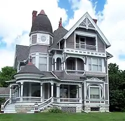 James A. Beck House |
March 29, 1978 (#78001225) |
401 E. Burlington Ave. 41°00′30″N 91°57′47″W |
Fairfield | Designed by architect George Franklin Barber |
| 4 | Burnett-Montgomery House | 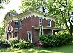 Burnett-Montgomery House |
January 27, 1983 (#83000372) |
605 N. 3rd St. 41°00′52″N 91°57′55″W |
Fairfield | |
| 5 | James F. Clarke House | 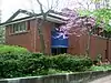 James F. Clarke House |
February 8, 1980 (#80001453) |
500 S. Main St. 41°00′21″N 91°58′00″W |
Fairfield | |
| 6 | Evergreen Ridge Stock Farm Historic District | June 21, 2007 (#07000559) |
2224 IA S 40°59′04″N 91°57′55″W |
Fairfield | ||
| 7 | Fairfield Public Library | 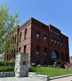 Fairfield Public Library |
May 23, 1983 (#83000373) |
Court and Washington 41°00′29″N 91°54′43″W |
Fairfield | |
| 8 | Former US Post Office Building | 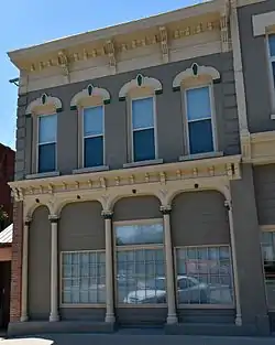 Former US Post Office Building |
January 24, 1991 (#90002128) |
110 S. Court St. 41°00′27″N 91°57′43″W |
Fairfield | |
| 9 | O.F. and Lulu E. Fryer House | 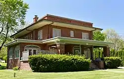 O.F. and Lulu E. Fryer House |
February 5, 1999 (#99000131) |
902 S. Main St. 40°59′32″N 91°57′18″W |
Fairfield | |
| 10 | Fred and Rosa Fulton Barn | 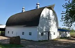 Fred and Rosa Fulton Barn |
February 22, 1999 (#99000119) |
1210 278th Boulevard 40°54′04″N 92°08′18″W |
Selma | |
| 11 | Gobble and Heer-Spurgeons Building | 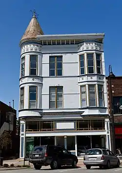 Gobble and Heer-Spurgeons Building |
October 13, 2015 (#15000727) |
51 E. Broadway 41°00′28″N 91°57′47″W |
Fairfield | |
| 12 | Henn Mansion | 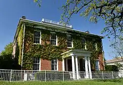 Henn Mansion |
January 11, 1983 (#83000374) |
Maharishi University of Management campus 41°01′00″N 91°57′59″W |
Fairfield | |
| 13 | Iowa Malleable Iron Company | 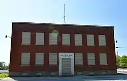 Iowa Malleable Iron Company |
February 22, 1999 (#99000122) |
600-608 N. 9th St. 41°00′47″N 91°58′33″W |
Fairfield | |
| 14 | Jefferson County Courthouse | 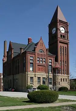 Jefferson County Courthouse |
July 2, 1981 (#81000250) |
Court St. between Briggs and Hempstead Aves. 41°00′37″N 91°57′55″W |
Fairfield | |
| 15 | Louden Machinery Company | 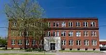 Louden Machinery Company |
February 22, 1999 (#99000128) |
607 W. Broadway Ave. 41°00′32″N 91°58′15″W |
Fairfield | |
| 16 | Louden Monorail System in the Auto Repair Shop | 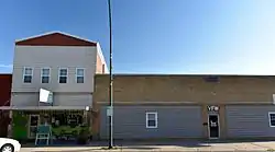 Louden Monorail System in the Auto Repair Shop |
February 22, 1999 (#99000129) |
117 E. Broadway Ave. 41°00′27″N 91°57′43″W |
Fairfield | |
| 17 | Louden Whirl-Around | 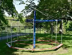 Louden Whirl-Around |
February 22, 1999 (#99000123) |
905 E. Harrison Ave. 40°59′54″N 91°57′06″W |
Fairfield | |
| 18 | R. B. and Lizzie L. Louden House | 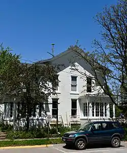 R. B. and Lizzie L. Louden House |
February 22, 1999 (#99000125) |
107 W. Washington Ave. 41°00′21″N 91°57′53″W |
Fairfield | |
| 19 | R. Bruce and May W. Louden House | 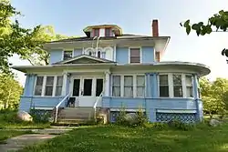 R. Bruce and May W. Louden House |
September 12, 2003 (#99000124) |
501 W. Adams Ave. 41°00′18″N 91°58′09″W |
Fairfield | |
| 20 | R.R. and Antoinette Louden House | 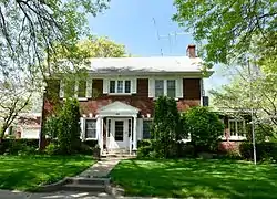 R.R. and Antoinette Louden House |
February 22, 1999 (#99000130) |
905 E. Adams Ave. 41°00′17″N 91°57′05″W |
Fairfield | |
| 21 | William and Mary Jane Louden House | 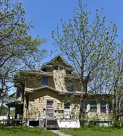 William and Mary Jane Louden House |
February 18, 1999 (#99000118) |
501 W. Washington Ave. 41°00′22″N 91°58′09″W |
Fairfield | |
| 22 | August and Vera Luedtke Barn | February 22, 1999 (#99000121) |
1938 185th St. 41°02′17″N 91°59′57″W |
Fairfield | ||
| 23 | McElhinny House | 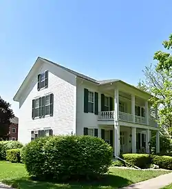 McElhinny House |
December 19, 1977 (#77000524) |
300 N. Court St. 41°00′43″N 92°02′25″W |
Fairfield | |
| 24 | New Sweden Chapel | 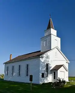 New Sweden Chapel |
March 25, 1977 (#77000525) |
East of Fairfield off U.S. Route 34 41°01′22″N 91°46′47″W |
Fairfield | |
| 25 | Old Settlers' Association Park and Rhodham Bonnifield House | 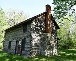 Old Settlers' Association Park and Rhodham Bonnifield House |
August 14, 1986 (#86001601) |
B St. 41°01′08″N 91°57′24″W |
Fairfield | |
| 26 | George A. Wells House | 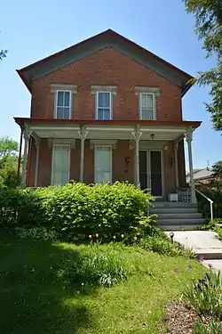 George A. Wells House |
January 27, 1983 (#83000375) |
304 S. Main St. 41°00′15″N 91°57′50″W |
Fairfield | |
| 27 | Wells-Stubbs House | 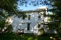 Wells-Stubbs House |
October 10, 1985 (#85003000) |
508 E. Burlington Ave. 41°00′56″N 91°57′22″W |
Fairfield | |
| 28 | Wilson Building | 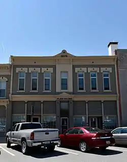 Wilson Building |
January 24, 1991 (#90002129) |
106-108 S. Court St. 41°00′28″N 91°57′40″W |
Fairfield | |
| 29 | US Senator James F. Wilson House | 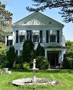 US Senator James F. Wilson House |
January 24, 1991 (#90002130) |
805 S. Main St. 40°59′44″N 91°57′45″W |
Fairfield |
See also
| Wikimedia Commons has media related to National Register of Historic Places in Jefferson County, Iowa. |
References
- The latitude and longitude information provided in this table was derived originally from the National Register Information System, which has been found to be fairly accurate for about 99% of listings. Some locations in this table may have been corrected to current GPS standards.
- "National Register of Historic Places: Weekly List Actions". National Park Service, United States Department of the Interior. Retrieved on February 5, 2021.
- Numbers represent an alphabetical ordering by significant words. Various colorings, defined here, differentiate National Historic Landmarks and historic districts from other NRHP buildings, structures, sites or objects.
- "National Register Information System". National Register of Historic Places. National Park Service. April 24, 2008.
- The eight-digit number below each date is the number assigned to each location in the National Register Information System database, which can be viewed by clicking the number.
| Topics | |
|---|---|
| Lists by state |
|
| Lists by insular areas | |
| Lists by associated state | |
| Other areas | |
| Related | |
| |

Municipalities and communities of Jefferson County, Iowa, United States | ||
|---|---|---|
| Cities | Map of Iowa highlighting Jefferson County | |
| Townships | ||
| Unincorporated communities | ||
| Footnotes | ‡This populated place also has portions in an adjacent county or counties | |
| ||
This article is issued from Wikipedia. The text is licensed under Creative Commons - Attribution - Sharealike. Additional terms may apply for the media files.