National Register of Historic Places listings in Marion County, Iowa
This is a list of the National Register of Historic Places listings in Marion County, Iowa.
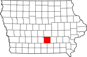
Location of Marion County in Iowa
This is intended to be a complete list of the properties and districts on the National Register of Historic Places in Marion County, Iowa, United States. Latitude and longitude coordinates are provided for many National Register properties and districts; these locations may be seen together in a map.[1]
There are 28 properties and districts listed on the National Register in the county.
- This National Park Service list is complete through NPS recent listings posted February 5, 2021.[2]
Current listings
| [3] | Name on the Register[4] | Image | Date listed[5] | Location | City or town | Description |
|---|---|---|---|---|---|---|
| 1 | Chicago, Rock Island and Pacific Passenger Depot-Pella | 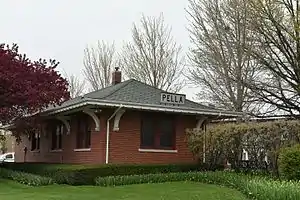 Chicago, Rock Island and Pacific Passenger Depot-Pella |
July 22, 1991 (#91000909) |
Junction of Main and Oskaloosa Sts. 41°23′54″N 92°54′54″W |
Pella | |
| 2 | Coal Ridge Baptist Church and Cemetery | 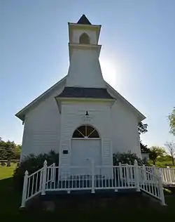 Coal Ridge Baptist Church and Cemetery |
August 23, 2006 (#06000711) |
1034 Iowa Highway 71 41°22′41″N 93°01′15″W |
Knoxville | |
| 3 | Collegiate Neighborhood Historic District | 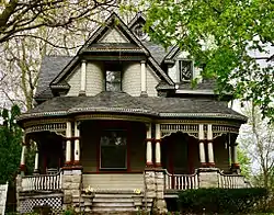 Collegiate Neighborhood Historic District |
October 26, 2017 (#100001766) |
Main to W. 1st, Independence to Union & w. side of W. 1st to Liberty Sts. 41°24′11″N 92°55′06″W |
Pella | |
| 4 | East Amsterdam School | 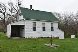 East Amsterdam School |
December 1, 2000 (#00001471) |
1010 198th Place 41°22′34″N 92°57′28″W |
Pella | |
| 5 | Evan F. Ellis Farmhouse | 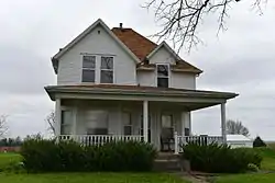 Evan F. Ellis Farmhouse |
January 3, 1985 (#85000006) |
Junction of Story and West Sts. 41°13′10″N 92°53′20″W |
Bussey | |
| 6 | First Christian Church | 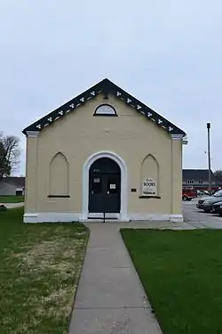 First Christian Church |
March 29, 2007 (#07000206) |
824 Franklin St. 41°24′26″N 92°55′09″W |
Pella | |
| 7 | Hammond Bridge | 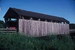 Hammond Bridge |
May 15, 1998 (#98000500) |
170th Pl. over North Cedar Creek 41°10′39″N 93°00′50″W |
Hamilton | |
| 8 | Harvey Railroad Bridge | 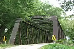 Harvey Railroad Bridge |
May 15, 1998 (#98000502) |
Harvey Island Rd. 41°19′02″N 92°54′36″W |
Harvey | |
| 9 | E.R. Hays House | 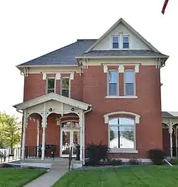 E.R. Hays House |
September 27, 1984 (#84001283) |
301 N. 2nd St. 41°19′16″N 93°05′49″W |
Knoxville | |
| 10 | Knoxville Veterans Administration Hospital Historic District | 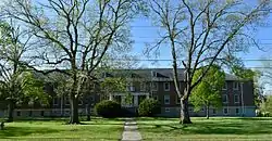 Knoxville Veterans Administration Hospital Historic District |
May 1, 2012 (#12000246) |
1515 W. Pleasant St. 41°19′20″N 93°06′51″W |
Knoxville | United States Second Generation Veterans Hospitals Multiple Property Submission |
| 11 | Knoxville WPA Athletic Field Historic District | Knoxville WPA Athletic Field Historic District |
August 2, 2007 (#07000775) |
Bounded by Lincoln St., Robinson St., Stadium St., and Marion St. 41°19′08″N 93°06′31″W |
Knoxville | |
| 12 | Philipus J. and Cornelia Koelman House | 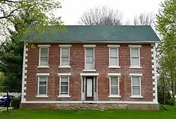 Philipus J. and Cornelia Koelman House |
December 21, 2005 (#05001430) |
1005 Broadway St. 41°24′35″N 92°55′06″W |
Pella | |
| 13 | Marion County Courthouse | 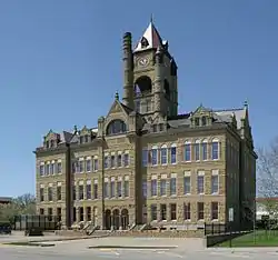 Marion County Courthouse |
July 2, 1981 (#81000256) |
Main St. 41°19′06″N 93°05′48″W |
Knoxville | |
| 14 | Pella High School | October 19, 2020 (#100005684) |
712 Union St. 41°24′16″N 92°55′04″W |
Pella | ||
| 15 | Pella Opera House | 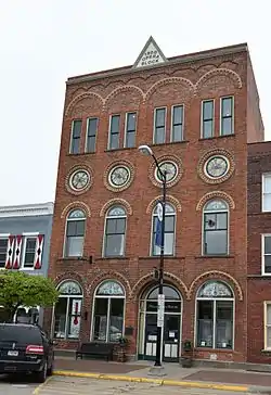 Pella Opera House |
March 20, 1992 (#91001080) |
611 Franklin St. 41°24′23″N 92°54′51″W |
Pella | |
| 16 | Peoples National Bank | .jpeg.webp) Peoples National Bank |
April 21, 2010 (#10000202) |
717 Main St. 41°24′20″N 92°54′59″W |
Pella | |
| 17 | Porter-Rhynsburger House | 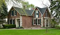 Porter-Rhynsburger House |
August 28, 2003 (#03000837) |
514 Broadway St. 41°24′14″N 92°55′06″W |
Pella | |
| 18 | St. Joseph's Roman Catholic Church and Cemetery Historic District | 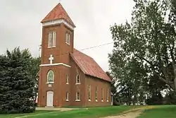 St. Joseph's Roman Catholic Church and Cemetery Historic District |
January 24, 1995 (#94001580) |
1 mile (1.6 km) east of the junction of County Road G76 and SE. 97th St. 41°12′12″N 93°18′29″W |
Lacona | |
| 19 | Dominie Henry P. Scholte House | 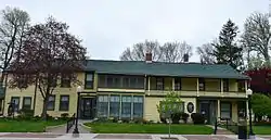 Dominie Henry P. Scholte House |
December 10, 1982 (#82000415) |
739 Washington St. 41°24′30″N 92°55′02″W |
Pella | |
| 20 | Ten Hagen Cottage-Stegman Store | 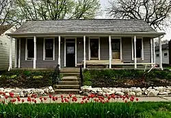 Ten Hagen Cottage-Stegman Store |
July 16, 2008 (#08000685) |
1110 W. Washington St. 41°24′29″N 92°55′25″W |
Pella | |
| 21 | Thomas F. and Nancy Tuttle House | 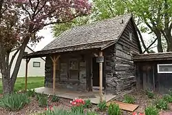 Thomas F. and Nancy Tuttle House |
January 27, 2015 (#14001209) |
608 Lincoln St. 41°24′39″N 92°54′55″W |
Pella | |
| 22 | William Van Asch House-Huibert Debooy Commercial Room | 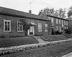 William Van Asch House-Huibert Debooy Commercial Room |
December 2, 1987 (#87002056) |
1105, 1107, and 1109 W. Washington St. 41°24′28″N 92°55′27″W |
Pella | |
| 23 | Hendrik J. and Wilhelmina H. Van Den Berg Cottage | 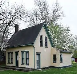 Hendrik J. and Wilhelmina H. Van Den Berg Cottage |
August 28, 2003 (#03000835) |
1305 W. Washington St. 41°24′14″N 92°55′42″W |
Pella | |
| 24 | Dirk Van Loon House | 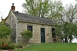 Dirk Van Loon House |
November 17, 1977 (#77000539) |
1401 University Ave. 41°24′02″N 92°55′33″W |
Pella | |
| 25 | Henry and Johanna Van Maren House-Diamond Filling Station | 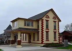 Henry and Johanna Van Maren House-Diamond Filling Station |
July 10, 2008 (#08000683) |
615 Main St. 41°24′15″N 92°54′59″W |
Pella | |
| 26 | B.H. and J.H.H. Van Spanckeren Row Houses | 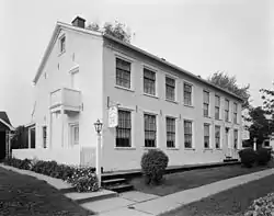 B.H. and J.H.H. Van Spanckeren Row Houses |
February 12, 1990 (#90000004) |
505-507 Franklin St. 41°24′08″N 92°54′30″W |
Pella | |
| 27 | Dirk and Cornelia J. Vander Wilt Cottage | 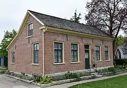 Dirk and Cornelia J. Vander Wilt Cottage |
August 8, 2001 (#01000856) |
925 Broadway St. 41°24′32″N 92°55′06″W |
Pella | |
| 28 | Wabash Railroad Bridge | 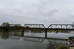 Wabash Railroad Bridge |
May 15, 1998 (#98000501) |
216th Pl. over the Des Moines River 41°20′26″N 92°56′25″W |
Pella |
See also
| Wikimedia Commons has media related to National Register of Historic Places in Marion County, Iowa. |
References
- The latitude and longitude information provided in this table was derived originally from the National Register Information System, which has been found to be fairly accurate for about 99% of listings. Some locations in this table may have been corrected to current GPS standards.
- "National Register of Historic Places: Weekly List Actions". National Park Service, United States Department of the Interior. Retrieved on February 5, 2021.
- Numbers represent an alphabetical ordering by significant words. Various colorings, defined here, differentiate National Historic Landmarks and historic districts from other NRHP buildings, structures, sites or objects.
- "National Register Information System". National Register of Historic Places. National Park Service. April 24, 2008.
- The eight-digit number below each date is the number assigned to each location in the National Register Information System database, which can be viewed by clicking the number.
| Topics | |
|---|---|
| Lists by state |
|
| Lists by insular areas | |
| Lists by associated state | |
| Other areas | |
| Related | |
| |

Municipalities and communities of Marion County, Iowa, United States | ||
|---|---|---|
| Cities | Map of Iowa highlighting Marion County | |
| Unincorporated communities | ||
| ||
This article is issued from Wikipedia. The text is licensed under Creative Commons - Attribution - Sharealike. Additional terms may apply for the media files.