National Register of Historic Places listings in Linn County, Iowa
This is a list of the National Register of Historic Places listings in Linn County, Iowa.
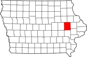
Location of Linn County in Iowa
This is intended to be a complete list of the properties and districts on the National Register of Historic Places in Linn County, Iowa, United States. Latitude and longitude coordinates are provided for many National Register properties and districts; these locations may be seen together in a map.[1]
There are 114 properties and districts listed on the National Register in the county. Five other sites that were once listed have been removed.
- This National Park Service list is complete through NPS recent listings posted February 5, 2021.[2]
Current listings
| [3] | Name on the Register[4] | Image | Date listed[5] | Location | City or town | Description |
|---|---|---|---|---|---|---|
| 1 | Henry D. and Juliana (Wortz) Albright House | August 27, 2020 (#100005495) |
224 1st St. SW 41°55′23″N 91°25′09″W |
Mount Vernon | ||
| 2 | Robert and Esther Armstrong House |  Robert and Esther Armstrong House |
November 16, 1989 (#89002009) |
370 34th St., SE. 41°59′05″N 91°37′02″W |
Cedar Rapids | |
| 3 | Ash Park Historic District |  Ash Park Historic District |
September 13, 1993 (#93000899) |
5th-8th Aves. N., between 6th and 8th Sts., NW. 41°55′40″N 91°25′15″W |
Mount Vernon | |
| 4 | Ausadie Building |  Ausadie Building |
December 6, 2004 (#04001324) |
845 1st Ave., SE. 41°58′59″N 91°39′37″W |
Cedar Rapids | |
| 5 | A. T. Averill House | 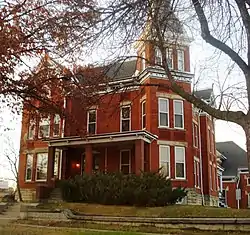 A. T. Averill House |
November 28, 1978 (#78001236) |
1120 2nd Ave., SE 41°59′03″N 91°39′25″W |
Cedar Rapids | |
| 6 | Glenn M. and Edith Averill House | 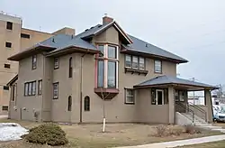 Glenn M. and Edith Averill House |
July 27, 2015 (#15000472) |
616 4th Ave., SE 41°58′45″N 91°39′40″W |
Cedar Rapids | |
| 7 | B Avenue NE Historic District | 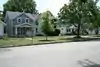 B Avenue NE Historic District |
September 11, 2013 (#13000692) |
Along B Avenue, NE, from 15th to 21st Streets 41°59′35″N 91°38′54″W |
Cedar Rapids | |
| 8 | Augustus and Elizabeth (Huntsberger) Bauman House | _Bauman_House_pict_2.jpg.webp) Augustus and Elizabeth (Huntsberger) Bauman House |
August 27, 2020 (#100005489) |
601 1st Ave. SW 41°55′06″N 91°25′16″W |
Mount Vernon | |
| 9 | Beach School | 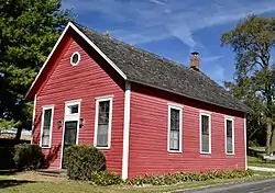 Beach School |
September 16, 1982 (#82002630) |
Northwest of Mount Vernon off U.S. Route 30 41°59′28″N 91°28′45″W |
Mount Vernon | |
| 10 | Best Oil and Refining Company Service Station | 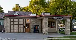 Best Oil and Refining Company Service Station |
June 27, 2014 (#14000359) |
624 12th Ave., SE 41°58′22″N 91°39′15″W |
Cedar Rapids | |
| 11 | Bethel African Methodist Episcopal Church | 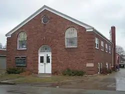 Bethel African Methodist Episcopal Church |
December 18, 2013 (#13000927) |
512 6th Street, SE 41°58′39″N 91°39′37″W |
Cedar Rapids | |
| 12 | Bohemian Commercial Historic District | 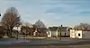 Bohemian Commercial Historic District |
December 20, 2002 (#02001539) |
1000 to 1300 blocks of 3rd St., SE. and the 100 and 200 blocks of 14th Ave., SE. • Boundary increase (listed March 12, 2012, refnum 12000096): Roughly bounded by 9th Ave. SE., 4th St. SE., 14th Ave. SE., 15th Ave. SW., C St. SW., 17th Ave SW. & A St. SW. 41°58′10″N 91°38′49″W |
Cedar Rapids | Cedar Rapids, Iowa Multiple Property Submission |
| 13 | James W. and Ida G. Bowman House | 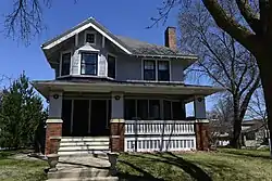 James W. and Ida G. Bowman House |
September 14, 2002 (#02001015) |
1372 8th Ave. 42°02′03″N 91°35′40″W |
Marion | |
| 14 | Braska House |  Braska House |
March 21, 1979 (#79000911) |
889 2nd Ave. 42°01′43″N 91°36′02″W |
Marion | |
| 15 | Brown Apartments | 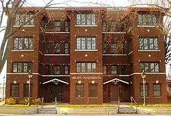 Brown Apartments |
March 17, 2010 (#10000075) |
1234 4th Ave. SE 41°58′57″N 91°39′17″W |
Cedar Rapids | |
| 16 | Burlington, Cedar Rapids, and Minnesota Railroad: Walker Station | 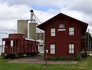 Burlington, Cedar Rapids, and Minnesota Railroad: Walker Station |
February 14, 1978 (#78001242) |
Between Rowley and Washington Sts. 42°17′03″N 91°42′52″W |
Walker | |
| 17 | C.S.P.S. Hall | 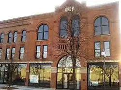 C.S.P.S. Hall |
November 29, 1978 (#78001237) |
1105 3rd St., SE. 41°58′15″N 91°39′31″W |
Cedar Rapids | A building of the Czech-Slovak Protective Society, built in 1891. |
| 18 | Calder Houses | 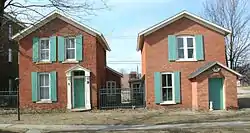 Calder Houses |
January 18, 1978 (#78001238) |
1214 and 1216 2nd Ave., SE. 41°59′04″N 91°39′23″W |
Cedar Rapids | |
| 19 | Cedar Rapids 2nd Avenue SE. Automobile Row Historic District | 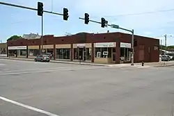 Cedar Rapids 2nd Avenue SE. Automobile Row Historic District |
October 23, 2015 (#15000749) |
Roughly 2nd to 3rd Aves., SE., from 6th to 8th Sts., SE. 41°58′49″N 91°39′45″W |
Cedar Rapids | |
| 20 | Cedar Rapids Central Business District Commercial Historic District | 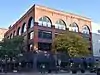 Cedar Rapids Central Business District Commercial Historic District |
November 2, 2015 (#15000757) |
Roughly bounded by 1st & 5th Aves., SE. & 5th & 2nd Sts., SE. 41°58′39″N 91°39′56″W |
Cedar Rapids | |
| 21 | Cedar Rapids Central Fire Station | 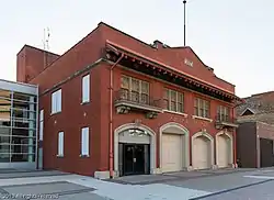 Cedar Rapids Central Fire Station |
April 29, 2014 (#14000175) |
427 1st St., SE 41°58′29″N 91°40′00″W |
Cedar Rapids | |
| 22 | Cedar Rapids Milk Condensing Company |  Cedar Rapids Milk Condensing Company |
May 8, 2017 (#100000966) |
525 Valor Way, SW 41°58′21″N 91°40′07″W |
Cedar Rapids | |
| 23 | Cedar Rapids Post Office and Public Building |  Cedar Rapids Post Office and Public Building |
November 10, 1982 (#82000413) |
305 2nd Ave., SE. 41°58′42″N 91°39′58″W |
Cedar Rapids | |
| 24 | Cedar Rapids Pump Company Factory and Warehouse |  Cedar Rapids Pump Company Factory and Warehouse |
November 6, 2012 (#12000907) |
605 G Avenue NW 41°58′48″N 91°40′53″W |
Cedar Rapids | |
| 25 | Central City Commercial Historic District |  Central City Commercial Historic District |
March 18, 2003 (#02001027) |
300 and 400 blocks of E. Main St., N. 4th St. to Commercial 42°12′15″N 91°31′28″W |
Central City | |
| 26 | Chain Lakes Bridge | 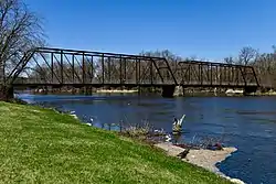 Chain Lakes Bridge |
May 15, 1998 (#98000529) |
Pedestrian trail over the Cedar River 42°02′59″N 91°46′32″W |
Hiawatha | |
| 27 | Coggon Commercial Historic District | August 7, 2019 (#100004229) |
East Main Street between 1st Street South and 3rd Street North 42°16′49″N 91°31′51″W |
Coggon | ||
| 28 | Coggon Public School | 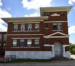 Coggon Public School |
September 12, 2016 (#16000605) |
408 E. Linn St. 42°16′51″N 91°31′40″W |
Coggon | |
| 29 | Consistory Building No. 2 | Consistory Building No. 2 |
November 20, 1998 (#98001327) |
616 A Ave., NE. 41°58′58″N 91°39′52″W |
Cedar Rapids | Also known as Scottish Rite Temple |
| 30 | Cornell College-Mount Vernon Historic District | 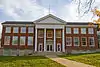 Cornell College-Mount Vernon Historic District |
July 18, 1980 (#80001456) |
Roughly bounded by railroad tracks, College Boulevard, N. 10th, N. 8th, and S. 3rd Aves., and N. 2nd and S. 4th Sts. 41°55′34″N 91°25′29″W |
Mount Vernon | |
| 31 | William and Sue Damour House | 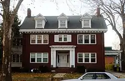 William and Sue Damour House |
January 16, 1997 (#96001586) |
1844 2nd Ave., SE. 41°59′30″N 91°38′38″W |
Cedar Rapids | |
| 32 | Dewitt-Harman Archeological Site | September 14, 2000 (#00001077) |
Address Restricted |
Cedar Rapids | ||
| 33 | George B. Douglas House | 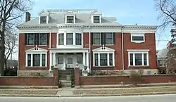 George B. Douglas House |
September 9, 1982 (#82002628) |
800 2nd Ave., SE. 41°58′56″N 91°39′39″W |
Cedar Rapids | |
| 34 | Dows Street Historic District | 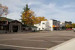 Dows Street Historic District |
November 14, 2003 (#02001026) |
Dows St. between State and Main Sts. 41°52′23″N 91°35′10″W |
Ely | |
| 35 | William and Phebe C. Dunn House | 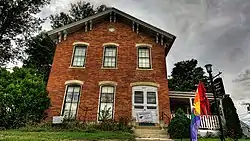 William and Phebe C. Dunn House |
September 4, 2013 (#13000663) |
524 10th St. 42°01′54″N 91°35′58″W |
Marion | |
| 36 | Ely School House | 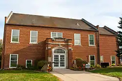 Ely School House |
September 20, 2006 (#06000859) |
1570 Rowley St. 41°52′17″N 91°35′05″W |
Ely | |
| 37 | Evans Manufacturing Company Building | 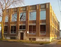 Evans Manufacturing Company Building |
April 15, 1999 (#99000450) |
301 6th Ave., SE. 41°58′32″N 91°39′46″W |
Cedar Rapids | |
| 38 | First Avenue Bridge | 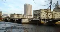 First Avenue Bridge |
May 15, 1998 (#98000530) |
U.S. Route 151 over the Cedar River 41°58′36″N 91°40′20″W |
Cedar Rapids | |
| 39 | First Church of Christ, Scientist | .jpg.webp) First Church of Christ, Scientist |
October 10, 2017 (#100001698) |
1246 2nd Ave. SE. 41°59′05″N 91°39′20″W |
Cedar Rapids | |
| 40 | First Presbyterian Church of Marion, Iowa | 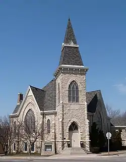 First Presbyterian Church of Marion, Iowa |
July 24, 1992 (#92000924) |
802 12th St. 42°02′04″N 91°35′50″W |
Marion | |
| 41 | First Universalist Church of Cedar Rapids | 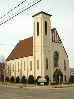 First Universalist Church of Cedar Rapids |
August 24, 1978 (#78001239) |
600 3rd Ave., SE. 41°58′48″N 91°39′44″W |
Cedar Rapids | Demolished in 2011.[6] |
| 42 | Granger House | 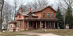 Granger House |
August 13, 1976 (#76000781) |
970 10th St. 42°02′09″N 91°35′59″W |
Marion | |
| 43 | Grant Vocational High School | Grant Vocational High School |
October 13, 2015 (#15000728) |
346 2nd Ave., SW. 41°58′27″N 91°40′38″W |
Cedar Rapids | |
| 44 | Grant Wood's "Fall Plowing" Rural Historic Landscape District | 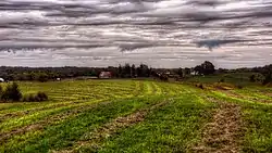 Grant Wood's "Fall Plowing" Rural Historic Landscape District |
May 30, 2003 (#03000476) |
0.5 miles (0.80 km) north of the junction of Matsell Ln. and Stone City Rd. 42°06′55″N 91°23′20″W |
Viola | |
| 45 | Douglas and Charlotte Grant House | _NW_View.jpg.webp) Douglas and Charlotte Grant House |
November 9, 1988 (#88002145) |
3400 Adel St., SE. 42°00′42″N 91°37′20″W |
Marion | |
| 46 | Hamilton Brothers Building | 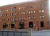 Hamilton Brothers Building |
September 8, 1994 (#94001098) |
401 1st St., SE. 41°58′30″N 91°40′02″W |
Cedar Rapids | |
| 47 | Harper and McIntire Company Warehouse | 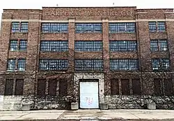 Harper and McIntire Company Warehouse |
November 2, 2015 (#15000758) |
411 6th Ave., SE. 41°58′34″N 91°39′42″W |
Cedar Rapids | |
| 48 | Dr. Percy and Lileah Harris House | February 4, 2021 (#100006115) |
3626 Bever Ave. SE 41°59′04″N 91°36′56″W |
Cedar Rapids | Twentieth Century African American Civil Rights-related Resources in Iowa MPS | |
| 49 | Highwater Rock | 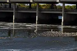 Highwater Rock |
November 17, 1977 (#77000535) |
Cedar River near 1st Ave. and 1st St., NE. 41°58′43″N 91°40′19″W |
Cedar Rapids | |
| 50 | Hotel Roosevelt | 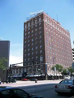 Hotel Roosevelt |
May 1, 1991 (#91000534) |
200 1st Ave., NE. 41°58′45″N 91°40′06″W |
Cedar Rapids | |
| 51 | IANR Railroad Underpass | IANR Railroad Underpass |
May 15, 1998 (#98000528) |
Ely Rd. 41°56′40″N 91°38′12″W |
Cedar Rapids | |
| 52 | Indian Creek Bridge | 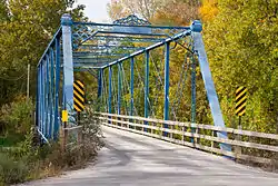 Indian Creek Bridge |
May 15, 1998 (#98000514) |
Artesian Rd. over Indian Creek 41°58′02″N 91°34′52″W |
Cedar Rapids | |
| 53 | Iowa Building | 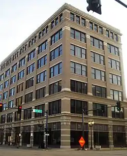 Iowa Building |
February 17, 1983 (#83000385) |
221 4th Ave., SE. 41°58′36″N 91°39′53″W |
Cedar Rapids | |
| 54 | Iowa State Highway Commission, District 6 Building |  Iowa State Highway Commission, District 6 Building |
January 17, 2017 (#100000486) |
430 16th Ave., SW. 41°57′44″N 91°40′33″W |
Cedar Rapids | |
| 55 | Iowa Wind Mill and Pump Company Office and Warehouse | 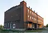 Iowa Wind Mill and Pump Company Office and Warehouse |
October 31, 2012 (#12000890) |
42 7th Ave., SW. 41°58′19″N 91°40′03″W |
Cedar Rapids | |
| 56 | Jan F. and Antonie Janko Farmstead District | 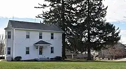 Jan F. and Antonie Janko Farmstead District |
September 14, 2000 (#00001079) |
4021 Vista Rd. 41°52′25″N 91°36′18″W |
Ely | |
| 57 | King Memorial Chapel | 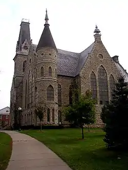 King Memorial Chapel |
November 7, 1976 (#76000782) |
Cornell College campus 41°55′30″N 91°25′25″W |
Mount Vernon | |
| 58 | Adams R., Frederick L. and Martha (Taylor) Knott House | _House_-pict_3.jpg.webp) Adams R., Frederick L. and Martha (Taylor) Knott House |
August 27, 2020 (#100005488) |
417 A Ave. SE 41°55′09″N 91°25′08″W |
Mount Vernon | |
| 59 | Samuel M. Lane House |  Samuel M. Lane House |
September 14, 2002 (#02001014) |
1776 8th Ave. 42°02′03″N 91°35′31″W |
Marion | |
| 60 | Lattner Auditorium Building | 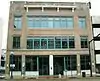 Lattner Auditorium Building |
February 17, 1983 (#83000386) |
217 4th Ave., SE. 41°58′35″N 91°39′55″W |
Cedar Rapids | |
| 61 | Lesinger Block | 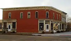 Lesinger Block |
December 24, 1997 (#97001544) |
1317 3rd St., SE. 41°57′46″N 91°39′34″W |
Cedar Rapids | |
| 62 | Lisbon Main Street Historic District | 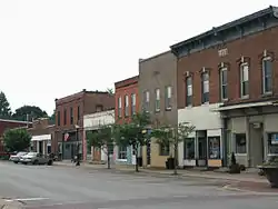 Lisbon Main Street Historic District |
November 1, 2019 (#100004555) |
101-145 E. and W. Main St., 102-122 W. Main St. 41°55′17″N 91°23′08″W |
Lisbon | |
| 63 | Lisbon Methodist Church | 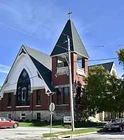 Lisbon Methodist Church |
January 5, 2016 (#15000952) |
200 E. Market St. 41°55′21″N 91°23′00″W |
Lisbon | |
| 64 | Lustron Home No. 02102 | Lustron Home No. 02102 |
August 25, 2004 (#04000898) |
2009 Williams Boulevard, SW. 41°58′15″N 91°42′03″W |
Cedar Rapids | |
| 65 | Marion Carnegie Public Library | 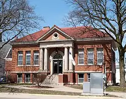 Marion Carnegie Public Library |
March 25, 1994 (#94000260) |
1298 7th Ave. 42°02′01″N 91°35′45″W |
Marion | |
| 66 | Marion Commercial Historic District | 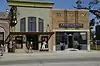 Marion Commercial Historic District |
November 18, 2009 (#09000930) |
560-748 10th St., 958-1298 7th Ave., 760-96 11th St., 766-76 13th St., 1108 8th Ave., and 969 6th Ave. 42°02′00″N 91°35′58″W |
Marion | |
| 67 | Matsell Bridge | 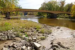 Matsell Bridge |
May 15, 1998 (#98000534) |
Natsell Park Rd. over the Wapsipinicon River 42°07′49″N 91°23′01″W |
Springville | |
| 68 | May's Island Historic District | 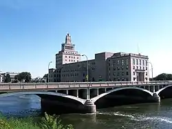 May's Island Historic District |
October 19, 1978 (#78001240) |
Between 1st and 5th Aves. on May Island 41°58′54″N 91°40′10″W |
Cedar Rapids | |
| 69 | James H. and Mayetta (Degrush) McCartney House | _McCartney_House.jpg.webp) James H. and Mayetta (Degrush) McCartney House |
August 27, 2020 (#100005498) |
214 2nd St. SE 41°55′14″N 91°24′59″W |
Mount Vernon | |
| 70 | Joseph P. Mentzer House |  Joseph P. Mentzer House |
April 12, 1982 (#82002629) |
2233 3rd Ave. 42°01′49″N 91°35′26″W |
Marion | |
| 71 | Josias L. and Elizabeth A. Minor Farmstead District | 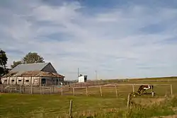 Josias L. and Elizabeth A. Minor Farmstead District |
September 14, 2000 (#00001080) |
7500 Ely Rd. 41°54′19″N 91°36′51″W |
Ely | |
| 72 | Monroe Elementary School Historic District |  Monroe Elementary School Historic District |
October 23, 2015 (#15000751) |
3200 Pioneer Ave., SE. 41°58′11″N 91°37′12″W |
Cedar Rapids | |
| 73 | Joseph and Clara Amanda H. Moorhead House |  Joseph and Clara Amanda H. Moorhead House |
September 14, 2000 (#00001081) |
88 Palisades Access Rd. 41°51′59″N 91°32′08″W |
Ely | |
| 74 | Moslem Temple | 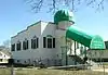 Moslem Temple |
May 15, 1996 (#96000516) |
1335 9th St., NW. 41°59′11″N 91°41′02″W |
Cedar Rapids | |
| 75 | Mount Vernon Commercial Historic District |  Mount Vernon Commercial Historic District |
September 13, 1993 (#93000898) |
1st St. between 2nd and 1st Aves., N. 41°55′20″N 91°25′01″W |
Mount Vernon | |
| 76 | Notbohm Mill Archaeological District | March 29, 2000 (#99001383) |
Address Restricted |
Alburnett | ||
| 77 | Oak Hill Cemetery Historic District |  Oak Hill Cemetery Historic District |
May 8, 2013 (#13000243) |
Roughly bounded by Mt. Vernon Rd., SE., 15th St., SE., S.& E. lot lines 41°58′33″N 91°38′45″W |
Cedar Rapids | |
| 78 | Odd Fellows Hall | 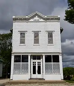 Odd Fellows Hall |
October 10, 1985 (#85003008) |
Troy Mills Rd. 42°17′20″N 91°40′57″W |
Troy Mills | |
| 79 | Our Mother of Sorrows Grotto Historic District |  Our Mother of Sorrows Grotto Historic District |
January 21, 2015 (#14000213) |
1330 Elmhurst Dr., NE. (on the Mount Mercy University campus) 42°00′10″N 91°39′12″W |
Cedar Rapids | |
| 80 | Paramount Theater Building | 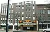 Paramount Theater Building |
August 26, 1976 (#76000778) |
121-127 3rd Ave., SE. 41°58′36″N 91°40′00″W |
Cedar Rapids | |
| 81 | Dr. Luther L. and Susette E. (Baker) Pease House | _Pease_House_3.jpg.webp) Dr. Luther L. and Susette E. (Baker) Pease House |
August 27, 2020 (#100005491) |
600 1st Ave. South 41°55′05″N 91°25′13″W |
Mount Vernon | |
| 82 | People's Savings Bank | 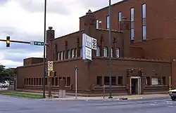 People's Savings Bank |
March 29, 1978 (#78001241) |
101 3rd Ave., SW. 41°58′28″N 91°40′18″W |
Cedar Rapids | |
| 83 | Charles W. and Nellie Perkins House | 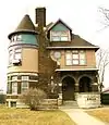 Charles W. and Nellie Perkins House |
May 9, 2002 (#02000456) |
1228 3rd Ave., SE. 41°59′02″N 91°39′18″W |
Cedar Rapids | |
| 84 | Podhajsky-Jansa Farmstead District | .jpg.webp) Podhajsky-Jansa Farmstead District |
September 14, 2000 (#00001082) |
Hoosier Creek Rd. 41°51′41″N 91°36′30″W |
Ely | |
| 85 | Pucker Street Historic District |  Pucker Street Historic District |
September 14, 2002 (#02001013) |
Bounded by 13th St., 9th Ave., 20th St., and 8th Ave. 42°02′03″N 91°35′34″W |
Marion | |
| 86 | Glenn O. and Lucy O. Pyle House | 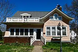 Glenn O. and Lucy O. Pyle House |
September 14, 2002 (#02001016) |
1540 8th Ave. 42°02′03″N 91°35′35″W |
Marion | |
| 87 | Redmond Park-Grande Avenue Historic District | 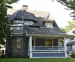 Redmond Park-Grande Avenue Historic District |
September 10, 2001 (#01000994) |
Roughly bounded by U.S. Route 151, 19th St., and Washington Ave. 41°59′16″N 91°38′42″W |
Cedar Rapids | |
| 88 | George W. and Mary J. (Maxwell) Robinson House | _Robinson_House_4.jpg.webp) George W. and Mary J. (Maxwell) Robinson House |
August 27, 2020 (#100005494) |
514 1st St. SE 41°55′12″N 91°24′45″W |
Mount Vernon | |
| 89 | St. James United Methodist Church | 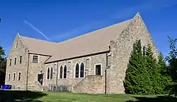 St. James United Methodist Church |
December 15, 2015 (#15000894) |
1430 Ellis Blvd., NW 41°59′15″N 91°40′57″W |
Cedar Rapids | |
| 90 | St. Paul Methodist Episcopal Church | 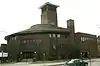 St. Paul Methodist Episcopal Church |
June 27, 1985 (#85001376) |
1340 3rd Ave., SE 41°59′08″N 91°39′10″W |
Cedar Rapids | |
| 91 | Second and Third Avenue Historic District | Second and Third Avenue Historic District |
August 10, 2000 (#00000926) |
1400 to 1800 blocks of 2nd Ave., SE. and 3rd Ave., SE. 41°59′14″N 91°38′12″W |
Cedar Rapids | |
| 92 | Security Building | .jpg.webp) Security Building |
December 7, 1977 (#77000536) |
2nd Ave. and 2nd St., SE 41°58′40″N 91°40′03″W |
Cedar Rapids | |
| 93 | Seminole Valley Farmstead | 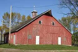 Seminole Valley Farmstead |
October 8, 1976 (#76000779) |
West of Cedar Rapids 42°00′13″N 91°43′38″W |
Cedar Rapids | |
| 94 | Martin L. and Mary Jane (Yount) Shantz House | _Shantz_House_1.jpg.webp) Martin L. and Mary Jane (Yount) Shantz House |
August 27, 2020 (#100005499) |
303 A Ave. SE 41°55′13″N 91°25′04″W |
Mount Vernon | |
| 95 | Shores-Mueller Company | 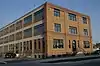 Shores-Mueller Company |
June 22, 2020 (#100005298) |
700 16th St. NE 41°59′42″N 91°39′19″W |
Cedar Rapids | |
| 96 | Sinclair Building-Smulekoffs Furniture Store | .jpg.webp) Sinclair Building-Smulekoffs Furniture Store |
2016-05-Shores-Mueller Company03 (#16000214) |
97 3rd Ave., SE 41°58′34″N 91°40′05″W |
Cedar Rapids | |
| 97 | T.M. Sinclair Mansion | 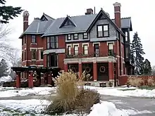 T.M. Sinclair Mansion |
December 12, 1976 (#76000780) |
2160 Linden Dr., SE 41°59′31″N 91°38′19″W |
Cedar Rapids | |
| 98 | James J. and Anna J. (Linean) Smith House #1 | _Smith_House_1c.jpg.webp) James J. and Anna J. (Linean) Smith House #1 |
August 27, 2020 (#100005496) |
316 3rd Ave. SW 41°55′16″N 91°25′15″W |
Mount Vernon | |
| 99 | James J. and Anna J. (Linean) Smith House #2 | _Smith_House_2a.jpg.webp) James J. and Anna J. (Linean) Smith House #2 |
August 27, 2020 (#100005497) |
201 2nd Ave. NW 41°55′26″N 91°25′03″W |
Mount Vernon | |
| 100 | Sokol Gymnasium | 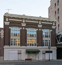 Sokol Gymnasium |
May 14, 2013 (#13000274) |
417 3rd St., SE 41°58′34″N 91°39′53″W |
Cedar Rapids | |
| 101 | Harrison Stuckslager House |  Harrison Stuckslager House |
October 1, 1979 (#79000910) |
207 N. Jackson St. 41°55′25″N 91°23′05″W |
Lisbon | |
| 102 | Sumner School |  Sumner School |
May 8, 2013 (#13000242) |
877 W. Mount Vernon Rd. 41°56′32″N 91°27′05″W |
Mount Vernon vicinity | |
| 103 | Taylor-Van Note |  Taylor-Van Note |
October 10, 1985 (#85003009) |
4600 Blairs Ferry Rd. 42°02′31″N 91°43′42″W |
Cedar Rapids | |
| 104 | Terrace Park Historic District |  Terrace Park Historic District |
October 25, 2006 (#06000953) |
Roughly bounded by 10th Ave., 9th Ave., 11th St., and the eastern side of 12th St. 42°02′15″N 91°35′50″W |
Marion | |
| 105 | Torrance House | 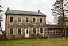 Torrance House |
July 7, 1983 (#83000387) |
South of Lisbon 41°53′44″N 91°23′48″W |
Lisbon | |
| 106 | Upper Paris Bridge | 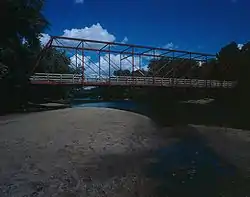 Upper Paris Bridge |
May 15, 1998 (#98000532) |
Sutton Rd. over the Wapsipinicon River 42°14′40″N 91°35′04″W |
Coggon | |
| 107 | WCF & N Center Point Depot and Substation | 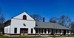 WCF & N Center Point Depot and Substation |
March 7, 2018 (#100002185) |
700 Washington St. 42°11′35″N 91°46′53″W |
Center Point | |
| 108 | Elijah D. and Mary J. (Adams) Waln House | _Waln_House_pict_3.jpg.webp) Elijah D. and Mary J. (Adams) Waln House |
August 27, 2020 (#100005492) |
323 3rd St. NE 41°55′22″N 91°24′44″W |
Mount Vernon | |
| 109 | Wesley West House | 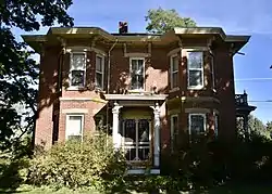 Wesley West House |
June 27, 1985 (#85001380) |
Palisades Rd. 41°55′04″N 91°25′43″W |
Mount Vernon | |
| 110 | West Side Third Avenue SW Commercial Historic District | West Side Third Avenue SW Commercial Historic District |
June 13, 2014 (#14000323) |
3rd Avenue SW, between 1st and 3rd streets SW 41°58′27″N 91°40′24″W |
Cedar Rapids | |
| 111 | Whittier Friends Meeting House | 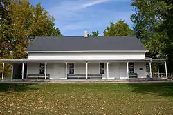 Whittier Friends Meeting House |
July 29, 1993 (#93000653) |
Junction of County Roads E34 and X20 42°05′35″N 91°27′50″W |
Whittier | |
| 112 | Col. John Q. and Rowena (Camp) Wilds House | _Wilds_House_b.jpg.webp) Col. John Q. and Rowena (Camp) Wilds House |
August 27, 2020 (#100005490) |
113 2nd Ave. NW 41°55′24″N 91°25′04″W |
Mount Vernon | |
| 113 | Witwer Grocery Company Building | 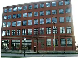 Witwer Grocery Company Building |
May 1, 1998 (#98000386) |
905 3rd St., SE. 41°58′21″N 91°39′38″W |
Cedar Rapids | |
| 114 | Philip A. Wolff House and Carriage House | .jpg.webp) Philip A. Wolff House and Carriage House |
October 7, 1982 (#82000414) |
1420 Seminole Ave., NW. 41°58′43″N 91°41′30″W |
Cedar Rapids | Restored property now Belmont Hill Victorian Bed & Breakfast |
Former listings
| [3] | Name on the Register | Image | Date listed | Date removed | Location | City or town | Summary |
|---|---|---|---|---|---|---|---|
| 1 | Bertram Bridge | 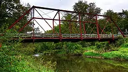 Bertram Bridge |
May 15, 1998 (#98000531) | December 8, 2014 | Ely St. over Big Creek 41°57′23″N 91°31′36″W |
Bertram | |
| 2 | Luther A. and Elinore T. Brewer House | 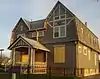 Luther A. and Elinore T. Brewer House |
April 23, 1998 (#98000383) | April 3, 2014 | 847 4th Ave., SE. 41°58′51″N 91°39′27″W |
Cedar Rapids | |
| 3 | Henek and Mary Horecky Log Cabin | September 14, 2000 (#00001078) | July 21, 2015 | Address Restricted |
Mount Vernon vicinity | ||
| 4 | Indian Creek Bridge II | May 15, 1998 (#98000515) | March 11, 1999 | Artesian Rd. over Indian Creek |
Cedar Rapids | ||
| 5 | Mittvatsky House | September 5, 1975 (#75000695) | October 24, 2007 | 1035 2nd St., SE |
Cedar Rapids |
See also
| Wikimedia Commons has media related to National Register of Historic Places in Linn County, Iowa. |
References
- The latitude and longitude information provided in this table was derived originally from the National Register Information System, which has been found to be fairly accurate for about 99% of listings. Some locations in this table may have been corrected to current GPS standards.
- "National Register of Historic Places: Weekly List Actions". National Park Service, United States Department of the Interior. Retrieved on February 5, 2021.
- Numbers represent an alphabetical ordering by significant words. Various colorings, defined here, differentiate National Historic Landmarks and historic districts from other NRHP buildings, structures, sites or objects.
- "National Register Information System". National Register of Historic Places. National Park Service. April 24, 2008.
- The eight-digit number below each date is the number assigned to each location in the National Register Information System database, which can be viewed by clicking the number.
- http://www.kcrg.com/news/local/Peoples-Church-Building-Demolished-Because-of-Mold-and-Structural-Problems-132501683.html
| Topics | |
|---|---|
| Lists by state |
|
| Lists by insular areas | |
| Lists by associated state | |
| Other areas | |
| Related | |
| |

Municipalities and communities of Linn County, Iowa, United States | ||
|---|---|---|
| Cities | Map of Iowa highlighting Linn County | |
| Townships | ||
| Unincorporated communities | ||
| Footnotes | ‡This populated place also has portions in an adjacent county or counties | |
| ||
This article is issued from Wikipedia. The text is licensed under Creative Commons - Attribution - Sharealike. Additional terms may apply for the media files.