National Register of Historic Places listings in Mahaska County, Iowa
This is a list of the National Register of Historic Places listings in Mahaska County, Iowa.
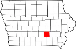
Location of Mahaska County in Iowa
This is intended to be a complete list of the properties and districts on the National Register of Historic Places in Mahaska County, Iowa, United States. Latitude and longitude coordinates are provided for many National Register properties and districts; these locations may be seen together in a map.[1]
There are 48 properties and districts listed on the National Register in the county.
- This National Park Service list is complete through NPS recent listings posted February 5, 2021.[2]
Current listings
| [3] | Name on the Register[4] | Image | Date listed[5] | Location | City or town | Description |
|---|---|---|---|---|---|---|
| 1 | Carroll Alsop House | 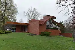 Carroll Alsop House |
November 9, 1988 (#88002142) |
1907 A Ave., E. 41°17′49″N 92°37′21″W |
Oskaloosa | |
| 2 | Bellefountain Bridge | Bellefountain Bridge |
May 15, 1998 (#98000506) |
Ashland Ave. over the Des Moines River 41°19′58″N 92°51′56″W |
Tracy | |
| 3 | Dr. William E. and Ethel Rosenberger Berry House |  Dr. William E. and Ethel Rosenberger Berry House |
March 29, 1996 (#96000343) |
116 Rosenberger Ave. 41°18′22″N 92°38′46″W |
Oskaloosa | |
| 4 | Thomas J. Conover House | 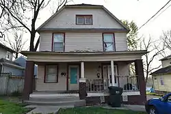 Thomas J. Conover House |
March 28, 1996 (#96000342) |
1010 N. Market St. 41°18′14″N 92°38′39″W |
Oskaloosa | |
| 5 | Edmundson Park Historic District | 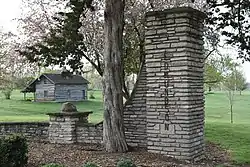 Edmundson Park Historic District |
September 27, 2007 (#07001005) |
Junction of 11th Ave., W. and Edmundson Dr. 41°17′07″N 92°39′36″W |
Oskaloosa | |
| 6 | Eveland Bridge | 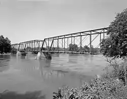 Eveland Bridge |
May 15, 1998 (#98000504) |
Fulton Ave. over the Des Moines River 41°14′34″N 92°45′24″W |
Oskaloosa | |
| 7 | Forest Cemetery Entrance | 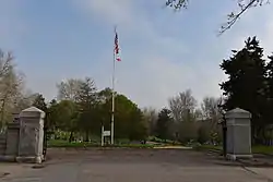 Forest Cemetery Entrance |
December 13, 1991 (#91001765) |
Junction of N. 9th St. and J Ave., E. 41°18′12″N 92°38′02″W |
Oskaloosa | |
| 8 | E.H. Gibbs House | December 13, 1991 (#91001761) |
William Penn University campus, N. Market Extension 41°18′31″N 92°38′41″W |
Oskaloosa | ||
| 9 | Ulysses Simpson Grant Elementary School | 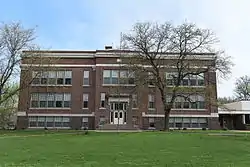 Ulysses Simpson Grant Elementary School |
December 10, 2008 (#08001163) |
715 B Ave., E. 41°17′50″N 92°38′16″W |
Oskaloosa | |
| 10 | Phil Hoffman House | 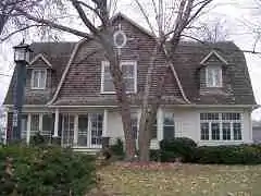 Phil Hoffman House |
December 13, 1991 (#91001760) |
807 High Ave., E. 41°17′44″N 92°38′09″W |
Oskaloosa | |
| 11 | Iowa Yearly Meeting House-College Avenue Friends Church | 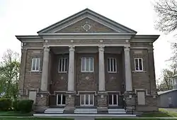 Iowa Yearly Meeting House-College Avenue Friends Church |
March 29, 1996 (#96000344) |
912 N. C St. 41°18′12″N 92°38′53″W |
Oskaloosa | |
| 12 | William A. and Ida C. Johnson House | 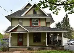 William A. and Ida C. Johnson House |
March 28, 1996 (#96000346) |
307 College Ave. 41°18′14″N 92°38′50″W |
Oskaloosa | |
| 13 | Dr. William H. and Mae R. Klose House | 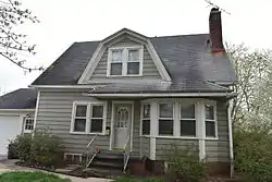 Dr. William H. and Mae R. Klose House |
March 29, 1996 (#96000350) |
1002 Penn Boulevard 41°18′23″N 92°38′51″W |
Oskaloosa | |
| 14 | Lake Keomah State Park, Bathhouse-Lodge Area (Area A) | November 15, 1990 (#90001666) |
Off Iowa Highway 371 south of its junction with Iowa Highway 92 41°17′26″N 92°32′27″W |
Oskaloosa | ||
| 15 | Lake Keomah State Park, Erosion Control Area (Area B) | November 15, 1990 (#90001667) |
Off Iowa Highway 371 south of its junction with Iowa Highway 92 41°17′07″N 92°32′32″W |
Oskaloosa | ||
| 16 | Jack Lamberson House | 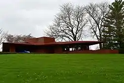 Jack Lamberson House |
November 9, 1988 (#88002146) |
511 N. Park Ave. 41°18′01″N 92°37′37″W |
Oskaloosa | |
| 17 | Lincoln School | 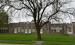 Lincoln School |
December 13, 1991 (#91001766) |
911 B Ave., W. 41°17′51″N 92°39′17″W |
Oskaloosa | |
| 18 | Mahaska County Courthouse | 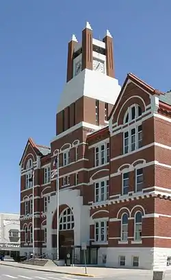 Mahaska County Courthouse |
July 2, 1981 (#81000255) |
Market St. and 2nd Ave. 41°17′42″N 92°38′35″W |
Oskaloosa | |
| 19 | Maj. James W. McMullin House | 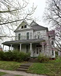 Maj. James W. McMullin House |
April 11, 1985 (#85000723) |
403 1st Ave., E. 41°17′40″N 92°38′26″W |
Oskaloosa | |
| 20 | W.A. McNeill House | 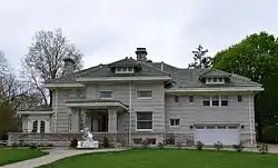 W.A. McNeill House |
October 21, 1999 (#99001267) |
1282 C Ave., E. 41°17′54″N 92°37′36″W |
Oskaloosa | |
| 21 | Daniel Nelson House and Barn | 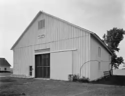 Daniel Nelson House and Barn |
November 20, 1974 (#74000798) |
2211 Nelson Lane 41°19′14″N 92°37′50″W |
Oskaloosa | |
| 22 | North Skunk River Bridge | May 15, 1998 (#98000503) |
County Road G13 over the North Skunk River 41°29′41″N 92°38′00″W |
New Sharon | ||
| 23 | Oskaloosa City Hall | 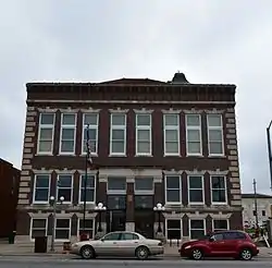 Oskaloosa City Hall |
December 13, 1991 (#91001764) |
Northeastern corner of the junction of S. Market St. and 2nd Ave., E. 41°17′37″N 92°38′40″W |
Oskaloosa | |
| 24 | Oskaloosa City Park and Band Stand | 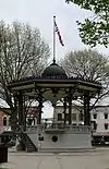 Oskaloosa City Park and Band Stand |
July 28, 1983 (#83000389) |
City Park 41°17′42″N 92°38′38″W |
Oskaloosa | |
| 25 | Oskaloosa City Square Commercial Historic District | 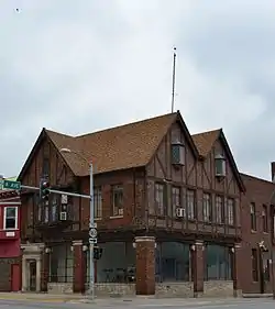 Oskaloosa City Square Commercial Historic District |
April 10, 1986 (#86000716) |
Roughly bounded by A Ave., E, N. and S. 2nd St., 2nd Ave., E, and N. and S. A St. 41°17′48″N 92°38′39″W |
Oskaloosa | |
| 26 | Oskaloosa Fire Station | 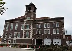 Oskaloosa Fire Station |
December 13, 1991 (#91001763) |
109-111 2nd Ave., E. 41°17′37″N 92°38′39″W |
Oskaloosa | |
| 27 | Oskaloosa Monthly Meeting of Friends Parsonage | 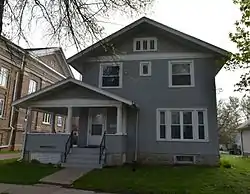 Oskaloosa Monthly Meeting of Friends Parsonage |
March 29, 1996 (#96000348) |
910 N. C St. 41°18′10″N 92°38′53″W |
Oskaloosa | |
| 28 | Oskaloosa Post Office | February 6, 2020 (#100004975) |
206 North Market St. 41°17′47″N 92°38′42″W |
Oskaloosa | ||
| 29 | Oskaloosa Public Library | 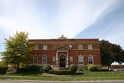 Oskaloosa Public Library |
December 13, 1991 (#83004763) |
Southwestern corner of the junction of Market St. and 2nd Ave. 41°17′35″N 92°38′42″W |
Oskaloosa | |
| 30 | Paradise Block Historic District | 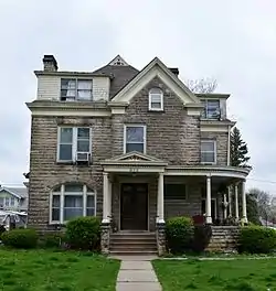 Paradise Block Historic District |
December 13, 1991 (#91001767) |
402, 406, 408, 410, 414, 418, and 510-714 High Ave. E. 41°17′43″N 92°38′18″W |
Oskaloosa | |
| 31 | Penn College Historic District | 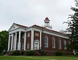 Penn College Historic District |
April 4, 1996 (#96000391) |
201 Trueblood Ave. 41°18′32″N 92°38′47″W |
Oskaloosa | |
| 32 | Pierson-Betts House | 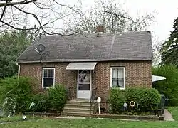 Pierson-Betts House |
March 28, 1996 (#96000347) |
815 Penn Boulevard 41°18′22″N 92°38′52″W |
Oskaloosa | |
| 33 | President's Cottage |  President's Cottage |
March 28, 1996 (#96000340) |
425 College Ave. 41°18′13″N 92°39′00″W |
Oskaloosa | |
| 34 | Rock Island Passenger Depot | 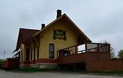 Rock Island Passenger Depot |
October 30, 1989 (#89001780) |
Rock Island Ave. between 1st and 2nd Sts. 41°17′21″N 92°38′34″W |
Oskaloosa | |
| 35 | Rose Hill Methodist Episcopal Church | 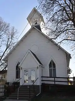 Rose Hill Methodist Episcopal Church |
April 11, 2003 (#03000201) |
304 Main St. 41°19′14″N 92°27′55″W |
Rose Hill | |
| 36 | St. James Episcopal Church | 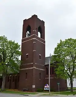 St. James Episcopal Church |
December 13, 1991 (#91001762) |
Southwestern corner of the junction of 1st Ave. and S. 3rd St. 41°17′39″N 92°38′29″W |
Oskaloosa | |
| 37 | Seeberger-Loring-Kilburn House | 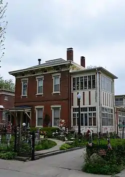 Seeberger-Loring-Kilburn House |
July 14, 1983 (#83000390) |
509 High Ave., E. 41°17′44″N 92°38′22″W |
Oskaloosa | |
| 38 | John H. Shoemake House | 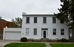 John H. Shoemake House |
March 22, 1984 (#84001276) |
116 2nd Ave., W. 41°17′36″N 92°38′44″W |
Oskaloosa | |
| 39 | Smith-Johnson House | 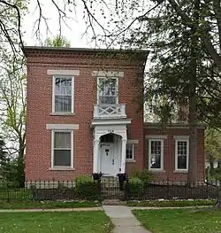 Smith-Johnson House |
November 9, 1977 (#77000538) |
713 High Ave., E. 41°17′44″N 92°38′13″W |
Oskaloosa | |
| 40 | Spring Creek Friends Cemetery | March 29, 1996 (#96000351) |
Junction of Osburn Ave. and 235th St. 41°18′41″N 92°36′09″W |
Oskaloosa | ||
| 41 | Spring Creek Meeting House-H Street Mission | March 28, 1996 (#96000339) |
207 N. H St. 41°17′47″N 92°39′17″W |
Oskaloosa | ||
| 42 | Spurgin Residence | 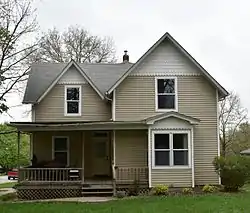 Spurgin Residence |
March 28, 1996 (#96000341) |
313 College Ave. 41°18′14″N 92°39′00″W |
Oskaloosa | |
| 43 | Stock Judging Pavilion | 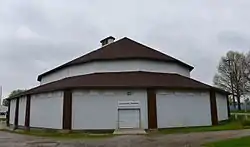 Stock Judging Pavilion |
April 12, 1984 (#84001280) |
Southern Iowa Fairgrounds 41°18′04″N 92°39′43″W |
Oskaloosa | |
| 44 | Dr. Ella Stokes House | 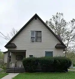 Dr. Ella Stokes House |
March 29, 1996 (#96000349) |
416 W. College Hill Ave. 41°18′21″N 92°38′59″W |
Oskaloosa | |
| 45 | Prof. Edgar H. and Irene D. Stranahan House | 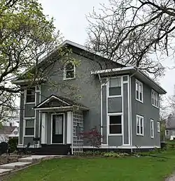 Prof. Edgar H. and Irene D. Stranahan House |
March 28, 1996 (#96000345) |
1001 Gurney St. 41°18′23″N 92°38′49″W |
Oskaloosa | |
| 46 | Vander Wilt Farmstead Historic District | 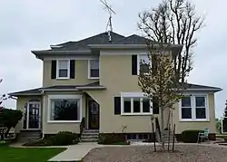 Vander Wilt Farmstead Historic District |
January 8, 2004 (#03001370) |
1345 Iowa Highway 163, Sec. 22, T26N, R17W, SW of NE 41°22′22″N 92°48′11″W |
Leighton | |
| 47 | Gary J. and Matilda Vermeer Farmstead | July 23, 2018 (#100002682) |
1688 250th Ave. 41°24′35″N 92°52′16″W |
Pella | ||
| 48 | John K. Voorhees House | 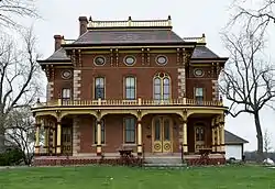 John K. Voorhees House |
March 5, 1982 (#82002632) |
Northwest of Oskaloosa on Iowa Highway 163 41°23′09″N 92°49′22″W |
Oskaloosa |
Former listings
One property was formerly listed but has been removed:
| [3] | Name on the Register | Image | Date listed/removed | Location | City or town | Summary |
|---|---|---|---|---|---|---|
| 1 | Bridge near New Sharon | September 10, 2008 (#98000505) |
County Road G29 over drainage ditch |
New Sharon vicinity |
See also
| Wikimedia Commons has media related to National Register of Historic Places in Mahaska County, Iowa. |
References
- The latitude and longitude information provided in this table was derived originally from the National Register Information System, which has been found to be fairly accurate for about 99% of listings. Some locations in this table may have been corrected to current GPS standards.
- "National Register of Historic Places: Weekly List Actions". National Park Service, United States Department of the Interior. Retrieved on February 5, 2021.
- Numbers represent an alphabetical ordering by significant words. Various colorings, defined here, differentiate National Historic Landmarks and historic districts from other NRHP buildings, structures, sites or objects.
- "National Register Information System". National Register of Historic Places. National Park Service. April 24, 2008.
- The eight-digit number below each date is the number assigned to each location in the National Register Information System database, which can be viewed by clicking the number.
| Topics | |
|---|---|
| Lists by state |
|
| Lists by insular areas | |
| Lists by associated state | |
| Other areas | |
| Related | |
| |

Municipalities and communities of Mahaska County, Iowa, United States | ||
|---|---|---|
| Cities | Map of Iowa highlighting Mahaska County | |
| Unincorporated communities | ||
| Footnotes | ‡This populated place also has portions in an adjacent county or counties | |
| ||
This article is issued from Wikipedia. The text is licensed under Creative Commons - Attribution - Sharealike. Additional terms may apply for the media files.