National Register of Historic Places listings in Lee County, Iowa
This is a list of the National Register of Historic Places listings in Lee County, Iowa.
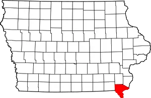
Location of Lee County in Iowa
This is intended to be a complete list of the properties and districts on the National Register of Historic Places in Lee County, Iowa, United States. Latitude and longitude coordinates are provided for many National Register properties and districts; these locations may be seen together in an online map.[1]
There are 45 properties and districts listed on the National Register in the county, including 1 National Historic Landmark.
- This National Park Service list is complete through NPS recent listings posted February 5, 2021.[2]
Current listings
| [3] | Name on the Register[4] | Image | Date listed[5] | Location | City or town | Description |
|---|---|---|---|---|---|---|
| 1 | Albright House | 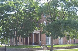 Albright House |
July 24, 1978 (#78001233) |
716-718 Ave. F 40°37′54″N 91°18′38″W |
Fort Madison | |
| 2 | Atchison, Topeka and Santa Fe Passenger and Freight Complex Historic District | 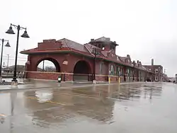 Atchison, Topeka and Santa Fe Passenger and Freight Complex Historic District |
March 5, 1992 (#92000100) |
902 Ave. H 40°37′48″N 91°18′49″W |
Fort Madison | A former passenger train station and a former freight station built in 1909 by the Atchison, Topeka and Santa Fe Railway. |
| 3 | Chief Justice Joseph M. Beck House | 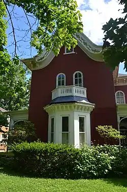 Chief Justice Joseph M. Beck House |
July 21, 1988 (#88001116) |
630 Ave. E 40°37′58″N 91°18′34″W |
Fort Madison | |
| 4 | Gen. William Worth Belknap House | 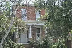 Gen. William Worth Belknap House |
October 10, 1975 (#75000694) |
511 N. 3rd St. 40°23′51″N 91°22′33″W |
Keokuk | Greek Revival home built in 1854 by William Worth Belknap who became a Civil War general and Secretary of War under President Ulysses S. Grant. |
| 5 | Bridgeport Bridge | .jpg.webp) Bridgeport Bridge |
May 15, 1998 (#98000533) |
Old Quarry Rd. 40°47′25″N 91°21′50″W |
Denmark | A Pennsylvania through truss bridge built by the Clinton Bridge and Iron Works and completed in 1904. Extends into Des Moines County. |
| 6 | Cattermole Memorial Library | 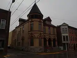 Cattermole Memorial Library |
April 5, 1984 (#84001267) |
614 7th St. 40°37′53″N 91°18′34″W |
Fort Madison | |
| 7 | Gen. Samuel R. Curtis House | 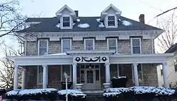 Gen. Samuel R. Curtis House |
April 23, 1998 (#98000384) |
206 High St. 40°23′43″N 91°22′42″W |
Keokuk | Greek Revival residence of Civil War general Samuel R. Curtis. |
| 8 | Denmark Congregational Church | December 2, 1977 (#77000534) |
Academy Ave. and 4th St. 40°44′31″N 91°20′00″W |
Denmark | Abolitionist Asa Turner, Jr. was pastor of the church in the mid-19th century. | |
| 9 | Faeth Farmstead and Orchard District | 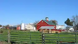 Faeth Farmstead and Orchard District |
September 16, 2005 (#05001020) |
2469 Iowa Highway 2 40°38′11″N 91°26′11″W |
Fort Madison | On the Most Endangered list of the Iowa Historic Preservation Alliance[6] |
| 10 | Fort Madison Bridge | 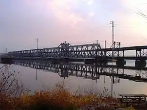 Fort Madison Bridge |
August 27, 1999 (#99001035) |
Iowa Highway 9 over the Mississippi River 40°37′16″N 91°17′15″W |
Fort Madison | A swinging truss toll bridge over the Mississippi River that connects Fort Madison with Niota in Hancock County, Illinois |
| 11 | Fort Madison High School | 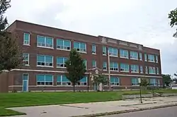 Fort Madison High School |
January 21, 2015 (#14001169) |
1812 Avenue F 40°37′54″N 91°19′50″W |
Fort Madison | |
| 12 | Fort Madison Downtown Commercial Historic District | 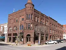 Fort Madison Downtown Commercial Historic District |
August 31, 2007 (#07000852) |
Centered on Avenue G, from near 6th St. to the middle of the 900 block, including Avenue H from 7th to 9th 40°37′51″N 91°18′40″W |
Fort Madison | Federal and Late Victorian buildings from the late 19th century. |
| 13 | GEO. M. VERITY | 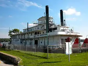 GEO. M. VERITY |
December 20, 1989 (#89002459) |
Keokuk River Museum, Victory Park 40°23′35″N 91°22′21″W |
Keokuk | Towboat built by the Dubuque Boat & Boiler Works in 1927. |
| 14 | E. H. Harrison House | 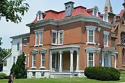 E. H. Harrison House |
January 12, 1984 (#84001270) |
220 N. 4th St. 40°23′49″N 91°22′47″W |
Keokuk | A combination Federal and Second Empire style house designed by Frederick H. Moore from 1857. |
| 15 | Christian and Katharina Herschler House, Barn, and Outbuildings Historic District | February 16, 1996 (#96000064) |
Junction of 6th and Green Sts. 40°39′53″N 91°30′49″W |
Franklin | ||
| 16 | Hotel Iowa | .jpg.webp) Hotel Iowa |
February 5, 1987 (#87000022) |
401 Main St. 40°23′43″N 91°22′55″W |
Keokuk | An eight-story Chicago Commercial style building from 1913. |
| 17 | Iowa State Penitentiary Cellhouses Historic District |  Iowa State Penitentiary Cellhouses Historic District |
December 18, 1992 (#92001663) |
Junction of Avenue G and U.S. Route 61 40°38′02″N 91°17′45″W |
Fort Madison | State penitentiary that was founded in the Territory of Iowa in 1839 and patterned after the penitentiary in Auburn, New York. |
| 18 | John N. and Mary L. (Rankin) Irwin House | 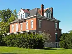 John N. and Mary L. (Rankin) Irwin House |
October 14, 1999 (#99001206) |
633 Grand Ave. 40°24′05″N 91°22′34″W |
Keokuk | Two-story brick home of John N. Irwin who served as the territorial governor of the Idaho Territory, the Arizona Territory and as the US minister to Portugal. |
| 19 | C. R. Joy House | 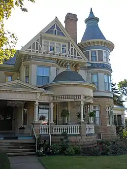 C. R. Joy House |
January 16, 1997 (#96001587) |
816 Grand Ave. 40°24′16″N 91°22′34″W |
Keokuk | Queen Anne stylehouse designed by architect George Franklin Barber. |
| 20 | Keokuk Lock and Dam | 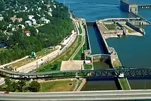 Keokuk Lock and Dam |
October 19, 1978 (#78001234) |
At the Mississippi River 40°23′51″N 91°22′01″W |
Keokuk | A 4,620 feet (1,408.2 m) long dam across the Mississippi River. It includes locks that are 1,200 feet (365.8 m) long and 110 feet (33.5 m) wide. |
| 21 | Keokuk National Cemetery | 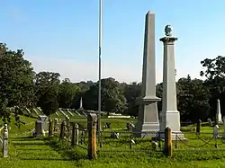 Keokuk National Cemetery |
June 4, 1997 (#97000528) |
1701 J St. 40°23′58″N 91°24′18″W |
Keokuk | American Civil War era cemetery that was established to bury the Union soldiers who died in the five army hospitals that were located in Keokuk. |
| 22 | Keokuk Union Depot | 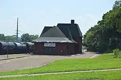 Keokuk Union Depot |
March 27, 2013 (#13000109) |
200 Exchange St. 40°23′26″N 91°22′54″W |
Keokuk | |
| 23 | Keokuk Young Women's Christian Association Building | 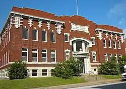 Keokuk Young Women's Christian Association Building |
October 12, 2004 (#04001140) |
425 Blondeau St. 40°23′47″N 91°22′54″W |
Keokuk | A 1913 building that is representative of transitional architecture in the early 20th century. |
| 24 | Lee County Courthouse | 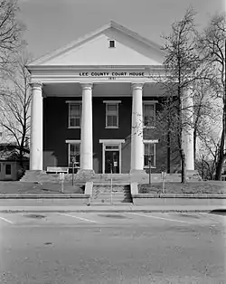 Lee County Courthouse |
September 30, 1976 (#76000777) |
701 Ave. F 40°37′55″N 91°18′36″W |
Fort Madison | Greek Revival style building from 1842. It is the courthouse for northern Lee County. |
| 25 | Lock and Dam No. 19 Historic District | Lock and Dam No. 19 Historic District |
March 10, 2004 (#04000179) |
525 N. Water St. 40°23′45″N 91°22′32″W |
Keokuk | Historic district that includes 7 buildings, 12 structures, 1 object. |
| 26 | Daniel McConn Barn |  Daniel McConn Barn |
May 26, 2000 (#00000531) |
2095 US Business 61 40°39′10″N 91°16′34″W |
Fort Madison | |
| 27 | John McGreer Barn and Crib | August 8, 2001 (#01000859) |
2056 150th Ave. 40°39′34″N 91°37′22″W |
Donnellson | ||
| 28 | Justice Samuel Freeman Miller House | 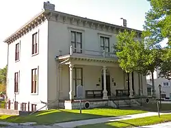 Justice Samuel Freeman Miller House |
October 10, 1972 (#72000477) |
318 N. 5th St. 40°23′53″N 91°22′46″W |
Keokuk | An Italianate house from 1859 that was home to Samuel Freeman Miller who served for 28 years on the United States Supreme Court. |
| 29 | Moyce-Steffens House | 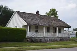 Moyce-Steffens House |
May 2, 1997 (#97000394) |
1615 Avenue H 40°37′49″N 91°19′38″W |
Fort Madison | |
| 30 | Old Fort Madison Site | 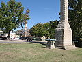 Old Fort Madison Site |
May 7, 1973 (#73000734) |
Address Restricted |
Fort Madison | The first permanent U.S. military fortification on the Upper Mississippi River. On the Most Endangered list of the Iowa Historic Preservation Alliance.[6] Boundary increases approved April 18, 2018. |
| 31 | Park-to-Park Residential Historic District | 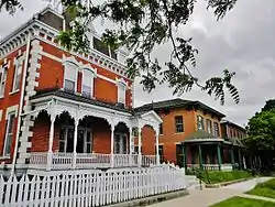 Park-to-Park Residential Historic District |
December 22, 2014 (#14001069) |
400-1100 blocks of Ave. F & 400-1100 blocks of Ave. E 40°37′58″N 91°18′35″W |
Fort Madison | |
| 32 | Primrose Mill | March 17, 1983 (#83000383) |
Off Iowa Highway 2 40°40′31″N 91°38′16″W |
Primrose | ||
| 33 | Saint Barnabas Episcopal Church | 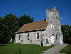 Saint Barnabas Episcopal Church |
April 11, 1986 (#86000721) |
Chestnut St. 40°31′54″N 91°25′06″W |
Montrose | Gothic Revival style church from 1869. |
| 34 | St. John's Episcopal Church and Parish Hall | 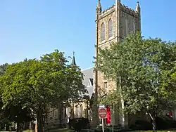 St. John's Episcopal Church and Parish Hall |
July 11, 1989 (#89000806) |
4th and Concert 40°23′48″N 91°22′58″W |
Keokuk | Gothic Revival church designed by Daniel Appleton and H.M. Stephenson. It was built from 1884 to 1888. |
| 35 | St. Mary of the Assumption Church | 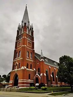 St. Mary of the Assumption Church |
February 8, 1980 (#80001455) |
1031 Ave. E 40°38′00″N 91°19′00″W |
Fort Madison | Gothic Revival style church designed by Walch & Schmidt and completed in 1871. It is now a part of Holy Family parish. |
| 36 | St. Peter Church | 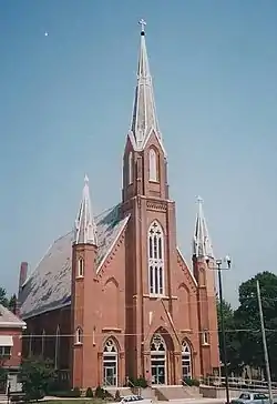 St. Peter Church |
July 14, 1983 (#83000384) |
301 S. 9th St. 40°23′50″N 91°23′25″W |
Keokuk | Gothic Revival church built between 1879 and 1885. It is now known as the Church of All Saints. |
| 37 | Hugh W. and Sarah Sample House | 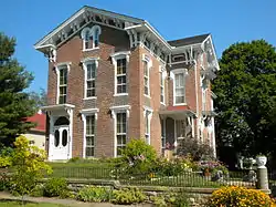 Hugh W. and Sarah Sample House |
November 22, 1995 (#95001318) |
205 N. 2nd St. 40°23′40″N 91°22′45″W |
Keokuk | Italianate style house from 1859. |
| 38 | George E. Schlapp House | 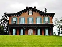 George E. Schlapp House |
February 4, 1982 (#82002627) |
639 Ave. C 40°38′09″N 91°18′32″W |
Fort Madison | |
| 39 | Sharon Cemetery Historic District |  Sharon Cemetery Historic District |
January 11, 1991 (#90002133) |
County Road J40 about 3 miles (4.8 km) east of the Van Buren county line 40°43′31″N 91°39′41″W |
Farmington | |
| 40 | Craig and Virginia Sheaffer House | 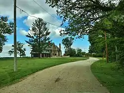 Craig and Virginia Sheaffer House |
April 22, 1993 (#93000329) |
10 High Point 40°38′04″N 91°17′10″W |
Fort Madison | |
| 41 | Walter A. Sheaffer House | Walter A. Sheaffer House |
September 19, 2006 (#06000858) |
11 High Point 40°38′02″N 91°17′14″W |
Fort Madison | |
| 42 | The Park Place-Grand Avenue Residential District | 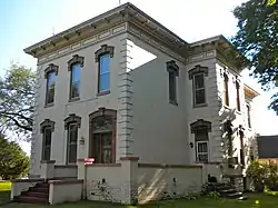 The Park Place-Grand Avenue Residential District |
September 12, 2002 (#02001020) |
4th at Park Place and Orleans St. and north up Grand Ave. to Rand Park 40°24′18″N 91°22′36″W |
Keokuk | Residential area of Late Victorian homes that were mostly built in the early 20th century. |
| 43 | U.S. Post Office and Courthouse | 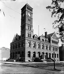 U.S. Post Office and Courthouse |
January 24, 1974 (#74000796) |
25 N. 7th St. 40°23′51″N 91°23′02″W |
Keokuk | Late Victorian building from 1887. It was originally built as a Federal courthouse, but now serves as the South Lee County Courthouse as well as a post office. |
| 44 | Alois and Annie Weber House | 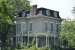 Alois and Annie Weber House |
April 16, 2002 (#02000375) |
802 Orleans Ave. 40°24′09″N 91°22′44″W |
Keokuk | Second Empire style home from 1873. |
| 45 | Frank J. Weess House | 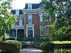 Frank J. Weess House |
May 22, 1978 (#78001235) |
224-226 Morgan St. 40°23′47″N 91°22′39″W |
Keokuk | Second Empire style home that was built from 1880 to 1881. |
See also
| Wikimedia Commons has media related to National Register of Historic Places in Lee County, Iowa. |
References
- The latitude and longitude information provided in this table was derived originally from the National Register Information System, which has been found to be fairly accurate for about 99% of listings. Some locations in this table may have been corrected to current GPS standards.
- "National Register of Historic Places: Weekly List Actions". National Park Service, United States Department of the Interior. Retrieved on February 5, 2021.
- Numbers represent an alphabetical ordering by significant words. Various colorings, defined here, differentiate National Historic Landmarks and historic districts from other NRHP buildings, structures, sites or objects.
- "National Register Information System". National Register of Historic Places. National Park Service. April 24, 2008.
- The eight-digit number below each date is the number assigned to each location in the National Register Information System database, which can be viewed by clicking the number.
- Iowa's Most Endangered Properties, "Archived copy". Archived from the original on 2008-10-07. Retrieved 2008-12-22.CS1 maint: archived copy as title (link)
| Topics | |
|---|---|
| Lists by state |
|
| Lists by insular areas | |
| Lists by associated state | |
| Other areas | |
| Related | |
| |

Municipalities and communities of Lee County, Iowa, United States | ||
|---|---|---|
| Cities | | |
| Townships | ||
| CDP | ||
| Other unincorporated communities | ||
| ||
This article is issued from Wikipedia. The text is licensed under Creative Commons - Attribution - Sharealike. Additional terms may apply for the media files.