National Register of Historic Places listings in Greene County, Iowa
This is a list of the National Register of Historic Places listings in Greene County, Iowa.
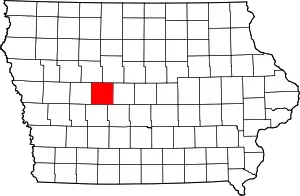
Location of Greene County in Iowa
This is intended to be a complete list of the properties and districts on the National Register of Historic Places in Greene County, Iowa, United States. Latitude and longitude coordinates are provided for many National Register properties and districts; these locations may be seen together in a map.[1]
There are 17 properties and districts listed on the National Register in the county.
- This National Park Service list is complete through NPS recent listings posted February 5, 2021.[2]
| [3] | Name on the Register[4] | Image | Date listed[5] | Location | City or town | Description |
|---|---|---|---|---|---|---|
| 1 | Chicago, Milwaukee & St. Paul Depot-Jefferson | 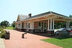 Chicago, Milwaukee & St. Paul Depot-Jefferson |
September 30, 1994 (#93000326) |
507 E. Lincoln Way 42°00′54″N 94°22′05″W |
Jefferson | |
| 2 | Frantz Round Barn | June 30, 1986 (#86001432) |
Off U.S. Route 30 42°02′19″N 94°12′04″W |
Grand Junction | Demolished. | |
| 3 | George H. Gallup House | 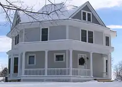 George H. Gallup House |
July 18, 1985 (#85001581) |
703 S. Chestnut St. 42°00′27″N 94°22′23″W |
Jefferson | |
| 4 | Greene County Courthouse | 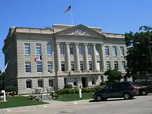 Greene County Courthouse |
December 14, 1978 (#78001222) |
E. Lincoln Way and Chestnut St. 42°00′57″N 94°22′26″W |
Jefferson | |
| 5 | Jefferson Square Commercial Historic District | 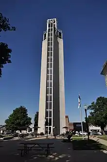 Jefferson Square Commercial Historic District |
November 22, 2011 (#11000503) |
Courthouse Sq. and fronting blocks of N. Wilson, N. Chestnut, E. Lincoln, E. State & 115 S. Wilson Sts. 42°00′57″N 94°22′27″W |
Jefferson | |
| 6 | Lincoln Highway Marker (1) | March 29, 1993 (#93000163) |
Address Restricted |
Jefferson | ||
| 7 | Lincoln Highway Marker (2) | March 29, 1993 (#93000164) |
Junction of Lincoln Way and Chestnut St. 42°00′54″N 94°22′05″W |
Jefferson | Has been moved or lost. | |
| 8 | Lincoln Highway-Buttrick's Creek Abandoned Segment | 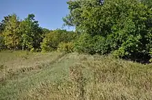 Lincoln Highway-Buttrick's Creek Abandoned Segment |
March 29, 1993 (#93000166) |
Approximately 3.5 miles east of Jefferson on the southern side of the Buttrick's Creek bridge 42°01′02″N 94°17′43″W |
Jefferson | |
| 9 | Lincoln Highway-Buttrick's Creek to Grand Junction Segment | 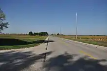 Lincoln Highway-Buttrick's Creek to Grand Junction Segment |
March 29, 1993 (#93000167) |
From Buttrick's Creek east to Iowa Highway 144 42°01′21″N 94°15′52″W |
Grand Junction | |
| 10 | Lincoln Highway-Grand Junction Segment |  Lincoln Highway-Grand Junction Segment |
March 29, 1993 (#93000168) |
Through and 1 mile east of Grand Junction, south of the Chicago & Northwestern railroad line 42°01′54″N 94°13′32″W |
Grand Junction | |
| 11 | Lincoln Highway-Little Beaver Creek Bridge | 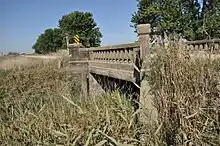 Lincoln Highway-Little Beaver Creek Bridge |
March 29, 1993 (#93000170) |
2.5 miles east and 1 mile north of Grand Junction across Little Beaver Creek 42°02′57″N 94°10′38″W |
Grand Junction | |
| 12 | Lincoln Highway-Raccoon River Rural Segment |  Lincoln Highway-Raccoon River Rural Segment |
March 29, 1993 (#93000162) |
County Road E53 approximately 0.1 miles west of Jefferson city limits, going west across the Raccoon River 42°00′38″N 94°26′02″W |
Jefferson | |
| 13 | Lincoln Highway-West Beaver Creek Abandoned Segment | 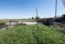 Lincoln Highway-West Beaver Creek Abandoned Segment |
March 29, 1993 (#93000169) |
Approximately 1 mile east of Grand Junction between the Chicago & Northwestern railroad line and U.S. Route 30 42°02′01″N 94°12′39″W |
Grand Junction | |
| 14 | Lincoln Highway-West Greene County Rural Segment | 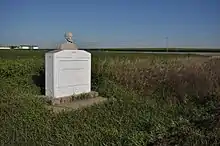 Lincoln Highway-West Greene County Rural Segment |
March 29, 1993 (#93000161) |
North from the junction of U.S. Route 30 and Iowa Highway 25, approximately 0.5 miles north of Scranton, then west to its junction with U.S. Route 30 42°02′56″N 94°33′09″W |
Scranton | |
| 15 | Lincoln Statue | 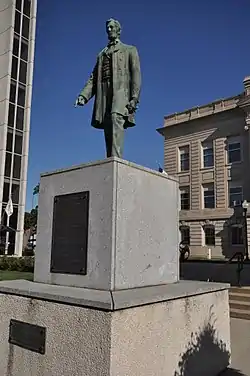 Lincoln Statue |
March 29, 1993 (#93000165) |
Junction of Lincoln Way and Chestnut St. 42°00′56″N 94°22′27″W |
Jefferson | |
| 16 | St. Patrick's Catholic Church, Cedar | 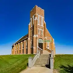 St. Patrick's Catholic Church, Cedar |
July 10, 1992 (#92000840) |
4 miles west of Churdan on E. 19, 0.5 miles north on a gravel road 42°09′34″N 94°33′05″W |
Churdan | |
| 17 | Squirrel Hollow County Park Historic District | December 23, 1991 (#91001835) |
Eastern bank of the North Raccoon River southeast of Jefferson 41°57′07″N 94°17′16″W |
Jefferson |
See also
| Wikimedia Commons has media related to National Register of Historic Places in Greene County, Iowa. |
References
- The latitude and longitude information provided in this table was derived originally from the National Register Information System, which has been found to be fairly accurate for about 99% of listings. Some locations in this table may have been corrected to current GPS standards.
- "National Register of Historic Places: Weekly List Actions". National Park Service, United States Department of the Interior. Retrieved on February 5, 2021.
- Numbers represent an alphabetical ordering by significant words. Various colorings, defined here, differentiate National Historic Landmarks and historic districts from other NRHP buildings, structures, sites or objects.
- "National Register Information System". National Register of Historic Places. National Park Service. April 24, 2008.
- The eight-digit number below each date is the number assigned to each location in the National Register Information System database, which can be viewed by clicking the number.
| Topics | |
|---|---|
| Lists by state |
|
| Lists by insular areas | |
| Lists by associated state | |
| Other areas | |
| Related | |
| |

Municipalities and communities of Greene County, Iowa, United States | ||
|---|---|---|
| Cities | Map of Iowa highlighting Greene County | |
| Townships | ||
| Unincorporated communities | ||
| Footnotes | ‡This populated place also has portions in an adjacent county or counties | |
| ||
This article is issued from Wikipedia. The text is licensed under Creative Commons - Attribution - Sharealike. Additional terms may apply for the media files.