National Register of Historic Places listings in Webster County, Iowa
This is a list of the National Register of Historic Places listings in Webster County, Iowa.
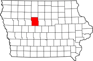
Location of Webster County in Iowa
This is intended to be a complete list of the properties and districts on the National Register of Historic Places in Webster County, Iowa, United States. Latitude and longitude coordinates are provided for many National Register properties and districts; these locations may be seen together in a map.[1]
There are 14 properties and districts listed on the National Register in the county.
- This National Park Service list is complete through NPS recent listings posted January 29, 2021.[2]
| [3] | Name on the Register[4] | Image | Date listed[5] | Location | City or town | Description |
|---|---|---|---|---|---|---|
| 1 | Lorenzo S. Coffin Burial Plot | 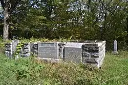 Lorenzo S. Coffin Burial Plot |
November 17, 1977 (#77000566) |
Northwest of Fort Dodge on Iowa Highway 7 42°31′40″N 94°14′26″W |
Fort Dodge | |
| 2 | Corpus Christi Church | 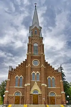 Corpus Christi Church |
October 8, 1976 (#76000812) |
416 N. 8th St. 42°30′31″N 94°11′20″W |
Fort Dodge | |
| 3 | Dolliver Memorial State Park, Entrance Area (Area A) | 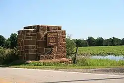 Dolliver Memorial State Park, Entrance Area (Area A) |
November 15, 1990 (#90001684) |
North of Iowa Highway 50 on the Des Moines River 42°24′06″N 94°04′56″W |
Lehigh | |
| 4 | Dolliver Memorial State Park, Picnic, Hiking & Maintenance Area (Area B) | 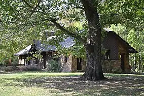 Dolliver Memorial State Park, Picnic, Hiking & Maintenance Area (Area B) |
November 15, 1990 (#90001685) |
North of Iowa Highway 50 on the Des Moines River 42°23′13″N 94°04′53″W |
Lehigh | |
| 5 | First National Bank Building | 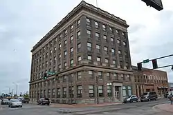 First National Bank Building |
February 27, 2003 (#03000061) |
629 Central Ave. 42°30′17″N 94°11′19″W |
Fort Dodge | |
| 6 | Fort Dodge Downtown Historic District | 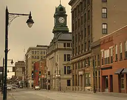 Fort Dodge Downtown Historic District |
November 10, 2010 (#10000918) |
1st Ave. N., Central Ave., and 1st Ave. S. from 3rd St. on the west to 12th St. on east 42°30′18″N 94°11′15″W |
Fort Dodge | |
| 7 | Fort Dodge Junior High School | October 13, 2015 (#15000730) |
416 S. 10th St. 42°30′06″N 94°11′01″W |
Fort Dodge | ||
| 8 | Fort Dodge Senior High School | October 13, 2015 (#15000731) |
1015 5th Ave., N. 42°30′36″N 94°11′08″W |
Fort Dodge | ||
| 9 | Oak Hill Historic District | 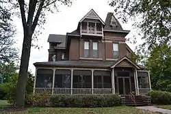 Oak Hill Historic District |
May 5, 1977 (#77000567) |
8th-12th Sts. and 2nd and 3rd Aves. 42°30′20″N 94°11′11″W |
Fort Dodge | |
| 10 | Oakland Cemetery |  Oakland Cemetery |
August 25, 2000 (#00000984) |
1600 N. 15th St. 42°30′45″N 94°10′47″W |
Fort Dodge | |
| 11 | Oleson Park Music Pavilion | 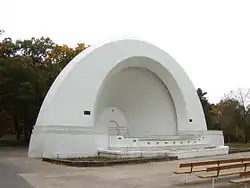 Oleson Park Music Pavilion |
May 9, 2003 (#03000357) |
1400 Oleson Park Ave. 42°29′20″N 94°10′20″W |
Fort Dodge | |
| 12 | Vincent House | 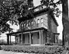 Vincent House |
April 23, 1973 (#73000743) |
824 3rd Ave., S. 42°30′10″N 94°11′01″W |
Fort Dodge | |
| 13 | Wahkonsa Hotel | 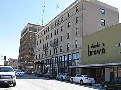 Wahkonsa Hotel |
May 21, 2008 (#08000443) |
927 Central Ave. 42°30′19″N 94°11′09″W |
Fort Dodge | |
| 14 | Webster County Courthouse | 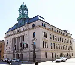 Webster County Courthouse |
July 2, 1981 (#81000274) |
701 Central Ave. 42°30′17″N 94°11′17″W |
Fort Dodge |
Former listings
| [3] | Name on the Register | Image | Date listed | Date removed | Location | City or town | Summary |
|---|---|---|---|---|---|---|---|
| 1 | Illinois Central Freight House and Office Building-Fort Dodge | September 6, 1990 (#90001306) | January 30, 2003 | Jct. of 4th St. and 4th Ave., S. |
Fort Dodge | ||
| 2 | Illinois Central Passenger Depot--Fort Dodge | September 6, 1990 (#90001307) | January 30, 2003 | Jct. of 4th St. and 4th Ave., S. |
Fort Dodge |
See also
| Wikimedia Commons has media related to National Register of Historic Places in Webster County, Iowa. |
References
- The latitude and longitude information provided in this table was derived originally from the National Register Information System, which has been found to be fairly accurate for about 99% of listings. Some locations in this table may have been corrected to current GPS standards.
- "National Register of Historic Places: Weekly List Actions". National Park Service, United States Department of the Interior. Retrieved on January 29, 2021.
- Numbers represent an alphabetical ordering by significant words. Various colorings, defined here, differentiate National Historic Landmarks and historic districts from other NRHP buildings, structures, sites or objects.
- "National Register Information System". National Register of Historic Places. National Park Service. April 24, 2008.
- The eight-digit number below each date is the number assigned to each location in the National Register Information System database, which can be viewed by clicking the number.
| Topics | |
|---|---|
| Lists by state |
|
| Lists by insular areas | |
| Lists by associated state | |
| Other areas | |
| Related | |
| |

Municipalities and communities of Webster County, Iowa, United States | ||
|---|---|---|
| Cities | Map of Iowa highlighting Webster County | |
| Townships | ||
| CDP | ||
| Communities | ||
| Footnotes | ‡This populated place also has portions in an adjacent county or counties | |
| ||
This article is issued from Wikipedia. The text is licensed under Creative Commons - Attribution - Sharealike. Additional terms may apply for the media files.