National Register of Historic Places listings in Sac County, Iowa
This is a list of the National Register of Historic Places listings in Sac County, Iowa.
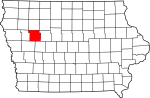
Location of Sac County in Iowa
This is intended to be a complete list of the properties and districts on the National Register of Historic Places in Sac County, Iowa, United States. Latitude and longitude coordinates are provided for many National Register properties and districts; these locations may be seen together in a map.[1]
There are 13 properties and districts listed on the National Register in the county.
- This National Park Service list is complete through NPS recent listings posted February 5, 2021.[2]
Current listings
| [3] | Name on the Register[4] | Image | Date listed[5] | Location | City or town | Description |
|---|---|---|---|---|---|---|
| 1 | Blackhawk State Park, Wildlife Preserve Area (Area A) | 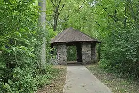 Blackhawk State Park, Wildlife Preserve Area (Area A) |
November 15, 1990 (#90001678) |
South of the junction of U.S. Route 71 and County Highway M68 42°17′54″N 95°02′51″W |
Lake View | |
| 2 | Blackhawk State Park, Black Hawk Preserve (Area B) |  Blackhawk State Park, Black Hawk Preserve (Area B) |
November 15, 1990 (#90001679) |
South of the junction of U.S. Route 71 and County Highway M68 42°18′05″N 95°02′34″W |
Lake View | |
| 3 | Blackhawk State Park, Denison Beach Area (Area C) |  Blackhawk State Park, Denison Beach Area (Area C) |
November 15, 1990 (#90001680) |
South of the junction of U.S. Route 71 and County Highway M68 42°18′08″N 95°02′09″W |
Lake View | |
| 4 | Chautauqua Park Historic District | February 5, 2014 (#13001138) |
106 Park Ave. 42°25′14″N 94°59′05″W |
Sac City | ||
| 5 | Chicago and North Western Passenger Depot | May 9, 2003 (#03000358) |
3727 Perkins Ave. 42°16′13″N 95°05′23″W |
Wall Lake | ||
| 6 | Chief Black Hawk Statue | 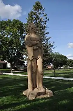 Chief Black Hawk Statue |
May 26, 2000 (#00000532) |
Crescent Park Dr. 42°18′31″N 95°02′33″W |
Lake View | |
| 7 | Lakeside Park Historic District | 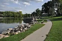 Lakeside Park Historic District |
December 23, 1991 (#91001841) |
3rd St. from Lake to Park St. 42°18′23″N 95°02′46″W |
Lake View | |
| 8 | Park Hotel | January 17, 2017 (#100000491) |
115 N. West State St. 42°25′20″N 94°59′19″W |
Sac City | ||
| 9 | George and Lola Perkins House | January 26, 2016 (#15000997) |
803 W. Main St. 42°25′19″N 94°59′35″W |
Sac City | ||
| 10 | Sac City Chicago and North Western Depot | January 26, 2016 (#15000998) |
103 N. 13th St. 42°25′23″N 94°59′58″W |
Sac City | ||
| 11 | Sac City Monument Square Historic District | 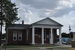 Sac City Monument Square Historic District |
May 4, 2015 (#15000193) |
400 W. Main St. 42°25′18″N 94°59′17″W |
Sac City | |
| 12 | Sac County Courthouse | 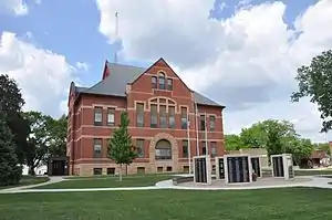 Sac County Courthouse |
July 2, 1981 (#81000268) |
Main St. 42°25′21″N 94°59′17″W |
Sac City | |
| 13 | Seven Oaks | March 7, 1996 (#96000236) |
707 Audubon St. 42°25′16″N 94°59′33″W |
Sac City |
See also
| Wikimedia Commons has media related to National Register of Historic Places in Sac County, Iowa. |
References
- The latitude and longitude information provided in this table was derived originally from the National Register Information System, which has been found to be fairly accurate for about 99% of listings. Some locations in this table may have been corrected to current GPS standards.
- "National Register of Historic Places: Weekly List Actions". National Park Service, United States Department of the Interior. Retrieved on February 5, 2021.
- Numbers represent an alphabetical ordering by significant words. Various colorings, defined here, differentiate National Historic Landmarks and historic districts from other NRHP buildings, structures, sites or objects.
- "National Register Information System". National Register of Historic Places. National Park Service. July 9, 2010.
- The eight-digit number below each date is the number assigned to each location in the National Register Information System database, which can be viewed by clicking the number.
| Topics | |
|---|---|
| Lists by state |
|
| Lists by insular areas | |
| Lists by associated state | |
| Other areas | |
| Related | |
| |

Municipalities and communities of Sac County, Iowa, United States | ||
|---|---|---|
| Cities | Map of Iowa highlighting Sac County | |
| Townships | ||
| Unincorporated community | ||
| Ghost town | ||
| Footnotes | ‡This populated place also has portions in an adjacent county or counties | |
| ||
This article is issued from Wikipedia. The text is licensed under Creative Commons - Attribution - Sharealike. Additional terms may apply for the media files.