National Register of Historic Places listings in Johnson County, Iowa
This is a list of the National Register of Historic Places listings in Johnson County, Iowa.
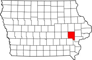
Location of Johnson County in Iowa
This is intended to be a complete list of the properties and districts on the National Register of Historic Places in Johnson County, Iowa, United States. Latitude and longitude coordinates are provided for many National Register properties and districts; these locations may be seen together in a map.[1]
There are 93 properties and districts listed on the National Register in the county, including 1 National Historic Landmark. Another 2 properties were formerly listed but have been removed.
- This National Park Service list is complete through NPS recent listings posted February 5, 2021.[2]
Current listings
| [3] | Name on the Register[4] | Image | Date listed[5] | Location | City or town | Description |
|---|---|---|---|---|---|---|
| 1 | Ned Ashton House | 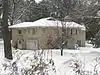 Ned Ashton House |
January 26, 2001 (#00001677) |
820 Park Rd. 41°40′20″N 91°33′03″W |
Iowa City | |
| 2 | Charles Berryhill House | 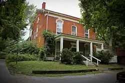 Charles Berryhill House |
May 31, 1979 (#79000904) |
414 Brown St. 41°40′13″N 91°31′46″W |
Iowa City | |
| 3 | Bethel AME Church | 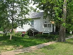 Bethel AME Church |
September 27, 2000 (#00000925) |
411 S. Governor St. 41°39′22″N 91°31′23″W |
Iowa City | |
| 4 | Billingsley-Hills House | 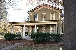 Billingsley-Hills House |
January 21, 1983 (#83000376) |
629 Melrose Ave. 41°39′23″N 91°32′54″W |
Iowa City | |
| 5 | Boerner-Fry Company/Davis Hotel |  Boerner-Fry Company/Davis Hotel |
January 27, 1983 (#83000377) |
332 E. Washington St. 41°39′37″N 91°31′49″W |
Iowa City | |
| 6 | Albert J. and Alice E. Borts House | May 8, 2019 (#100003921) |
416 Reno St. 41°39′59″N 91°31′07″W |
Iowa City | ||
| 7 | William Bostick House | 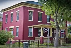 William Bostick House |
March 28, 1996 (#96000312) |
115 N. Gilbert St. 41°39′45″N 91°31′50″W |
Iowa City | |
| 8 | Bowery Street Grocery Store | 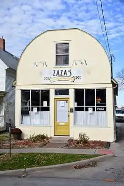 Bowery Street Grocery Store |
April 7, 2014 (#14000112) |
518 E. Bowery St. 41°39′15″N 91°31′41″W |
Iowa City | |
| 9 | Brown Street Historic District | 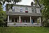 Brown Street Historic District |
September 23, 1994 (#94001112) |
Roughly Brown St. from west of Linn St. to Governor St. and adjacent parts of intersecting streets • Boundary increase (listed September 29, 2004, refnum 04001096): the 500-800 blocks of E. Ronalds St. 41°40′15″N 91°31′42″W |
Iowa City | part of the Iowa City Multiple Property Submission (MPS) |
| 10 | Buresh Farm | April 29, 1977 (#77000533) |
West of Solon off Iowa Highway 382 41°48′35″N 91°33′46″W |
Solon | ||
| 11 | Dr. Albert Henry Byfield House | 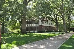 Dr. Albert Henry Byfield House |
March 23, 2017 (#100000792) |
715 W. Park Rd. 41°40′16″N 91°32′56″W |
Iowa City | |
| 12 | Wilbur D. and Hattie Cannon House | 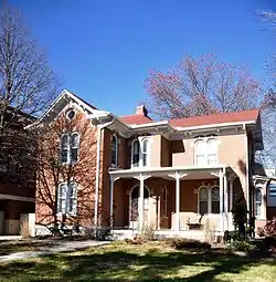 Wilbur D. and Hattie Cannon House |
October 7, 1994 (#94001198) |
320 Melrose Ave. 41°39′23″N 91°32′42″W |
Iowa City | |
| 13 | Thomas C. Carson House | 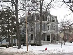 Thomas C. Carson House |
September 9, 1982 (#82002623) |
906 E. College St. 41°39′33″N 91°31′21″W |
Iowa City | |
| 14 | Cavanaugh-Zetek House | 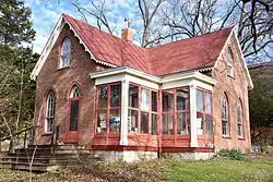 Cavanaugh-Zetek House |
September 16, 1977 (#77000527) |
704 Reno St. 41°40′08″N 91°31′05″W |
Iowa City | |
| 15 | Chicago, Rock Island and Pacific Railroad Passenger Station | 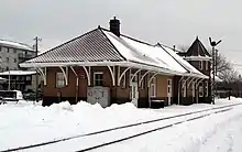 Chicago, Rock Island and Pacific Railroad Passenger Station |
December 10, 1982 (#82000411) |
115 Wright St. 41°39′13″N 91°32′01″W |
Iowa City | |
| 16 | Clark House | 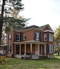 Clark House |
May 16, 1996 (#96000545) |
829 Kirkwood Ave. 41°38′56″N 91°31′22″W |
Iowa City | |
| 17 | Close House | 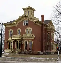 Close House |
May 31, 1974 (#74000791) |
538 S. Gilbert St. 41°39′16″N 91°31′47″W |
Iowa City | |
| 18 | College Block Building | 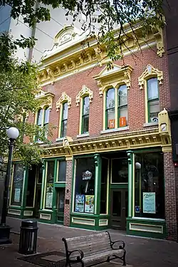 College Block Building |
July 23, 1973 (#73000728) |
125 E. College St. 41°39′31″N 91°31′35″W |
Iowa City | |
| 19 | College Green Historic District | College Green Historic District |
July 9, 1997 (#97000623) |
Roughly bounded by Burlington, Summit, Washington, and Van Buren Sts. 41°39′32″N 91°31′32″W |
Iowa City | part of the Iowa City MPS |
| 20 | Congregational Church of Iowa City | .JPG.webp) Congregational Church of Iowa City |
June 18, 1973 (#73000729) |
30 N. Clinton St. 41°39′44″N 91°32′02″W |
Iowa City | |
| 21 | Coralville Public School | 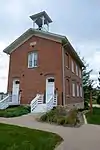 Coralville Public School |
January 11, 1974 (#74000789) |
402-404 5th St. 41°40′26″N 91°34′12″W |
Coralville | |
| 22 | Coralville Union Ecclesiastical Church | 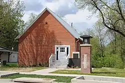 Coralville Union Ecclesiastical Church |
April 11, 1977 (#77000526) |
405 2nd Ave. 41°40′22″N 91°33′57″W |
Coralville | |
| 23 | Cottage at Rock and Dubuque Streets | 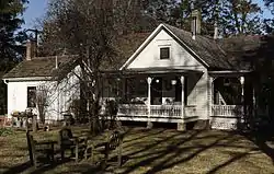 Cottage at Rock and Dubuque Streets |
January 3, 1985 (#85000004) |
Route 4, Box 3 41°48′35″N 91°29′40″W |
Solon | |
| 24 | Czecho Slovakian Association Hall | 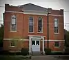 Czecho Slovakian Association Hall |
November 7, 1976 (#76000775) |
524 N. Johnson St. 41°40′02″N 91°31′36″W |
Iowa City | |
| 25 | East College Street Historic District |  East College Street Historic District |
July 9, 1997 (#97000624) |
Roughly bounded by Muscatine Ave., Summitt, Washington, and Burlington Sts. 41°39′28″N 91°31′40″W |
Iowa City | part of the Iowa City MPS |
| 26 | Economy Advertising Company | 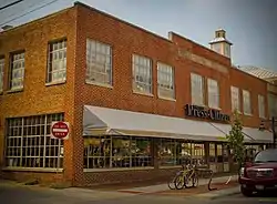 Economy Advertising Company |
April 28, 1986 (#86000875) |
119-123 N. Linn 41°39′48″N 91°31′53″W |
Iowa City | |
| 27 | Englert Theatre | 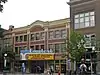 Englert Theatre |
August 30, 2001 (#01000911) |
221 E. Washington St. 41°39′35″N 91°31′56″W |
Iowa City | |
| 28 | First Johnson County Asylum | 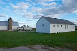 First Johnson County Asylum |
August 31, 1978 (#78001226) |
West of Iowa City 41°39′22″N 91°36′18″W |
Iowa City | |
| 29 | First Unitarian Church | .jpg.webp) First Unitarian Church |
October 5, 2018 (#100002996) |
10 S Gilbert St. 41°39′40″N 91°31′49″W |
Iowa City | |
| 30 | First Welsh Congregational Church |  First Welsh Congregational Church |
April 13, 1977 (#77000528) |
5 miles (8.0 km) southwest of Iowa City off Iowa Highway 1 41°36′47″N 91°36′33″W |
Iowa City | |
| 31 | Arthur Hillyer Ford House | 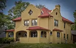 Arthur Hillyer Ford House |
April 10, 1986 (#86000713) |
228 Brown St. 41°40′14″N 91°31′48″W |
Iowa City | |
| 32 | Franklin Printing House |  Franklin Printing House |
April 10, 1986 (#86000712) |
115 S. Dubuque 41°39′34″N 91°32′00″W |
Iowa City | |
| 33 | Gilbert-Linn Street Historic District |  Gilbert-Linn Street Historic District |
April 21, 2005 (#05000366) |
Portions of the 300-600 blocks of N. Gilbert and N. Linn Sts. 41°40′00″N 91°31′49″W |
Iowa City | part of the Iowa City, Iowa MPS AD |
| 34 | Emma J. Harvat and Mary E. Stach House |  Emma J. Harvat and Mary E. Stach House |
May 11, 2000 (#00000478) |
332 E. Davenport St. 41°40′02″N 91°31′49″W |
Iowa City | part of the Iowa City MPS |
| 35 | Hawthorne Glove and Novelty Company-Shrader Drug Company Building |  Hawthorne Glove and Novelty Company-Shrader Drug Company Building |
September 22, 2014 (#14000666) |
529 S. Gilbert St. 41°39′16″N 91°31′49″W |
Iowa City | |
| 36 | Henyon-Kasper-Duffy Barn |  Henyon-Kasper-Duffy Barn |
January 2, 2004 (#03001348) |
2520 Iowa Highway 1, NE. 41°44′58″N 91°28′20″W |
Solon | |
| 37 | Iowa Federation Home for Colored Girls | December 6, 2019 (#100004731) |
942 Iowa Ave. 41°39′41″N 91°31′16″W |
Iowa City | ||
| 38 | Jackson-Swisher House and Carriage House | 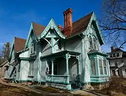 Jackson-Swisher House and Carriage House |
November 10, 1982 (#82000412) |
120 E. Fairchild St. 41°40′02″N 91°32′00″W |
Iowa City | |
| 39 | Jefferson Street Historic District |  Jefferson Street Historic District |
September 29, 2004 (#04001097) |
Portions of the 100-400 blocks of E. Jefferson St. 41°39′46″N 91°31′51″W |
Iowa City | part of the Iowa City, Iowa MPS AD |
| 40 | Johnson County Courthouse | 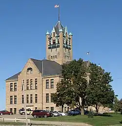 Johnson County Courthouse |
March 27, 1975 (#75000692) |
S. Clinton St. 41°39′22″N 91°32′07″W |
Iowa City | part of the County Courthouses in Iowa Thematic Resource (TR) (AD) |
| 41 | Johnson County Poor Farm and Asylum Historic District | 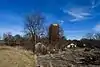 Johnson County Poor Farm and Asylum Historic District |
September 22, 2014 (#14000668) |
S. side of Melrose & Slothtower Aves. 41°39′26″N 91°36′17″W |
Iowa City | |
| 42 | Johnson County Savings Bank | .jpg.webp) Johnson County Savings Bank |
September 8, 2017 (#100001580) |
102 S. Clinton St. 41°39′36″N 91°32′05″W |
Iowa City | |
| 43 | Sylvanus Johnson House | 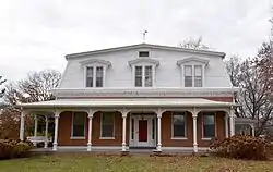 Sylvanus Johnson House |
December 6, 1990 (#90001857) |
2155 Prairie du Chien Rd. 41°41′26″N 91°31′31″W |
Iowa City | |
| 44 | Kirkwood House |  Kirkwood House |
September 17, 1974 (#74000792) |
1101 Kirkwood 41°38′57″N 91°31′09″W |
Iowa City | |
| 45 | Letovsky-Rohret House | 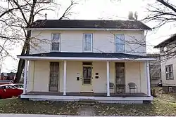 Letovsky-Rohret House |
April 12, 1982 (#82002624) |
515 E. Davenport St. 41°39′55″N 91°31′39″W |
Iowa City | |
| 46 | Linsay House | 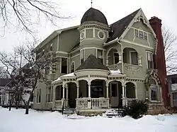 Linsay House |
August 2, 1977 (#77000529) |
935 E. College 41°39′27″N 91°31′17″W |
Iowa City | |
| 47 | Longfellow Historic District | 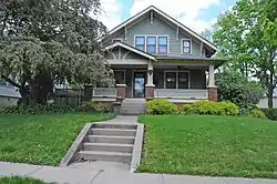 Longfellow Historic District |
September 12, 2002 (#02001023) |
Roughly bounded by Court, Rundell, Sheridan, and the western boundary of Longfellow School 41°39′16″N 91°30′59″W |
Iowa City | part of the Iowa City, Iowa MPS AD |
| 48 | James McCollister Farmstead | 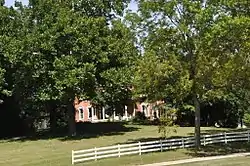 James McCollister Farmstead |
October 8, 1976 (#76000776) |
Southeast of the junction of U.S. Routes 6 and 218 41°38′03″N 91°31′45″W |
Iowa City | |
| 49 | Melrose Historic District | 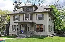 Melrose Historic District |
December 6, 2004 (#04001321) |
Portions of Melrose Ave., Melrose Ct., Melrose Circle, Brookland Park Dr., Brookland Place, and Myrtle Ave. 41°39′21″N 91°32′45″W |
Iowa City | part of the Iowa City, Iowa MPS AD |
| 50 | Miller Round Barn | 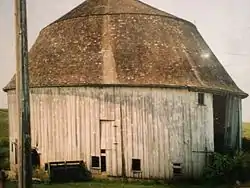 Miller Round Barn |
June 30, 1986 (#86001445) |
County Road F62 41°33′38″N 91°37′52″W |
Sharon Center | part of the Iowa Round Barns: The Sixty Year Experiment TR |
| 51 | Muscatine Avenue Moffitt Cottage Historic District | 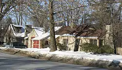 Muscatine Avenue Moffitt Cottage Historic District |
May 4, 1993 (#93000327) |
1322-1330 Muscatine Ave. 41°39′26″N 91°30′55″W |
Iowa City | part of the Small Homes of Howard F. Moffitt in Iowa City and Coralville MPS |
| 52 | Nicking House | 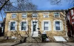 Nicking House |
April 21, 1975 (#75000693) |
410 E. Market St. 41°39′49″N 91°31′45″W |
Iowa City | |
| 53 | North Presbyterian Church | 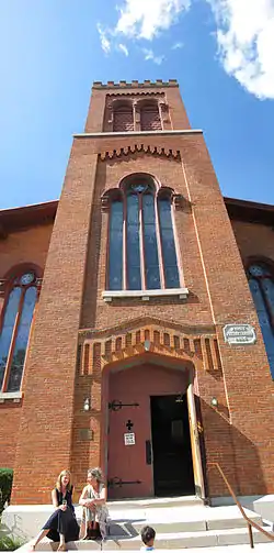 North Presbyterian Church |
August 28, 1973 (#73000730) |
26 E. Market St. 41°39′50″N 91°32′04″W |
Iowa City | |
| 54 | Oakes-Wood House | 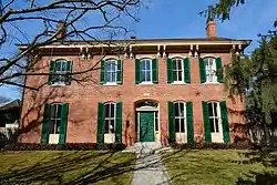 Oakes-Wood House |
April 14, 1978 (#78001227) |
1142 E. Court St. 41°39′25″N 91°31′05″W |
Iowa City | |
| 55 | Old Capitol | 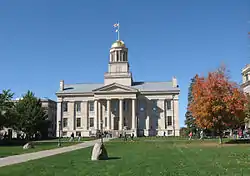 Old Capitol |
May 31, 1972 (#72000475) |
University of Iowa campus 41°39′41″N 91°32′08″W |
Iowa City | |
| 56 | Old Post Office | 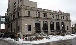 Old Post Office |
April 17, 1979 (#79000905) |
28 S. Linn St. 41°39′38″N 91°31′52″W |
Iowa City | |
| 57 | Old Settlers' Association of Johnson County Cabins | 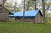 Old Settlers' Association of Johnson County Cabins |
June 25, 2013 (#13000429) |
Upper City Park Rd. off 100 blk. Park Rd. 41°40′16″N 91°32′32″W |
Iowa City | |
| 58 | Old State Quarry | February 23, 1998 (#97001676) |
0.1 miles (0.16 km) south of the southern end of Rice Ridge Ln., NE., at Coralville Lake 41°45′48″N 91°34′13″W |
North Liberty | ||
| 59 | Oxford Commercial Historic District | 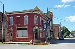 Oxford Commercial Historic District |
May 2, 1997 (#97000389) |
Roughly Augusta Ave. between Wilson St. and the Center St. alley 41°43′26″N 91°47′25″W |
Oxford | |
| 60 | Park House Hotel | 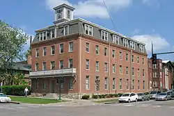 Park House Hotel |
December 11, 1978 (#78001229) |
130 E. Jefferson St. 41°39′46″N 91°32′00″W |
Iowa City | |
| 61 | Paul–Helen Building | 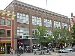 Paul–Helen Building |
April 10, 1986 (#86000708) |
207-215 E. Washington 41°39′35″N 91°31′57″W |
Iowa City | |
| 62 | Pentacrest | 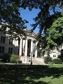 Pentacrest |
March 29, 1978 (#78001230) |
Bounded by Clinton, Madison, Jefferson, and Washington Sts. 41°39′41″N 91°32′09″W |
Iowa City | |
| 63 | Plum Grove | 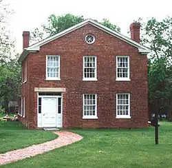 Plum Grove |
May 7, 1973 (#73000731) |
1030 Carroll Ave. 41°38′52″N 91°31′28″W |
Iowa City | |
| 64 | Polygonal Barn, Lincoln Township | June 30, 1986 (#86001452) |
Off U.S. Route 6 41°35′16″N 91°23′41″W |
Lincoln Township | part of the Iowa Round Barns: The Sixty Year Experiment TR | |
| 65 | A.W. Pratt House | 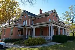 A.W. Pratt House |
February 3, 1983 (#83000378) |
503 Melrose Ave. 41°39′23″N 91°32′45″W |
Iowa City | |
| 66 | Samuel and Emma A. Ranshaw House | 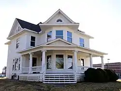 Samuel and Emma A. Ranshaw House |
September 26, 2012 (#12000814) |
515 W. Penn St. 41°45′05″N 91°36′21″W |
North Liberty | |
| 67 | F.X. Rittenmeyer House | 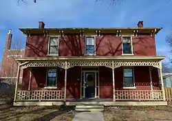 F.X. Rittenmeyer House |
May 31, 1979 (#79000906) |
630 E. Fairchild St. 41°40′01″N 91°31′32″W |
Iowa City | |
| 68 | Roberts Octagon Barn | 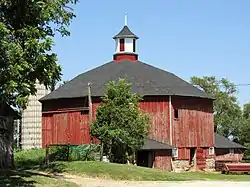 Roberts Octagon Barn |
June 30, 1986 (#86001449) |
County Road W62 41°35′24″N 91°38′07″W |
Sharon Center | part of the Iowa Round Barns: The Sixty Year Experiment TR |
| 69 | Rose Hill |  Rose Hill |
April 28, 1992 (#92000425) |
1415 E. Davenport St. 41°39′57″N 91°31′01″W |
Iowa City | |
| 70 | St. John's Lutheran Church |  St. John's Lutheran Church |
April 5, 1977 (#77000532) |
North of Kalona 41°33′15″N 91°40′03″W |
Kalona | |
| 71 | St. Mary's Church and Rectory | 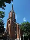 St. Mary's Church and Rectory |
February 8, 1980 (#80001454) |
220 E. Jefferson St. 41°39′46″N 91°31′54″W |
Iowa City | |
| 72 | St. Mary's Rectory | 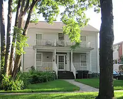 St. Mary's Rectory |
July 7, 1995 (#95000811) |
610 E. Jefferson St. 41°39′48″N 91°31′54″W |
Iowa City | |
| 73 | Saints Peter and Paul Catholic Church | _02.JPG.webp) Saints Peter and Paul Catholic Church |
July 9, 1997 (#97000622) |
1165 NE. Taft Ave. 41°50′57″N 91°27′49″W |
Solon | |
| 74 | Schindhelm-Drews House | 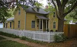 Schindhelm-Drews House |
January 28, 1994 (#93001589) |
410 N. Lucas St. 41°39′58″N 91°31′27″W |
Iowa City | |
| 75 | Secrest Octagon Barn | 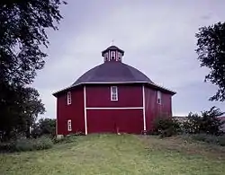 Secrest Octagon Barn |
November 5, 1974 (#74000790) |
West of Downey 41°36′49″N 91°22′13″W |
Downey | part of the Iowa Round Barns: The Sixty Year Experiment TR |
| 76 | Bohumil Shimek House | Bohumil Shimek House |
December 23, 1991 (#91001837) |
529 Brown St. 41°40′11″N 91°31′37″W |
Iowa City | part of the Conservation Movement in Iowa MPS |
| 77 | Sigma Pi Fraternity House |  Sigma Pi Fraternity House |
December 31, 2013 (#13001019) |
108 McLean St. 41°40′10″N 91°32′30″W |
Iowa City | |
| 78 | South Summit Street District | 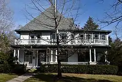 South Summit Street District |
October 9, 1973 (#73000732) |
301-818 S. Summit St. 41°39′16″N 91°31′16″W |
Iowa City | |
| 79 | Stone Academy | 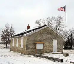 Stone Academy |
January 16, 2001 (#00001653) |
Iowa Highway 1, 2 miles (3.2 km) north of Solon 41°50′20″N 91°30′05″W |
Solon | |
| 80 | Summit Apartment Building | 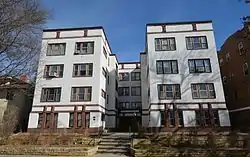 Summit Apartment Building |
September 29, 1983 (#83004188) |
228 S. Summit St. 41°39′29″N 91°31′14″W |
Iowa City | |
| 81 | Sutliff Bridge | 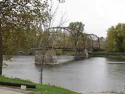 Sutliff Bridge |
May 15, 1998 (#98000520) |
Sutliff Rd. over the Cedar River 41°50′23″N 91°23′33″W |
Sutliff | part of the Highway Bridges of Iowa MPS |
| 82 | Tate Arms | December 9, 2019 (#100004732) |
914 S. Dubuque St. 41°39′02″N 91°31′58″W |
Iowa City | ||
| 83 | Trinity Episcopal Church | 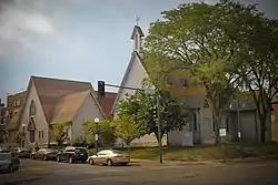 Trinity Episcopal Church |
December 31, 1974 (#74000793) |
320 E. College St. 41°39′33″N 91°31′49″W |
Iowa City | |
| 84 | Union Bakery | 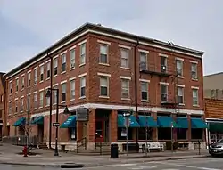 Union Bakery |
December 15, 2015 (#15000893) |
203 N. Linn St. 41°39′50″N 91°31′55″W |
Iowa City | |
| 85 | Union Brewery |  Union Brewery |
April 10, 1986 (#86000710) |
127-131 N. Linn St. and 221-227 E. Market St. 41°39′48″N 91°31′54″W |
Iowa City | |
| 86 | Vogt House | 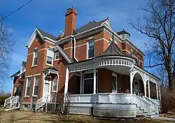 Vogt House |
July 24, 1978 (#78001231) |
800 N. Van Buren St. 41°40′15″N 91°31′42″W |
Iowa City | |
| 87 | Washington Township Center High School | 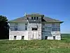 Washington Township Center High School |
December 15, 1979 (#79000903) |
Northeast of Amish 41°33′20″N 91°46′12″W |
Washington Township | |
| 88 | Roland and Marilyn Wehner House | 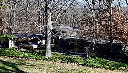 Roland and Marilyn Wehner House |
September 9, 2013 (#13000691) |
3112 Iowa Highway 1 41°42′29″N 91°28′58″W |
Iowa City vicinity | |
| 89 | Jacob Wentz House | 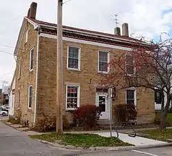 Jacob Wentz House |
August 27, 1974 (#74000794) |
219 N. Gilbert St. 41°39′51″N 91°31′48″W |
Iowa City | |
| 90 | Isaac A. Wetherby House | 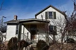 Isaac A. Wetherby House |
March 17, 2009 (#09000127) |
611 North Governor Street 41°40′05″N 91°31′23″W |
Iowa City | Former home of Isaac Augustus Wetherby. |
| 91 | H.A. White General Store and House | 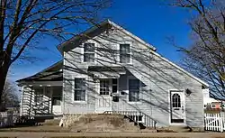 H.A. White General Store and House |
January 12, 1984 (#84001265) |
10 W. Cherry St. 41°45′33″N 91°35′52″W |
North Liberty | |
| 92 | Windrem House |  Windrem House |
September 13, 1977 (#77000531) |
604 Iowa Ave. 41°39′41″N 91°31′36″W |
Iowa City | |
| 93 | Woodlawn Historic District |  Woodlawn Historic District |
March 26, 1979 (#79000907) |
Irregular pattern along Woodlawn Ave. 41°39′40″N 91°31′10″W |
Iowa City |
Former listings
| [3] | Name on the Register | Image | Date listed | Date removed | Location | City or town | Summary |
|---|---|---|---|---|---|---|---|
| 1 | Opera House Block | November 29, 1978 (#78001228) | October 11, 2006 | 210–212 South Clinton Street 41°39′40″N 91°31′10″W |
Iowa City | ||
| 2 | M. T. Close and Company Flaxseed Warehouse | July 12, 1984 (#84001262) | August 15, 1995 | 521 S. Gilbert St. 41°39′40″N 91°31′10″W |
Iowa City | ||
| 3 | St. Mary's High School | December 19, 1977 (#77000530) | November 12, 1997 | 104 E. Jefferson St. |
Iowa City | ||
| 4 | Benjamin F. Shambaugh and Bertha M. Horack House | August 16, 1996 (#96000895) | March 18, 2004 | 219 N. Clinton Street |
Iowa City | ||
| 5 | Van Patten House |  Van Patten House |
January 27, 1983 (#83000379) | March 7, 2016 | 9 S. Linn St. 41°39′38″N 91°30′57″W |
Iowa City | Demolished in January 2012 following a fire started at a nearby business.[6] |
See also
| Wikimedia Commons has media related to National Register of Historic Places in Johnson County, Iowa. |
References
- The latitude and longitude information provided in this table was derived originally from the National Register Information System, which has been found to be fairly accurate for about 99% of listings. Some locations in this table may have been corrected to current GPS standards.
- "National Register of Historic Places: Weekly List Actions". National Park Service, United States Department of the Interior. Retrieved on February 5, 2021.
- Numbers represent an alphabetical ordering by significant words. Various colorings, defined here, differentiate National Historic Landmarks and historic districts from other NRHP buildings, structures, sites or objects.
- "National Register Information System". National Register of Historic Places. National Park Service. April 24, 2008.
- The eight-digit number below each date is the number assigned to each location in the National Register Information System database, which can be viewed by clicking the number.
- "Van Patten House set to come down next week". Iowa City Press-Citizen. Iowa City, Iowa. Retrieved January 30, 2012.
| Topics | |
|---|---|
| Lists by state |
|
| Lists by insular areas | |
| Lists by associated state | |
| Other areas | |
| Related | |
| |

Municipalities and communities of Johnson County, Iowa, United States | ||
|---|---|---|
| Cities | Map of Iowa highlighting Johnson County | |
| Townships | ||
| CDP | ||
| Other unincorporated communities | ||
| Ghost town | ||
| Footnotes | ‡This populated place also has portions in an adjacent county or counties | |
| ||
This article is issued from Wikipedia. The text is licensed under Creative Commons - Attribution - Sharealike. Additional terms may apply for the media files.