National Register of Historic Places listings in Muscatine County, Iowa
This is a list of the National Register of Historic Places listings in Muscatine County, Iowa.
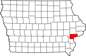
Location of Muscatine County in Iowa
This is intended to be a complete list of the properties and districts on the National Register of Historic Places in Muscatine County, Iowa, United States. Latitude and longitude coordinates are provided for many National Register properties and districts; these locations may be seen together in a map.[1]
There are 35 properties and districts listed on the National Register in the county. Another property was once listed but has been removed.
- This National Park Service list is complete through NPS recent listings posted January 29, 2021.[2]
Current listings
| [3] | Name on the Register[4] | Image | Date listed[5] | Location | City or town | Description |
|---|---|---|---|---|---|---|
| 1 | Beers and St. John Company Coach Inn | 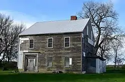 Beers and St. John Company Coach Inn |
April 5, 2016 (#16000130) |
1193 US 6 41°35′08″N 91°19′45″W |
West Liberty | |
| 2 | Big Slough Creek Bridge | 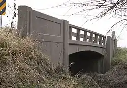 Big Slough Creek Bridge |
May 15, 1998 (#98000492) |
Bancroft Ave. over Big Slough Creek 41°28′38″N 91°20′53″W |
Nichols | |
| 3 | Bridge near West Liberty | Bridge near West Liberty |
May 15, 1998 (#98000491) |
120th St. over an unnamed stream 41°34′06″N 91°19′24″W |
West Liberty | |
| 4 | Chicago, Rock Island and Pacific Railroad-Wilton Depot | 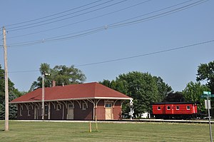 Chicago, Rock Island and Pacific Railroad-Wilton Depot |
August 25, 1988 (#88001326) |
N. Railroad St. 41°35′16″N 91°00′58″W |
Wilton | |
| 5 | Alexander Clark House | 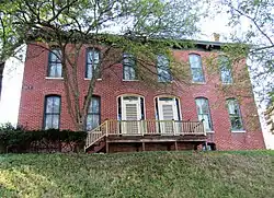 Alexander Clark House |
October 14, 1976 (#76000796) |
203 W. 3rd St. 41°25′17″N 91°02′53″W |
Muscatine | |
| 6 | Clark-Blackwell House |  Clark-Blackwell House |
January 27, 1983 (#83000396) |
206 Cherry St. 41°25′01″N 91°03′12″W |
Muscatine | |
| 7 | Downtown Commercial Historic District | 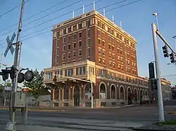 Downtown Commercial Historic District |
May 24, 2006 (#06000423) |
Roughly nine blocks centered on 2nd St. between Pine and Mulberry 41°25′24″N 91°02′44″W |
Muscatine | |
| 8 | Fair Oaks Historic District | 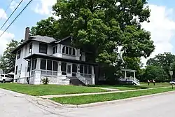 Fair Oaks Historic District |
February 24, 2020 (#100004983) |
Bounded by Park Ave., Washington St., Weed Park, and northern Fair Oaks Addition line 41°26′14″N 91°01′39″W |
Muscatine | |
| 9 | Pliny and Adelia Fay House | 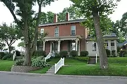 Pliny and Adelia Fay House |
April 23, 1998 (#98000382) |
112 Locust St. 41°25′04″N 91°03′03″W |
Muscatine | |
| 10 | First Presbyterian Church | 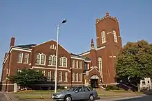 First Presbyterian Church |
September 14, 1977 (#77000544) |
401 Iowa Ave. 41°25′22″N 91°02′51″W |
Muscatine | |
| 11 | W. Joseph Fuller House | 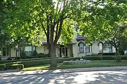 W. Joseph Fuller House |
December 10, 1982 (#82000416) |
1001 Mulberry Ave. 41°25′49″N 91°02′51″W |
Muscatine | |
| 12 | Greenwood Cemetery Chapel | 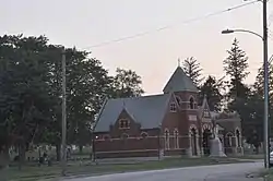 Greenwood Cemetery Chapel |
September 21, 2001 (#01001013) |
1814 Lucas 41°25′12″N 91°03′50″W |
Muscatine | |
| 13 | Ijem Avenue Commercial Historic District | 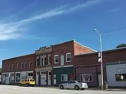 Ijem Avenue Commercial Historic District |
September 18, 2020 (#100005566) |
Ijem Ave. between Railroad St. and Main St. 41°28′52″N 91°18′30″W |
Nichols | |
| 14 | Doctor Alexander R. (A.R.) and Louisa J. Leith House | October 2, 2020 (#100005657) |
117 West 6th St. 41°35′28″N 91°01′04″W |
Wilton | ||
| 15 | Lock and Dam No. 16 Historic District |  Lock and Dam No. 16 Historic District |
March 10, 2004 (#04000176) |
33109 102nd Ave., W. 41°25′46″N 91°00′42″W |
Muscatine | |
| 16 | Laura Musser McColm Historic District | 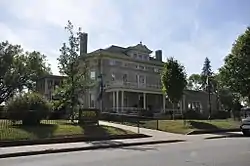 Laura Musser McColm Historic District |
January 24, 2017 (#100000562) |
1314 Mulberry Ave. 41°25′57″N 91°03′05″W |
Muscatine | |
| 17 | S. M. McKibben House | 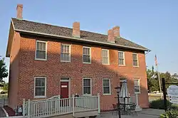 S. M. McKibben House |
August 27, 1974 (#74000800) |
Walnut St. between Front and 2nd 41°25′21″N 91°02′32″W |
Muscatine | Now houses the local chamber of commerce |
| 18 | Muscatine County Courthouse |  Muscatine County Courthouse |
July 2, 1981 (#81000260) |
3rd St. 41°25′28″N 91°02′35″W |
Muscatine | |
| 19 | Muscatine County Home Dairy Barn | 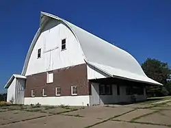 Muscatine County Home Dairy Barn |
January 31, 2019 (#100003365) |
3210 Harmony Ln. 41°26′02″N 91°05′07″W |
Muscatine | |
| 20 | Samuel Nichols House | 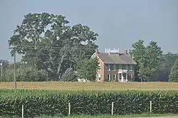 Samuel Nichols House |
March 31, 1978 (#78001247) |
East of Nichols off Iowa Highway 22 41°28′43″N 91°16′58″W |
Nichols | |
| 21 | Henry E. and Ella M. (Knott) Nicolaus House | 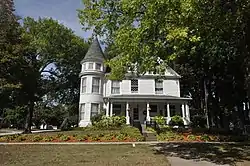 Henry E. and Ella M. (Knott) Nicolaus House |
May 8, 2017 (#100000968) |
319 4th St. W. 41°35′21″N 91°01′15″W |
Wilton | |
| 22 | Old Jail | 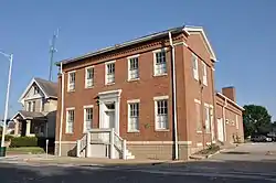 Old Jail |
July 24, 1974 (#74000801) |
411 E. 4th St. 41°25′49″N 91°02′37″W |
Muscatine | |
| 23 | Pine Creek Gristmill | 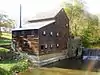 Pine Creek Gristmill |
December 10, 1979 (#79000919) |
Northeast of Muscatine in Wildcat Den State Park 41°28′03″N 90°52′03″W |
Muscatine | |
| 24 | Pine Mill Bridge | 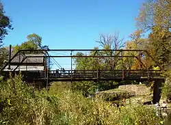 Pine Mill Bridge |
May 15, 1998 (#98000493) |
Over Pine Creek in Wildcat Den State Park 41°28′03″N 90°52′02″W |
Muscatine | |
| 25 | Pine Mills German Methodist Episcopal Church | 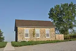 Pine Mills German Methodist Episcopal Church |
October 17, 2003 (#03001051) |
180th St. and Verde Ave. 41°28′50″N 90°52′51″W |
Muscatine | |
| 26 | Sinnett Octagon House | 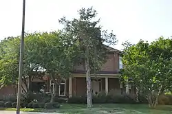 Sinnett Octagon House |
July 18, 1974 (#74000802) |
North of Muscatine near Iowa Highway 38 41°27′11″N 91°01′50″W |
Muscatine | |
| 27 | Trinity Episcopal Church | 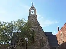 Trinity Episcopal Church |
October 29, 1974 (#74000803) |
411 E. 2nd St. 41°25′25″N 91°02′31″W |
Muscatine | |
| 28 | George H. and Loretta Ward House | _from_SE_3.JPG.webp) George H. and Loretta Ward House |
May 2, 1997 (#97000388) |
719 N. Calhoun St. 41°34′31″N 91°15′49″W |
West Liberty | |
| 29 | J. C. B. Warde House | 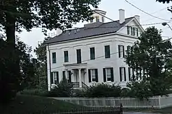 J. C. B. Warde House |
April 26, 1979 (#79000920) |
205 Cherry St. 41°25′02″N 91°03′09″W |
Muscatine | |
| 30 | Welch Apartments | 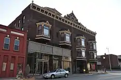 Welch Apartments |
January 15, 1979 (#79000921) |
224 Iowa Ave. 41°25′18″N 91°02′47″W |
Muscatine | |
| 31 | West Hill Historic District |  West Hill Historic District |
April 30, 2008 (#08000356) |
Roughly bounded by W. 2nd St. from Pine to Ash, W. 3rd St., and W. 4th St. from Chestnut to near Ash. 41°25′10″N 91°03′03″W |
Muscatine | |
| 32 | West Liberty Commercial Historic District | 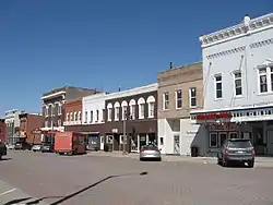 West Liberty Commercial Historic District |
September 12, 2002 (#02001035) |
Bounded by 4th St., railroad tracks, and Clay and Spencer Sts. 40°34′16″N 91°15′48″W |
West Liberty | |
| 33 | West Liberty Fairgrounds Historic District | 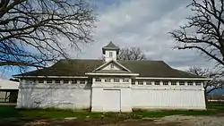 West Liberty Fairgrounds Historic District |
December 22, 2015 (#15000916) |
101 N. Clay St. 41°34′03″N 91°15′56″W |
West Liberty | |
| 34 | Wilton Candy Kitchen | 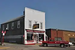 Wilton Candy Kitchen |
January 7, 1993 (#92001742) |
310 Cedar St. 41°35′16″N 91°01′06″W |
Wilton | |
| 35 | Wilton Commercial Historic District | 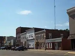 Wilton Commercial Historic District |
September 12, 2016 (#16000606) |
Roughly bounded by 4th, E. & W. Cedar, Railroad E. & W. & Chestnut Sts. 41°35′19″N 91°01′01″W |
Wilton |
Former listing
| [3] | Name on the Register | Image | Date listed | Date removed | Location | City or town | Summary |
|---|---|---|---|---|---|---|---|
| 1 | Bowman Livery Stable | June 28, 1974 (#74000799) | May 22, 2003 | 219 E. Mississippi Drive |
Muscatine |
See also
| Wikimedia Commons has media related to National Register of Historic Places in Muscatine County, Iowa. |
References
- The latitude and longitude information provided in this table was derived originally from the National Register Information System, which has been found to be fairly accurate for about 99% of listings. Some locations in this table may have been corrected to current GPS standards.
- "National Register of Historic Places: Weekly List Actions". National Park Service, United States Department of the Interior. Retrieved on January 29, 2021.
- Numbers represent an alphabetical ordering by significant words. Various colorings, defined here, differentiate National Historic Landmarks and historic districts from other NRHP buildings, structures, sites or objects.
- "National Register Information System". National Register of Historic Places. National Park Service. April 24, 2008.
- The eight-digit number below each date is the number assigned to each location in the National Register Information System database, which can be viewed by clicking the number.
| Topics | |
|---|---|
| Lists by state |
|
| Lists by insular areas | |
| Lists by associated state | |
| Other areas | |
| Related | |
| |

This article is issued from Wikipedia. The text is licensed under Creative Commons - Attribution - Sharealike. Additional terms may apply for the media files.