National Register of Historic Places listings in Plymouth County, Iowa
This is intended to be a complete list of the properties and districts on the National Register of Historic Places in Plymouth County, Iowa, United States. Latitude and longitude coordinates are provided for many National Register properties and districts; these locations may be seen together in a map.[1]
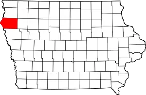
Location of Plymouth County in Iowa
There are 11 properties and districts listed on the National Register in the county, including 1 National Historic Landmark.
- This National Park Service list is complete through NPS recent listings posted January 29, 2021.[2]
| [3] | Name on the Register | Image | Date listed[4] | Location | City or town | Description |
|---|---|---|---|---|---|---|
| 1 | Akron Opera House | 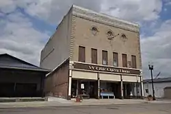 Akron Opera House |
July 10, 2012 (#12000403) |
151 Reed St. 42°49′44″N 96°33′36″W |
Akron | |
| 2 | Foster Park Historic District | April 25, 2008 (#08000329) |
500-900 blocks of Central Ave., S. and blocks around Foster Park 42°47′01″N 96°09′59″W |
Le Mars | ||
| 3 | Kimball Village | 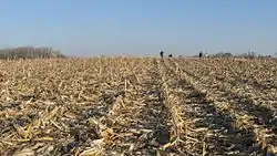 Kimball Village |
June 11, 2010 (#10000343) |
Address Restricted |
Westfield | Designated a National Historic Landmark on January 11, 2017 |
| 4 | Le Mars Central High School | 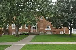 Le Mars Central High School |
May 14, 1999 (#99000492) |
335 1st Ave., SW. 42°47′19″N 96°10′05″W |
Le Mars | |
| 5 | Le Mars Downtown Commercial Historic District | 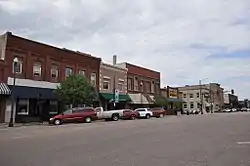 Le Mars Downtown Commercial Historic District |
November 6, 2012 (#12000908) |
Bounded by 2nd St., N., 2nd Ave., W., 1st St., S., and 1st Ave., E. 42°47′37″N 96°10′02″W |
Le Mars | |
| 6 | Le Mars Municipal Park and Golf Course Historic District |  Le Mars Municipal Park and Golf Course Historic District |
August 8, 2001 (#01000858) |
Between 4th Ave., NE. and Iowa Highway 3 42°48′10″N 96°09′03″W |
Le Mars | |
| 7 | Le Mars Public Library | 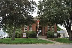 Le Mars Public Library |
March 26, 1979 (#79000922) |
200 Central 42°47′25″N 96°09′56″W |
Le Mars | |
| 8 | Plymouth County Courthouse | 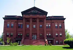 Plymouth County Courthouse |
July 2, 1981 (#81000263) |
E. 3rd Ave. 42°47′23″N 96°09′40″W |
Le Mars | |
| 9 | Sacred Heart Hospital | 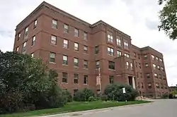 Sacred Heart Hospital |
February 3, 2010 (#09001303) |
4110 6th Ave., NE. 42°47′41″N 96°09′27″W |
Le Mars | |
| 10 | St. George's Episcopal Church | November 21, 1976 (#76000797) |
400 1st Ave., SE. 42°47′16″N 96°09′52″W |
Le Mars | ||
| 11 | Tonsfeldt Round Barn | 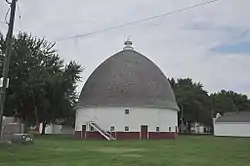 Tonsfeldt Round Barn |
November 19, 1986 (#86003194) |
Plymouth County Fairgrounds 42°47′52″N 96°09′34″W |
Le Mars |
Former listing
| [3] | Name on the Register | Image | Date listed | Date removed | Location | City or town | Summary |
|---|---|---|---|---|---|---|---|
| 1 | Thoren Hall | May 22, 1978 (#78001248) | May 22, 1998 | Westmar College campus, 10th St. |
Le Mars | Demolished November 11, 1990[5] | |
| 2 | Reeves Farmstead Historic District | 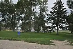 Reeves Farmstead Historic District |
January 26, 2001 (#00001680) | December 2, 2020 | Lake St. 42°48′49″N 96°11′37″W |
Le Mars |
See also
| Wikimedia Commons has media related to National Register of Historic Places in Plymouth County, Iowa. |
References
- The latitude and longitude information provided in this table was derived originally from the National Register Information System, which has been found to be fairly accurate for about 99% of listings. Some locations in this table may have been corrected to current GPS standards.
- "National Register of Historic Places: Weekly List Actions". National Park Service, United States Department of the Interior. Retrieved on January 29, 2021.
- Numbers represent an alphabetical ordering by significant words. Various colorings, defined here, differentiate National Historic Landmarks and historic districts from other NRHP buildings, structures, sites or objects.
- The eight-digit number below each date is the number assigned to each location in the National Register Information System database, which can be viewed by clicking the number.
| Topics | |
|---|---|
| Lists by state |
|
| Lists by insular areas | |
| Lists by associated state | |
| Other areas | |
| Related | |
| |

Municipalities and communities of Plymouth County, Iowa, United States | ||
|---|---|---|
| Cities | Map of Iowa highlighting Plymouth County | |
| Unincorporated communities | ||
| Footnotes | ‡This populated place also has portions in an adjacent county or counties | |
| ||
This article is issued from Wikipedia. The text is licensed under Creative Commons - Attribution - Sharealike. Additional terms may apply for the media files.