National Register of Historic Places listings in Trimble County, Kentucky
This is a list of the National Register of Historic Places listings in Trimble County, Kentucky.

Location of Trimble County in Kentucky
This is intended to be a complete list of the properties and districts on the National Register of Historic Places in Trimble County, Kentucky, United States. The locations of National Register properties and districts for which the latitude and longitude coordinates are included below, may be seen in a Google map.[1]
There are 29 properties and districts listed on the National Register in the county.
- This National Park Service list is complete through NPS recent listings posted February 5, 2021.[2]
Current listings
| [3] | Name on the Register | Image | Date listed[4] | Location | City or town | Description |
|---|---|---|---|---|---|---|
| 1 | Bates House | 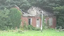 Bates House |
April 9, 1984 (#84002026) |
New Hope Rd. 38°38′41″N 85°20′57″W |
Bedford | |
| 2 | Callis General Store and Post Office | 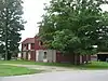 Callis General Store and Post Office |
July 21, 1983 (#83002878) |
New Hope Rd. 38°38′41″N 85°19′42″W |
Bedford | |
| 3 | Coleman House | 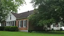 Coleman House |
July 21, 1983 (#83002880) |
Main St. 38°35′27″N 85°19′08″W |
Bedford | |
| 4 | William L. Coleman House | 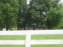 William L. Coleman House |
July 21, 1983 (#83002879) |
Sulphur-Bedford Rd. 38°32′42″N 85°17′56″W |
Bedford | |
| 5 | Ginn's Furniture Store | 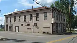 Ginn's Furniture Store |
July 21, 1983 (#83002881) |
Main St. 38°43′29″N 85°22′10″W |
Milton | |
| 6 | Hancock House |  Hancock House |
April 9, 1984 (#84002029) |
Main St. 38°35′39″N 85°19′01″W |
Bedford | |
| 7 | House at Moffett Cemetery Road |  House at Moffett Cemetery Road |
July 21, 1983 (#83002882) |
Moffett Cemetery Rd. 38°43′05″N 85°22′35″W |
Milton | |
| 8 | House on KY 1492 | April 9, 1984 (#84002031) |
Kentucky Route 1492 38°41′18″N 85°19′40″W |
Milton | Federal-style house built in early 1800s. | |
| 9 | House Tm-B-7 | 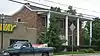 House Tm-B-7 |
April 9, 1984 (#84002033) |
Main St. 38°35′41″N 85°19′01″W |
Bedford | |
| 10 | House Tm-M-27 | 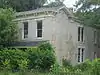 House Tm-M-27 |
April 9, 1984 (#84002035) |
Kentucky Route 36 38°43′28″N 85°21′57″W |
Milton | |
| 11 | House Tm-M-28 | 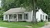 House Tm-M-28 |
April 9, 1984 (#84002036) |
Kentucky Route 36 38°43′28″N 85°21′56″W |
Milton | |
| 12 | Humphrey Place | 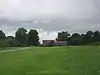 Humphrey Place |
July 21, 1983 (#83002883) |
North of Bedford on U.S. Route 421 38°38′27″N 85°19′37″W |
Bedford | |
| 13 | Hunter's Bottom Historic District | 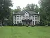 Hunter's Bottom Historic District |
August 11, 1976 (#76000862) |
West of Carrollton 38°43′29″N 85°20′57″W |
Carrollton | Extends into Carroll County |
| 14 | W.W. Logan House | 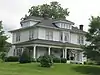 W.W. Logan House |
April 9, 1984 (#84002052) |
Sulpher-Bedford Pike 38°32′22″N 85°18′00″W |
Bedford | |
| 15 | Milton Masonic Lodge and County General Store | 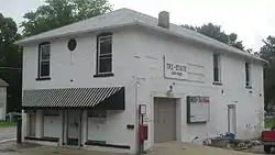 Milton Masonic Lodge and County General Store |
July 21, 1983 (#83002884) |
Main St. 38°43′29″N 85°22′08″W |
Milton | |
| 16 | Moreland School | April 9, 1984 (#84002053) |
Cooper's Bottom Rd. 38°40′19″N 85°25′59″W |
Milton | ||
| 17 | Neal House | 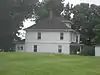 Neal House |
April 9, 1984 (#84002054) |
U.S. Route 421 38°41′41″N 85°21′55″W |
Milton | |
| 18 | Norfolk Farm Tenant Log House | January 8, 2014 (#13001055) |
600 Log House Ln.[5] 38°37′17″N 85°23′59″W |
Bedford | ||
| 19 | Old Kentucky Tavern | July 21, 1983 (#83002885) |
U.S. Route 42 38°31′46″N 85°20′11″W |
Bedford | Five miles south of Bedford; a significant landmark since the days of the stagecoach[6] | |
| 20 | Page House | 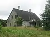 Page House |
April 10, 1984 (#84002056) |
Cooper's Bottom Rd. 38°43′45″N 85°24′58″W |
Milton | |
| 21 | Page-Bell House | July 21, 1983 (#83002886) |
Cooper's Bottom Rd. 38°43′03″N 85°25′57″W |
Milton | ||
| 22 | Peak House | 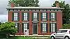 Peak House |
April 9, 1984 (#84002057) |
Spring and West Sts. 38°35′35″N 85°19′07″W |
Bedford | |
| 23 | Preston House | July 21, 1983 (#83002887) |
Rodgers Rd. 38°37′58″N 85°25′31″W |
Milton | ||
| 24 | Rowlett House | April 9, 1984 (#84002058) |
Kentucky Route 625 38°37′52″N 85°23′53″W |
Milton | ||
| 25 | Rowlett's Grocery | 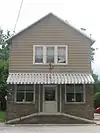 Rowlett's Grocery |
July 21, 1983 (#83002888) |
Main St. 38°43′26″N 85°22′09″W |
Milton | |
| 26 | Third Street Historic District |  Third Street Historic District |
April 10, 1984 (#84002059) |
3rd St. at U.S. Route 421 38°43′28″N 85°22′12″W |
Milton | |
| 27 | Trimble County Jail |  Trimble County Jail |
April 9, 1984 (#84002061) |
Main St. 38°35′37″N 85°19′04″W |
Bedford | |
| 28 | Trout House | July 21, 1983 (#83002889) |
Kentucky Route 625 38°40′15″N 85°24′55″W |
Milton | ||
| 29 | Yeager General Store | 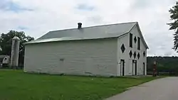 Yeager General Store |
July 21, 1983 (#83004528) |
Barebone Rd. 38°34′14″N 85°24′25″W |
Wises Landing |
See also
| Wikimedia Commons has media related to National Register of Historic Places in Trimble County, Kentucky. |
References
- The latitude and longitude information provided in this table was derived originally from the National Register Information System, which has been found to be fairly accurate for about 99% of listings. Some locations in this table may have been corrected to current GPS standards.
- "National Register of Historic Places: Weekly List Actions". National Park Service, United States Department of the Interior. Retrieved on February 5, 2021.
- Numbers represent an alphabetical ordering by significant words. Various colorings, defined here, differentiate National Historic Landmarks and historic districts from other NRHP buildings, structures, sites or objects.
- The eight-digit number below each date is the number assigned to each location in the National Register Information System database, which can be viewed by clicking the number.
- Maas, Anna. National Register of Historic Places Inventory/Nomination: Norfolk Farm Tenant Log House. National Park Service, 2013-06-01, 1.
- Federal Writers' Project. Kentucky: A Guide to the Bluegrass State. Lexington: U of Kentucky, 1939, 340.
Municipalities and communities of Trimble County, Kentucky, United States | ||
|---|---|---|
| Cities | Location of Trimble County, Kentucky | |
| Unincorporated communities | ||
| Ghost town | ||
| ||
This article is issued from Wikipedia. The text is licensed under Creative Commons - Attribution - Sharealike. Additional terms may apply for the media files.