National Register of Historic Places listings in Mercer County, Kentucky
This is a list of the National Register of Historic Places listings in Mercer County, Kentucky.
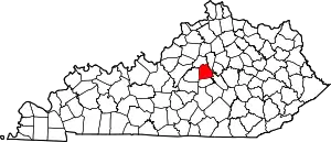
Location of Mercer County in Kentucky
This is intended to be a complete list of the properties and districts on the National Register of Historic Places in Mercer County, Kentucky, United States. The locations of National Register properties and districts for which the latitude and longitude coordinates are included below, may be seen in a map.[1]
There are 71 properties and districts listed on the National Register in the county; 1 of these is a National Historic Landmark. Another property was once listed but has been removed.
- This National Park Service list is complete through NPS recent listings posted February 5, 2021.[2]
Current listings
| [3] | Name on the Register | Image | Date listed[4] | Location | City or town | Description |
|---|---|---|---|---|---|---|
| 1 | Adams House | February 8, 1989 (#88003357) |
Van Arsdell Pike 37°53′01″N 84°55′24″W |
Salvisa | ||
| 2 | Archeological Site 15ME15 | July 11, 1985 (#85001507) |
Across the Salt River from the mouth of Dry Branch Creek[5] 37°43′50″N 84°51′48″W |
Harrodsburg | Also known as "Mercer Village"[6] | |
| 3 | Aspen Hall | 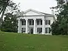 Aspen Hall |
February 8, 1989 (#88003372) |
558 Aspen Hall Dr. 37°50′23″N 84°50′08″W |
Harrodsburg | |
| 4 | Baldin House | February 8, 1989 (#88003349) |
South of Ebenezer on Ebenezer Rd. 37°52′32″N 84°48′57″W |
Ebenezer | ||
| 5 | Beaumont Avenue Residential District | 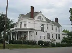 Beaumont Avenue Residential District |
February 8, 1989 (#88003359) |
338-538 Beaumont Ave. 37°45′24″N 84°50′36″W |
Harrodsburg | |
| 6 | Boise House | February 8, 1989 (#88003356) |
Bohon Rd. east of Salt River 37°48′11″N 84°52′40″W |
Harrodsburg | ||
| 7 | Bonta House | February 8, 1989 (#88003354) |
Northeast of Danville on U.S. Route 127 37°43′11″N 84°49′07″W |
Danville | ||
| 8 | Col. John Bowman House | February 8, 1989 (#88003353) |
Kennedy Bridge Rd. 37°44′21″N 84°43′39″W |
Harrodsburg | ||
| 9 | Burford Hill | 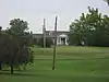 Burford Hill |
February 8, 1989 (#88003367) |
Greenville St. 37°46′21″N 84°50′26″W |
Harrodsburg | |
| 10 | Burris House | February 8, 1989 (#88003362) |
South of Kirkwood Rd. 37°54′33″N 84°53′03″W |
Salvisa | ||
| 11 | Nathaniel Burrus House | 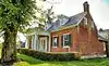 Nathaniel Burrus House |
August 1, 1984 (#84001840) |
955 Vanarsdall Rd. 37°53′45″N 84°53′31″W |
Harrodsburg | |
| 12 | Ambrose Burton House | August 11, 1983 (#83002826) |
Unity Rd. 37°51′09″N 84°50′18″W |
Harrodsburg | ||
| 13 | Cardwellton | 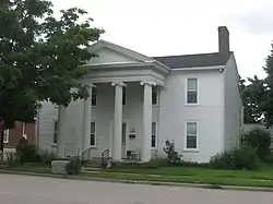 Cardwellton |
November 17, 1977 (#77000636) |
103 E. Broadway 37°45′49″N 84°50′34″W |
Harrodsburg | |
| 14 | Clay Hill | 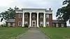 Clay Hill |
November 7, 1976 (#76000925) |
433 Beaumont Ave. 37°45′29″N 84°50′33″W |
Harrodsburg | |
| 15 | College Street Historic District | 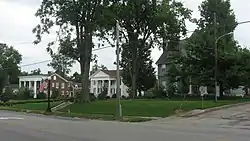 College Street Historic District |
February 9, 1979 (#79001023) |
College St. from North Lane to Factory St. 37°45′59″N 84°50′43″W |
Harrodsburg | |
| 16 | Confederate Monument in Harrodsburg | 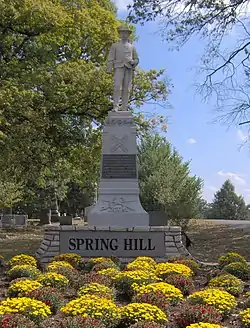 Confederate Monument in Harrodsburg |
July 17, 1997 (#97000677) |
Springhill Cemetery, 0.5 miles southeast of the junction of U.S. Route 127 and Kentucky Route 1989 37°46′09″N 84°50′29″W |
Harrodsburg | |
| 17 | Cunningham House | February 9, 1989 (#88003361) |
West of railroad tracks in Bondville 37°55′15″N 84°52′24″W |
Salvisa | ||
| 18 | Daniel Curry House | 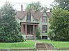 Daniel Curry House |
February 9, 1989 (#88003383) |
414 N. Main St. 37°46′03″N 84°50′36″W |
Harrodsburg | |
| 19 | Benjamin Daniel House | August 2, 1983 (#83002827) |
Northeast of Harrodsburg off U.S. Route 68 37°50′43″N 84°44′22″W |
Harrodsburg | ||
| 20 | Daughters' College | April 2, 1980 (#80001656) |
638 Beaumont Dr. 37°45′09″N 84°50′34″W |
Harrodsburg | ||
| 21 | Doricham | 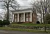 Doricham |
October 22, 1976 (#76000926) |
409 N. College St. 37°46′04″N 84°50′41″W |
Harrodsburg | |
| 22 | Peter Dunn House | February 9, 1989 (#88003358) |
South of McAfee off Old U.S. Route 127 37°50′42″N 84°51′19″W |
McAfee | ||
| 23 | Dutch Reformed Church | February 16, 1973 (#73000819) |
3 miles southwest of Harrodsburg on Dry Branch Rd. 37°43′27″N 84°51′48″W |
Harrodsburg | ||
| 24 | The Elms | 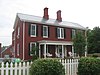 The Elms |
February 9, 1989 (#88003370) |
354 E. Lexington 37°45′42″N 84°50′20″W |
Harrodsburg | |
| 25 | Fairview | August 1, 1984 (#84001883) |
2408 Lexington Rd. 37°48′22″N 84°46′41″W |
Harrodsburg | ||
| 26 | Forsythe-Shewmaker House | February 28, 2012 (#12000048) |
603 Vanarsdall Rd. 37°53′42″N 84°52′42″W |
Harrodsburg | ||
| 27 | Froman-McCann House | July 27, 2004 (#02000344) |
532 Bailey Pike 37°46′22″N 84°46′52″W |
Harrodsburg | ||
| 28 | Greek Revival Houses of Mercer County: Lynnwood, Walnut Hall, Glenworth | March 30, 1978 (#78001388) |
North and east of Harrodsburg off U.S. Route 127 37°45′45″N 84°47′16″W |
Harrodsburg | ||
| 29 | Greystone | February 9, 1989 (#88003382) |
618 Beaumont Ave. 37°45′13″N 84°50′33″W |
Harrodsburg | ||
| 30 | Floyd Gritton House | February 9, 1989 (#88003363) |
Bondville Rd. west of Salt River 37°56′06″N 84°54′13″W |
Salvisa | ||
| 31 | Harrodsburg Armory | 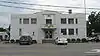 Harrodsburg Armory |
March 24, 2000 (#00000281) |
130 N. College St. 37°45′48″N 84°50′45″W |
Harrodsburg | |
| 32 | Harrodsburg Downtown Historic District | 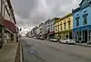 Harrodsburg Downtown Historic District |
April 3, 1980 (#80001657) |
Roughly bounded by Lexington, Greenville, and Chiles Sts. and Moreland and Beaumont Aves.; also 109-225 E. Poplar, 115, 125 W. Poplar, 320 -104 S. Chiles, 122, 112, 108 W. Lexington 37°45′37″N 84°50′36″W |
Harrodsburg | Second set of addresses represent a boundary increase approved December 12, 2017. |
| 33 | Honeysuckle Hill | 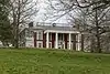 Honeysuckle Hill |
August 11, 1983 (#83002828) |
712 Beaumont Ave. 37°45′01″N 84°50′18″W |
Harrodsburg | |
| 34 | Moses Jones House | February 9, 1979 (#79001024) |
North of Harrodsburg on Oregon Rd. 37°54′45″N 84°48′21″W |
Harrodsburg | ||
| 35 | Lexington and Cane Run Historic District | November 14, 2011 (#11000795) |
E. Lexington & Cane Run Sts. 37°45′43″N 84°50′17″W |
Harrodsburg | ||
| 36 | Lexington, Harrodsburg, and Perryville Turnpike Rural Historic District | October 23, 2003 (#03000087) |
U.S. Route 68 37°48′35″N 84°46′52″W |
Harrodsburg | ||
| 37 | Beriah Magoffin Monument | 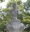 Beriah Magoffin Monument |
July 17, 1997 (#97000676) |
Springhill Cemetery, 0.5 miles southeast of the junction of U.S. Route 127 and KY 1989 37°46′10″N 84°50′20″W |
Harrodsburg | |
| 38 | Matheny-Taylor House |  Matheny-Taylor House |
February 9, 1989 (#88003378) |
Poplar and College Sts. 37°45′42″N 84°50′45″W |
Harrodsburg | |
| 39 | McAfee Farm Historic District | 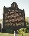 McAfee Farm Historic District |
February 9, 1989 (#88003360) |
South of McAfee on Old Louisville Rd. 37°50′18″N 84°51′49″W |
McAfee | |
| 40 | George McAfee House | June 23, 1983 (#83002829) |
Off KY 1160 37°50′51″N 84°52′46″W |
Cornishville | ||
| 41 | James McAfee House | June 23, 1983 (#83002830) |
Talmage Rd 37°51′24″N 84°52′20″W |
Harrodsburg | ||
| 42 | Joseph McCoun-D.S. Sharp House | August 3, 2005 (#05000788) |
Junction of Bondville Rd. and Crews St. 37°55′13″N 84°52′16″W |
Bondville/Salvisa | ||
| 43 | McGee House | February 9, 1989 (#88003364) |
Jackson Rd. 37°49′29″N 84°51′49″W |
Harrodsburg | ||
| 44 | John McGee House | June 23, 1983 (#83002831) |
Jackson Rd. 37°49′48″N 84°52′43″W |
Cornishville | Stone house from c.1790 and c.1825 | |
| 45 | Mercer County Jailer's Residence | 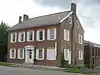 Mercer County Jailer's Residence |
February 9, 1989 (#88003375) |
320 S. Chiles St. 37°45′35″N 84°50′42″W |
Harrodsburg | |
| 46 | Millwood | July 6, 1976 (#76000928) |
South of Salvisa off U.S. Route 127 37°52′57″N 84°52′23″W |
Salvisa | ||
| 47 | Moreland House | 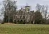 Moreland House |
February 9, 1989 (#88003371) |
Off U.S. Route 68 37°45′58″N 84°49′47″W |
Harrodsburg | |
| 48 | Morgan Row | 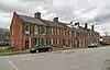 Morgan Row |
February 16, 1973 (#73000820) |
222, 230, 232 S. Chiles St. 37°45′38″N 84°50′43″W |
Harrodsburg | |
| 49 | Joseph Morgan House | April 18, 1990 (#88003365) |
Moberly Rd. 37°46′48″N 84°51′48″W |
Harrodsburg | ||
| 50 | New Providence Presbyterian Church | 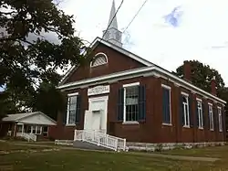 New Providence Presbyterian Church |
October 10, 1975 (#75000806) |
3 miles south of Salvisa on U.S. Route 127 37°51′53″N 84°51′10″W |
Salvisa | |
| 51 | North Main Street Historic District | 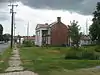 North Main Street Historic District |
December 19, 2011 (#11000796) |
105-414 N. Main St., 109 W. Lexington, 101 W. Broadway, 163 E. Broadway 37°45′54″N 84°50′35″W |
Harrodsburg | |
| 52 | Benjamin Passmore Hotel | 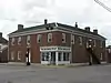 Benjamin Passmore Hotel |
June 18, 1990 (#88003374) |
N. Main St. and Broadway 37°45′50″N 84°50′36″W |
Harrodsburg | |
| 53 | Benjamin Passmore House | 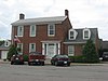 Benjamin Passmore House |
February 8, 1989 (#88003376) |
111 W. Broadway 37°45′49″N 84°50′39″W |
Harrodsburg | |
| 54 | George Passmore House | 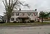 George Passmore House |
February 9, 1989 (#88003379) |
Poplar and Greenville Sts. 37°45′39″N 84°50′32″W |
Harrodsburg | |
| 55 | Pioneer Memorial State Park | Pioneer Memorial State Park |
February 9, 1989 (#88003377) |
College Ave. between Lexington and Poplar Sts. 37°45′42″N 84°50′53″W |
Harrodsburg | |
| 56 | Dr. A.D. Price House | 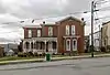 Dr. A.D. Price House |
February 9, 1989 (#88003373) |
115 W. Poplar St. 37°45′41″N 84°50′39″W |
Harrodsburg | |
| 57 | Roach-Ison House |  Roach-Ison House |
February 9, 1989 (#88003352) |
Northeast of Harrodsburg off U.S. Route 68 37°46′13″N 84°49′38″W |
Harrodsburg | |
| 58 | St. Peter's AME Church | 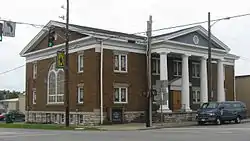 St. Peter's AME Church |
February 9, 1989 (#88003381) |
Lexington St. and U.S. Route 127 37°45′46″N 84°50′43″W |
Harrodsburg | |
| 59 | St. Philip's Episcopal Church | 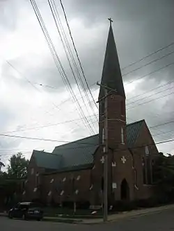 St. Philip's Episcopal Church |
January 31, 1978 (#78001389) |
Short and Chiles Sts. 37°45′39″N 84°50′40″W |
Harrodsburg | |
| 60 | Shaker West Lot Farm | 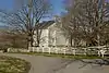 Shaker West Lot Farm |
June 23, 1983 (#83002832) |
Off U.S. Route 68 37°49′35″N 84°45′18″W |
Harrodsburg | |
| 61 | Shakertown at Pleasant Hill Historic District |  Shakertown at Pleasant Hill Historic District |
November 11, 1971 (#71000353) |
On U.S. Route 68 37°49′14″N 84°44′36″W |
Pleasant Hill | |
| 62 | Shawnee Springs | July 19, 1976 (#76000927) |
4 miles northeast of Harrodsburg on Curry Rd. 37°49′01″N 84°48′07″W |
Harrodsburg | ||
| 63 | Smith-Williams House | February 9, 1989 (#88003355) |
South of Cane Run Pike 37°44′57″N 84°47′01″W |
Burgin | ||
| 64 | Stone Quarters on Burgin Road | June 23, 1983 (#83002833) |
KY 152 37°45′40″N 84°49′15″W |
Harrodsburg | ||
| 65 | Sutfield House | 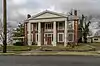 Sutfield House |
February 9, 1989 (#88003368) |
304 N. Main St. 37°45′54″N 84°50′36″W |
Harrodsburg | |
| 66 | Sutfield-Thompson House | 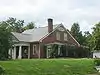 Sutfield-Thompson House |
September 13, 1977 (#77000637) |
362 N. Main 37°45′59″N 84°50′36″W |
Harrodsburg | |
| 67 | Capt. Samuel Taylor House | 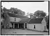 Capt. Samuel Taylor House |
April 13, 1977 (#77000638) |
Northeast of Harrodsburg on Chatham Pike 37°47′56″N 84°45′49″W |
Harrodsburg | |
| 68 | US Post Office-Harrodsburg | 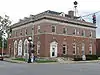 US Post Office-Harrodsburg |
March 1, 1989 (#89000019) |
105 N. Main St. 37°45′45″N 84°50′35″W |
Harrodsburg | |
| 69 | Wildwood | February 9, 1989 (#88003366) |
388 Curry Pike 37°48′19″N 84°48′43″W |
Harrodsburg | ||
| 70 | Williams House | June 18, 1990 (#88003351) |
Warwick Rd. 37°49′50″N 84°49′35″W |
Harrodsburg | ||
| 71 | Archibald Woods House | 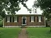 Archibald Woods House |
October 29, 1983 (#83002834) |
129 N. East St. 37°45′46″N 84°50′27″W |
Harrodsburg | Still owned by same family that built house on what was originally four-acre tract along south side of Town Creek near site of James Harrod's June 1774 'Big Spring' settlement. Six generations of the Woods family have lived here. Believed to have been modeled after Warren House (ca. 1760) near Smithfield, Surry County, Virginia. |
Former listing
| [3] | Name on the Register | Image | Date listed | Date removed | Location | City or town | Summary |
|---|---|---|---|---|---|---|---|
| 1 | Tobin House | February 9, 1989 (#88003350) | January 31, 1992 | 1450 Curry Pike |
Harrodsburg |
See also
| Wikimedia Commons has media related to National Register of Historic Places in Mercer County, Kentucky. |
References
- The latitude and longitude information provided in this table was derived originally from the National Register Information System, which has been found to be fairly accurate for about 99% of listings. Some locations in this table may have been corrected to current GPS standards.
- "National Register of Historic Places: Weekly List Actions". National Park Service, United States Department of the Interior. Retrieved on February 5, 2021.
- Numbers represent an alphabetical ordering by significant words. Various colorings, defined here, differentiate National Historic Landmarks and historic districts from other NRHP buildings, structures, sites or objects.
- The eight-digit number below each date is the number assigned to each location in the National Register Information System database, which can be viewed by clicking the number.
- Pollack, David, ed. The Archaeology of Kentucky: An Update. Frankfort: Kentucky Heritage Council, 2008, 753.
- "National Register Information System". National Register of Historic Places. National Park Service. July 9, 2010.
| Topics | |
|---|---|
| Lists by state |
|
| Lists by insular areas | |
| Lists by associated state | |
| Other areas | |
| Related | |
| |
Municipalities and communities of Mercer County, Kentucky, United States | ||
|---|---|---|
| Cities | Location of Mercer County, Kentucky | |
| CDP | ||
| Unincorporated communities | ||
| Ghost town | ||
| ||
This article is issued from Wikipedia. The text is licensed under Creative Commons - Attribution - Sharealike. Additional terms may apply for the media files.