National Register of Historic Places listings in Henderson County, Kentucky
This is a list of the National Register of Historic Places listings in Henderson County, Kentucky.
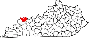
Location of Henderson County in Kentucky
This is intended to be a complete list of the properties and districts on the National Register of Historic Places in Henderson County, Kentucky, United States. The locations of National Register properties and districts for which the latitude and longitude coordinates are included below, may be seen in a map.[1]
There are 27 properties and districts listed on the National Register in the county, of which 4 are part of a National Historic Landmark spread across multiple counties. Another property was once listed but has been removed.
- This National Park Service list is complete through NPS recent listings posted January 29, 2021.[2]
Current listings
| [3] | Name on the Register | Image | Date listed[4] | Location | City or town | Description |
|---|---|---|---|---|---|---|
| 1 | Alves Historic District |  Alves Historic District |
September 7, 1989 (#89001151) |
Roughly bounded by Green, Center, S. Alvasia, Powell, S. Adams, and Washington Sts. 37°50′05″N 87°35′09″W |
Henderson | |
| 2 | Archeological Site KHC-3 (15HE635) |  Archeological Site KHC-3 (15HE635) |
April 1, 1986 (#86000641) |
In the lawn of a house on Reed Bluff City Rd., northeast of Bluff City[5] 37°48′54″N 87°22′12″W |
Hebbardsville | Part of the Green River Shell Middens Archeological District National Historic Landmark[6]:17 |
| 3 | Archeological Site KHC-4 (15HE580) |  Archeological Site KHC-4 (15HE580) |
April 1, 1986 (#86000642) |
Right bank of the Green River, 1 mile (1.6 km) above Bluff City[5] 37°48′25″N 87°21′56″W |
Hebbardsville | Part of the Green River Shell Middens Archeological District National Historic Landmark[6]:15 |
| 4 | Audubon School | 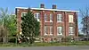 Audubon School |
December 22, 1998 (#98001497) |
1400 Clay St. 37°49′32″N 87°34′48″W |
Henderson | |
| 5 | John James Audubon State Park | 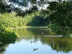 John James Audubon State Park |
March 10, 1988 (#87002220) |
U.S. Route 41 37°52′56″N 87°32′53″W |
Henderson | |
| 6 | Barret House | 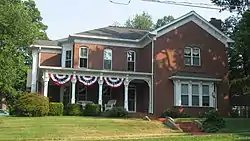 Barret House |
January 5, 1978 (#78001340) |
204 S. Elm St. 37°50′08″N 87°35′36″W |
Henderson | |
| 7 | Barret-Keach Farm | 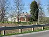 Barret-Keach Farm |
January 11, 2001 (#00001596) |
1586 Kentucky Route 136 W. 37°47′58″N 87°39′25″W |
Henderson | |
| 8 | Bluff City Shell Mound (15HE160) |  Bluff City Shell Mound (15HE160) |
April 1, 1986 (#86000644) |
0.5 miles (0.80 km) above Bluff City on a Green River bluff[7] 37°47′58″N 87°22′20″W |
Hebbardsville | Part of the Green River Shell Middens Archeological District National Historic Landmark[6]:14 |
| 9 | Delano-Alves House | 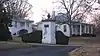 Delano-Alves House |
February 11, 1993 (#93000044) |
536 Chestnut St. 37°49′34″N 87°35′50″W |
Henderson | |
| 10 | E.L. Ehlen Livery and Sale Stable | November 16, 1989 (#89002007) |
110 1st St. 37°50′22″N 87°35′36″W |
Henderson | ||
| 11 | Geibel House | 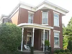 Geibel House |
December 10, 1998 (#98001491) |
327 N. Main St. 37°50′34″N 87°35′26″W |
Henderson | |
| 12 | J. Hawkins Hart House | 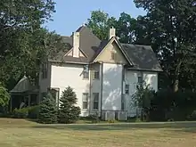 J. Hawkins Hart House |
February 11, 2011 (#11000005) |
630 Center St. 37°50′06″N 87°35′11″W |
Henderson | Designed by architect George Franklin Barber |
| 13 | Henderson Armory | 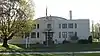 Henderson Armory |
September 6, 2002 (#02000928) |
735 N. Elm St. 37°50′51″N 87°35′09″W |
Henderson | |
| 14 | Henderson Commercial District | 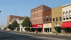 Henderson Commercial District |
November 13, 1989 (#89001975) |
Roughly bounded by Main, 3rd, Elm, and 1st Sts. 37°50′24″N 87°35′27″W |
Henderson | |
| 15 | Henderson Cotton Mill Workers Housing District | 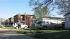 Henderson Cotton Mill Workers Housing District |
December 10, 1998 (#98001495) |
Roughly bounded by Washington, Letcher, and Powell Sts., and Ranklin Ave. 37°49′46″N 87°34′46″W |
Henderson | |
| 16 | Henderson Louisville and Nashville Railroad Depot | 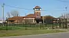 Henderson Louisville and Nashville Railroad Depot |
May 14, 1980 (#80001549) |
300 Clark St. 37°50′12″N 87°34′39″W |
Henderson | |
| 17 | Jackson-Ijames Farm | 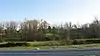 Jackson-Ijames Farm |
January 4, 2001 (#00001593) |
12500 S. Kentucky Route 1078[8] 37°46′50″N 87°27′54″W |
Henderson | Also known as "Tallmadge"[9] |
| 18 | James Giles Shell Midden (15HE589) | 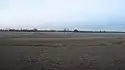 James Giles Shell Midden (15HE589) |
April 1, 1986 (#86000646) |
Left bank of the Green River, east of Bluff City[5] 37°48′20″N 87°19′31″W |
Bluff City | Part of the Green River Shell Middens Archeological District National Historic Landmark[6]:16 |
| 19 | Klee Funeral Parlor | 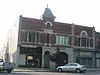 Klee Funeral Parlor |
November 16, 1989 (#89002006) |
13-17 S. Main St. 37°50′18″N 87°35′37″W |
Henderson | |
| 20 | John E. McCallister House | 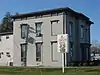 John E. McCallister House |
September 21, 1982 (#82002701) |
839 N. Green St. 37°50′54″N 87°35′00″W |
Henderson | |
| 21 | North Main Street Historic District | 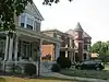 North Main Street Historic District |
March 7, 1990 (#90000297) |
N. Main St. from 5th to 8th Sts. 37°51′04″N 87°35′17″W |
Henderson | |
| 22 | John O'Byrne House | 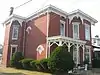 John O'Byrne House |
March 22, 1990 (#90000485) |
317 N. Main St. 37°50′34″N 87°35′27″W |
Henderson | |
| 23 | Prichett House | 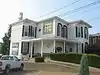 Prichett House |
December 10, 1998 (#98001490) |
311 N. Main St. 37°50′33″N 87°35′27″W |
Henderson | |
| 24 | St. Paul's Episcopal Church | 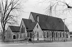 St. Paul's Episcopal Church |
October 19, 1978 (#78001341) |
338 Center St. 37°50′13″N 87°35′25″W |
Henderson | |
| 25 | William Soaper Farm | January 11, 2001 (#00001595) |
2323 Zion Rd. 37°49′57″N 87°33′39″W |
Henderson | ||
| 26 | South Main and South Elm Streets Historic District | 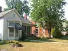 South Main and South Elm Streets Historic District |
May 11, 1992 (#92000500) |
Roughly bounded by Washington, Center, S. Green, Jefferson, S. Main, and Water Sts. 37°50′02″N 87°35′45″W |
Henderson | |
| 27 | Stewart House | 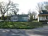 Stewart House |
December 22, 1998 (#98001496) |
827 S. Green St. 37°49′40″N 87°35′58″W |
Henderson |
Former listing
| [3] | Name on the Register | Image | Date listed | Date removed | Location | City or town | Summary |
|---|---|---|---|---|---|---|---|
| 1 | Douglass High School | August 18, 1980 (#80001548) | February 3, 1988 | 300 S. Alvasia St. |
Henderson |
See also
| Wikimedia Commons has media related to National Register of Historic Places in Henderson County, Kentucky. |
References
- The latitude and longitude information provided in this table was derived originally from the National Register Information System, which has been found to be fairly accurate for about 99% of listings. Some locations in this table may have been corrected to current GPS standards.
- "National Register of Historic Places: Weekly List Actions". National Park Service, United States Department of the Interior. Retrieved on January 29, 2021.
- Numbers represent an alphabetical ordering by significant words. Various colorings, defined here, differentiate National Historic Landmarks and historic districts from other NRHP buildings, structures, sites or objects.
- The eight-digit number below each date is the number assigned to each location in the National Register Information System database, which can be viewed by clicking the number.
- Claassen, Cheryl. Feasting with Shellfish in the Southern Ohio Valley: Archaic Sacred Sites and Rituals. Knoxville: U of Tennessee P, 2010, 40.
- National Historic Landmark Nomination: Green River Shell Middens. National Park Service: 1994-05-05.
- Moore, Clarence B. "Some Aboriginal Sites on Green River, Kentucky". Journal of the Philadelphia Academy of Natural Sciences 16 (1916): 431-487: 440.
- Boyett, Frank. "No silk purse: Town industry never got off the ground, Evansville Courier & Press, 2009-08-15. Accessed 2013-04-06.
- "National Register Information System". National Register of Historic Places. National Park Service. July 9, 2010.
| Topics | |
|---|---|
| Lists by state |
|
| Lists by insular areas | |
| Lists by associated state | |
| Other areas | |
| Related | |
| |
Municipalities and communities of Henderson County, Kentucky, United States | ||
|---|---|---|
| Cities | Map of Kentucky highlighting Henderson County | |
| CDPs | ||
| Other communities | ||
| Ghost town | ||
| Footnotes | ‡This populated place also has portions in an adjacent county or counties | |
| ||
This article is issued from Wikipedia. The text is licensed under Creative Commons - Attribution - Sharealike. Additional terms may apply for the media files.