National Register of Historic Places listings in Hardin County, Kentucky
This is a list of the National Register of Historic Places listings in Hardin County, Kentucky.
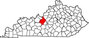
Location of Hardin County in Kentucky
This is intended to be a complete list of the properties and districts on the National Register of Historic Places in Hardin County, Kentucky, United States. The locations of National Register properties and districts for which the latitude and longitude coordinates are included below, may be seen in a map.[1]
There are 90 properties and districts listed on the National Register in the county. Another property was once listed but has been removed.
- This National Park Service list is complete through NPS recent listings posted January 29, 2021.[2]
Current listings
| [3] | Name on the Register | Image | Date listed[4] | Location | City or town | Description |
|---|---|---|---|---|---|---|
| 1 | Dr. Abel House | October 4, 1988 (#88001768) |
Kentucky Route 1904 1 mile west of Kentucky Route 222 37°36′38″N 85°57′42″W |
Glendale | ||
| 2 | Applegate-Fisher House | October 4, 1988 (#88001787) |
404 Elm St. 37°59′58″N 85°56′50″W |
West Point | ||
| 3 | Philip Arnold House | October 4, 1988 (#88001798) |
422 E. Poplar St. 37°41′31″N 85°50′51″W |
Elizabethtown | ||
| 4 | Ashe House | October 4, 1988 (#88001755) |
Kentucky Route 1868, 1 mile west of its junction with Kentucky Route 1136 37°36′05″N 85°54′20″W |
Glendale | ||
| 5 | Bethlehem Academy Historic District | October 4, 1988 (#88001813) |
Near the junction of Kentucky Routes 253 and 1357 37°42′03″N 85°59′46″W |
St. John | ||
| 6 | John D. Bland House | October 4, 1988 (#88001729) |
Kentucky Route 720, 2 miles west of its junction with Kentucky Route 84 37°30′40″N 85°54′51″W |
Sonora | ||
| 7 | William Bland House | October 4, 1988 (#88001734) |
Kentucky Route 222, 2.5 miles west of Glendale 37°36′50″N 85°58′15″W |
Glendale | ||
| 8 | Bland-Overall House | October 4, 1988 (#88001728) |
Kentucky Route 1868, 0.8 miles west of its junction with Kentucky Route 1136 37°34′53″N 85°55′47″W |
Sonora | ||
| 9 | Blue Ball Church | October 4, 1988 (#88001727) |
Blue Ball Church Rd., 0.6 miles south of its junction with Kentucky Routes 220 and 1375 37°43′32″N 86°02′14″W |
Howe Valley | ||
| 10 | J. Roy Bond House | 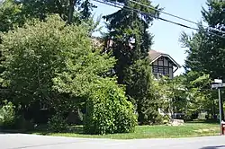 J. Roy Bond House |
October 4, 1988 (#88001811) |
317 College St. 37°41′36″N 85°52′00″W |
Elizabethtown | |
| 11 | Daniel Brackett House | October 4, 1988 (#88001752) |
Kentucky Route 1931, 0.5 miles south of Kentucky Route 224 37°26′53″N 85°57′31″W |
Upton | ||
| 12 | Brown Pusey House Community Center | 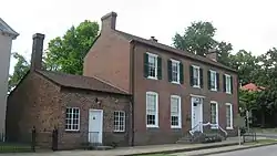 Brown Pusey House Community Center |
July 12, 1974 (#74000878) |
128 N. Maine St. 37°41′39″N 85°51′26″W |
Elizabethtown | |
| 13 | William Bush House | 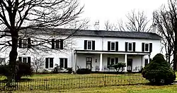 William Bush House |
October 4, 1988 (#88001807) |
1927 Tunnel Hill Rd. 37°43′43″N 85°50′05″W |
Elizabethtown | |
| 14 | Dr. Clyde Carroll House | October 4, 1988 (#88001764) |
Dead Man's Cave Rd. 37°33′31″N 86°01′46″W |
White Mills | ||
| 15 | Chenault House | October 4, 1988 (#88001781) |
Kentucky Route 1375, 1.5 miles north of Kentucky Route 84 37°34′26″N 85°58′21″W |
Star Mills | ||
| 16 | Chestnut Grove | October 4, 1988 (#88001731) |
Kentucky Route 222, 1 mile west of Glendale 37°37′00″N 85°55′02″W |
Glendale | ||
| 17 | Christ Episcopal Church | 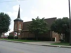 Christ Episcopal Church |
October 4, 1988 (#88001792) |
Poplar St. 37°41′42″N 85°51′32″W |
Elizabethtown | |
| 18 | Abraham Ditto House | October 4, 1988 (#88001789) |
204 Elm St. 37°59′59″N 85°56′44″W |
West Point | ||
| 19 | Ditto-Prewitt House | October 4, 1988 (#88001786) |
306 Elm St. 37°59′58″N 85°56′47″W |
West Point | ||
| 20 | Elizabethtown Armory | 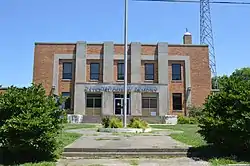 Elizabethtown Armory |
September 6, 2002 (#02000921) |
205 Warfield St. 37°41′57″N 85°51′22″W |
Elizabethtown | |
| 21 | Elizabethtown City Cemetery | 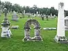 Elizabethtown City Cemetery |
August 18, 1997 (#97000872) |
E. Dixie Ave., junction of E. Dixie Ave. and Crestwood St. 37°41′20″N 85°51′16″W |
Elizabethtown | |
| 22 | Elizabethtown Courthouse Square and Commercial District | 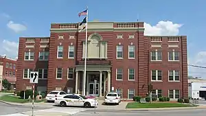 Elizabethtown Courthouse Square and Commercial District |
March 19, 1980 (#80001535) |
Kentucky Route 61 37°41′35″N 85°51′29″W |
Elizabethtown | |
| 23 | Embry Chapel Church | 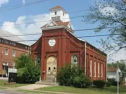 Embry Chapel Church |
October 4, 1988 (#88001803) |
117 Mulberry St. 37°41′40″N 85°51′38″W |
Elizabethtown | |
| 24 | First Baptist Church | 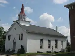 First Baptist Church |
December 31, 1974 (#74000879) |
112 W. Poplar St. 37°41′40″N 85°51′29″W |
Elizabethtown | |
| 25 | First Presbyterian Church | 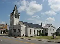 First Presbyterian Church |
October 4, 1988 (#88001802) |
212 W. Dixie Ave. 37°41′39″N 85°51′38″W |
Elizabethtown | |
| 26 | Fort Duffield | .JPG.webp) Fort Duffield |
January 31, 1994 (#93001584) |
East of U.S. Route 31W off West Point Marina Rd. 37°59′35″N 85°56′31″W |
West Point | |
| 27 | Fort Sands | November 25, 1994 (#94001379) |
Off Interstate 65 southwest of Lebanon Junction, above the CSX railroad trestle over Sulfur Fork 37°45′28″N 85°48′28″W |
Lebanon Junction | ||
| 28 | Glendale Historic District | October 4, 1988 (#88001816) |
Main St. between County Highway 1136 and Railroad Ave. 37°36′08″N 85°54′25″W |
Glendale | ||
| 29 | Hagan House | October 4, 1988 (#88001760) |
Kentucky Route 1136 2.5 miles west of its junction with U.S. Route 31W 37°38′51″N 85°52′43″W |
Elizabethtown | ||
| 30 | Hance Hamilton House | October 4, 1988 (#88001741) |
Porter Rd., 1 mile east of its junction with U.S. Route 62 37°45′15″N 85°42′22″W |
Boston | ||
| 31 | Hardin Springs School | October 4, 1988 (#88001783) |
Kentucky Route 84, 0.4 miles east of Hardin Springs Bridge 37°36′27″N 86°15′04″W |
Hardin Springs | ||
| 32 | Fannie Harrison Farm | February 7, 2008 (#08000005) |
132 Arnold Ln.[5] 37°39′37″N 85°53′34″W |
Elizabethtown | ||
| 33 | Hatfield Hotel | October 4, 1988 (#88001763) |
Dead Man's Cave Rd. 37°33′18″N 86°01′50″W |
White Mills | ||
| 34 | Haycraft Inn | October 4, 1988 (#88001742) |
2315 S. Wilson Rd. 37°48′36″N 85°55′28″W |
Radcliffe | ||
| 35 | Hazel Hill | October 5, 1988 (#88001744) |
Gaither's Station Rd., 2 miles south of U.S. Route 62 37°39′28″N 85°54′40″W |
Elizabethtown | ||
| 36 | Heller Hotel | October 4, 1988 (#88001756) |
Robinson St. 37°39′55″N 85°56′01″W |
Cecilia | ||
| 37 | Helm Place | 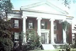 Helm Place |
November 9, 1976 (#76000895) |
1.5 miles north of Elizabethtown on U.S. Route 31W 37°42′38″N 85°52′25″W |
Elizabethtown | |
| 38 | Benjamin Helm House | 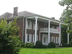 Benjamin Helm House |
October 4, 1988 (#88001801) |
238 Helm Ave. 37°41′38″N 85°51′48″W |
Elizabethtown | |
| 39 | John B. Helm House | 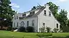 John B. Helm House |
October 4, 1988 (#88001800) |
210 Helm Ave. 37°41′35″N 85°51′41″W |
Elizabethtown | |
| 40 | Jonathan Hills House | 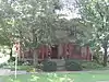 Jonathan Hills House |
December 23, 2009 (#09001139) |
202 N. Main St. 37°41′40″N 85°51′26″W |
Elizabethtown | |
| 41 | Kentucky and Indiana Bank | October 4, 1988 (#88001788) |
309 Elm St. 37°59′56″N 85°56′47″W |
West Point | ||
| 42 | W.T. Kerrick House | 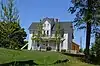 W.T. Kerrick House |
October 4, 1988 (#88001808) |
604 N. Main St. 37°41′57″N 85°51′05″W |
Elizabethtown | |
| 43 | Larue-Layman House |  Larue-Layman House |
October 4, 1988 (#88001794) |
115 W. Poplar St. 37°41′43″N 85°51′29″W |
Elizabethtown | |
| 44 | Lincoln Heritage House |  Lincoln Heritage House |
March 26, 1973 (#73000805) |
North of Elizabethtown on Freeman Lake 37°43′08″N 85°52′22″W |
Elizabethtown | |
| 45 | Louisville-Nashville Turnpike Segment | July 31, 1996 (#96000790) |
Northern boundary of Fort Knox at the foot of Muldraugh Hill and continuing south for 3 miles 37°57′22″N 85°57′23″W |
Fort Knox | ||
| 46 | Maple Hill | October 4, 1988 (#88001735) |
Maple St. 37°36′48″N 85°54′31″W |
Glendale | ||
| 47 | Maplehurst | October 4, 1988 (#88001732) |
Kentucky Route 222, 1 mile northeast of Glendale 37°37′21″N 85°54′35″W |
Glendale | ||
| 48 | Haynes Mason House | October 4, 1988 (#88001782) |
Haynes Mason Rd., 0.3 miles south of Kentucky Route 720 37°29′43″N 85°55′49″W |
Upton | ||
| 49 | David L. May House |  David L. May House |
October 5, 1988 (#88001805) |
201 N. Main St. 37°41′39″N 85°51′24″W |
Elizabethtown | |
| 50 | Stiles McDougal House | October 4, 1988 (#88001740) |
0.3 miles south of the junction of U.S. Route 62 and Kentucky Route 1375 37°37′23″N 85°58′43″W |
Glendale | ||
| 51 | McKinney-Helm House |  McKinney-Helm House |
October 5, 1988 (#88001795) |
218 W. Poplar St. 37°41′44″N 85°51′36″W |
Elizabethtown | |
| 52 | Melton House | October 5, 1988 (#88001769) |
Kentucky Route 1904 2 miles east of Kentucky Route 1375 37°35′58″N 85°57′11″W |
Glendale | ||
| 53 | Adam Monin House | October 5, 1988 (#88001745) |
Monin Rd., off Route 1 37°41′43″N 85°51′33″W |
Glendale | ||
| 54 | Montgomery Avenue Historic District | 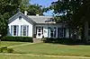 Montgomery Avenue Historic District |
October 5, 1988 (#88001814) |
602, 606, 608, 610, 614, 616, and 624 Montgomery Ave. 37°41′55″N 85°50′56″W |
Elizabethtown | |
| 55 | William Montgomery House | 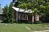 William Montgomery House |
October 5, 1988 (#88001806) |
414 Central Ave. 37°41′49″N 85°51′09″W |
Elizabethtown | |
| 56 | Morrison Lodge | 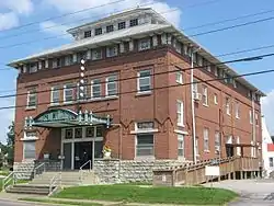 Morrison Lodge |
October 5, 1988 (#88001804) |
121 N. Mulberry St. 37°41′41″N 85°51′30″W |
Elizabethtown | |
| 57 | Nall House | October 5, 1988 (#88001784) |
Middle Creek Rd., 0.2 miles west of Locust Grove Rd. 37°39′59″N 85°47′24″W |
Elizabethtown | ||
| 58 | Nolin Banking Company | October 5, 1988 (#88001749) |
Kentucky Route 1407 37°33′38″N 85°54′11″W |
Nolin | ||
| 59 | Penniston House | October 5, 1988 (#88001785) |
U.S. Route 62, 0.4 miles east of Upper Colesburg Rd. 37°41′35″N 85°51′51″W |
Elizabethtown | ||
| 60 | Josiah Phillips House | October 5, 1988 (#88001747) |
Western Ave. 37°31′26″N 85°53′42″W |
Sonora | ||
| 61 | Dr. Robert B. Pusey House | 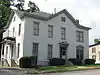 Dr. Robert B. Pusey House |
January 4, 1989 (#88001793) |
204 N. Mulberry St. 37°41′44″N 85°51′30″W |
Elizabethtown | |
| 62 | John Raine House | October 5, 1988 (#88001748) |
Kentucky Route 84 37°31′27″N 85°53′24″W |
Sonora | ||
| 63 | Stephen Rawlings House | 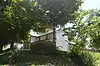 Stephen Rawlings House |
October 5, 1988 (#88001791) |
811 N. Main St. 37°42′07″N 85°50′45″W |
Elizabethtown | |
| 64 | Richards-Hamm House | October 5, 1988 (#88001766) |
Kentucky Route 1136 0.4 miles west of U.S. Route 31W 37°34′27″N 85°52′32″W |
Glendale | ||
| 65 | Richards-Murray House | October 5, 1988 (#88001767) |
Junction of U.S. Route 31W and Kentucky Route 1136 37°34′22″N 85°52′10″W |
Glendale | ||
| 66 | Richardson Hotel | October 5, 1988 (#88001762) |
Dead Man's Cave Rd. 37°33′17″N 86°01′52″W |
White Mills | ||
| 67 | Zachariah Riney House | October 5, 1988 (#88001758) |
Junction of Kentucky Routes 220 and 1600 37°44′58″N 85°58′10″W |
Rineyville | ||
| 68 | Samuel Robertson House | 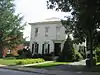 Samuel Robertson House |
October 5, 1988 (#88001812) |
214 W. Poplar St. 37°41′44″N 85°51′34″W |
Elizabethtown | |
| 69 | Richard Skees House | October 5, 1988 (#88001780) |
Jerome Peerce Rd., off Kentucky Route 1823 37°34′27″N 85°58′57″W |
White Mills | ||
| 70 | William Skees House | October 5, 1988 (#88001757) |
Off Kentucky Route 1866 2 miles north of its junction with Kentucky Route 720 37°30′39″N 86°03′30″W |
White Mills | ||
| 71 | George W. Smith House | October 5, 1988 (#88001738) |
Kentucky Route 1904, 3 miles south of its junction with U.S. Route 62 37°37′56″N 85°55′14″W |
Elizabethtown | ||
| 72 | William Sprigg House | January 4, 1989 (#88001736) |
Kentucky Route 1375, 1 mile north of its junction with Kentucky Route 84 37°33′55″N 85°58′46″W |
Glendale | ||
| 73 | Stader Hotel | October 5, 1988 (#88001751) |
104 E. Main St. 37°48′34″N 85°58′57″W |
Vine Grove | ||
| 74 | Stark House | October 5, 1988 (#88001725) |
0.4 miles west of the junction of Kentucky Route 1868 and Gilead Church/Star Mills Rd. 37°38′51″N 85°52′43″W |
Glendale | ||
| 75 | State Theatre | 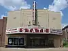 State Theatre |
December 10, 1998 (#98001492) |
205 W. Dixie Ave. 37°41′40″N 85°51′35″W |
Elizabethtown | |
| 76 | John Stuart House | October 5, 1988 (#88001765) |
St. Anthony Church Rd., 0.5 miles east of U.S. Route 31W 37°34′36″N 85°51′05″W |
Glendale | ||
| 77 | Samuel B. Thomas House |  Samuel B. Thomas House |
October 5, 1988 (#88001797) |
337 W. Poplar St. 37°41′57″N 85°51′48″W |
Elizabethtown | |
| 78 | William Tichenor House | October 5, 1988 (#88001753) |
Sonora-Upton Rd., 1 mile west of Upton 37°30′20″N 85°54′08″W |
Upton | ||
| 79 | US Bullion Depository, Fort Knox, Kentucky | US Bullion Depository, Fort Knox, Kentucky |
February 18, 1988 (#88000056) |
Gold Vault Rd. and Bullion Boulevard 37°53′00″N 85°57′55″W |
Fort Knox | |
| 80 | US Post Office-Elizabethtown | 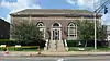 US Post Office-Elizabethtown |
October 5, 1988 (#88001810) |
200 W. Dixie Ave. 37°41′39″N 85°51′34″W |
Elizabethtown | |
| 81 | Jacob Van Meter House | October 5, 1988 (#88001746) |
Kentucky Route 222, 0.6 miles west of Glendale 37°37′02″N 85°55′45″W |
Glendale | ||
| 82 | Eliza Vertrees House |  Eliza Vertrees House |
October 5, 1988 (#88001809) |
206 W. Poplar St. 37°41′42″N 85°51′30″W |
Elizabethtown | |
| 83 | Vine Grove Historic District | October 5, 1988 (#88001815) |
104-221 W. Main St. 37°48′36″N 85°59′01″W |
Vine Grove | ||
| 84 | West Point Historic District | November 15, 1996 (#96001344) |
Roughly bounded by the Salt River, 2nd, South, 13th, Mulberry, and Elm Sts. 37°59′54″N 85°56′54″W |
West Point | ||
| 85 | West Point Hotel | October 5, 1988 (#88001790) |
401 South St. 37°59′51″N 85°56′47″W |
West Point | ||
| 86 | White Mill | October 5, 1988 (#88001761) |
Nolin River 37°33′19″N 86°01′52″W |
White Mills | ||
| 87 | William Wilson House |  William Wilson House |
October 5, 1988 (#88001799) |
200 Logan Ave. 37°42′02″N 85°50′43″W |
Elizabethtown | |
| 88 | Horatio Wintersmith House |  Horatio Wintersmith House |
October 5, 1988 (#88001796) |
221 W. Poplar St. 37°41′45″N 85°51′35″W |
Elizabethtown | |
| 89 | George Woodard House |  George Woodard House |
March 3, 2003 (#02001467) |
232 W. Poplar St. 37°41′46″N 85°51′38″W |
Elizabethtown | |
| 90 | James Young House and Inn |  James Young House and Inn |
February 17, 1978 (#78001336) |
109 Elm St. 38°00′02″N 85°56′40″W |
West Point |
Former listing
| [3] | Name on the Register | Image | Date listed | Date removed | Location | City or town | Summary |
|---|---|---|---|---|---|---|---|
| 1 | John Hart House | April 30, 1980 (#80001536) | December 30, 1985 | 6 miles east of Elizabethtown |
Elizabethtown |
See also
| Wikimedia Commons has media related to National Register of Historic Places in Hardin County, Kentucky. |
References
- The latitude and longitude information provided in this table was derived originally from the National Register Information System, which has been found to be fairly accurate for about 99% of listings. Some locations in this table may have been corrected to current GPS standards.
- "National Register of Historic Places: Weekly List Actions". National Park Service, United States Department of the Interior. Retrieved on January 29, 2021.
- Numbers represent an alphabetical ordering by significant words. Various colorings, defined here, differentiate National Historic Landmarks and historic districts from other NRHP buildings, structures, sites or objects.
- The eight-digit number below each date is the number assigned to each location in the National Register Information System database, which can be viewed by clicking the number.
- KY Historic Preservation Review Board to meet Thursday in Lexington, Kentucky Heritage Council, 2007-12-12. Accessed 2014-06-23.
| Topics | |
|---|---|
| Lists by state |
|
| Lists by insular areas | |
| Lists by associated state | |
| Other areas | |
| Related | |
| |
Municipalities and communities of Hardin County, Kentucky, United States | ||
|---|---|---|
| Cities | Location of Hardin County, Kentucky | |
| CDPs | ||
| Other unincorporated communities | ||
| Footnotes | ‡This populated place also has portions in an adjacent county or counties | |
| ||
This article is issued from Wikipedia. The text is licensed under Creative Commons - Attribution - Sharealike. Additional terms may apply for the media files.