National Register of Historic Places listings in Leslie County, Kentucky
This is a list of the National Register of Historic Places listings in Leslie County, Kentucky.
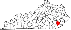
Location of Leslie County in Kentucky
It is intended to be a complete list of the properties on the National Register of Historic Places in Leslie County, Kentucky, United States. The locations of National Register properties for which the latitude and longitude coordinates are included below, may be seen in a map.[1]
There are 5 properties listed on the National Register in the county, including 1 National Historic Landmark.
- This National Park Service list is complete through NPS recent listings posted February 5, 2021.[2]
Current listings
| [3] | Name on the Register | Image | Date listed[4] | Location | City or town | Description |
|---|---|---|---|---|---|---|
| 1 | Frontier Nursing Service | 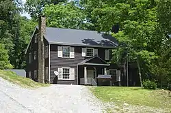 Frontier Nursing Service |
January 11, 1991 (#90002126) |
Hospital Hill, off Hickory St. 37°09′55″N 83°22′45″W |
Hyden | |
| 2 | Roderick McIntosh Farm | 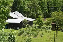 Roderick McIntosh Farm |
November 7, 1991 (#91001666) |
South of Dry Hill-McIntosh Rd. on the confluence of McIntosh and Cutshin Creeks 37°12′21″N 83°20′13″W |
Dryhill | |
| 3 | John Shell Cabin | 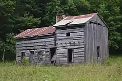 John Shell Cabin |
November 12, 1975 (#75000791) |
South of Chappell on Greasy Creek Road (Kentucky Route 2009) 36°58′42″N 83°19′36″W |
Chappell | |
| 4 | Wendover | 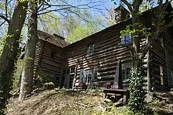 Wendover |
October 21, 1975 (#75000792) |
South of Hyden off Kentucky Route 80 37°07′39″N 83°21′55″W |
Hyden | |
| 5 | Wooton Presbyterian Center | 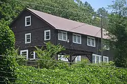 Wooton Presbyterian Center |
May 24, 1979 (#79001019) |
Kentucky Route 80 37°10′51″N 83°18′07″W |
Wooton |
See also
| Wikimedia Commons has media related to National Register of Historic Places in Leslie County, Kentucky. |
References
- The latitude and longitude information provided in this table was derived originally from the National Register Information System, which has been found to be fairly accurate for about 99% of listings. Some locations in this table may have been corrected to current GPS standards.
- "National Register of Historic Places: Weekly List Actions". National Park Service, United States Department of the Interior. Retrieved on February 5, 2021.
- Numbers represent an alphabetical ordering by significant words. Various colorings, defined here, differentiate National Historic Landmarks and historic districts from other NRHP buildings, structures, sites or objects.
- The eight-digit number below each date is the number assigned to each location in the National Register Information System database, which can be viewed by clicking the number.
| Topics | |
|---|---|
| Lists by state |
|
| Lists by insular areas | |
| Lists by associated state | |
| Other areas | |
| Related | |
| |
Municipalities and communities of Leslie County, Kentucky, United States | ||
|---|---|---|
| City | Location of Leslie County, Kentucky | |
| Unincorporated communities | ||
| ||
This article is issued from Wikipedia. The text is licensed under Creative Commons - Attribution - Sharealike. Additional terms may apply for the media files.