National Register of Historic Places listings in Calloway County, Kentucky
This is a list of the National Register of Historic Places listings in Calloway County, Kentucky. It is intended to be a complete list of the properties and districts on the National Register of Historic Places in Calloway County, Kentucky, United States. The locations of National Register properties and districts for which the latitude and longitude coordinates are included below, may be seen in a map.[1]
Location of Calloway County in Kentucky
There are 17 properties and districts listed on the National Register in the county.
- This National Park Service list is complete through NPS recent listings posted January 29, 2021.[2]
Current listings
| [3] | Name on the Register | Image | Date listed[4] | Location | City or town | Description |
|---|---|---|---|---|---|---|
| 1 | Archeological Site 15CW64 | July 11, 1985 (#85001506) |
Ridgeline ¼ mile southeast of Backusburg, along the Clarks River[5] 36°42′09″N 88°27′39″W |
Backusburg | Also known as the "Backusburg Mounds"[6] | |
| 2 | Calloway County Courthouse | 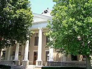 Calloway County Courthouse |
February 19, 1986 (#86000287) |
Town Sq. 36°36′37″N 88°18′08″W |
Murray | |
| 3 | Confederate Monument in Murray | 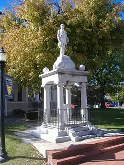 Confederate Monument in Murray |
July 17, 1997 (#97000711) |
Junction of KY 94 and KY 121 36°36′36″N 88°18′18″W |
Murray | |
| 4 | Edwin S. Diuguid House | 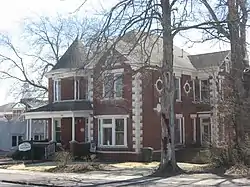 Edwin S. Diuguid House |
May 17, 1976 (#76000855) |
601 W. Main St. 36°36′38″N 88°18′15″W |
Murray | |
| 5 | First Baptist Church | 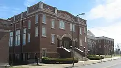 First Baptist Church |
February 19, 1986 (#86000289) |
203 S. 4th St. 36°36′33″N 88°18′05″W |
Murray | |
| 6 | First Christian Church | 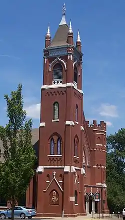 First Christian Church |
February 19, 1986 (#86000292) |
111 N. 5th St. 36°36′41″N 88°18′11″W |
Murray | |
| 7 | Fort Heiman Site | December 12, 1976 (#76000856) |
1.6 miles southeast of New Concord off Fort Heiman Rd. 36°30′00″N 88°03′23″W |
New Concord | ||
| 8 | Will Linn House | 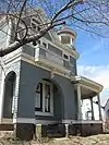 Will Linn House |
December 4, 1980 (#80001491) |
103 N. 6th St. 36°36′40″N 88°18′17″W |
Murray | |
| 9 | Main Street Historic District | 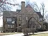 Main Street Historic District |
February 19, 1986 (#86000294) |
700 and 800 blocks of W. Main St. 36°36′37″N 88°18′21″W |
Murray | |
| 10 | Murray Commercial Historic District | 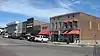 Murray Commercial Historic District |
June 24, 2003 (#02001464) |
Roughly bounded by Walnut St., L.P. Miller St., Poplar St. and 6th St. 36°36′37″N 88°18′10″W |
Murray | |
| 11 | Murray State University Historic Buildings | 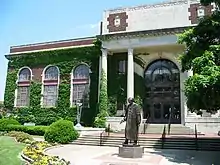 Murray State University Historic Buildings |
August 3, 1978 (#78001307) |
15th, 16th, and Main Sts., including the Murray State University campus 36°36′40″N 88°19′23″W |
Murray | "Including the MSU campus" represents a boundary increase of May 26, 1983, the Main Library addition |
| 12 | The Murray Woman's Club Clubhouse |  The Murray Woman's Club Clubhouse |
November 10, 2011 (#11000792) |
704 Vine St. 36°36′21″N 88°18′21″W |
Murray | |
| 13 | National Hotel | 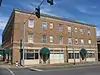 National Hotel |
February 19, 1986 (#86000298) |
N. 6th and Main Sts. 36°36′38″N 88°18′14″W |
Murray | |
| 14 | Old Normal School Building | 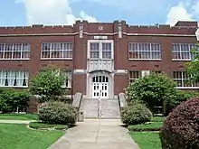 Old Normal School Building |
June 11, 1975 (#75000740) |
Murray State University campus 36°36′39″N 88°19′25″W |
Murray | |
| 15 | Seclusaval | June 10, 1975 (#75000741) |
8 miles east of Murray on KY 614 36°34′39″N 88°09′17″W |
Murray | ||
| 16 | W.G. Swann Tobacco Company | September 29, 2015 (#15000647) |
111 Poplar St. 36°36′31″N 88°17′53″W |
Murray | ||
| 17 | US Post Office-Murray | 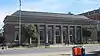 US Post Office-Murray |
February 19, 1986 (#86000296) |
Maple and S. 4th St. 36°36′35″N 88°18′06″W |
Murray |
See also
| Wikimedia Commons has media related to National Register of Historic Places in Calloway County, Kentucky. |
References
- The latitude and longitude information provided in this table was derived originally from the National Register Information System, which has been found to be fairly accurate for about 99% of listings. Some locations in this table may have been corrected to current GPS standards.
- "National Register of Historic Places: Weekly List Actions". National Park Service, United States Department of the Interior. Retrieved on January 29, 2021.
- Numbers represent an alphabetical ordering by significant words. Various colorings, defined here, differentiate National Historic Landmarks and historic districts from other NRHP buildings, structures, sites or objects.
- The eight-digit number below each date is the number assigned to each location in the National Register Information System database, which can be viewed by clicking the number.
- Funkhouser, W.D., and W.S. Webb. "Archaeological Survey of Kentucky". University of Kentucky Reports in Anthropology 7.5 (1950): 62/65.
- "National Register Information System". National Register of Historic Places. National Park Service. July 9, 2010.
| Topics | |
|---|---|
| Lists by state |
|
| Lists by insular areas | |
| Lists by associated state | |
| Other areas | |
| Related | |
| |
Municipalities and communities of Calloway County, Kentucky, United States | ||
|---|---|---|
| Cities | Location of Calloway County, Kentucky | |
| CDP | ||
| Unincorporated communities | ||
| ||
This article is issued from Wikipedia. The text is licensed under Creative Commons - Attribution - Sharealike. Additional terms may apply for the media files.