National Register of Historic Places listings in Scott County, Kentucky
This is a list of the National Register of Historic Places listings in Scott County, Kentucky.
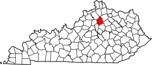
Location of Scott County in Kentucky
This is intended to be a complete list of the properties and districts on the National Register of Historic Places in Scott County, Kentucky, United States. The locations of National Register properties and districts for which the latitude and longitude coordinates are included below, may be seen in a Google map.[1]
There are 82 properties and districts listed on the National Register in the county.
- This National Park Service list is complete through NPS recent listings posted January 29, 2021.[2]
Current listings
| [3] | Name on the Register | Image | Date listed[4] | Location | City or town | Description |
|---|---|---|---|---|---|---|
| 1 | Allenhurst | April 2, 1973 (#73000829) |
Cane Run Pike west of Georgetown 38°11′31″N 84°36′55″W |
Georgetown | ||
| 2 | Audubon | December 4, 1973 (#73000830) |
Southwest of Georgetown off U.S. Route 62, on Moore's Mill Pike 38°09′18″N 84°37′22″W |
Georgetown | ||
| 3 | Julius Blackburn House | April 14, 1977 (#77000641) |
West of Georgetown off U.S. Route 460 38°13′49″N 84°43′27″W |
Georgetown | ||
| 4 | Alexander Bradford House | June 27, 1974 (#74000905) |
Main St. at Locust Fork Pike 38°16′21″N 84°41′16″W |
Stamping Ground | ||
| 5 | Fielding Bradford House | December 4, 1973 (#73000831) |
North of Georgetown off U.S. Route 25 on Long Lick Pike 38°14′42″N 84°34′46″W |
Georgetown | ||
| 6 | John W. Bradley House | November 5, 1974 (#74000898) |
Southwest of Georgetown off U.S. Route 62 38°11′32″N 84°35′52″W |
Georgetown | ||
| 7 | Branham House | 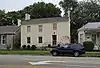 Branham House |
April 2, 1973 (#73000832) |
208 S. Broadway 38°12′29″N 84°33′36″W |
Georgetown | |
| 8 | Richard Branham House | June 23, 1983 (#83002863) |
Prate Rd. 38°13′47″N 84°39′29″W |
Midway | ||
| 9 | James Briscoe Quarters | June 23, 1983 (#83002864) |
Off U.S. Route 25 38°15′08″N 84°33′39″W |
Delaplain | ||
| 10 | Vivion Upshaw Brooking House | May 28, 1975 (#75000824) |
West of Georgetown off Stamping Ground Pike (KY 227) 38°13′16″N 84°38′19″W |
Georgetown | ||
| 11 | Buford-Duke House | June 19, 1973 (#73000833) |
Southeast of Georgetown off KY 1963 38°10′19″N 84°31′54″W |
Georgetown | ||
| 12 | Joseph Fields Burgess House | November 29, 1984 (#84000368) |
Off U.S. Route 25 and the southwestern corner of KY 608 38°25′57″N 84°34′00″W |
Sadieville | ||
| 13 | William Campbell House | November 29, 1984 (#84000415) |
Off U.S. Route 227 38°15′42″N 84°39′56″W |
Stamping Ground | ||
| 14 | Cantrill House | Cantrill House |
April 2, 1973 (#73000834) |
324 E. Jackson St. 38°12′23″N 84°33′22″W |
Georgetown | |
| 15 | Cardome | 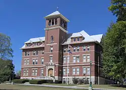 Cardome |
March 13, 1975 (#75000825) |
0.5 miles north of Georgetown on U.S. Route 25 38°13′21″N 84°34′03″W |
Georgetown | |
| 16 | Choctaw Indian Academy | March 7, 1973 (#73000835) |
4.5 miles west of Georgetown off U.S. Route 227 38°13′55″N 84°38′05″W |
Georgetown | ||
| 17 | Confederate Monument in Georgetown | 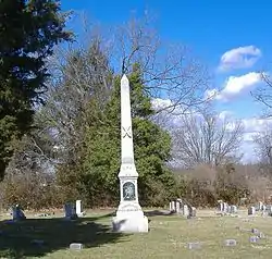 Confederate Monument in Georgetown |
July 17, 1997 (#97000669) |
Georgetown Cemetery, 0.5 miles south of the junction of U.S. Route 25 and KY 1692 38°11′53″N 84°33′38″W |
Georgetown | |
| 18 | Rhodin Coppage Spring House | June 23, 1983 (#83002865) |
Off U.S. Route 25 38°14′44″N 84°33′37″W |
Georgetown | ||
| 19 | Newton Craig House and Penitentiary Buildings Complex | 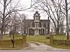 Newton Craig House and Penitentiary Buildings Complex |
July 19, 1984 (#84001980) |
U.S. Route 460 38°12′34″N 84°38′06″W |
Georgetown | |
| 20 | Craig-Johnson Mill Dam and Mill Sites | June 10, 1975 (#75000828) |
Address Restricted |
Great Crossing | ||
| 21 | Craig-Peak House | August 2, 2017 (#100001428) |
556 Cane Run Rd. 38°11′31″N 84°36′34″W |
Georgetown | ||
| 22 | Dry Run Site | December 5, 1985 (#85003041) |
Address Restricted |
Georgetown | ||
| 23 | Edge Hill Farm | March 1, 1984 (#84001983) |
1661 Payne's Depot Pike 38°11′12″N 84°35′42″W |
Georgetown | ||
| 24 | Elkwood | January 20, 1978 (#78001395) |
Northwest of Georgetown 38°13′35″N 84°35′47″W |
Georgetown | ||
| 25 | Elmwood | November 19, 1974 (#74000899) |
Northeast of Georgetown off U.S. Routes 227 and 460 38°13′33″N 84°30′51″W |
Georgetown | ||
| 26 | Ash Emison Quarters | June 23, 1983 (#83002866) |
Off U.S. 25 38°15′34″N 84°33′23″W |
Delaplain | ||
| 27 | First African Baptist Church and Parsonage | 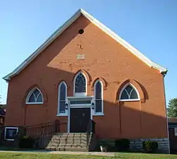 First African Baptist Church and Parsonage |
March 1, 1984 (#84001985) |
209-211 W. Jefferson St. 38°12′45″N 84°33′40″W |
Georgetown | |
| 28 | Matthew Flournoy House | June 23, 1983 (#83002867) |
Off Crumbough Pike 38°11′46″N 84°29′26″W |
Centerville | ||
| 29 | Flournoy-Nutter House | July 28, 1977 (#77000642) |
East of Georgetown off KY 922 38°10′52″N 84°28′44″W |
Georgetown | ||
| 30 | James Gaines House | November 7, 1976 (#76000942) |
South of Georgetown on Yarnallton Pike 38°09′15″N 84°33′58″W |
Georgetown | ||
| 31 | Garth School | Garth School |
November 16, 1988 (#88002187) |
501 S. Hamilton St. 38°12′21″N 84°33′33″W |
Georgetown | |
| 32 | John M. Garth House | November 20, 1974 (#74000900) |
Southeast of Georgetown off Interstate 75 38°10′39″N 84°30′16″W |
Georgetown | ||
| 33 | Georgetown College Historic Buildings | 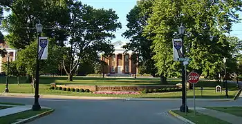 Georgetown College Historic Buildings |
August 8, 1979 (#79001030) |
E. Jackson St. 38°12′25″N 84°33′17″W |
Georgetown | |
| 34 | Georgetown East Main Street Residential District | 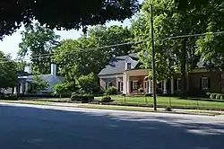 Georgetown East Main Street Residential District |
June 7, 1978 (#78001396) |
Irregular pattern along Main St. between Warrendale Ave. and Mulberry St. 38°12′34″N 84°33′15″W |
Georgetown | |
| 35 | Giddings Hall, Georgetown College |  Giddings Hall, Georgetown College |
February 6, 1973 (#73000836) |
Giddings Dr. between Jackson and College Sts. 38°12′25″N 84°33′17″W |
Georgetown | |
| 36 | Griffith House | August 29, 1979 (#79003545) |
South of Interstate 64 on Moore's Mill Pike 38°09′34″N 84°37′43″W |
Midway | ||
| 37 | Halley Place | August 28, 1979 (#79003546) |
U.S. Route 62 38°08′43″N 84°37′04″W |
Georgetown | ||
| 38 | Matthew Henry House | June 23, 1983 (#83002868) |
KY 922 38°12′19″N 84°28′55″W |
Centerville | ||
| 39 | Dr. H. C. Herndon House | April 10, 1980 (#80001666) |
West of Georgetown on KY 227 38°13′04″N 84°36′33″W |
Georgetown | ||
| 40 | Holy Trinity Episcopal Church | .jpg.webp) Holy Trinity Episcopal Church |
October 30, 1973 (#73000837) |
S. Broadway and W. Clinton Sts. 38°12′28″N 84°33′38″W |
Georgetown | |
| 41 | George W. Johnson Slave Quarters and Smokehouse | November 19, 1974 (#74000901) |
Southwest of Georgetown off Ironworks Rd. 38°10′25″N 84°36′44″W |
Georgetown | ||
| 42 | James Johnson Quarters | October 11, 1983 (#83003818) |
Off KY 227 38°12′48″N 84°36′50″W |
Georgetown | ||
| 43 | Leonidas Johnson House | October 8, 1976 (#76000943) |
7 miles northwest of Georgetown on U.S. Route 227 38°14′44″N 84°39′35″W |
Georgetown | ||
| 44 | Johnson-Pence House | November 20, 1978 (#78001397) |
West of Georgetown off U.S. Route 460 38°13′23″N 84°37′31″W |
Georgetown | ||
| 45 | Johnston-Jacobs House | 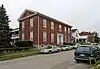 Johnston-Jacobs House |
October 2, 1973 (#73000838) |
205 N. Hamilton St. 38°12′42″N 84°33′30″W |
Georgetown | |
| 46 | Lane's Run Historic District | January 12, 1984 (#84001986) |
Old Oxford Rd., U.S. Routes 62 and 460 38°13′55″N 84°31′07″W |
Georgetown | ||
| 47 | Leatherer-Lemon House | July 20, 1977 (#77000643) |
Lemon's Mill Pike, 0.5 miles west of Newtown Pike 38°10′56″N 84°29′38″W |
Georgetown | ||
| 48 | William James-Trotter Lindsay House | August 28, 1979 (#79003550) |
U.S. Route 62 38°08′15″N 84°37′43″W |
Georgetown | ||
| 49 | Longview | October 25, 1973 (#73000839) |
About 4 miles west of Georgetown off U.S. Route 460 38°13′10″N 84°39′04″W |
Georgetown | ||
| 50 | Main Street Commercial District | 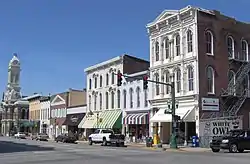 Main Street Commercial District |
February 24, 1975 (#75000826) |
Both sides of E. Main St. from Mulberry to Broadway, southern side from Elley Alley to Broadway 38°15′49″N 84°33′25″W |
Georgetown | |
| 51 | McFarland House | 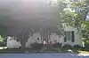 McFarland House |
October 15, 1973 (#73000840) |
510 Fountain Ave. 38°12′16″N 84°33′00″W |
Georgetown | |
| 52 | Miller's Run Historic District | November 15, 1978 (#78001398) |
Roughly bounded by Old Oxford Pike, KY 922, U.S. Route 460, and Miller's Run 38°14′14″N 84°29′44″W |
Oxford | ||
| 53 | John Andrew Miller House | November 9, 1977 (#77000644) |
3 miles east of Georgetown off U.S. Route 460 38°13′21″N 84°29′58″W |
Georgetown | ||
| 54 | New Zion Historic District | December 4, 2008 (#08001118) |
4972 Newtown Pike through 5200 Newtown Pike, and 103-135 New Zion Rd. 38°13′26″N 84°28′57″W |
Scott | Extends into Fayette County | |
| 55 | Lewis Nuckols House | 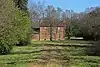 Lewis Nuckols House |
August 28, 1979 (#79003547) |
U.S. Route 421 38°07′53″N 84°37′25″W |
Georgetown | |
| 56 | Osburn House | April 11, 1973 (#73000841) |
4 miles north of Georgetown on U.S. Route 25 38°15′53″N 84°34′02″W |
Georgetown | ||
| 57 | Oxford Historic District | September 11, 1979 (#79001031) |
Northeast of Georgetown at U.S. Route 62 and KY 922 38°16′08″N 84°30′04″W |
Georgetown | ||
| 58 | Joseph Patterson Quarters | June 23, 1983 (#83002869) |
Off U.S. Route 421 38°09′00″N 84°38′20″W |
Midway | ||
| 59 | Asa Payne House | August 28, 1979 (#79003548) |
U.S. Route 62 38°08′46″N 84°37′20″W |
Georgetown | ||
| 60 | Gen. John Payne House | March 3, 1975 (#75000827) |
1.5 miles west of Georgetown on U.S. Route 460 38°12′47″N 84°35′22″W |
Georgetown | ||
| 61 | Payne-Desha House | 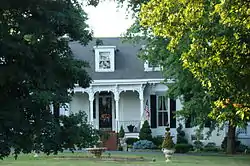 Payne-Desha House |
December 2, 1974 (#74000902) |
Kelly Ave. 38°12′45″N 84°33′48″W |
Georgetown | |
| 62 | Levi Prewitt House | November 1, 1974 (#74000903) |
South of Georgetown off Interstate 64 38°09′01″N 84°34′54″W |
Georgetown | ||
| 63 | Royal Spring Park | 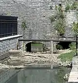 Royal Spring Park |
April 2, 1973 (#73000842) |
Between Clinton and Jefferson Sts., west of Water, Broadway, and Georgetown Sts. 38°12′37″N 84°33′33″W |
Georgetown | |
| 64 | Sadieville Historic District | July 30, 2013 (#13000566) |
100-326 College, 100-245 Main, 350-714 Pike, 216 Church, 204 Cunningham & 100-247 Vine Sts., 109-123 Gano Ave. 38°23′28″N 84°32′11″W |
Sadieville | ||
| 65 | St. Francis Mission at White Sulphur | 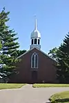 St. Francis Mission at White Sulphur |
April 11, 1973 (#73000847) |
7 miles west of Georgetown on U.S. Route 460 38°12′27″N 84°41′50″W |
Georgetown | |
| 66 | Robert Sanders House | October 15, 1973 (#73000843) |
2 miles south of Georgetown on U.S. Route 25 38°10′11″N 84°33′29″W |
Georgetown | ||
| 67 | Scott County Courthouse | 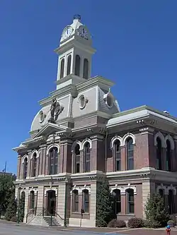 Scott County Courthouse |
September 28, 1972 (#72000542) |
E. Main and Broadway 38°12′36″N 84°33′35″W |
Georgetown | |
| 68 | Scott County Jail Complex | 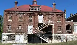 Scott County Jail Complex |
September 6, 2002 (#02000923) |
117 N. Water St. 38°12′29″N 84°33′45″W |
Georgetown | |
| 69 | Showalter House |  Showalter House |
April 2, 1973 (#73000844) |
316 N. Hamilton St. 38°12′47″N 84°33′26″W |
Georgetown | |
| 70 | Shropshire House |  Shropshire House |
April 2, 1973 (#73000845) |
355 E. Main St. 38°12′36″N 84°33′20″W |
Georgetown | |
| 71 | Dr. William Addison Smith House | November 29, 1984 (#84000363) |
1589 Newton Pike 38°12′10″N 84°28′53″W |
Georgetown | ||
| 72 | Nelson and Clifton Rodes Smith House | October 3, 1973 (#73000846) |
Northeast of Georgetown off Leesburg Pike 38°14′50″N 84°27′03″W |
Georgetown | ||
| 73 | South Broadway Neighborhood District |  South Broadway Neighborhood District |
December 19, 1991 (#91001856) |
Roughly Georgetown Cemetery, S. Broadway north to College St. and S. Hamilton St. from Clayton Ave. to College St. 38°12′27″N 84°33′36″W |
Georgetown | |
| 74 | Henry Stevenson House | August 28, 1979 (#79003549) |
U.S. Route 62 38°09′11″N 84°36′42″W |
Georgetown | ||
| 75 | Stone-Grant House | January 11, 1974 (#74000904) |
East of Georgetown on E. Main St. extended 38°12′24″N 84°32′38″W |
Georgetown | ||
| 76 | John Suggett House | June 23, 1983 (#83002870) |
U.S. Route 460 38°12′12″N 84°37′09″W |
Georgetown | ||
| 77 | William Suggett Agricultural and Industrial District | November 16, 1988 (#88002182) |
Southwest of the junction of Cane Run Rd. and U.S. Route 460 38°12′18″N 84°36′46″W |
Georgetown | ||
| 78 | Thomsons Mill Warehouse | June 23, 1983 (#83002871) |
Off U.S. Route 460 38°13′06″N 84°34′29″W |
Georgetown | ||
| 79 | Ward Hall | 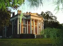 Ward Hall |
April 2, 1973 (#85001841) |
1.5 miles west of Georgetown on U.S. Route 460 38°12′23″N 84°35′21″W |
Georgetown | |
| 80 | Weisenberger Mills and Related Buildings | 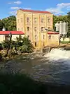 Weisenberger Mills and Related Buildings |
August 16, 1984 (#84001987) |
Off U.S. Route 421 38°07′34″N 84°38′13″W |
Midway | Extends into Woodford County |
| 81 | West Main Street Historic District | 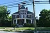 West Main Street Historic District |
November 5, 1985 (#85003491) |
217-600 W. Main St. 38°12′39″N 84°33′59″W |
Georgetown | |
| 82 | Charles Whitaker House | June 23, 1983 (#83002872) |
Off Old Oxford Rd. 38°14′22″N 84°30′03″W |
Georgetown | ||
| 83 | Merritt Williams House | February 28, 1979 (#79003551) |
Moore's Mill Pike at Can Run Pike 38°09′46″N 84°38′33″W |
Midway |
See also
| Wikimedia Commons has media related to National Register of Historic Places in Scott County, Kentucky. |
References
- The latitude and longitude information provided in this table was derived originally from the National Register Information System, which has been found to be fairly accurate for about 99% of listings. Some locations in this table may have been corrected to current GPS standards.
- "National Register of Historic Places: Weekly List Actions". National Park Service, United States Department of the Interior. Retrieved on January 29, 2021.
- Numbers represent an alphabetical ordering by significant words. Various colorings, defined here, differentiate National Historic Landmarks and historic districts from other NRHP buildings, structures, sites or objects.
- The eight-digit number below each date is the number assigned to each location in the National Register Information System database, which can be viewed by clicking the number.
| Topics | |
|---|---|
| Lists by state |
|
| Lists by insular areas | |
| Lists by associated state | |
| Other areas | |
| Related | |
| |
Municipalities and communities of Scott County, Kentucky, United States | ||
|---|---|---|
| Cities | Location of Scott County, Kentucky | |
| Other localities |
| |
| Footnotes | ‡This populated place also has portions in an adjacent county or counties | |
| ||
This article is issued from Wikipedia. The text is licensed under Creative Commons - Attribution - Sharealike. Additional terms may apply for the media files.