National Register of Historic Places listings in Washington County, Kentucky
This is a list of the National Register of Historic Places listings in Washington County, Kentucky.

Location of Washington County in Kentucky
This is intended to be a complete list of the properties and districts on the National Register of Historic Places in Washington County, Kentucky, United States. The locations of National Register properties and districts for which the latitude and longitude coordinates are included below, may be seen in a map.[1]
There are 68 properties and districts listed on the National Register in the county.
- This National Park Service list is complete through NPS recent listings posted February 5, 2021.[2]
Current listings
| [3] | Name on the Register | Image | Date listed[4] | Location | City or town | Description |
|---|---|---|---|---|---|---|
| 1 | John R. Barber House | February 10, 1989 (#88003423) |
West of Springfield on U.S. Route 150 37°42′49″N 85°15′50″W |
Springfield | ||
| 2 | Beech Fork Bridge, Mackville Road | February 10, 1989 (#88003429) |
East of Springfield on Kentucky Route 152 37°42′15″N 85°08′46″W |
Springfield | ||
| 3 | Beechfork Presbyterian Church | February 10, 1989 (#88003406) |
North of Springfield off Kentucky Route 55 37°45′14″N 85°10′30″W |
Springfield | ||
| 4 | Richard Berry, Jr., House | February 10, 1989 (#88003400) |
North of Springfield on Kentucky Route 438 37°46′10″N 85°11′33″W |
Springfield | ||
| 5 | William Blackwell House | 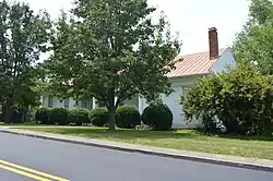 William Blackwell House |
February 10, 1989 (#88003391) |
138 Lebanon Hill 37°40′55″N 85°13′28″W |
Springfield | |
| 6 | Stephen Cooke Brown House | November 21, 1994 (#88003471) |
Kentucky Route 438 37°45′40″N 85°10′20″W |
Springfield | ||
| 7 | William Caldwell Kitchen | October 6, 1987 (#87002054) |
Off Kentucky Route 55 on Spaulding Lane 37°43′03″N 85°10′50″W |
Springfield | ||
| 8 | Cartwright Creek Bridge | February 10, 1989 (#88003425) |
West of Springfield on Booker Rd. 37°39′34″N 85°16′23″W |
Springfield | ||
| 9 | Clements House | February 10, 1989 (#88003401) |
West of Springfield on U.S. Route 150 37°42′15″N 85°15′11″W |
Springfield | ||
| 10 | Cocanougher House | February 10, 1989 (#88003413) |
Off U.S. Route 150 37°39′27″N 85°06′07″W |
Mackville | ||
| 11 | George Conner House | February 10, 1989 (#88003402) |
Off U.S. Route 150 37°45′35″N 85°20′38″W |
Fredericktown | ||
| 12 | Covington Institute Teachers' Residence | 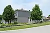 Covington Institute Teachers' Residence |
January 27, 1983 (#83002890) |
333 E. Main St. 37°41′00″N 85°13′00″W |
Springfield | |
| 13 | Ed Cusick House | February 10, 1989 (#88003426) |
West of Springfield on Bearwallow Rd. 37°42′59″N 85°21′59″W |
Springfield | ||
| 14 | Doe Run Trestle | 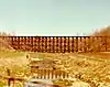 Doe Run Trestle |
February 10, 1989 (#88003418) |
West of Springfield off U.S. Route 150 37°46′40″N 85°17′40″W |
Springfield | |
| 15 | Duncan House | 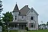 Duncan House |
February 10, 1989 (#88003393) |
206 Lincoln Park Rd. 37°41′11″N 85°13′18″W |
Springfield | |
| 16 | Edelen House | February 10, 1989 (#88003433) |
Highway 1183 37°42′52″N 85°23′15″W |
Springfield | ||
| 17 | Elmwood | December 20, 1977 (#77000658) |
Kentucky Route 55 37°40′41″N 85°13′35″W |
Springfield | ||
| 18 | Farmer's Bank of Mackville |  Farmer's Bank of Mackville |
February 10, 1989 (#88003431) |
Kentucky Route 152 37°43′41″N 85°04′00″W |
Mackville | |
| 19 | Fields' House | February 10, 1989 (#88003422) |
Highway 1183 37°42′13″N 85°19′06″W |
Springfield | ||
| 20 | Glenn Cottage Tract | February 10, 1989 (#88003416) |
Kentucky Route 55 37°49′07″N 85°17′38″W |
Maud | ||
| 21 | Gregory-Barlow Place | February 10, 1989 (#88003398) |
South of Mooresville off Kentucky Route 55 37°46′54″N 85°15′42″W |
Mooresville | ||
| 22 | Grundy Houses | January 17, 1978 (#78001411) |
North of Springfield off Kentucky Route 55 37°44′53″N 85°16′39″W |
Springfield | ||
| 23 | Hamilton Farm | July 22, 1993 (#93000695) |
U.S. Route 150 0.7 miles west of Parker's Branch crossing 37°45′56″N 85°19′23″W |
Springfield | ||
| 24 | Thomas H. Hamilton House | February 10, 1989 (#88003403) |
West of Springfield on U.S. Route 150 37°42′56″N 85°16′11″W |
Springfield | ||
| 25 | Hatchett Tobacco Barn | February 7, 2008 (#08000013) |
3067 Beechland Rd. 37°45′58″N 85°12′32″W |
Springfield | ||
| 26 | Holy Rosary Church | 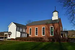 Holy Rosary Church |
February 10, 1989 (#88003409) |
Kentucky Route 1183 37°42′47″N 85°23′15″W |
Manton | |
| 27 | Johnson's Chapel AME Church | 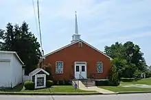 Johnson's Chapel AME Church |
February 10, 1989 (#88003396) |
E. High St. 37°41′04″N 85°13′00″W |
Springfield | |
| 28 | Kalarama Saddlebred Horse Farm | August 5, 2010 (#10000528) |
101 Kalarama Dr. 37°41′42″N 85°12′27″W |
Springfield | ||
| 29 | Kendrick-Croake House |  Kendrick-Croake House |
February 10, 1989 (#88003417) |
Hog Run, Booker Station 37°46′49″N 85°18′09″W |
Maud | |
| 30 | Kendrick-Tucker-Barber House |  Kendrick-Tucker-Barber House |
February 10, 1989 (#88003421) |
Off U.S. Route 150 37°45′56″N 85°18′36″W |
Mooresville | |
| 31 | Mordecai Lincoln House | 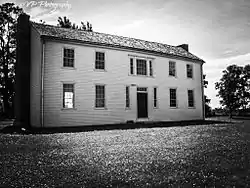 Mordecai Lincoln House |
August 21, 1972 (#72000547) |
5.9 miles north of Springfield on Kentucky Route 528 37°44′54″N 85°12′35″W |
Springfield | |
| 32 | John Litsey House | February 10, 1989 (#88003404) |
North of Springfield off Kentucky Route 438 37°46′24″N 85°12′45″W |
Springfield | ||
| 33 | Long Lick Creek Bridge | February 10, 1989 (#88003414) |
Hardesty-Polin Rd. over Long Lick Creek 37°48′38″N 85°12′45″W |
Willisburg | ||
| 34 | Pat Lyddan House | February 10, 1989 (#88003420) |
South of Mooresville on Kentucky Route 55 37°47′26″N 85°15′27″W |
Mooresville | ||
| 35 | Mackville Historic District |  Mackville Historic District |
January 22, 2014 (#12001203) |
Along Kentucky Routes 152 and 433 37°44′13″N 85°03′59″W |
Mackville | |
| 36 | Maple Grove | August 5, 2010 (#10000527) |
3216 Perryville Rd. 37°39′57″N 85°10′57″W |
Springfield vicinity | ||
| 37 | Archibald Scott Mayes House | February 10, 1989 (#88003405) |
East of Springfield off U.S. Route 150 37°39′40″N 85°09′58″W |
Springfield | ||
| 38 | William C. McChord House | 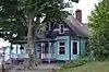 William C. McChord House |
December 11, 1978 (#78001412) |
202 Lincoln Park Rd. 37°41′09″N 85°13′18″W |
Springfield | |
| 39 | T.I. McElroy House | February 10, 1989 (#88003397) |
East of Springfield on U.S. Route 150 37°39′42″N 85°11′02″W |
Springfield | ||
| 40 | Wilson McElroy House | 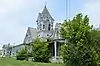 Wilson McElroy House |
February 10, 1989 (#88003392) |
321 E. High St. 37°41′06″N 85°13′02″W |
Springfield | |
| 41 | Mount Zion Covered Bridge | 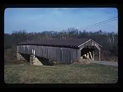 Mount Zion Covered Bridge |
March 26, 1976 (#76000958) |
North of Mooresville on Kentucky Route 458 37°49′40″N 85°15′23″W |
Mooresville | |
| 42 | Parrot House | February 10, 1989 (#88003412) |
East of Springfield on Kentucky Route 152 37°41′39″N 85°10′51″W |
Springfield | ||
| 43 | Benjamin Pile House | February 10, 1989 (#88003407) |
Off Kentucky Route 55 37°48′59″N 85°16′54″W |
Springfield | ||
| 44 | John Pope House | 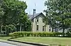 John Pope House |
May 13, 1976 (#76000959) |
207 Walnut St. 37°41′08″N 85°13′11″W |
Springfield | |
| 45 | Ray-Wakefield House | February 10, 1989 (#88003415) |
Off Kentucky Route 55 37°49′12″N 85°17′28″W |
Maud | ||
| 46 | Road Run School | February 10, 1989 (#88003424) |
West of Springfield off Kentucky Route 152 37°40′42″N 85°21′02″W |
Springfield | ||
| 47 | Round Stone Smokehouse | January 8, 1987 (#87000164) |
U.S. Route 150 37°45′32″N 85°18′55″W |
Fredericktown | ||
| 48 | St. Catherine of Sienna Convent | February 10, 1989 (#88003395) |
West of Springfield on U.S. Route 150 37°42′29″N 85°15′38″W |
Springfield | ||
| 49 | St. Dominic's Catholic Church | 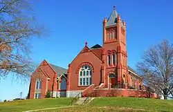 St. Dominic's Catholic Church |
February 10, 1989 (#88003388) |
Main St. 37°41′14″N 85°13′30″W |
Springfield | |
| 50 | St. Rose Roman Catholic Church Complex | 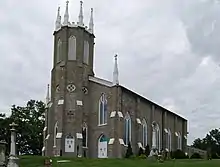 St. Rose Roman Catholic Church Complex |
February 14, 1978 (#78001413) |
West of Springfield off U.S. Route 150 37°41′36″N 85°15′49″W |
Springfield | |
| 51 | Simms-Edelen House | February 10, 1989 (#88003427) |
Southeast of Springfield 37°38′05″N 85°10′39″W |
Springfield | ||
| 52 | Simms-Mattingly House | February 10, 1989 (#88003428) |
East of Springfield off Kentucky Route 152 37°42′11″N 85°09′52″W |
Springfield | ||
| 53 | Simmstown |  Simmstown |
February 10, 1989 (#88003408) |
South of Springfield on Rineltown-Simmstown Rd. 37°38′05″N 85°11′08″W |
Springfield | |
| 54 | Levi J. Smith House | February 10, 1989 (#88003411) |
West of Springfield on U.S. Route 150 37°41′58″N 85°15′02″W |
Springfield | ||
| 55 | Springfield Armory |  Springfield Armory |
March 24, 2000 (#00000283) |
126 Armory Hill Rd. 37°40′57″N 85°13′33″W |
Springfield | |
| 56 | Springfield Baptist Church | 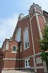 Springfield Baptist Church |
February 10, 1989 (#88003394) |
Lincoln Park Rd. 37°41′11″N 85°13′15″W |
Springfield | |
| 57 | Springfield Graded School |  Springfield Graded School |
February 10, 1989 (#88003389) |
Mackville and Perry Rds. 37°40′55″N 85°12′52″W |
Springfield | |
| 58 | Springfield Main Street Historic District | 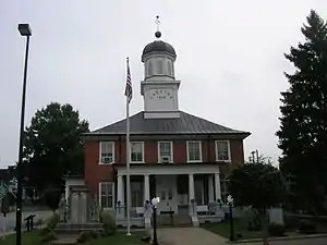 Springfield Main Street Historic District |
February 10, 1989 (#88003434) |
Roughly bounded by McCord, Walnut, Ballard and Doctor Sts.; also roughly Commercial Ave. to College St., and McCord and High Sts. to E. Depot St. 37°41′07″N 85°13′19″W |
Springfield | Originally the Springfield Historic Commercial District, a small downtown district; second set of addresses represent a boundary increase of December 19, 2012,[5] which included a name change and greatly expanded boundaries[6] |
| 59 | Tatham Springs | February 10, 1989 (#88003399) |
North of Willisburg on Hwy. 1796 37°51′50″N 85°07′28″W |
Willisburg | ||
| 60 | John Thomas House | February 10, 1989 (#88003419) |
South of Mooresville on Kentucky Route 55 37°47′09″N 85°15′17″W |
Mooresville | ||
| 61 | Dr. Thompson House | February 10, 1989 (#88003430) |
East of Springfield on Mackville Rd. 37°43′19″N 85°05′59″W |
Springfield | ||
| 62 | S.F. Turner and Company Steam Flouring and Grist Mill |  S.F. Turner and Company Steam Flouring and Grist Mill |
February 10, 1989 (#88003390) |
400 W. Main St. 37°41′19″N 85°13′46″W |
Springfield | |
| 63 | Walnut Street Historic District |  Walnut Street Historic District |
February 10, 1989 (#88003435) |
200-600 blocks of Walnut St. 37°41′12″N 85°13′10″W |
Springfield | |
| 64 | Walton Manor Cottage | August 24, 1977 (#77000659) |
2 miles west of Springfield on Kentucky Route 150 37°42′13″N 85°15′14″W |
Springfield | ||
| 65 | Washington County Courthouse | Washington County Courthouse |
July 25, 1977 (#77000660) |
Public Sq., Main at Lincoln Park Rd. 37°41′06″N 85°13′16″W |
Springfield | Two-story brick courthouse built in 1815, with an octagonal cupola added in 1840. Included in Springfield Main Street Historic District. |
| 66 | Thomas H. Williams House | February 10, 1989 (#88003410) |
Hardesty Rd. 37°48′00″N 85°12′41″W |
Springfield | ||
| 67 | Willisburg Central Bank and Post Office | 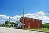 Willisburg Central Bank and Post Office |
February 10, 1989 (#88003432) |
Kentucky Route 53 37°48′30″N 85°07′29″W |
Willisburg | |
| 68 | Willisburg Historic District |  Willisburg Historic District |
January 22, 2014 (#12001204) |
Along Kentucky Routes 53 and 433 37°48′27″N 85°07′25″W |
Willisburg |
See also
| Wikimedia Commons has media related to National Register of Historic Places in Washington County, Kentucky. |
References
- The latitude and longitude information provided in this table was derived originally from the National Register Information System, which has been found to be fairly accurate for about 99% of listings. Some locations in this table may have been corrected to current GPS standards.
- "National Register of Historic Places: Weekly List Actions". National Park Service, United States Department of the Interior. Retrieved on February 5, 2021.
- Numbers represent an alphabetical ordering by significant words. Various colorings, defined here, differentiate National Historic Landmarks and historic districts from other NRHP buildings, structures, sites or objects.
- The eight-digit number below each date is the number assigned to each location in the National Register Information System database, which can be viewed by clicking the number.
- "National Register Information System". National Register of Historic Places. National Park Service. July 9, 2010.
- Ryall, Jennifer. National Register of Historic Places Inventory/Nomination: Springfield Main Street Historic District. National Park Service, 2011-06-07, 3.
| Topics | |
|---|---|
| Lists by state |
|
| Lists by insular areas | |
| Lists by associated state | |
| Other areas | |
| Related | |
| |
Municipalities and communities of Washington County, Kentucky, United States | ||
|---|---|---|
| Cities | Location of Washington County, Kentucky | |
| Unincorporated communities | ||
| ||
This article is issued from Wikipedia. The text is licensed under Creative Commons - Attribution - Sharealike. Additional terms may apply for the media files.