National Register of Historic Places listings in Oldham County, Kentucky
This is a list of the National Register of Historic Places listings in Oldham County, Kentucky.
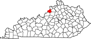
Location of Oldham County in Kentucky
This is intended to be a complete list of the properties and districts on the National Register of Historic Places in Oldham County, Kentucky, United States. The locations of National Register properties and districts for which the latitude and longitude coordinates are included below, may be seen in an online map.[1]
There are 48 properties and districts listed on the National Register in the county.
- This National Park Service list is complete through NPS recent listings posted January 29, 2021.[2]
Current listings
| [3] | Name on the Register | Image | Date listed[4] | Location | City or town | Description |
|---|---|---|---|---|---|---|
| 1 | Ashbourne Farms |  Ashbourne Farms |
March 25, 2008 (#08000212) |
3800 Old Westport Rd. 38°27′03″N 85°25′22″W |
La Grange | |
| 2 | Ashwood Avenue Historic District | August 7, 1989 (#89000951) |
Roughly Ash Ave. from La Grange Rd. to Elm Ave. 38°18′26″N 85°29′19″W |
Pewee Valley | ||
| 3 | John Leslie Bate House | January 8, 1987 (#87000144) |
East of Buckeye Ln. off Kentucky Route 42 38°25′44″N 85°33′46″W |
Goshen | ||
| 4 | Bondurant-Hustin House | November 27, 1989 (#89001989) |
104 Castlewood Dr. 38°18′21″N 85°29′45″W |
Pewee Valley | ||
| 5 | Bradshaw-Duncan House | July 14, 2005 (#05000254) |
8502 Todds Point Rd. 38°18′12″N 85°26′03″W |
Crestwood | ||
| 6 | Building at 301 La Grange Road | November 27, 1989 (#89001980) |
301 La Grange Rd. 38°18′38″N 85°29′14″W |
Pewee Valley | ||
| 7 | Carpenter-Smith House | February 25, 1982 (#82002739) |
Covered Bridge Rd. 38°22′08″N 85°31′46″W |
Crestwood | ||
| 8 | Central Avenue Historic District | August 7, 1989 (#89000950) |
Roughly Central Ave. from Peace Ln. to Mt. Mercy Dr. 38°18′40″N 85°29′35″W |
Pewee Valley | ||
| 9 | Central La Grange Historic District | 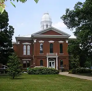 Central La Grange Historic District |
September 8, 1988 (#88001316) |
Primarily along Washington, Main, and Jefferson Sts., Kentucky Ave., and 1st through 6th Aves. 38°24′25″N 85°22′54″W |
La Grange | |
| 10 | Clifton | August 18, 1997 (#97000874) |
4801 Greenhaven Ln. 38°27′50″N 85°28′55″W |
Goshen | ||
| 11 | Albert E. Clore House | May 26, 1983 (#83002842) |
6400 Clore Lane 38°19′58″N 85°30′04″W |
Crestwood | ||
| 12 | Confederate Memorial in Pewee Valley | 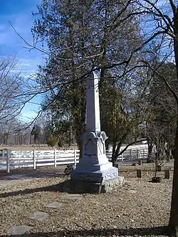 Confederate Memorial in Pewee Valley |
July 17, 1997 (#97000673) |
Confederate Cemetery, junction of Maple Ave. and Old Floydsburg Rd. 38°18′11″N 85°28′32″W |
Pewee Valley | |
| 13 | Joseph H. Ellis House | November 27, 1989 (#89001988) |
320 Maple Ave. 38°18′20″N 85°28′46″W |
Pewee Valley | ||
| 14 | Forrester-Duvall House | November 27, 1989 (#89001987) |
115 Old Forest Rd. 38°18′12″N 85°29′12″W |
Pewee Valley | ||
| 15 | D. W. Griffith House | 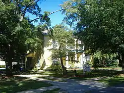 D. W. Griffith House |
June 3, 1976 (#76000935) |
206 N. 4th St. 38°24′30″N 85°23′02″W |
La Grange | |
| 16 | Harrods Creek Baptist Church and Rev. William Kellar House | September 8, 1976 (#76000934) |
Northwest of Crestwood on Old Brownsboro Rd. 38°21′32″N 85°30′39″W |
Crestwood | ||
| 17 | The Hermitage | December 2, 1982 (#82001572) |
Off U.S. Route 42 38°24′51″N 85°32′38″W |
Goshen | ||
| 18 | William Ingram House | August 18, 1983 (#83002843) |
6800 Shrader Lane 38°24′11″N 85°29′47″W |
Buckner | ||
| 19 | Johnson's Landing House and Farm | August 4, 2016 (#16000505) |
2300 Rose Island Rd. 38°25′33″N 85°35′44″W |
Goshen | ||
| 20 | Abraham Kellar House | July 9, 1979 (#79001029) |
West of Brownsboro off Kentucky Route 329 38°21′36″N 85°31′26″W |
Brownsboro | ||
| 21 | Locke-Mount House | November 24, 1982 (#82001573) |
South of Goshen off U.S. Route 42 38°21′59″N 85°35′02″W |
Goshen | ||
| 22 | The Locust | July 30, 1975 (#75000817) |
LaGrange Rd. off Kentucky Route 146 38°19′12″N 85°29′13″W |
Pewee Valley | ||
| 23 | McMahan House | 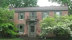 McMahan House |
May 13, 1982 (#82002741) |
203 Washington St. 38°24′25″N 85°22′37″W |
La Grange | |
| 24 | William McMakin House | January 8, 1987 (#87000211) |
Off Kentucky Route 1817 38°22′11″N 85°27′55″W |
Brownsboro | ||
| 25 | George Miller House | November 27, 1989 (#89001986) |
331 Central Ave. 38°19′05″N 85°29′41″W |
Pewee Valley | ||
| 26 | Dr. Thomas C. Peebles House | November 27, 1989 (#89001985) |
114 Maple Ave. 38°18′35″N 85°28′58″W |
Pewee Valley | ||
| 27 | Pewee Valley Confederate Cemetery | 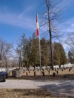 Pewee Valley Confederate Cemetery |
November 27, 1989 (#89001984) |
Maple Ave., southeast of its junction with Old Floydsburg Rd. 38°18′12″N 85°28′34″W |
Pewee Valley | |
| 28 | John Ritter House | January 8, 1987 (#87000159) |
Old Floydsburg Rd. off Kentucky Route 1408 38°18′39″N 85°27′34″W |
Floydsburg | ||
| 29 | Ross-Hollenbach Farm | July 8, 2008 (#08000651) |
4701 S. Highway 1694 (Sleepy Hollow Rd.) 38°21′20″N 85°32′47″W |
Brownsboro | ||
| 30 | Russell Court |  Russell Court |
November 10, 1988 (#88002612) |
Roughly bounded by Madison St., Chestnut St., E. Jefferson St., and Maple St. 38°24′42″N 85°22′19″W |
La Grange | |
| 31 | St. Aloysius Church | 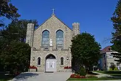 St. Aloysius Church |
November 27, 1989 (#89001983) |
202 Mt. Mercy Dr. 38°18′29″N 85°29′30″W |
Pewee Valley | |
| 32 | Saint James' Episcopal Church | 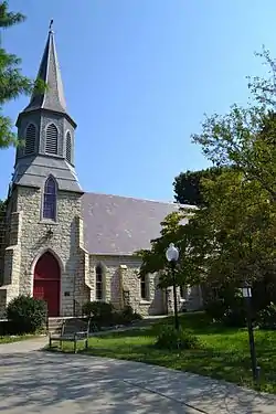 Saint James' Episcopal Church |
December 5, 1985 (#85003072) |
401 Old LaGrange Rd. 38°18′47″N 85°29′04″W |
Pewee Valley | |
| 33 | Reuben Sale House | November 24, 1982 (#82001574) |
3700 Smith Lane 38°28′04″N 85°25′30″W |
La Grange | ||
| 34 | William Alexander Smith House | November 27, 1989 (#89001982) |
108 Mt. Mercy Dr. 38°18′21″N 85°29′39″W |
Pewee Valley | ||
| 35 | Spring Hill | April 2, 1980 (#80001664) |
South of Ballardsville off Kentucky Route 53 38°19′56″N 85°20′01″W |
Ballardsville | ||
| 36 | Tanglewood | November 27, 1989 (#89001981) |
417 La Grange Rd. 38°18′52″N 85°29′02″W |
Pewee Valley | ||
| 37 | Phillip R. Taylor House | May 24, 1983 (#83002844) |
Shuler Lane 38°20′18″N 85°34′06″W |
Louisville | ||
| 38 | Tuliphurst | November 27, 1989 (#89001979) |
115 La Grange Rd. 38°18′18″N 85°29′27″W |
Pewee Valley | ||
| 39 | Van Horn-Ross House | November 27, 1989 (#89001978) |
138 Rosswoods Dr. 38°18′50″N 85°29′40″W |
Pewee Valley | ||
| 40 | Waldeck Farm | January 4, 2001 (#00001618) |
5900 W. Kentucky Route 22 38°19′41″N 85°27′30″W |
Crestwood | ||
| 41 | Wesley Methodist Church | January 8, 1987 (#87000179) |
Haunz Ln. 38°19′54″N 85°32′07″W |
Anchorage | ||
| 42 | Wildwood Farm | March 30, 2006 (#06000214) |
3901 Axton Ln. 38°26′55″N 85°32′10″W |
Skylight | ||
| 43 | Woodland | August 8, 2016 (#16000506) |
3008 Ann Trese Cove 38°21′42″N 85°20′42″W |
Crestwood | ||
| 44 | Wooldridge-Rose House | September 13, 2006 (#06000810) |
315 Wooldridge Ave. 38°19′03″N 85°29′24″W |
Pewee Valley | ||
| 45 | William Woolfolk House | January 8, 1987 (#87000202) |
Off U.S. Route 42 38°26′17″N 85°27′23″W |
La Grange | ||
| 46 | Yager House | June 17, 1982 (#82002740) |
Southeast of Goshen on Covered Bridge Rd. 38°22′44″N 85°32′07″W |
Goshen | ||
| 47 | Yew Dell Farm | August 19, 2011 (#11000540) |
5800 N. Camden Ln. 38°20′21″N 85°27′47″W |
Crestwood | ||
| 48 | Yewell-Snyder House | November 3, 1983 (#83003802) |
6206 N. Hitt Lane 38°20′32″N 85°32′46″W |
Brownsboro |
See also
| Wikimedia Commons has media related to National Register of Historic Places in Oldham County, Kentucky. |
References
- The latitude and longitude information provided in this table was derived originally from the National Register Information System, which has been found to be fairly accurate for about 99% of listings. Some locations in this table may have been corrected to current GPS standards.
- "National Register of Historic Places: Weekly List Actions". National Park Service, United States Department of the Interior. Retrieved on January 29, 2021.
- Numbers represent an alphabetical ordering by significant words. Various colorings, defined here, differentiate National Historic Landmarks and historic districts from other NRHP buildings, structures, sites or objects.
- The eight-digit number below each date is the number assigned to each location in the National Register Information System database, which can be viewed by clicking the number.
| Topics | |
|---|---|
| Lists by state |
|
| Lists by insular areas | |
| Lists by associated state | |
| Other areas | |
| Related | |
| |
Municipalities and communities of Oldham County, Kentucky, United States | ||
|---|---|---|
| Cities | Location of Oldham County, Kentucky | |
| CDPs | ||
| Unincorporated communities | ||
| Footnotes | ‡This populated place also has portions in an adjacent county or counties | |
| ||
This article is issued from Wikipedia. The text is licensed under Creative Commons - Attribution - Sharealike. Additional terms may apply for the media files.