National Register of Historic Places listings in Allen County, Kentucky
This is a list of the National Register of Historic Places listings in Allen County, Kentucky.
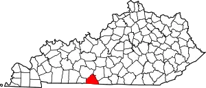
Location of Allen County in Kentucky
This is intended to be a complete list of the properties and districts on the National Register of Historic Places in Allen County, Kentucky, United States. The locations of National Register properties and districts for which the latitude and longitude coordinates are included below, may be seen in a map.[1]
There are 12 properties and districts listed on the National Register in the county.
- This National Park Service list is complete through NPS recent listings posted January 29, 2021.[2]
Current listings
| [3] | Name on the Register | Image | Date listed[4] | Location | City or town | Description |
|---|---|---|---|---|---|---|
| 1 | Allen County Poor Farm | November 7, 1991 (#91001662) |
3540 Holland Rd. 36°43′37″N 86°08′31″W |
Scottsville | ||
| 2 | Big Spring School-Oliver Farmstead | July 12, 2004 (#03000712) |
3293 and 3109 Big Springs Rd. 36°52′58″N 86°14′13″W |
Settle | ||
| 3 | Dumont Hill | 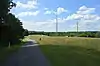 Dumont Hill |
December 4, 2003 (#03001227) |
0.25 miles north of Kentucky Route 1386 36°45′32″N 86°11′55″W |
Scottsville | |
| 4 | Dr. Pellie G. Graves House | 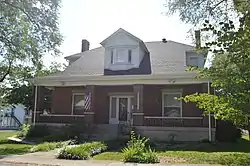 Dr. Pellie G. Graves House |
August 2, 2001 (#01000798) |
301 N. 4th St. 36°45′17″N 86°11′10″W |
Scottsville | |
| 5 | Dr. Francis Joseph (F.J.) Halcomb Jr. House | August 8, 2018 (#100002152) |
253 Franklin Rd. 36°44′20″N 86°13′00″W |
Scottsville | ||
| 6 | Edward and Julia Satterfield House | November 25, 2005 (#05001304) |
10085 Bowling Green Rd. 36°49′59″N 86°19′11″W |
Scottsville | ||
| 7 | Scottsville Downtown Commercial Historic District | Scottsville Downtown Commercial Historic District |
August 2, 2001 (#01000797) |
Public Square and extending roughly one block north and south on Court St., and one block east and west on Main 36°45′13″N 86°11′27″W |
Scottsville | |
| 8 | Scottsville Freight Depot | 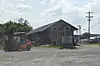 Scottsville Freight Depot |
August 2, 2001 (#01000799) |
E. Main St. at 8th St. 36°45′10″N 86°10′54″W |
Scottsville | |
| 9 | Scottsville Public Spring | 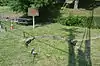 Scottsville Public Spring |
August 2, 2001 (#01000801) |
Junction of 1st and Locust Sts. 36°45′05″N 86°11′23″W |
Scottsville | |
| 10 | The Tabernacle | 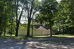 The Tabernacle |
August 2, 2001 (#01000800) |
829 Holland Rd. 36°44′44″N 86°10′58″W |
Scottsville | |
| 11 | J.L. Turner and Son Building | 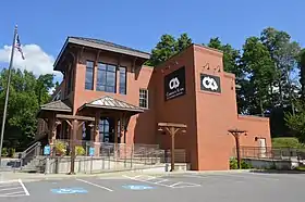 J.L. Turner and Son Building |
November 21, 2001 (#01001253) |
Old East Main St. at 7th St. 36°45′08″N 86°11′00″W |
Scottsville | |
| 12 | Andrew M. Whitney House and Barn | March 17, 1994 (#94000250) |
Kentucky Route 1855 northeast of Scottsville 36°47′37″N 86°04′01″W |
Scottsville |
See also
| Wikimedia Commons has media related to National Register of Historic Places in Allen County, Kentucky. |
References
- The latitude and longitude information provided in this table was derived originally from the National Register Information System, which has been found to be fairly accurate for about 99% of listings. Some locations in this table may have been corrected to current GPS standards.
- "National Register of Historic Places: Weekly List Actions". National Park Service, United States Department of the Interior. Retrieved on January 29, 2021.
- Numbers represent an alphabetical ordering by significant words. Various colorings, defined here, differentiate National Historic Landmarks and historic districts from other NRHP buildings, structures, sites or objects.
- The eight-digit number below each date is the number assigned to each location in the National Register Information System database, which can be viewed by clicking the number.
| Topics | |
|---|---|
| Lists by state |
|
| Lists by insular areas | |
| Lists by associated state | |
| Other areas | |
| Related | |
| |
Municipalities and communities of Allen County, Kentucky, United States | ||
|---|---|---|
| City | Location of Allen County, Kentucky | |
| Unincorporated communities | ||
| ||
This article is issued from Wikipedia. The text is licensed under Creative Commons - Attribution - Sharealike. Additional terms may apply for the media files.