National Register of Historic Places listings in McCracken County, Kentucky
This is a list of the National Register of Historic Places listings in McCracken County, Kentucky.
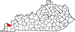
Location of McCracken County in Kentucky
This is intended to be a complete list of the properties and districts on the National Register of Historic Places in McCracken County, Kentucky, United States. The locations of National Register properties and districts for which the latitude and longitude coordinates are included below, may be seen in a map.[1]
There are 32 properties and districts listed on the National Register in the county.
- This National Park Service list is complete through NPS recent listings posted January 29, 2021.[2]
Current listings
| [3] | Name on the Register | Image | Date listed[4] | Location | City or town | Description |
|---|---|---|---|---|---|---|
| 1 | Artelia Anderson Hall | 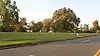 Artelia Anderson Hall |
May 26, 1983 (#83002824) |
1400 H.C. Mathis Dr. 37°05′28″N 88°37′59″W |
Paducah | |
| 2 | Anderson-Smith House | 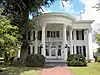 Anderson-Smith House |
March 1, 1984 (#84001824) |
Lone Oak Rd. 37°03′03″N 88°39′10″W |
Paducah | Now a welcome center for the state of Kentucky called Whitehaven, it is the only historic house used as any state's welcome center. The building contains the furniture of Vice President Alben Barkley.[5] |
| 3 | The Angles | 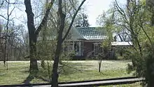 The Angles |
July 19, 1976 (#76002147) |
Alben W. Barkley Dr. near 40th St. 37°03′35″N 88°38′49″W |
Paducah | Home of Vice President Alben W. Barkley[6] |
| 4 | Archeological Site 15McN51 |  Archeological Site 15McN51 |
July 11, 1985 (#85001513) |
Under the Interstate 24 bridge over the Ohio River[7] 37°07′33″N 88°41′24″W |
Paducah | Also known as the "Reed Site"[8] |
| 5 | California Apartments |  California Apartments |
February 11, 2016 (#16000011) |
2900 Clay St. 37°04′39″N 88°38′11″W |
Paducah | |
| 6 | Confederate Monument in Paducah | 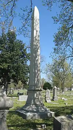 Confederate Monument in Paducah |
July 17, 1997 (#97000678) |
Oak Grove Cemetery, west of the junction of Park Ave. and 13th St. 37°05′10″N 88°37′24″W |
Paducah | |
| 7 | Grace Episcopal Church | 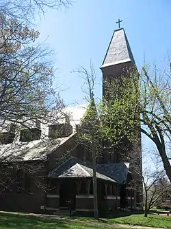 Grace Episcopal Church |
March 16, 1976 (#76002148) |
820 Broadway 37°05′03″N 88°36′13″W |
Paducah | |
| 8 | Home of the Friendless |  Home of the Friendless |
November 15, 2000 (#00000860) |
1335 Burnett St. 37°05′15″N 88°37′02″W |
Paducah | |
| 9 | Hotel Irvin Cobb |  Hotel Irvin Cobb |
August 24, 1978 (#78003065) |
Broadway and 6th St. 37°05′08″N 88°36′02″W |
Paducah | |
| 10 | Hotel Metropolitan | 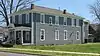 Hotel Metropolitan |
April 12, 2002 (#01001251) |
724 Oscar Cross Ave. 37°04′46″N 88°35′57″W |
Paducah | |
| 11 | Jefferson Street-Fountain Avenue Residential District | 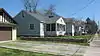 Jefferson Street-Fountain Avenue Residential District |
July 14, 1982 (#82002735) |
Jefferson and Madison Sts., Broadway, Fountain Ave., and Harahan Boulevard; also generally bounded by Park, Madison, and Fountain Aves., and Harahan Boulevard 37°05′00″N 88°37′00″W |
Paducah | Second set of boundaries represents a boundary increase of August 6, 2012 |
| 12 | Kenmil Place | 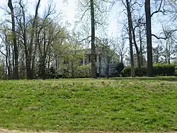 Kenmil Place |
February 11, 2009 (#09000008) |
4300 Alben Barkley Dr. 37°03′30″N 88°38′58″W |
Paducah | |
| 13 | Lincoln School | 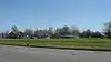 Lincoln School |
June 23, 1988 (#88000895) |
S. 8th St., between Ohio and Tennessee Sts. 37°04′40″N 88°35′57″W |
Paducah | |
| 14 | Lower Town Neighborhood District | 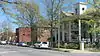 Lower Town Neighborhood District |
March 15, 1982 (#82002736) |
Roughly bounded by Park Ave. and Jefferson, 5th, and 9th Sts. 37°05′17″N 88°36′17″W |
Paducah | |
| 15 | Market House | 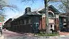 Market House |
June 19, 1973 (#73002255) |
S. 2nd St. between Broadway and Kentucky Ave. 37°05′14″N 88°35′43″W |
Paducah | |
| 16 | Masonic Temple |  Masonic Temple |
December 4, 2002 (#02001470) |
501-505 S. 7th St. 37°04′50″N 88°35′57″W |
Paducah | |
| 17 | Nashville, Chattanooga, and St. Louis Railway Office and Freight House |  Nashville, Chattanooga, and St. Louis Railway Office and Freight House |
July 17, 1979 (#79003118) |
300 S. 3rd St. 37°05′06″N 88°35′42″W |
Paducah | |
| 18 | Paducah City Hall | July 13, 2017 (#100000742) |
300 S. 5th St. 37°05′01″N 88°35′50″W |
Paducah | ||
| 19 | Paducah Coca-Cola Bottling Plant | 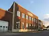 Paducah Coca-Cola Bottling Plant |
July 30, 2013 (#13000564) |
3121 Broadway 37°04′16″N 88°38′16″W |
Paducah | |
| 20 | Paducah Downtown Commercial District | 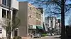 Paducah Downtown Commercial District |
April 20, 1982 (#82002737) |
Roughly bounded by 7th, 1st, Clark, and Monroe Sts.; also roughly bounded by 1st, Clark, 7th, and Monroe Sts. 37°05′11″N 88°35′56″W |
Paducah | Second set of boundaries represents a boundary increase of May 2, 1985 |
| 21 | Paducah Market House District | 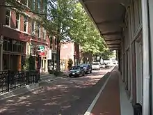 Paducah Market House District |
April 3, 1978 (#78003066) |
2nd St. between Broadway and Kentucky Ave. 37°05′14″N 88°35′44″W |
Paducah | |
| 22 | People's First National Bank and Trust Company Building | 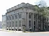 People's First National Bank and Trust Company Building |
August 11, 1980 (#80001655) |
300 Broadway 37°05′13″N 88°35′49″W |
Paducah | |
| 23 | Pettit Building | April 25, 2019 (#100003681) |
1135 Park Ave. 37°05′18″N 88°36′47″W |
Paducah | ||
| 24 | Saint Mary Academy Complex | 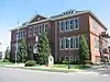 Saint Mary Academy Complex |
March 17, 1987 (#87000449) |
Bounded by 4th, 5th, Monroe, and Jefferson Sts. 37°05′16″N 88°36′00″W |
Paducah | |
| 25 | St. Francis DeSales Roman Catholic Church | 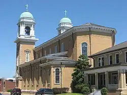 St. Francis DeSales Roman Catholic Church |
April 16, 1979 (#79003119) |
116 S. 6th St. 37°05′08″N 88°36′01″W |
Paducah | |
| 26 | Shawnee Steam Plant | August 4, 2016 (#16000504) |
7900 Metropolis Lake Rd. 37°08′29″N 88°45′56″W |
West Paducah | ||
| 27 | Augusta Tilghman High School | 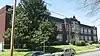 Augusta Tilghman High School |
April 3, 1995 (#95000300) |
401 Walter Jetton Boulevard 37°04′48″N 88°36′14″W |
Paducah | |
| 28 | Lloyd Tilghman Memorial | 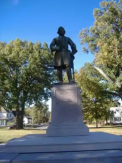 Lloyd Tilghman Memorial |
July 17, 1997 (#97000679) |
Lange Park, Madison St. between 16th and 19th Sts. 37°04′55″N 88°37′10″W |
Paducah | |
| 29 | Tilghman-Woolfolk House | 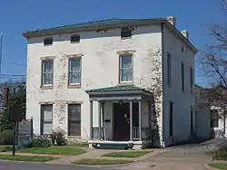 Tilghman-Woolfolk House |
August 13, 1998 (#98000940) |
631 Kentucky Ave. 37°05′04″N 88°36′04″W |
Paducah | |
| 30 | Union Station School | 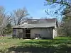 Union Station School |
August 19, 2011 (#11000539) |
3138 Flagman Dr. 37°02′21″N 88°36′20″W |
Paducah | School for black children until integration in 1966[9] |
| 31 | Wallace Park Neighborhood Historic District | 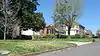 Wallace Park Neighborhood Historic District |
February 22, 2012 (#12000047) |
Roughly bounded by Buckner Ln., Maple Ave., Forest Circle, and Lone Oak Rd. 37°04′00″N 88°38′30″W |
Paducah | |
| 32 | Westminster Presbyterian Church | August 2, 2017 (#100001426) |
2732 Broadway 37°04′23″N 88°37′50″W |
Paducah | ||
| 33 | Mayor David A. Yeiser House |  Mayor David A. Yeiser House |
March 7, 1973 (#73002130) |
533 Madison St. 37°05′21″N 88°36′08″W |
Paducah |
See also
| Wikimedia Commons has media related to National Register of Historic Places in McCracken County, Kentucky. |
References
- The latitude and longitude information provided in this table was derived originally from the National Register Information System, which has been found to be fairly accurate for about 99% of listings. Some locations in this table may have been corrected to current GPS standards.
- "National Register of Historic Places: Weekly List Actions". National Park Service, United States Department of the Interior. Retrieved on January 29, 2021.
- Numbers represent an alphabetical ordering by significant words. Various colorings, defined here, differentiate National Historic Landmarks and historic districts from other NRHP buildings, structures, sites or objects.
- The eight-digit number below each date is the number assigned to each location in the National Register Information System database, which can be viewed by clicking the number.
- "WHITEHAVEN WELCOME CENTER". State of Kentucky. Retrieved October 28, 2015.
- "Alben Barkley Home, Effects to be Sold". Lexington Herald-Leader
- Carstens, Kenneth C. "Archeological Highlights of Western Kentucky and the Archeological Program of Murray State University". 1994 Plenary Session of the Kentucky Academy of Sciences. Paducah: Kentucky Academy of Sciences, 1994-11-05, 3. Accessed 2013-01-03.
- "National Register Information System". National Register of Historic Places. National Park Service. March 13, 2009.
- "National Register of Historic Places Registration Form: Union Station School" (PDF). p. 3. Retrieved September 4, 2011.
| Topics | |
|---|---|
| Lists by state |
|
| Lists by insular areas | |
| Lists by associated state | |
| Other areas | |
| Related | |
| |
Municipalities and communities of McCracken County, Kentucky, United States | ||
|---|---|---|
| City | Location of McCracken County, Kentucky | |
| CDPs | ||
| Unincorporated communities | ||
| Footnotes | ‡This populated place also has portions in an adjacent county or counties | |
| ||
This article is issued from Wikipedia. The text is licensed under Creative Commons - Attribution - Sharealike. Additional terms may apply for the media files.