National Register of Historic Places listings in Boyle County, Kentucky
This is a list of the National Register of Historic Places listings in Boyle County, Kentucky.
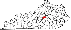
Location of Boyle County in Kentucky
This is intended to be a complete list of the properties and districts on the National Register of Historic Places in Boyle County, Kentucky, United States. The locations of National Register properties and districts for which the latitude and longitude coordinates are included below, may be seen in a map.[1]
There are 97 properties and districts listed on the National Register in the county, including 3 that are National Historic Landmarks.
- This National Park Service list is complete through NPS recent listings posted February 5, 2021.[2]
Current listings
| [3] | Name on the Register | Image | Date listed[4] | Location | City or town | Description |
|---|---|---|---|---|---|---|
| 1 | Aliceton Camp Meeting Ground | April 9, 1998 (#98000329) |
657 Ward's Branch Rd. 37°35′22″N 85°01′49″W |
Gravel Switch | ||
| 2 | John Barbee House | June 23, 1983 (#83002578) |
Kentucky Route 34 37°39′51″N 84°43′33″W |
Bryantsville | ||
| 3 | Thomas Barbee House | June 26, 2019 (#100004121) |
204 E. Walnut St. 37°38′40″N 84°46′06″W |
Danville | ||
| 4 | H.P. Bottom House | 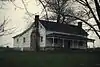 H.P. Bottom House |
January 1, 1976 (#76000851) |
Northwest of Perryville on Old Mackville Rd. 37°39′52″N 84°58′14″W |
Perryville | |
| 5 | Bower House | May 28, 1999 (#97001367) |
Kentucky Route 34 37°35′50″N 84°53′43″W |
Parksville | ||
| 6 | Boyle County Courthouse | 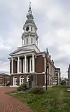 Boyle County Courthouse |
April 11, 1973 (#73000790) |
Main and 4th Sts. 37°38′47″N 84°46′24″W |
Danville | |
| 7 | Judge John Boyle House | November 25, 1980 (#80001485) |
North of Danville on Bellows Mill Rd. 37°42′58″N 84°47′37″W |
Danville | Demolished in 2017.[5] | |
| 8 | T. B. Bright House and Farmstead | November 19, 1997 (#97001356) |
Kentucky Route 34, 1 mile (1.6 km) east of Danville 37°39′52″N 84°43′38″W |
Danville | ||
| 9 | Nimrod I. Buster House and Farmstead | November 21, 1997 (#97001359) |
0.2 miles (0.32 km) east of Buster Rd., 0.1 miles (0.16 km) south of Mercer County line 37°42′53″N 84°46′42″W |
Danville | ||
| 10 | Caldwell House | June 23, 1983 (#83002579) |
Off U.S. Route 150 37°38′07″N 84°51′13″W |
Danville | ||
| 11 | Charles W. Caldwell House | May 28, 1999 (#97001361) |
0.2 miles (0.32 km) north of Kentucky Route 34, 0.6 miles (0.97 km) west of U.S Route 127 37°37′47″N 84°48′38″W |
Danville | ||
| 12 | W. Logan Caldwell Farmstead | May 28, 1999 (#97001368) |
Irvine Rd., 0.4 miles (0.64 km) north of Kentucky Route 34 37°37′13″N 84°51′04″W |
Danville | ||
| 13 | Cambus-Kenneth Estate | November 17, 1977 (#77000602) |
3 miles (4.8 km) northwest of Danville off U.S. Route 127 37°40′13″N 84°47′59″W |
Danville | ||
| 14 | Carnegie Library | 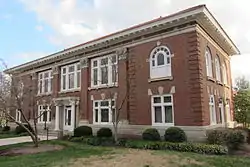 Carnegie Library |
March 28, 1986 (#86000645) |
Centre College campus 37°38′40″N 84°46′45″W |
Danville | |
| 15 | Cincinnati Southern Railroad Culvert-CSRR | April 9, 1998 (#98000327) |
Crossing of Norfolk Southern railroad line and Mocks Branch 37°41′54″N 84°46′48″W |
Danville | ||
| 16 | Clifton Baptist Church Complex | February 12, 1998 (#98000085) |
Clifton Rd., 1 mile (1.6 km) northeast of Kentucky Route 52 37°38′49″N 84°41′30″W |
Clifton | ||
| 17 | Clifton Road Culvert | November 21, 1997 (#97001375) |
Clifton Rd., 0.6 miles (0.97 km) north of Kentucky Route 52 37°38′31″N 84°41′44″W |
Clifton | ||
| 18 | Confederate Monument in Danville | 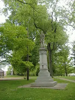 Confederate Monument in Danville |
July 17, 1997 (#97000720) |
Junction of Main and College Sts. 37°38′44″N 84°46′42″W |
Danville | |
| 19 | Confederate Monument in Perryville | 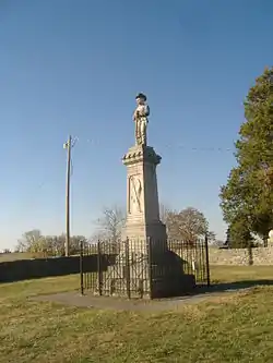 Confederate Monument in Perryville |
July 17, 1997 (#97000722) |
Perryville State Historic Site, 2.5 miles (4.0 km) northwest of Perryville 37°40′29″N 84°58′17″W |
Perryville | |
| 20 | Constitution Square Historic District | 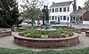 Constitution Square Historic District |
April 2, 1976 (#76000847) |
Bounded by Main and Walnut Sts., 1st and 2nd Sts. 37°38′42″N 84°46′14″W |
Danville | |
| 21 | Crawford House | 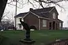 Crawford House |
January 1, 1976 (#76000852) |
Northeast of Perryville off U.S. Route 68 37°39′45″N 84°56′24″W |
Perryville | |
| 22 | William Crow House | 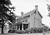 William Crow House |
June 23, 1983 (#83002581) |
Off Kentucky Route 52 37°38′21″N 84°44′46″W |
Bryantsville | |
| 23 | Crow-Barbee House | 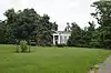 Crow-Barbee House |
June 23, 1983 (#83002580) |
Stanford Rd. and Alta Ave. 37°38′30″N 84°45′39″W |
Danville | |
| 24 | Henry Cutter Houses | 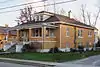 Henry Cutter Houses |
November 21, 1997 (#97001374) |
678 and 690 Shelby St. 37°35′07″N 84°47′33″W |
Junction City | |
| 25 | Danville Commercial District | 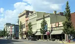 Danville Commercial District |
March 31, 1986 (#86000643) |
W. Main between N. 5th and N. 1st, and area bounded by S. 3rd, W. Walnut, and S. 4th 37°38′43″N 84°46′19″W |
Danville | |
| 26 | Danville National Cemetery | 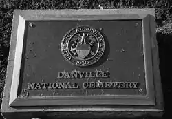 Danville National Cemetery |
May 29, 1998 (#98000591) |
277 N. 1st St. 37°39′13″N 84°46′15″W |
Danville | |
| 27 | Dutch Barn | July 31, 1998 (#98000941) |
Junction of Spears Ln. and Kentucky Route 33 east of Shakertown Rd. 37°40′44″N 84°45′15″W |
Danville | ||
| 28 | East Main Street Historic District |  East Main Street Historic District |
March 31, 1986 (#86000640) |
419-619 E. Main St. 37°38′42″N 84°45′42″W |
Danville | built between 1890 and 1930 |
| 29 | First Christian Church | 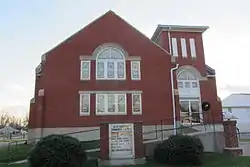 First Christian Church |
April 9, 1998 (#98000331) |
Junction of Shelby and Cemetery Sts. 37°35′05″N 84°47′29″W |
Junction City | |
| 30 | First Presbyterian Church | 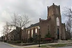 First Presbyterian Church |
March 31, 1986 (#86000638) |
W. Main between N. 5th and N. 6th Sts. 37°38′44″N 84°46′38″W |
Danville | |
| 31 | Forest Hill | October 16, 1989 (#89001712) |
Kentucky Route 34, 3 miles (4.8 km) northeast of Danville 37°40′09″N 84°43′47″W |
Danville | ||
| 32 | Forkland School and Gymnasium | 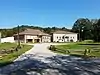 Forkland School and Gymnasium |
February 12, 1998 (#98000086) |
Junction of Kentucky Route 37 and Curtis Rd. 37°33′06″N 84°59′06″W |
Gravel Switch | |
| 33 | Gentry House | November 19, 1997 (#97001370) |
Kentucky Route 150, 0.4 miles (0.64 km) south of its bypass 37°37′01″N 84°43′44″W |
Danville | ||
| 34 | Goodall Building | 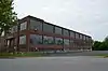 Goodall Building |
January 8, 2014 (#13001047) |
470 Stanford Rd. 37°38′28″N 84°45′50″W |
Danville | |
| 35 | Granite Hill Farmstead | .jpg.webp) Granite Hill Farmstead |
November 19, 1997 (#97001355) |
2570 Lancaster Rd. 37°37′47″N 84°43′48″W |
Danville | |
| 36 | Willis Grimes House | November 21, 1997 (#97001362) |
8803 Kentucky Route 34 37°37′14″N 84°49′36″W |
Danville | ||
| 37 | Guthrie-May House | May 28, 1999 (#98000336) |
North of the junction of Kentucky Routes 37 and 243 37°33′12″N 85°01′24″W |
Gravel Switch | ||
| 38 | Hankla-Walker House | July 31, 1998 (#98000931) |
0.3 miles (0.48 km) northwest of Kentucky Route 1920, 0.6 miles (0.97 km) south of Whites Rd. 37°40′37″N 84°57′41″W |
Perryville | ||
| 39 | Harlan's Station Site | October 21, 1976 (#76000848) |
5 miles (8.0 km) west of Danville on Salt River Rd. 37°40′21″N 84°52′21″W |
Danville | ||
| 40 | Elijah Harlan House | June 23, 1983 (#83002582) |
U.S. Route 150 37°40′07″N 84°52′09″W |
Danville | ||
| 41 | Harlan-Bruce House | November 14, 1978 (#78001304) |
5 miles (8.0 km) east of Danville off Kentucky Route 52 37°37′40″N 84°42′31″W |
Danville | ||
| 42 | Harrodsburg Pike Rural Historic District | December 21, 1998 (#98000942) |
Western side of U.S. Route 127, 3.25 miles (5.23 km) south of the county line 37°40′49″N 84°48′31″W |
Danville | ||
| 43 | W.H. Haskins House | 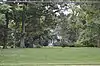 W.H. Haskins House |
March 31, 1986 (#86000636) |
420 Lexington Ave. 37°39′05″N 84°45′32″W |
Danville | |
| 44 | A. Hutchings House | November 19, 1997 (#97001353) |
Kentucky Route 52, 0.2 miles (0.32 km) west of its junction with Kentucky Route 590 37°38′07″N 84°41′11″W |
Danville | ||
| 45 | Jacobs Hall, Kentucky School for the Deaf | .jpg.webp) Jacobs Hall, Kentucky School for the Deaf |
October 15, 1966 (#66000354) |
S. 3rd St. 37°38′29″N 84°46′18″W |
Danville | |
| 46 | Junction City Municipal Building | 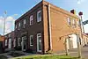 Junction City Municipal Building |
April 9, 1998 (#98000328) |
Junction of Shelby and Lucas Sts. 37°35′14″N 84°47′49″W |
Junction City | built in 1939 |
| 47 | Abner Knox Farm | June 23, 1983 (#83002583) |
U.S. Route 150 37°38′59″N 84°51′51″W |
Danville | ||
| 48 | Lazy Acres Farm | May 28, 1999 (#97001372) |
3910 Hustonville Rd. 37°35′22″N 84°46′27″W |
Danville | ||
| 49 | Lexington Avenue-Broadway Historic District | 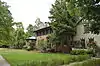 Lexington Avenue-Broadway Historic District |
January 12, 1987 (#87000198) |
W. and E. Lexington between N. 5th and Old Wilderness Rd. and area bounded by N. Larrimore, W. Broadway, and N. 5th 37°38′55″N 84°46′15″W |
Danville | |
| 50 | Maple Avenue District | Maple Avenue District |
June 16, 1987 (#87001241) |
Both sides of Maple Ave. between W. Main and High 37°38′59″N 84°46′57″W |
Danville | |
| 51 | Marshall House | June 23, 1983 (#83002584) |
Off Kentucky Route 34 37°37′14″N 84°48′29″W |
Junction City | ||
| 52 | Peter Mason House | November 27, 1991 (#91001711) |
Off U.S. Route 127, 3 miles (4.8 km) north of Danville 37°41′55″N 84°48′42″W |
Danville | ||
| 53 | McClure-Barbee House | 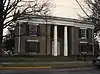 McClure-Barbee House |
March 7, 1973 (#73000791) |
304 S. 4th St. 37°38′36″N 84°46′26″W |
Danville | |
| 54 | Dr. Ephraim McDowell House | 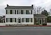 Dr. Ephraim McDowell House |
October 15, 1966 (#66000355) |
125-127 S. 2nd St. 37°38′43″N 84°46′15″W |
Danville | |
| 55 | McFerran House | November 21, 1997 (#97001360) |
U.S. Route 127, 0.2 miles (0.32 km) south of Kentucky Route 150 37°36′54″N 84°46′37″W |
Danville | ||
| 56 | McGrorty Avenue-Old Wilderness Road Historic District | March 7, 2019 (#100003476) |
Wilderness Rd. between E. Broadway and Fitzpatrick St. 37°38′51″N 84°45′56″W |
Danville | ||
| 57 | Melrose | April 3, 1986 (#86000631) |
U.S. Route 127 37°41′19″N 84°47′43″W |
Danville | ||
| 58 | James P. Mitchell House and Farmstead | November 19, 1997 (#97001349) |
Kentucky Route 34, 0.4 miles (0.64 km) from its junction with Kentucky Route 1856 37°36′04″N 84°56′42″W |
Mitchellsburg | ||
| 59 | Mitchellsburg Louisville and Nashville Railroad Culvert | April 9, 1998 (#98000332) |
L&N railroad grade over Buck Creek 37°36′05″N 84°57′10″W |
Mitchellsburg | ||
| 60 | Randolf Mock Farm | June 23, 1983 (#83002585) |
Off Kentucky Route 33 37°41′44″N 84°45′06″W |
Danville | ||
| 61 | Christopher Collins Moore Farm | December 29, 1994 (#94001506) |
3901 Harrodsburg Rd. 37°41′29″N 84°48′08″W |
Danville | ||
| 62 | J.J. Moore House | November 21, 1997 (#97001369) |
Junction of Kentucky Routes 34 and 1822 37°36′20″N 84°52′54″W |
Parksville | ||
| 63 | Old Centre, Centre College | 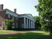 Old Centre, Centre College |
August 25, 1972 (#72000529) |
W. Walnut St., Centre College campus 37°38′44″N 84°46′54″W |
Danville | |
| 64 | Mary Simpson Oldham House | November 19, 1997 (#97001364) |
2907 Perryville Rd. 37°39′20″N 84°49′12″W |
Danville | ||
| 65 | Penn's Store | 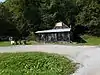 Penn's Store |
February 12, 1998 (#98000094) |
0.1 miles (0.16 km) west of Kentucky Route 243, on Boyle-Casey County line 37°32′59″N 85°01′41″W |
Gravel Switch | |
| 66 | Perryville Battlefield | 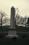 Perryville Battlefield |
October 15, 1966 (#66000356) |
West of Perryville on U.S. Route 150 37°40′35″N 84°58′04″W |
Perryville | |
| 67 | Perryville Historic District | 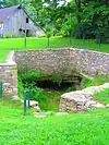 Perryville Historic District |
October 25, 1973 (#73000792) |
Roughly bounded by Sheridan Ave., Wood, Jefferson, and 5th Sts. 37°38′58″N 84°57′04″W |
Perryville | |
| 68 | Pleasant Vale | November 15, 1984 (#84000357) |
Lexington Rd. 37°40′19″N 84°45′05″W |
Danville | ||
| 69 | Purdom-Lewis-Hutchison House | November 19, 1997 (#97001351) |
Curtis Rd. at the Rolling Fork River 37°32′37″N 84°58′57″W |
Gravel Switch | ||
| 70 | Rice-Worthington House | March 30, 1995 (#95000301) |
0.3 miles (0.48 km) south of Faulconer Rd., on S. Buster Pike 37°42′08″N 84°46′49″W |
Danville | ||
| 71 | James Robinson House | April 9, 1998 (#98000333) |
Kentucky Route 1856, 1.5 miles (2.4 km) north of Kentucky Route 34 37°37′04″N 84°57′16″W |
Mitchellsburg | ||
| 72 | Rosel Hotel | 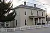 Rosel Hotel |
November 21, 1997 (#97001371) |
Junction of Shelby St. and White Oak Rd. 37°35′15″N 84°47′51″W |
Junction City | |
| 73 | Roselawn | March 13, 1986 (#86000369) |
U.S. Route 127 37°40′54″N 84°47′18″W |
Danville | ||
| 74 | St. James A.M.E. Church | 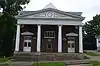 St. James A.M.E. Church |
January 23, 2013 (#12001198) |
124 E. Walnut St. 37°38′39″N 84°46′08″W |
Danville | |
| 75 | St. Mildred's Court-West Lexington Avenue Historic District |  St. Mildred's Court-West Lexington Avenue Historic District |
January 28, 1994 (#93001582) |
125-162 St. Mildred's Ct. and 797-852 W. Lexington Ave. 37°38′51″N 84°46′49″W |
Danville | |
| 76 | Salt River Road | November 19, 1997 (#97001350) |
Along Salt River Rd. 37°39′38″N 84°51′49″W |
Danville | ||
| 77 | Second Street Christian Church | 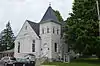 Second Street Christian Church |
January 23, 2013 (#12001197) |
228 S. 2nd St. 37°38′38″N 84°46′15″W |
Danville | |
| 78 | Spears-Craig House | November 21, 1997 (#97001358) |
0.1 miles (0.16 km) west of Kentucky Route 33, 0.6 miles (0.97 km) south of Spears Ln. 37°40′22″N 84°45′59″W |
Danville | ||
| 79 | Spring Hill (Thomas Lillard House) | January 27, 1983 (#83002586) |
South of Danville on U.S. Route 150 37°36′47″N 84°43′14″W |
Danville | ||
| 80 | Stone Bridge at Chaplin Creek | April 9, 1998 (#98000335) |
Junction of Cash Rd. and Old Mitchellsburg Rd. 37°35′51″N 84°54′38″W |
Parksville | ||
| 81 | Stone House on Old Stage Road | June 23, 1983 (#83002587) |
Kentucky Route 34 37°40′07″N 84°43′19″W |
Bryantsville | ||
| 82 | Tank Pond Railroad Underpass | April 9, 1998 (#98000334) |
Junction of Tank Pond Rd. and Kentucky Route 34 37°35′44″N 84°54′39″W |
Mitchellsburg | ||
| 83 | Terrace Court Historic District | 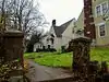 Terrace Court Historic District |
August 31, 2010 (#09001305) |
North and south sides of Terrace Ct., west of Old Wilderness Rd. 37°38′46″N 84°46′01″W |
Danville | |
| 84 | William Thompson House | June 23, 1983 (#83002588) |
Off U.S. Route 68 37°40′55″N 84°55′02″W |
Perryville | ||
| 85 | Three Gothic Villas | 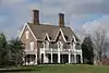 Three Gothic Villas |
July 20, 1977 (#77000603) |
Northwest of Danville off U.S. Route 127, 525 Maple Ave., and south of Danville off Kentucky Route 35 37°39′16″N 84°47′03″W |
Danville | |
| 86 | Todd-Montgomery Houses | 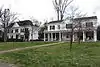 Todd-Montgomery Houses |
March 26, 1976 (#76000849) |
229, 243, 251, and 305 N. 3rd St. 37°38′55″N 84°46′21″W |
Danville | |
| 87 | Trinity Episcopal Church | 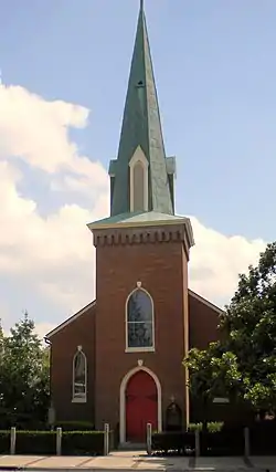 Trinity Episcopal Church |
September 15, 1977 (#77000604) |
320 W. Main St. 37°38′43″N 84°46′24″W |
Danville | |
| 88 | Union Monument in Perryville | 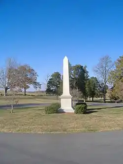 Union Monument in Perryville |
July 17, 1997 (#97000723) |
Perryville Battlefield State Historic Site, 2.5 miles (4.0 km) northwest of Perryville 37°40′30″N 84°58′17″W |
Perryville | |
| 89 | Unknown Confederate Dead Monument in Perryville | 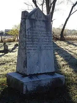 Unknown Confederate Dead Monument in Perryville |
July 17, 1997 (#97000721) |
Address Restricted |
Perryville | |
| 90 | J.S. and Nannie Vanarsdale House | November 19, 1997 (#97001376) |
Kentucky Route 52 in Atoka 37°38′54″N 84°51′40″W |
Danville | ||
| 91 | Vermillion House and Farmstead | August 14, 1998 (#97001373) |
378 Salt River Rd. 37°41′26″N 84°52′50″W |
Danville | ||
| 92 | J.S. Wallace House | November 19, 1997 (#97001357) |
Kentucky Route 34, 0.4 miles (0.64 km) south of the Mercer County line 37°42′31″N 84°45′46″W |
Danville | ||
| 93 | Warehouse District |  Warehouse District |
March 31, 1986 (#86000634) |
Intersection of Harding and W. Walnut Sts. 37°38′42″N 84°47′03″W |
Danville | |
| 94 | Waveland | 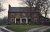 Waveland |
May 6, 1976 (#76000850) |
0.5 miles (0.80 km) south of Danville 37°37′28″N 84°46′06″W |
Danville | |
| 95 | Wilson's Station | 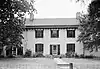 Wilson's Station |
November 21, 1997 (#97001363) |
3750 Lebanon Rd. 37°37′15″N 84°48′49″W |
Danville | |
| 96 | Charles T. Worthington House | November 21, 1997 (#97001365) |
0.3 miles (0.48 km) west of Bluegrass Rd., 0.6 miles (0.97 km) north of Gentry Ln. 37°41′01″N 84°50′06″W |
Danville | ||
| 97 | Samuel Yeager House | November 19, 1997 (#97001352) |
Kentucky Route 590, 0.7 miles (1.1 km) south of its junction with Kentucky Route 52 37°37′31″N 84°41′08″W |
Danville |
See also
| Wikimedia Commons has media related to National Register of Historic Places in Boyle County, Kentucky. |
References
- The latitude and longitude information provided in this table was derived originally from the National Register Information System, which has been found to be fairly accurate for about 99% of listings. Some locations in this table may have been corrected to current GPS standards.
- "National Register of Historic Places: Weekly List Actions". National Park Service, United States Department of the Interior. Retrieved on February 5, 2021.
- Numbers represent an alphabetical ordering by significant words. Various colorings, defined here, differentiate National Historic Landmarks and historic districts from other NRHP buildings, structures, sites or objects.
- The eight-digit number below each date is the number assigned to each location in the National Register Information System database, which can be viewed by clicking the number.
- https://www.kentucky.com/news/state/article159317574.html
| Topics | |
|---|---|
| Lists by state |
|
| Lists by insular areas | |
| Lists by associated state | |
| Other areas | |
| Related | |
| |
Municipalities and communities of Boyle County, Kentucky, United States | ||
|---|---|---|
| Cities | Location of Boyle County, Kentucky | |
| Unincorporated communities | ||
| ||
This article is issued from Wikipedia. The text is licensed under Creative Commons - Attribution - Sharealike. Additional terms may apply for the media files.