National Register of Historic Places listings in Barren County, Kentucky
This is a list of the National Register of Historic Places listings in Barren County, Kentucky.
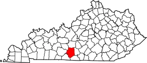
Location of Barren County in Kentucky
This is intended to be a complete list of the properties and districts on the National Register of Historic Places in Barren County, Kentucky, United States. The locations of National Register properties and districts for which the latitude and longitude coordinates are included below, may be seen in a map.[1]
There are 34 properties and districts listed on the National Register in the county.
- This National Park Service list is complete through NPS recent listings posted January 29, 2021.[2]
Current listings
| [3] | Name on the Register | Image | Date listed[4] | Location | City or town | Description |
|---|---|---|---|---|---|---|
| 1 | Belle's Tavern | 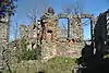 Belle's Tavern |
January 8, 1987 (#87000169) |
Kentucky Route 255 37°05′30″N 86°02′59″W |
Park City | |
| 2 | Ralph Bunche Historic District | 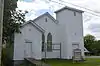 Ralph Bunche Historic District |
March 31, 2004 (#04000247) |
Roughly bound by E. College St., Landrum St., Twyman Court, and S. Lewis St. 36°59′29″N 85°54′42″W |
Glasgow | |
| 3 | Bybee House | 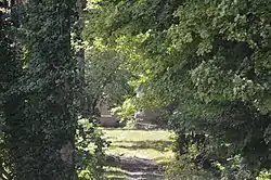 Bybee House |
August 6, 2012 (#12000444) |
3297 N. Jackson Highway[5] 37°02′20″N 85°54′13″W |
Glasgow | |
| 4 | Cave City Commercial District | 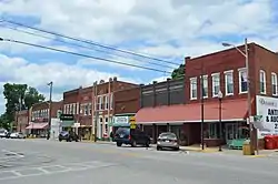 Cave City Commercial District |
July 20, 1983 (#83002529) |
Broadway between 1st and 2nd Sts. 37°08′18″N 85°57′31″W |
Cave City | |
| 5 | Confederate Monument in Glasgow | 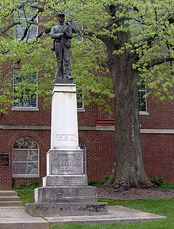 Confederate Monument in Glasgow |
July 17, 1997 (#97000717) |
Junction of Main and Green Sts. 36°59′44″N 85°54′45″W |
Glasgow | |
| 6 | Charles Penn Edmunds House | May 20, 1983 (#83002530) |
East of Becton 36°59′06″N 86°01′14″W |
Beckton | ||
| 7 | First National Bank | 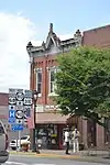 First National Bank |
May 20, 1983 (#83002531) |
Main St. 36°59′47″N 85°54′46″W |
Glasgow | |
| 8 | First Presbyterian Church | 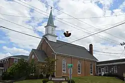 First Presbyterian Church |
May 20, 1983 (#83002532) |
Washington and Broadway 36°59′40″N 85°54′40″W |
Glasgow | |
| 9 | Fort Williams |  Fort Williams |
June 10, 1975 (#75000732) |
Between Glasgow Municipal Cemetery and U.S. Route 31E 36°59′53″N 85°55′33″W |
Glasgow | |
| 10 | Glasgow Central Business District | 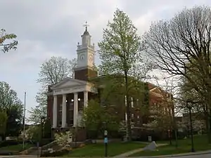 Glasgow Central Business District |
February 11, 1993 (#93000051) |
207 W. Main-117 E. Main, 100-114 S. Green, and 104 and 109 N. Race Sts.; also roughly bounded by Water St., Broadway St., Wayne St., and Liberty St. 36°59′46″N 85°54′44″W |
Glasgow | Second group of addresses represents a boundary increase of February 11, 2004 |
| 11 | Glasgow OMS#9 | September 6, 2002 (#02000922) |
Cavalry Dr. 36°58′50″N 85°56′06″W |
Glasgow | ||
| 12 | Gullian Gerig's Mill | 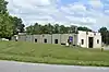 Gullian Gerig's Mill |
October 5, 1987 (#87002050) |
Beaver Valley Rd. 37°01′32″N 85°57′53″W |
Glasgow | |
| 13 | William Hicks House | May 20, 1983 (#83002533) |
Jeff Hicks Rd. 36°48′45″N 86°01′56″W |
Austin | ||
| 14 | Landrum | May 20, 1983 (#83002534) |
Kentucky Route 1318 36°52′56″N 85°56′05″W |
Roseville | ||
| 15 | Benjamin Martin House | May 20, 1983 (#83002535) |
Berry Store Rd. 36°55′44″N 86°07′34″W |
Finney | ||
| 16 | John Mayfield House | May 20, 1983 (#83002536) |
Southwest of Glasgow 36°59′06″N 85°58′54″W |
Glasgow | ||
| 17 | Andrew McCoy House | May 20, 1983 (#83002537) |
Railroad Ave. 37°08′17″N 85°57′43″W |
Cave City | ||
| 18 | Morris Building | 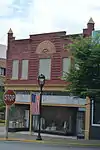 Morris Building |
May 20, 1983 (#83002538) |
Washington and Green Sts. 36°59′42″N 85°54′46″W |
Glasgow | |
| 19 | North Race Street Historic District | 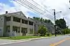 North Race Street Historic District |
July 20, 1983 (#83002539) |
N. Race St. between Front and Cherry Sts.; also roughly bounded by Happy Valley Rd., Green St., Garmon Ave. and Front St. 37°00′03″N 85°54′35″W |
Glasgow | Second group of addresses represents a boundary increase |
| 20 | Octagon Cottage | July 20, 1983 (#83002540) |
Off Kentucky Route 1297 36°58′10″N 86°02′44″W |
Rocky Hill | ||
| 21 | Old Zion Methodist Church | May 20, 1983 (#83002541) |
Kentucky Route 1297 36°59′00″N 86°03′53″W |
Park City | ||
| 22 | William Page House | May 20, 1983 (#83002542) |
South of Glasgow off Kentucky Route 249 36°54′51″N 85°55′18″W |
Glasgow | ||
| 23 | G.F. Quigley and Son Grocery | May 20, 1983 (#83002544) |
Off U.S. Route 31E 37°05′34″N 85°52′50″W |
Goodnight | ||
| 24 | Renfro Hotel | 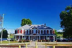 Renfro Hotel |
May 20, 1983 (#83002543) |
S. Dixie Ave. 37°05′31″N 86°02′53″W |
Park City | |
| 25 | Rock Cabin Camp | August 2, 2017 (#100001418) |
5091 Mammoth Cave Rd. 37°08′06″N 86°02′17″W |
Cave City | ||
| 26 | Franklin Settle House | May 20, 1983 (#83002545) |
Kentucky Routes 252 and 255 36°56′13″N 86°04′14″W |
Rocky Hill | ||
| 27 | Site Bn-54 | May 20, 1983 (#83002546) |
Roseville Rd. 36°54′52″N 85°55′17″W |
Bristletown | Located on the Rora Brown farm: One and one-half story double pen log house. It has fantastic late Federal mantles and chairrail and wainscoting in right pen-later trim in the left pen. Step shouldered brick end chimneys flank the i block and the rear. | |
| 28 | Southwest Glasgow Residential District | 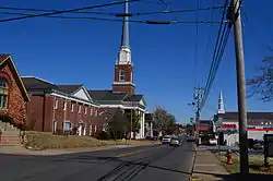 Southwest Glasgow Residential District |
August 30, 1983 (#83002547) |
Green St. between Cottage and College Sts., Leslie Ave., Liberty, Brown, and Washington Sts.; also roughly bounded by Washington St., Broadway St., Brookdale Dr., Cottage Ave., and Jefferson St. 36°59′15″N 85°55′12″W |
Glasgow | Second group of addresses represents a boundary increase |
| 29 | Third National Bank | 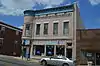 Third National Bank |
May 20, 1983 (#83002548) |
N. Green and Main Sts. 36°59′45″N 85°54′42″W |
Glasgow | |
| 30 | U.S. Post Office/Board of Education Building | 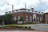 U.S. Post Office/Board of Education Building |
May 20, 1983 (#83002549) |
202 W. Washington St. 36°59′44″N 85°54′50″W |
Glasgow | |
| 31 | Jesse and Simon White House | May 20, 1983 (#83002550) |
Off U.S. Route 31E 36°52′45″N 86°01′27″W |
Lucas | ||
| 32 | Wigwam Village No. 2 | 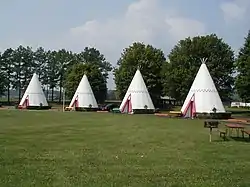 Wigwam Village No. 2 |
March 16, 1988 (#88000180) |
Northwestern side of U.S. Route 31W, 1.6 miles (2.6 km) northeast of its junction with Kentucky Route 70 37°08′41″N 85°56′43″W |
Cave City | |
| 33 | William Johnson Wood House | May 20, 1983 (#83002551) |
East of Hiseville 37°05′46″N 85°45′46″W |
Hiseville | ||
| 34 | Joseph Wooten House | May 20, 1983 (#83002552) |
Crabtree Rd. 36°50′13″N 85°47′40″W |
Tracy | ||
| 35 | Asa E. Young House | May 20, 1983 (#83002553) |
Off Kentucky Route 921 36°47′50″N 85°55′42″W |
Tracy |
See also
References
- The latitude and longitude information provided in this table was derived originally from the National Register Information System, which has been found to be fairly accurate for about 99% of listings. Some locations in this table may have been corrected to current GPS standards.
- "National Register of Historic Places: Weekly List Actions". National Park Service, United States Department of the Interior. Retrieved on January 29, 2021.
- Numbers represent an alphabetical ordering by significant words. Various colorings, defined here, differentiate National Historic Landmarks and historic districts from other NRHP buildings, structures, sites or objects.
- The eight-digit number below each date is the number assigned to each location in the National Register Information System database, which can be viewed by clicking the number.
- Maas, Anna. National Register of Historic Places Inventory/Nomination: Bybee House. National Park Service, 2012-02-01, 3.
| Topics | |
|---|---|
| Lists by state |
|
| Lists by insular areas | |
| Lists by associated state | |
| Other areas | |
| Related | |
| |
Municipalities and communities of Barren County, Kentucky, United States | ||
|---|---|---|
| Cities | Location of Barren County, Kentucky | |
| CDP | ||
| Unincorporated communities | ||
| ||
This article is issued from Wikipedia. The text is licensed under Creative Commons - Attribution - Sharealike. Additional terms may apply for the media files.