Bordeaux-Saint-Clair
Bordeaux-Saint-Clair is a commune in the Seine-Maritime department in the Normandy region in northern France.
Bordeaux-Saint-Clair | |
|---|---|
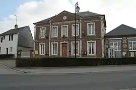 The town hall in Bordeaux-Saint-Clair | |
 Coat of arms | |
Location of Bordeaux-Saint-Clair 
| |
 Bordeaux-Saint-Clair  Bordeaux-Saint-Clair | |
| Coordinates: 49°42′06″N 0°15′14″E | |
| Country | France |
| Region | Normandy |
| Department | Seine-Maritime |
| Arrondissement | Le Havre |
| Canton | Octeville-sur-Mer |
| Intercommunality | Le Havre Seine Métropole |
| Area 1 | 10.31 km2 (3.98 sq mi) |
| Population (2017-01-01)[1] | 666 |
| • Density | 65/km2 (170/sq mi) |
| Time zone | UTC+01:00 (CET) |
| • Summer (DST) | UTC+02:00 (CEST) |
| INSEE/Postal code | 76117 /76790 |
| Elevation | 10–119 m (33–390 ft) (avg. 102 m or 335 ft) |
| 1 French Land Register data, which excludes lakes, ponds, glaciers > 1 km2 (0.386 sq mi or 247 acres) and river estuaries. | |
Geography
Bordeaux-Saint-Clair is a farming village situated in the Pays de Caux, some 15 miles (24 km) northeast of Le Havre, served by the D940 road between Fécamp and Etretat. The village is around 200 km away from Paris.[2]
Heraldry
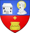
Arms of Bordeaux-Saint-Clair |
The arms of Bordeaux-Saint-Clair are blazoned: Per fess 1: Azure, the town hall argent masonned sable, to sinister a bust of St. Clair argent haloed Or; 2: Gules, cross couped and a vase Or. |
Population
| Year | 1962 | 1968 | 1975 | 1982 | 1990 | 1999 | 2006 |
|---|---|---|---|---|---|---|---|
| Population | 340 | 352 | 380 | 538 | 525 | 566 | 588 |
| From the year 1962 on: No double counting—residents of multiple communes (e.g. students and military personnel) are counted only once. | |||||||
Places of interest
- A 16th-century manorhouse and its park.
- Two churches, with parts dating from the 12th century
References
- "Populations légales 2017". INSEE. Retrieved 6 January 2020.
- "Google Maps Bordeaux-Saint-Clair - Paris".
| Wikimedia Commons has media related to Bordeaux-Saint-Clair. |
| Authority control |
|---|
This article is issued from Wikipedia. The text is licensed under Creative Commons - Attribution - Sharealike. Additional terms may apply for the media files.