Saint-Jean-de-Folleville
Saint-Jean-de-Folleville is a commune in the Seine-Maritime department in the Normandy region in northern France.
Saint-Jean-de-Folleville | |
|---|---|
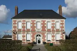 The town hall in Saint-Jean-de-Folleville | |
Location of Saint-Jean-de-Folleville 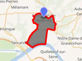
| |
 Saint-Jean-de-Folleville  Saint-Jean-de-Folleville | |
| Coordinates: 49°31′29″N 0°30′24″E | |
| Country | France |
| Region | Normandy |
| Department | Seine-Maritime |
| Arrondissement | Le Havre |
| Canton | Bolbec |
| Intercommunality | CA Caux vallée de Seine |
| Area 1 | 13.73 km2 (5.30 sq mi) |
| Population (2017-01-01)[1] | 827 |
| • Density | 60/km2 (160/sq mi) |
| Time zone | UTC+01:00 (CET) |
| • Summer (DST) | UTC+02:00 (CEST) |
| INSEE/Postal code | 76592 /76170 |
| Elevation | 0–134 m (0–440 ft) (avg. 133 m or 436 ft) |
| 1 French Land Register data, which excludes lakes, ponds, glaciers > 1 km2 (0.386 sq mi or 247 acres) and river estuaries. | |
Geography
A farming village in the Pays de Caux, situated some 19 miles (31 km) east of Le Havre, at the junction of the D81 and D982 roads. The river Seine marks the southern border of the commune.
Population
| Year | Pop. | ±% p.a. |
|---|---|---|
| 1968 | 586 | — |
| 1975 | 622 | +0.86% |
| 1982 | 599 | −0.54% |
| 1990 | 731 | +2.52% |
| 1999 | 742 | +0.17% |
| 2007 | 828 | +1.38% |
| 2012 | 834 | +0.14% |
| 2017 | 827 | −0.17% |
| Source: INSEE[2] | ||
Places of interest
- The church of St. Jean, dating from the thirteenth century.
- The church of Notre-Dame, in the village of Radicatel, dating from the sixteenth century.
- The eighteenth-century farmhouse de Gouberville, once owned by the father of Charlotte Corday.
References
- "Populations légales 2017". INSEE. Retrieved 6 January 2020.
- Population en historique depuis 1968, INSEE
| Wikimedia Commons has media related to Saint-Jean-de-Folleville. |
| Authority control |
|
|---|
This article is issued from Wikipedia. The text is licensed under Creative Commons - Attribution - Sharealike. Additional terms may apply for the media files.