Saint-Aubin-Celloville
Saint-Aubin-Celloville is a commune in the Seine-Maritime department in the Normandy region in northern France.
Saint-Aubin-Celloville | |
|---|---|
.svg.png.webp) Coat of arms | |
Location of Saint-Aubin-Celloville 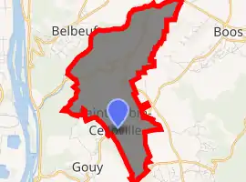
| |
 Saint-Aubin-Celloville  Saint-Aubin-Celloville | |
| Coordinates: 49°21′53″N 1°09′36″E | |
| Country | France |
| Region | Normandy |
| Department | Seine-Maritime |
| Arrondissement | Rouen |
| Canton | Darnétal |
| Intercommunality | Métropole Rouen Normandie |
| Government | |
| • Mayor (2020–2026) | Maxime Dehail[1] |
| Area 1 | 6.72 km2 (2.59 sq mi) |
| Population (2017-01-01)[2] | 1,057 |
| • Density | 160/km2 (410/sq mi) |
| Time zone | UTC+01:00 (CET) |
| • Summer (DST) | UTC+02:00 (CEST) |
| INSEE/Postal code | 76558 /76520 |
| Elevation | 30–157 m (98–515 ft) (avg. 140 m or 460 ft) |
| 1 French Land Register data, which excludes lakes, ponds, glaciers > 1 km2 (0.386 sq mi or 247 acres) and river estuaries. | |
Geography
A farming village situated near the banks of the Seine, some 8 miles (13 km) south of Rouen at the junction of the D91, D95 and the D291 roads.
Heraldry
Arms of Saint-Aubin-Celloville |
The arms of Saint-Aubin-Celloville are blazoned : Per pale 1: Gules, a crozier between the letters S and A Or; 2:Azure, the local belltower surmounting another smaller one, argent; on a base ployé Or a pot gules. (the French blazon is 'enté en point' which is basically a triangular base with curved sides. Not really used in English heraldry.) |
Population
| Year | Pop. | ±% p.a. |
|---|---|---|
| 1968 | 473 | — |
| 1975 | 654 | +4.74% |
| 1982 | 681 | +0.58% |
| 1990 | 990 | +4.79% |
| 1999 | 1,015 | +0.28% |
| 2007 | 963 | −0.66% |
| 2012 | 956 | −0.15% |
| 2017 | 1,057 | +2.03% |
| Source: INSEE[3] | ||
Places of interest
- The church of St. Aubin, dating from the eleventh century.
- The church of St. Pierre, dating from the seventeenth century.
- A seventeenth-century stone cross.
- The Château d'Incarville.
References
- Liste des maires du département de la Seine-Maritime, 10 August 2020
- "Populations légales 2017". INSEE. Retrieved 6 January 2020.
- Population en historique depuis 1968, INSEE
| Wikimedia Commons has media related to Saint-Aubin-Celloville. |
| Authority control |
|---|
This article is issued from Wikipedia. The text is licensed under Creative Commons - Attribution - Sharealike. Additional terms may apply for the media files.