Oissel
Oissel is a commune in the Seine-Maritime department in the Normandy region in northern France.
Oissel | |
|---|---|
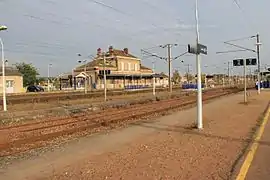 Oissel railway station | |
 Coat of arms | |
Location of Oissel 
| |
 Oissel  Oissel | |
| Coordinates: 49°20′33″N 1°05′32″E | |
| Country | France |
| Region | Normandy |
| Department | Seine-Maritime |
| Arrondissement | Rouen |
| Canton | Saint-Étienne-du-Rouvray |
| Intercommunality | Métropole Rouen Normandie |
| Government | |
| • Mayor (2020–2026) | Stéphane Barré |
| Area 1 | 22.19 km2 (8.57 sq mi) |
| Population (2017-01-01)[1] | 11,895 |
| • Density | 540/km2 (1,400/sq mi) |
| Time zone | UTC+01:00 (CET) |
| • Summer (DST) | UTC+02:00 (CEST) |
| INSEE/Postal code | 76484 /76350 |
| Elevation | 2–128 m (6.6–419.9 ft) (avg. 10 m or 33 ft) |
| 1 French Land Register data, which excludes lakes, ponds, glaciers > 1 km2 (0.386 sq mi or 247 acres) and river estuaries. | |
Geography
A suburban and light industrial town situated by the banks of the river Seine, just 8 miles (13 km) south of Rouen at the junction of the D18 and the D13 roads. Junction 22 of the A13 autoroute is entirely within the commune's borders. SNCF operates a TER rail service here.
Heraldry
Arms of Oissel |
The arms of Oissel are blazoned : Per pale argent and azure, a half-filled alembic gules and a garb Or, and on a chief gules, a leopard Or, armed and langued azure. |
Population
| Year | Pop. | ±% p.a. |
|---|---|---|
| 1968 | 9,949 | — |
| 1975 | 10,501 | +0.77% |
| 1982 | 11,712 | +1.57% |
| 1990 | 11,444 | −0.29% |
| 1999 | 11,053 | −0.39% |
| 2007 | 11,574 | +0.58% |
| 2012 | 11,445 | −0.22% |
| 2017 | 11,895 | +0.77% |
| Source: INSEE[2] | ||
People
- Daniel Horlaville, footballer born in 1945.
- Raoul Grimoin-Sanson (1860–1941), cinematographic inventor.
- Grégory Tafforeau, footballer born in 1976.
- Thierry Foucaud, 1954-, Politician.
Places of interest
- The church of St.Martin, dating from the nineteenth century.
- The sixteenth century manorhouse, the Manoir de La Chapelle.
- The Dambray Pavillon, from the seventeenth century.
- The Château de La Perreuse.
References
- "Populations légales 2017". INSEE. Retrieved 6 January 2020.
- Population en historique depuis 1968, INSEE
External links
| Wikimedia Commons has media related to Oissel. |
| Authority control |
|---|
This article is issued from Wikipedia. The text is licensed under Creative Commons - Attribution - Sharealike. Additional terms may apply for the media files.