Les Trois-Pierres
Les Trois-Pierres is a commune in the Seine-Maritime department in the Normandy region in northern France.
Les Trois-Pierres | |
|---|---|
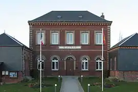 The town hall in Les Trois-Pierres | |
 Coat of arms | |
Location of Les Trois-Pierres 
| |
 Les Trois-Pierres  Les Trois-Pierres | |
| Coordinates: 49°32′52″N 0°25′00″E | |
| Country | France |
| Region | Normandy |
| Department | Seine-Maritime |
| Arrondissement | Le Havre |
| Canton | Saint-Romain-de-Colbosc |
| Intercommunality | Le Havre Seine Métropole |
| Government | |
| • Mayor (2020–2026) | Monique Bertrand[1] |
| Area 1 | 7.48 km2 (2.89 sq mi) |
| Population (2017-01-01)[2] | 751 |
| • Density | 100/km2 (260/sq mi) |
| Time zone | UTC+01:00 (CET) |
| • Summer (DST) | UTC+02:00 (CEST) |
| INSEE/Postal code | 76714 /76430 |
| Elevation | 63–132 m (207–433 ft) (avg. 110 m or 360 ft) |
| 1 French Land Register data, which excludes lakes, ponds, glaciers > 1 km2 (0.386 sq mi or 247 acres) and river estuaries. | |
Geography
It is a farming village in the Pays de Caux, some 15 miles (24 km) east of Le Havre, at the junction of the D9015, D34 and D910 roads.
Heraldry
Arms of Les Trois-Pierres |
The arms of the commune of Les Trois-Pierres are blazoned : Azure, a fess argent charged with 3 stalks of wheat vert, in chief a sun Or between 2 seagulls volant respectant, and in base 3 stones argent. |
Population
| Year | 1962 | 1968 | 1975 | 1982 | 1990 | 1999 | 2006 |
|---|---|---|---|---|---|---|---|
| Population | 305 | 337 | 391 | 595 | 686 | 723 | 732 |
| From the year 1962 on: No double counting—residents of multiple communes (e.g. students and military personnel) are counted only once. | |||||||
Places of interest
- The church of St. Pierre, dating from the thirteenth century.
References
- Liste des maires du département de la Seine-Maritime, 10 August 2020
- "Populations légales 2017". INSEE. Retrieved 6 January 2020.
| Wikimedia Commons has media related to Les Trois-Pierres. |
| Authority control |
|---|
This article is issued from Wikipedia. The text is licensed under Creative Commons - Attribution - Sharealike. Additional terms may apply for the media files.