Gonfreville-Caillot
Gonfreville-Caillot is a commune in the Seine-Maritime department in the Normandy region in northern France.
Gonfreville-Caillot | |
|---|---|
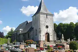 The church in Gonfreville-Caillot | |
.svg.png.webp) Coat of arms | |
Location of Gonfreville-Caillot 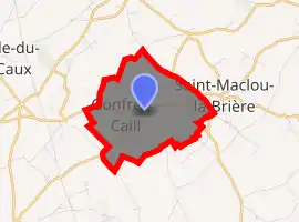
| |
 Gonfreville-Caillot  Gonfreville-Caillot | |
| Coordinates: 49°39′10″N 0°26′29″E | |
| Country | France |
| Region | Normandy |
| Department | Seine-Maritime |
| Arrondissement | Le Havre |
| Canton | Saint-Romain-de-Colbosc |
| Intercommunality | CC Campagne de Caux |
| Government | |
| • Mayor (2020–2026) | Christian Leroux |
| Area 1 | 4.22 km2 (1.63 sq mi) |
| Population (2017-01-01)[1] | 359 |
| • Density | 85/km2 (220/sq mi) |
| Time zone | UTC+01:00 (CET) |
| • Summer (DST) | UTC+02:00 (CEST) |
| INSEE/Postal code | 76304 /76110 |
| Elevation | 112–134 m (367–440 ft) (avg. 129 m or 423 ft) |
| 1 French Land Register data, which excludes lakes, ponds, glaciers > 1 km2 (0.386 sq mi or 247 acres) and river estuaries. | |
Geography
A small farming village situated in the Pays de Caux, some 19 miles (31 km) northeast of Le Havre, at the junction of the D452 and D75 roads.
Heraldry
Arms of Gonfreville-Caillot |
The arms of Gonfreville-Caillot are blazoned : Azure, a chevron between 2 quail respectant and a griffon's head erased Or. |
Population
| Year | 1962 | 1968 | 1975 | 1982 | 1990 | 1999 | 2006 |
|---|---|---|---|---|---|---|---|
| Population | 132 | 157 | 124 | 215 | 251 | 262 | 309 |
| From the year 1962 on: No double counting—residents of multiple communes (e.g. students and military personnel) are counted only once. | |||||||
Places of interest
References
- "Populations légales 2017". INSEE. Retrieved 6 January 2020.
| Wikimedia Commons has media related to Gonfreville-Caillot. |
| Authority control |
|---|
This article is issued from Wikipedia. The text is licensed under Creative Commons - Attribution - Sharealike. Additional terms may apply for the media files.
