Franqueville-Saint-Pierre
Franqueville-Saint-Pierre is a commune in the Seine-Maritime department in the Normandy region in northern France.
Franqueville-Saint-Pierre | |
|---|---|
 Town hall | |
 Coat of arms | |
Location of Franqueville-Saint-Pierre 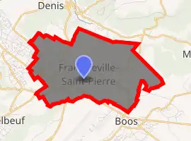
| |
 Franqueville-Saint-Pierre  Franqueville-Saint-Pierre | |
| Coordinates: 49°24′04″N 1°10′48″E | |
| Country | France |
| Region | Normandy |
| Department | Seine-Maritime |
| Arrondissement | Rouen |
| Canton | Le Mesnil-Esnard |
| Intercommunality | Métropole Rouen Normandie |
| Government | |
| • Mayor (2020–2026) | Bruno Guilbert |
| Area 1 | 8.56 km2 (3.31 sq mi) |
| Population (2017-01-01)[1] | 6,123 |
| • Density | 720/km2 (1,900/sq mi) |
| Time zone | UTC+01:00 (CET) |
| • Summer (DST) | UTC+02:00 (CEST) |
| INSEE/Postal code | 76475 /76520 |
| Elevation | 75–162 m (246–531 ft) (avg. 140 m or 460 ft) |
| 1 French Land Register data, which excludes lakes, ponds, glaciers > 1 km2 (0.386 sq mi or 247 acres) and river estuaries. | |
Geography
A small light industrial and farming town situated some 5 miles (8.0 km) southeast of the centre of Rouen, at the junction of the D7, D138 and the D6014 roads.
Heraldry
Arms of Franqueville-Saint-Pierre |
The arms of Franqueville-Saint-Pierre are blazoned : Azure, a chevron between 2 cocks respectant Or, a tower argent. |
Population
| Year | 1962 | 1968 | 1975 | 1982 | 1990 | 1999 | 2006 |
|---|---|---|---|---|---|---|---|
| Population | 1209 | 1888 | 2320 | 3551 | 4230 | 5099 | 5553 |
| From the year 1962 on: No double counting—residents of multiple communes (e.g. students and military personnel) are counted only once. | |||||||
Places of interest
- The twentieth century ’Hotel de Ville’ (town hall), built by Richard + Schoeller.
- The church of St.Pierre, dating from the seventeenth century.
- The church of Notre-Dame, dating from the eleventh century.
- A seventeenth-century chateau, built in brick.
References
- "Populations légales 2017". INSEE. Retrieved 6 January 2020.
External links
| Wikimedia Commons has media related to Franqueville-Saint-Pierre. |
- Official website of the commune (in French)
| Authority control |
|---|
This article is issued from Wikipedia. The text is licensed under Creative Commons - Attribution - Sharealike. Additional terms may apply for the media files.