Routes, Seine-Maritime
Routes is a commune in the Seine-Maritime department in the Normandy region in northern France.
Routes | |
|---|---|
Location of Routes 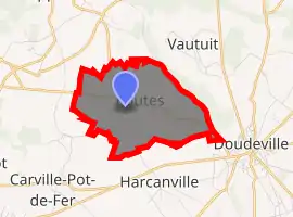
| |
 Routes  Routes | |
| Coordinates: 49°43′52″N 0°44′40″E | |
| Country | France |
| Region | Normandy |
| Department | Seine-Maritime |
| Arrondissement | Rouen |
| Canton | Yvetot |
| Intercommunality | CC Plateau de Caux-Doudeville-Yerville |
| Area 1 | 4.47 km2 (1.73 sq mi) |
| Population (2017-01-01)[1] | 273 |
| • Density | 61/km2 (160/sq mi) |
| Time zone | UTC+01:00 (CET) |
| • Summer (DST) | UTC+02:00 (CEST) |
| INSEE/Postal code | 76542 /76560 |
| Elevation | 95–149 m (312–489 ft) (avg. 142 m or 466 ft) |
| 1 French Land Register data, which excludes lakes, ponds, glaciers > 1 km2 (0.386 sq mi or 247 acres) and river estuaries. | |
Geography
A small farming village in the Pays de Caux, some 33 miles (53 km) northeast of Le Havre, at the junction of the D88 and D420 roads.
Population
| Year | Pop. | ±% p.a. |
|---|---|---|
| 1968 | 152 | — |
| 1975 | 143 | −0.87% |
| 1982 | 181 | +3.42% |
| 1990 | 166 | −1.08% |
| 1999 | 177 | +0.72% |
| 2007 | 220 | +2.76% |
| 2012 | 237 | +1.50% |
| 2017 | 273 | +2.87% |
| Source: INSEE[2] | ||
Places of interest
- The church of St. Martin-et-Notre-Dame, dating from the eighteenth century.
References
- "Populations légales 2017". INSEE. Retrieved 6 January 2020.
- Population en historique depuis 1968, INSEE
| Wikimedia Commons has media related to Routes (Seine-Maritime). |
| Authority control |
|---|
This article is issued from Wikipedia. The text is licensed under Creative Commons - Attribution - Sharealike. Additional terms may apply for the media files.