Vattetot-sur-Mer
Vattetot-sur-Mer is a commune in the Seine-Maritime department in the Normandy region in northern France.
Vattetot-sur-Mer | |
|---|---|
 The church in Vattetot-sur-Mer | |
Location of Vattetot-sur-Mer 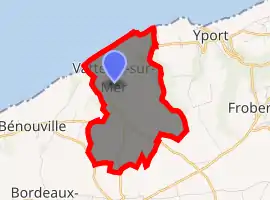
| |
 Vattetot-sur-Mer  Vattetot-sur-Mer | |
| Coordinates: 49°43′40″N 0°16′53″E | |
| Country | France |
| Region | Normandy |
| Department | Seine-Maritime |
| Arrondissement | Le Havre |
| Canton | Fécamp |
| Intercommunality | CA Fécamp Caux Littoral |
| Government | |
| • Mayor (2020–2026) | Franck Blanchet[1] |
| Area 1 | 5.14 km2 (1.98 sq mi) |
| Population (2017-01-01)[2] | 319 |
| • Density | 62/km2 (160/sq mi) |
| Time zone | UTC+01:00 (CET) |
| • Summer (DST) | UTC+02:00 (CEST) |
| INSEE/Postal code | 76726 /76111 |
| Elevation | 0–109 m (0–358 ft) (avg. 90 m or 300 ft) |
| 1 French Land Register data, which excludes lakes, ponds, glaciers > 1 km2 (0.386 sq mi or 247 acres) and river estuaries. | |
Geography
A small farming village and tourist spot on the coast of the Pays de Caux, situated some 22 miles (35 km) northeast of Le Havre, at the junction of the D11 and D211 roads. Imposing limestone cliffs look out onto the English Channel.
Population
| Year | 1962 | 1968 | 1975 | 1982 | 1990 | 1999 | 2006 |
|---|---|---|---|---|---|---|---|
| Population | 182 | 254 | 234 | 239 | 258 | 253 | 306 |
| From the year 1962 on: No double counting—residents of multiple communes (e.g. students and military personnel) are counted only once. | |||||||
Places of interest
- The church of St. Pierre, dating from the twelfth century.
References
- Liste des maires du département de la Seine-Maritime, 10 August 2020
- "Populations légales 2017". INSEE. Retrieved 6 January 2020.
| Wikimedia Commons has media related to Vattetot-sur-Mer. |
| Authority control |
|---|
This article is issued from Wikipedia. The text is licensed under Creative Commons - Attribution - Sharealike. Additional terms may apply for the media files.