Mésangueville
Mésangueville is a commune in the Seine-Maritime department in the Normandy region in northern France.
Mésangueville | |
|---|---|
 Coat of arms | |
Location of Mésangueville 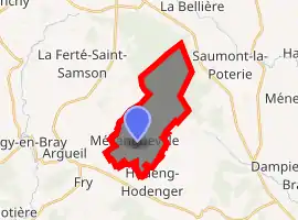
| |
 Mésangueville  Mésangueville | |
| Coordinates: 49°32′49″N 1°33′36″E | |
| Country | France |
| Region | Normandy |
| Department | Seine-Maritime |
| Arrondissement | Dieppe |
| Canton | Gournay-en-Bray |
| Intercommunality | CC 4 rivières |
| Government | |
| • Mayor (2020–2026) | Gilbert Coutard[1] |
| Area 1 | 10.55 km2 (4.07 sq mi) |
| Population (2017-01-01)[2] | 164 |
| • Density | 16/km2 (40/sq mi) |
| Time zone | UTC+01:00 (CET) |
| • Summer (DST) | UTC+02:00 (CEST) |
| INSEE/Postal code | 76426 /76780 |
| Elevation | 114–185 m (374–607 ft) (avg. 160 m or 520 ft) |
| 1 French Land Register data, which excludes lakes, ponds, glaciers > 1 km2 (0.386 sq mi or 247 acres) and river estuaries. | |
Geography
A small forestry and farming village situated in the valley of the river Epte in the Pays de Bray, some 23 miles (37 km) northeast of Rouen at the junction of the D128 with the D41.
Heraldry
Arms of Mésangueville |
The arms of Mésangueville are blazoned : Or, on an inescutcheon, a tit argent, all between 4 lozenges 1,2,1 sable. (these lozenges are rotated squares) |
Population
| Year | Pop. | ±% p.a. |
|---|---|---|
| 1968 | 201 | — |
| 1975 | 161 | −3.12% |
| 1982 | 137 | −2.28% |
| 1990 | 137 | +0.00% |
| 1999 | 143 | +0.48% |
| 2007 | 154 | +0.93% |
| 2012 | 179 | +3.05% |
| 2017 | 164 | −1.74% |
| Source: INSEE[3] | ||
Places of interest
- The church of St.Nicolas, dating from the thirteenth century.
References
- Liste des maires du département de la Seine-Maritime, 10 August 2020
- "Populations légales 2017". INSEE. Retrieved 6 January 2020.
- Population en historique depuis 1968, INSEE
| Wikimedia Commons has media related to Mésangueville. |
| Authority control |
|---|
This article is issued from Wikipedia. The text is licensed under Creative Commons - Attribution - Sharealike. Additional terms may apply for the media files.