Calleville-les-Deux-Églises
Calleville-les-Deux-Églises is a commune in the Seine-Maritime department in the Normandy region in north-western France.
Calleville-les-Deux-Églises | |
|---|---|
.svg.png.webp) Coat of arms | |
Location of Calleville-les-Deux-Églises 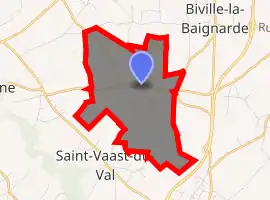
| |
 Calleville-les-Deux-Églises  Calleville-les-Deux-Églises | |
| Coordinates: 49°42′24″N 1°01′26″E | |
| Country | France |
| Region | Normandy |
| Department | Seine-Maritime |
| Arrondissement | Dieppe |
| Canton | Luneray |
| Intercommunality | CC Terroir de Caux |
| Government | |
| • Mayor (2014-2020) | Christophe Colombel |
| Area 1 | 5.71 km2 (2.20 sq mi) |
| Population (2017-01-01)[1] | 332 |
| • Density | 58/km2 (150/sq mi) |
| Time zone | UTC+01:00 (CET) |
| • Summer (DST) | UTC+02:00 (CEST) |
| INSEE/Postal code | 76153 /76890 |
| Elevation | 133–166 m (436–545 ft) (avg. 161 m or 528 ft) |
| 1 French Land Register data, which excludes lakes, ponds, glaciers > 1 km2 (0.386 sq mi or 247 acres) and river estuaries. | |
Geography
A farming village situated in the Pays de Caux, some 18 miles (29 km) south of Dieppe, at the junction of the D 101 with the D 203 road.
Population
| Year | 1793 | 1821 | 1946 | 1954 | 1962 | 1968 | 1975 | 1982 | 1990 | 1999 | 2004 | 2006 | 2009 | 2011 |
|---|---|---|---|---|---|---|---|---|---|---|---|---|---|---|
| Population | 160 | 601 | 175 | 186 | 171 | 197 | 178 | 285 | 303 | 305 | 303 | 305 | 318 | 331 |
| From the year 1962 on: No double counting—residents of multiple communes (e.g. students and military personnel) are counted only once. | ||||||||||||||
Places of interest
- The church of St.Paër, dating from the nineteenth century.
References
- "Populations légales 2017". INSEE. Retrieved 6 January 2020.
| Wikimedia Commons has media related to Calleville-les-Deux-Églises. |
| Authority control |
|
|---|
This article is issued from Wikipedia. The text is licensed under Creative Commons - Attribution - Sharealike. Additional terms may apply for the media files.