Villers-sous-Foucarmont
Villers-sous-Foucarmont is a commune in the Seine-Maritime department in the Normandy region in northern France.
Villers-sous-Foucarmont | |
|---|---|
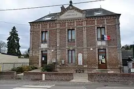 The town hall in Villers-sous-Foucarmont | |
Location of Villers-sous-Foucarmont 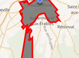
| |
 Villers-sous-Foucarmont  Villers-sous-Foucarmont | |
| Coordinates: 49°50′20″N 1°33′51″E | |
| Country | France |
| Region | Normandy |
| Department | Seine-Maritime |
| Arrondissement | Dieppe |
| Canton | Eu |
| Intercommunality | CC Aumale - Blangy-sur-Bresle |
| Government | |
| • Mayor (2008–2014) | Christine Crept |
| Area 1 | 7.01 km2 (2.71 sq mi) |
| Population (2017-01-01)[1] | 193 |
| • Density | 28/km2 (71/sq mi) |
| Time zone | UTC+01:00 (CET) |
| • Summer (DST) | UTC+02:00 (CEST) |
| INSEE/Postal code | 76744 /76340 |
| Elevation | 112–223 m (367–732 ft) (avg. 121 m or 397 ft) |
| 1 French Land Register data, which excludes lakes, ponds, glaciers > 1 km2 (0.386 sq mi or 247 acres) and river estuaries. | |
Geography
A small farming village situated by the banks of the Yères river in the Pays de Bray, some 22 miles (35 km) southeast of Dieppe at the junction of the D16, D24 and the D82 roads.
Population
| Year | 1962 | 1968 | 1975 | 1982 | 1990 | 1999 | 2006 |
|---|---|---|---|---|---|---|---|
| Population | 149 | 164 | 170 | 160 | 172 | 205 | 209 |
| From the year 1962 on: No double counting—residents of multiple communes (e.g. students and military personnel) are counted only once. | |||||||
Places of interest
- The church of St. Vincent, dating from the sixteenth century.
- The château de La Quesnoy, dating from the sixteenth century, with its chapel.
References
- "Populations légales 2017". INSEE. Retrieved 6 January 2020.
| Wikimedia Commons has media related to Villers-sous-Foucarmont. |
| Authority control |
|---|
This article is issued from Wikipedia. The text is licensed under Creative Commons - Attribution - Sharealike. Additional terms may apply for the media files.