Fresne-le-Plan
Fresne-le-Plan is a commune in the Seine-Maritime department in the Normandy region in north-western France.
Fresne-le-Plan | |
|---|---|
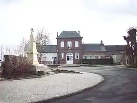 The town hall in Fresne-le-Plan | |
Location of Fresne-le-Plan 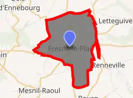
| |
 Fresne-le-Plan  Fresne-le-Plan | |
| Coordinates: 49°24′48″N 1°17′45″E | |
| Country | France |
| Region | Normandy |
| Department | Seine-Maritime |
| Arrondissement | Rouen |
| Canton | Le Mesnil-Esnard |
| Government | |
| • Mayor (2014-2020) | Antoine Maillard |
| Area 1 | 6.88 km2 (2.66 sq mi) |
| Population (2017-01-01)[1] | 609 |
| • Density | 89/km2 (230/sq mi) |
| Time zone | UTC+01:00 (CET) |
| • Summer (DST) | UTC+02:00 (CEST) |
| INSEE/Postal code | 76285 /76520 |
| Elevation | 125–161 m (410–528 ft) (avg. 155 m or 509 ft) |
| 1 French Land Register data, which excludes lakes, ponds, glaciers > 1 km2 (0.386 sq mi or 247 acres) and river estuaries. | |
Geography
A farming village situated on the border with the department of Eure, some 11 miles (18 km) east of Rouen, at the junction of the D 13 and the D 42 roads.
Population
| Year | 1962 | 1968 | 1975 | 1982 | 1990 | 1999 | 2004 | 2006 | 2009 | 2011 |
|---|---|---|---|---|---|---|---|---|---|---|
| Population | 219 | 232 | 320 | 369 | 379 | 456 | 506 | 531 | 595 | 631 |
| From the year 1962 on: No double counting—residents of multiple communes (e.g. students and military personnel) are counted only once. | ||||||||||
Places of interest
- The church of Sts.Pierre & Paul, dating from the thirteenth century.
- The dovecote of Mesnil Grain.
References
- "Populations légales 2017". INSEE. Retrieved 6 January 2020.
| Wikimedia Commons has media related to Fresne-le-Plan. |
| Authority control |
|---|
This article is issued from Wikipedia. The text is licensed under Creative Commons - Attribution - Sharealike. Additional terms may apply for the media files.