Saint-Pierre-le-Vieux, Seine-Maritime
Saint-Pierre-le-Vieux is a commune in the Seine-Maritime department in the Normandy region in north-western France.
Saint-Pierre-le-Vieux | |
|---|---|
.JPG.webp) The chateau of Herbouville in Saint-Pierre-le-Vieux | |
Location of Saint-Pierre-le-Vieux 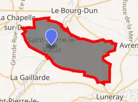
| |
 Saint-Pierre-le-Vieux  Saint-Pierre-le-Vieux | |
| Coordinates: 49°51′04″N 0°52′24″E | |
| Country | France |
| Region | Normandy |
| Department | Seine-Maritime |
| Arrondissement | Dieppe |
| Canton | Saint-Valery-en-Caux |
| Intercommunality | CC Côte d'Albâtre |
| Government | |
| • Mayor (2020–2026) | Emmanuel Boust[1] |
| Area 1 | 7.06 km2 (2.73 sq mi) |
| Population (2017-01-01)[2] | 192 |
| • Density | 27/km2 (70/sq mi) |
| Time zone | UTC+01:00 (CET) |
| • Summer (DST) | UTC+02:00 (CEST) |
| INSEE/Postal code | 76641 /76740 |
| Elevation | 18–71 m (59–233 ft) (avg. 35 m or 115 ft) |
| 1 French Land Register data, which excludes lakes, ponds, glaciers > 1 km2 (0.386 sq mi or 247 acres) and river estuaries. | |
Geography
A farming village situated by the banks of the Dun river in the Pays de Caux, some 19 miles (31 km) southwest of Dieppe at the junction of the D237 and the D101 roads.
Population
| Year | Pop. | ±% p.a. |
|---|---|---|
| 1968 | 267 | — |
| 1975 | 254 | −0.71% |
| 1982 | 249 | −0.28% |
| 1990 | 203 | −2.52% |
| 1999 | 203 | +0.00% |
| 2007 | 218 | +0.90% |
| 2012 | 205 | −1.22% |
| 2017 | 192 | −1.30% |
| Source: INSEE[3] | ||
Places of interest
- The church of St.Pierre, dating from the eleventh century.
- The sixteenth-century château de Saint-Pierre-le-Vieux, with a vaulted ceiling.
- The château and park of Bosc le Comte, dating from the sixteenth century.
References
- "Répertoire national des élus: les maires". data.gouv.fr, Plateforme ouverte des données publiques françaises (in French). 2 December 2020. Retrieved 7 December 2020.
- "Populations légales 2017". INSEE. Retrieved 6 January 2020.
- Population en historique depuis 1968, INSEE
External links
| Wikimedia Commons has media related to Saint-Pierre-le-Vieux (Seine-Maritime). |
- Saint-Pierre-le-Vieux on the Quid website (in French)
| Authority control |
|---|
This article is issued from Wikipedia. The text is licensed under Creative Commons - Attribution - Sharealike. Additional terms may apply for the media files.