Rouville, Seine-Maritime
Rouville is a commune in the Seine-Maritime department in the Normandy region in northern France.
Rouville | |
|---|---|
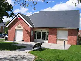 The town hall in Rouville | |
Location of Rouville 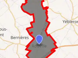
| |
 Rouville  Rouville | |
| Coordinates: 49°36′57″N 0°30′00″E | |
| Country | France |
| Region | Normandy |
| Department | Seine-Maritime |
| Arrondissement | Le Havre |
| Canton | Bolbec |
| Intercommunality | CA Caux vallée de Seine |
| Area 1 | 9.55 km2 (3.69 sq mi) |
| Population (2017-01-01)[1] | 617 |
| • Density | 65/km2 (170/sq mi) |
| Time zone | UTC+01:00 (CET) |
| • Summer (DST) | UTC+02:00 (CEST) |
| INSEE/Postal code | 76543 /76210 |
| Elevation | 109–143 m (358–469 ft) (avg. 130 m or 430 ft) |
| 1 French Land Register data, which excludes lakes, ponds, glaciers > 1 km2 (0.386 sq mi or 247 acres) and river estuaries. | |
Geography
A farming village in the Pays de Caux, situated some 21 miles (34 km) northeast of Le Havre, at the junction of the D17, D52 and D149 roads. The A29 autoroute follows the southern border of the commune.
Population
| Year | Pop. | ±% p.a. |
|---|---|---|
| 1968 | 377 | — |
| 1975 | 358 | −0.74% |
| 1982 | 392 | +1.30% |
| 1990 | 471 | +2.32% |
| 1999 | 508 | +0.84% |
| 2007 | 554 | +1.09% |
| 2012 | 610 | +1.94% |
| 2017 | 617 | +0.23% |
| Source: INSEE[2] | ||
Places of interest
- The church of St. Hermes, with parts dating from the eleventh century.
- The church of St. Pierre, also dating from the eleventh century.
- A seventeenth century manorhouse.
- The chapel of Notre Dame at Bielleville.
References
- "Populations légales 2017". INSEE. Retrieved 6 January 2020.
- Population en historique depuis 1968, INSEE
| Wikimedia Commons has media related to Rouville (Seine-Maritime). |
| Authority control |
|---|
This article is issued from Wikipedia. The text is licensed under Creative Commons - Attribution - Sharealike. Additional terms may apply for the media files.